
Beginner Off-Road Trails
Near North Cape May, New Jersey
Explore All Beginner Trails Near North Cape May, New Jersey
Beginner Off-Road Trails Near North Cape May, New Jersey
Discover the best beginner-friendly off-road trails near you. These easier, lower-rated trails are a great place to start — browse trail maps, check difficulty ratings, and find your next adventure.
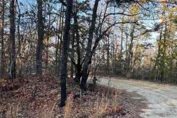
Make Peace Lake Road
Make Peace Lake Road runs through New Jersey Fish and Wildlife protected land. It primarily features a sandy and dirt surface with mud holes after rain. There is no risk of pinstriping, and most sections are wide enough for two vehicles. The road can be traversed with a high-clearance AWD or standar...
Learn more about Make Peace Lake Road
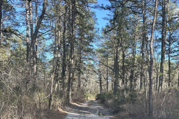
Battie Trail
The trail is a shortcut route between two larger roads. It is a flat trail just sand and gravel, with very slight grading, and can become narrow at times so be careful driving something wide through the trail. This is also one way with so be careful when driving down for oncoming traffic.
Learn more about Battie Trail

Batsto Fire Tower to Quaker Bridge
Typical Pine Barrens forest, though with fewer water features. The route can be run either north to south, Quaker Bridge to Batsto Fire Towner, or in reverse. The trail is uneven and depressions do collect water, though puddles here are generally less deep than other areas of Wharton State Forest. I...
Learn more about Batsto Fire Tower to Quaker Bridge
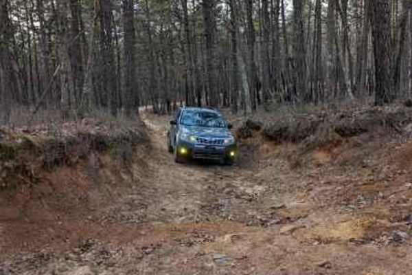
Lee's Trail
Enter in off of Washington Turnpike. The trail starts off with two heavy rutted dips, although there are side routes to avoid them. The rest of the trail you will encounter more of them along with some mellow whoops. The trail ends off of Penn Swamp Road. This area will also flood with rain so be ca...
Learn more about Lee's Trail
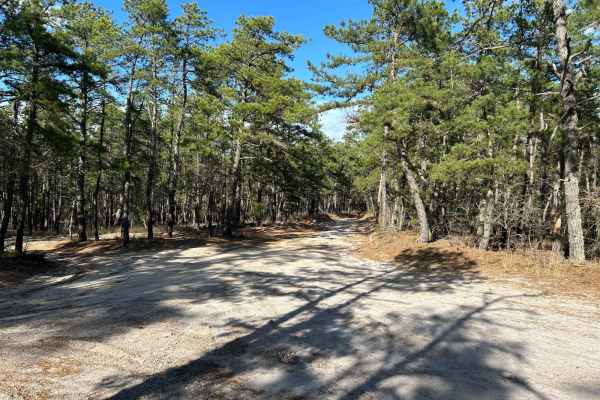
Marcus Trail
The trail is a mostly flat trail, with a mix of gravel and sand. There are a couple of whoops that are extremely mild and some dips. There is a water source close by that after a big rain that brings the possibility of flooding after heavy rains.
Learn more about Marcus Trail
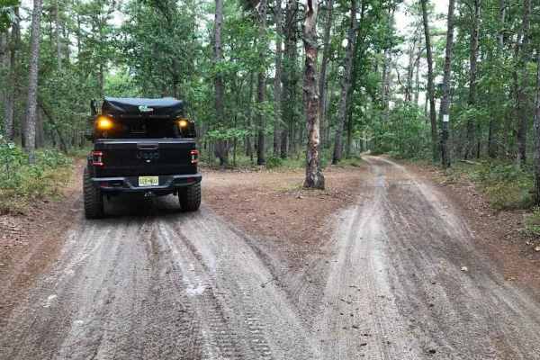
Middle Trail
This is a tight scenic trail, some whooped sections and low-hanging trees can make it easy to get some unwanted scratches. There is not a lot of room to let oncoming trail riders pass by. This Trail provides close access to both the Mullica River and the Batsto River.
Learn more about Middle Trail
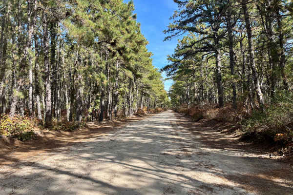
Dan's Bridge Road
This 4.4-mile trail sits just north of Bass River State Park. Along with several other sandy routes in the area, it makes for a great day trip while camping nearby. Like most off-pavement roads in the Pine Barrens, Dan’s Bridge is primarily sandy, with some muddy sections and a few larger, but gener...
Learn more about Dan's Bridge Road
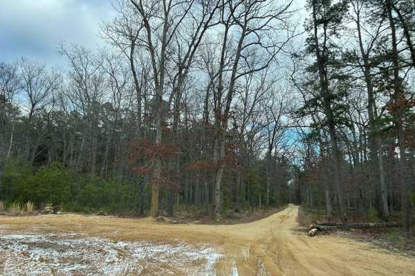
Jay's Iron Pipe Road
This trail is located off of Washington Turnpike at the 5-point intersection. The trail runs straight through the road from Washington Tpurnnpike to 563. This trail is mostly flat with some slight elevation changes and minor ruts. The trail type is a mix of compacted sand, loose sand, and gravel. Th...
Learn more about Jay's Iron Pipe Road
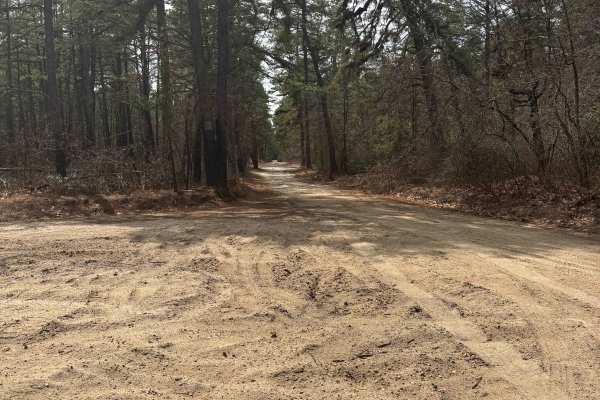
Dutch town to Burnt mill road
This one’s super easy and more about the scenery than anything else. The trail is mostly compacted sand, so it’s easy to drive on and doesn’t cause any trouble.
There are a few shallow water puddles here and there, but nothing deep or challenging. Honestly, you could get through this trail in a two...
Learn more about Dutch town to Burnt mill road
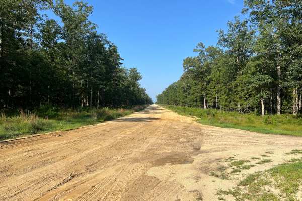
Washington Turnpike
Washington Turnpike is located in the middle of numerous other Wharton State Forest trails. The trail is a straight fire service-type road with one mud hole, approximately one foot deep, at the halfway point. The mud hole is in the center of the trail and can be bypassed by going left or right. The ...
Learn more about Washington Turnpike
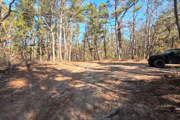
Lower Forge Road
Lower Forge Road will navigate to the pine barrens from the quaker bridge area to the beginning of the Bulldozed Road. Also will take you to the start of the foot trail for Lower Forge Primitive Camping Area. This is just under a mile. Once at the end you can continue your journey down bulldozed tra...
Learn more about Lower Forge Road
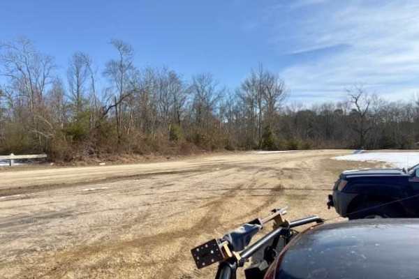
Quaker Bridge to Godfrey Bridge
This track takes you to two very good camping spots. Godfrey Bridge has several camp spots and pit toilets. Hawkins Bridge to the north has some large group camps, but be aware you will need to carry all your gear in as you can't park in the group sites. There are also a few individual sites where y...
Learn more about Quaker Bridge to Godfrey Bridge
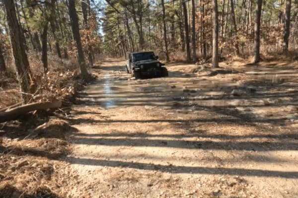
Bulldozed Road
Bulldozed Road starts out from either the Lower Forge Primitive Camp Area or the Tuckerton Road trail. If you enter from the Lower Forge road side, you will encounter a rather easy trail. Most of the obstacles are just as you are about to exit onto the Tuckerton Trail side. There are multiple Deep m...
Learn more about Bulldozed Road
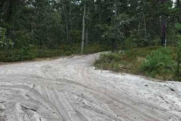
Stokes Connector
This is a very short and very rough trail connecting two main trails of the Wharton State Forest. This trail is bumpy and tight but does open up mid-way to a clearing that would be a great stop for some lunch or a place to relax. There is a small stream that may vary depending on rainfall and it is ...
Learn more about Stokes Connector
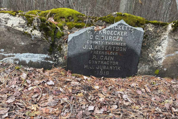
Sleepy Creek Trail
The trail was a mix of everything. There are some washed-out sections and a bunch of deep water puddles, so you’ll want to take your time picking lines. Ground conditions change a lot — some spots are hard-packed dirt, then it switches to loose sand, which can get a little tricky. We went out the da...
Learn more about Sleepy Creek Trail
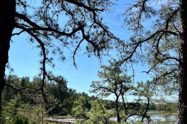
Atsion Lake to Batsto Lake
A nice trip in the Pine Barrens with some opportunities to stop along the Batsto River and Batsto Lake. The route can be run either north to south, Atsion to Batsto, or south to north, Batsto to Atsion. Both ends of the trip have relatively large unpaved parking areas to meet friends or attend to ve...
Learn more about Atsion Lake to Batsto Lake
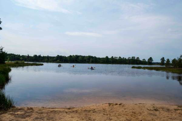
Lake Atsion to Lake Oswego
This scenic 20.2-mile route from Lake Atsion to Lake Oswego serves as an ideal introduction to Wharton State Forest and the Pine Barrens, making it perfect for beginners, families, and drivers seeking a relaxing day trip. Winding through the unique ecology of southern New Jersey, the trail features ...
Learn more about Lake Atsion to Lake Oswego
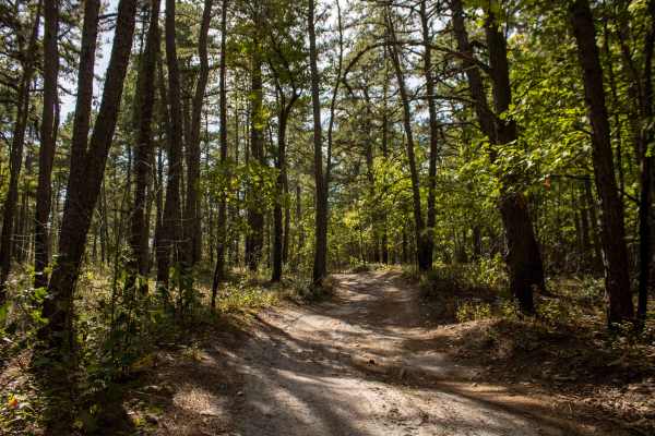
Little Mill Road
The northern half of the trail begins with moderately thick patches of sugar sand that can easily leave you stuck if you’re not careful. The middle section features a series of deep whoop-dee-doos that could cause low-clearance vehicles to bottom out. From there, the trail narrows, and full-size tru...
Learn more about Little Mill Road
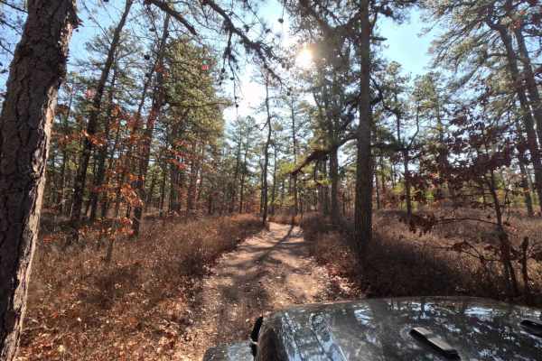
Hay Road
Very tight trail through Wharton state forest. This trail can be accessed from the intersection of Bulldozed road and Mines Spung Road, Quaker Bridge Sandy Ridge Road, or even Washington Quaker Bridge Road. Aside from the trail being tight there are a few mud pits, and low hanging trees.
Learn more about Hay Road
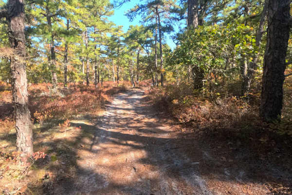
Swamp Road
Swamp Road is a lightly traveled trail with overgrown brush along the sides and a few low-hanging branches that may brush against vehicle roofs. Terrain conditions are easy, and most vehicles can navigate the route without difficulty.
Learn more about Swamp Road
Beginner ATV trails near North Cape May, New Jersey
Explore ATV-friendly trails near you. These trails are accessible for vehicles up to 50 inches wide, perfect for ATVs and smaller off-road machines.
Battie Trail
The trail is a shortcut route between two larger roads. It is a flat trail just sand and gravel, with very slight grading, and can become narrow at times so be careful driving something wide through the trail. This is also one way with so be careful when driving down for oncoming traffic.
Learn more about Battie Trail
Lee's Trail
Enter in off of Washington Turnpike. The trail starts off with two heavy rutted dips, although there are side routes to avoid them. The rest of the trail you will encounter more of them along with some mellow whoops. The trail ends off of Penn Swamp Road. This area will also flood with rain so be ca...
Learn more about Lee's Trail
Marcus Trail
The trail is a mostly flat trail, with a mix of gravel and sand. There are a couple of whoops that are extremely mild and some dips. There is a water source close by that after a big rain that brings the possibility of flooding after heavy rains.
Learn more about Marcus Trail
Middle Trail
This is a tight scenic trail, some whooped sections and low-hanging trees can make it easy to get some unwanted scratches. There is not a lot of room to let oncoming trail riders pass by. This Trail provides close access to both the Mullica River and the Batsto River.
Learn more about Middle Trail
Beginner UTV/side-by-side trails near North Cape May, New Jersey
Find UTV and side-by-side trails near you. These trails accommodate vehicles up to 60 inches wide, ideal for UTVs, side-by-sides, and wider off-road rigs.
Battie Trail
The trail is a shortcut route between two larger roads. It is a flat trail just sand and gravel, with very slight grading, and can become narrow at times so be careful driving something wide through the trail. This is also one way with so be careful when driving down for oncoming traffic.
Learn more about Battie Trail
Lee's Trail
Enter in off of Washington Turnpike. The trail starts off with two heavy rutted dips, although there are side routes to avoid them. The rest of the trail you will encounter more of them along with some mellow whoops. The trail ends off of Penn Swamp Road. This area will also flood with rain so be ca...
Learn more about Lee's Trail
Marcus Trail
The trail is a mostly flat trail, with a mix of gravel and sand. There are a couple of whoops that are extremely mild and some dips. There is a water source close by that after a big rain that brings the possibility of flooding after heavy rains.
Learn more about Marcus Trail
Middle Trail
This is a tight scenic trail, some whooped sections and low-hanging trees can make it easy to get some unwanted scratches. There is not a lot of room to let oncoming trail riders pass by. This Trail provides close access to both the Mullica River and the Batsto River.
Learn more about Middle Trail
The onX Offroad Difference
onX Offroad combines trail photos, descriptions, difficulty ratings, width restrictions, seasonality, and more in a user-friendly interface. Available on all devices, with offline access and full compatibility with CarPlay and Android Auto. Discover what you're missing today!
Open Trail Map