
Beginner Off-Road Trails
Near Mesa Verde, California
Explore All Beginner Trails Near Mesa Verde, California
Beginner Off-Road Trails Near Mesa Verde, California
Discover the best beginner-friendly off-road trails near you. These easier, lower-rated trails are a great place to start — browse trail maps, check difficulty ratings, and find your next adventure.
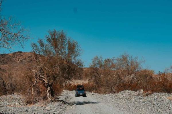
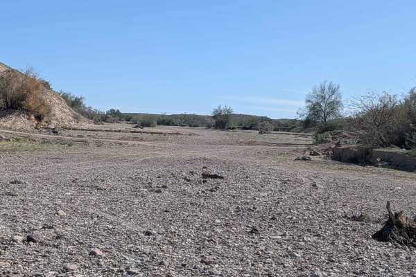
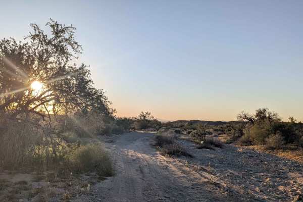
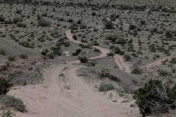
Bradshaw's Trail
Bradshaw's Trail is roughly a 70-mile-long trail stretching from Blythe, CA, to the eastern side of the Salton Sea. The trail runs east to west although it can be traveled from either end, and goes through the Chuckwalla Mountains and the Chocolate Mountain Aerial Gunnery Range. The main trail is a ...
Learn more about Bradshaw's Trail
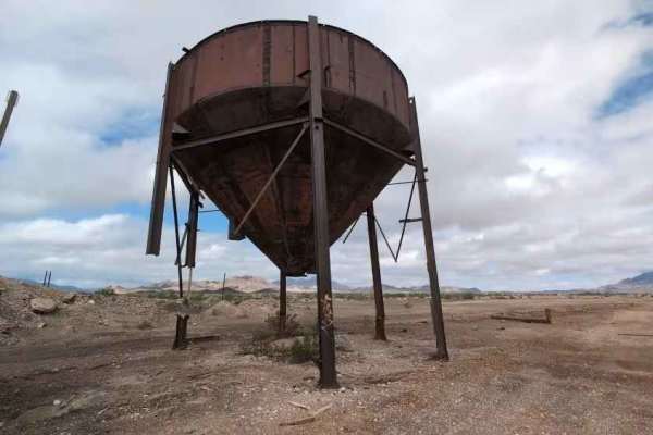
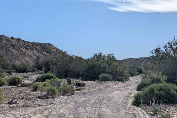
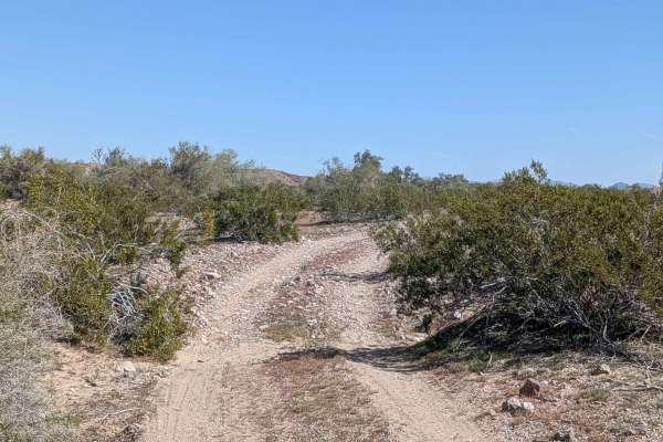
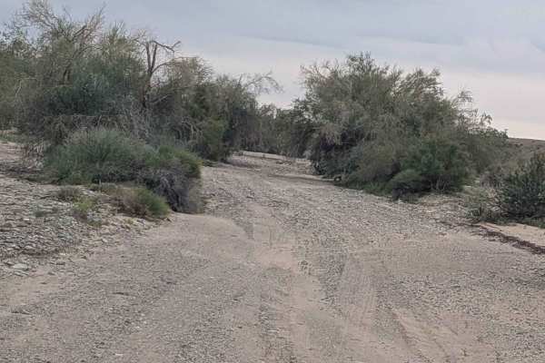
Blythe Junction Railroad
This trail is an old railroad route abandoned in 2011. It follows a smooth sandy path with sections of firm sandstone, making it manageable for most vehicles. Although the route parallels the former railbed, driving directly on the railbed is not recommended due to old railroad spikes that have caus...
Learn more about Blythe Junction Railroad
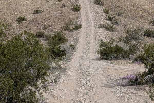
EC1187
This two-mile trail climbs over 200 feet, starting just off Levee Road in a large, wide sandy area. The trail quickly drops into a very fine sandy wash that alternates between a very wide wash and one vehicle-wide sections filled with lots of vegetation. The wash runs through a canyon with tall mud ...
Learn more about EC1187
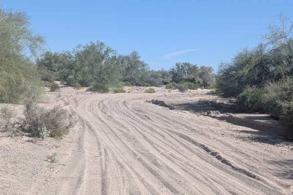
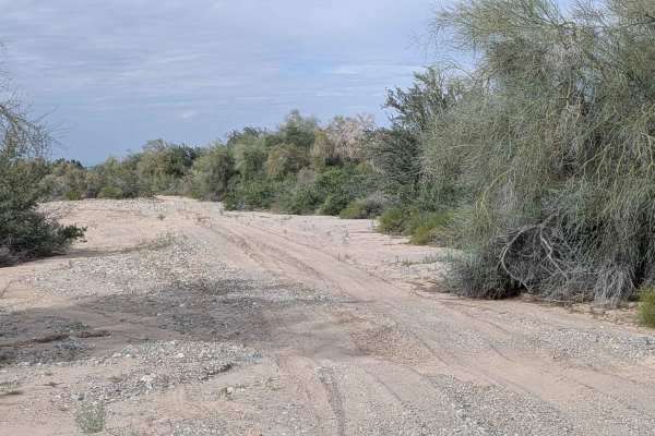
Trigo Wash EC1209
This is just over a 5-mile trail (10 miles out and back) that climbs 377 feet, starting on Levee Road and dropping quickly into a tight wash that's completely lined with brush. The surface is hard-packed sand with a little gravel, alternating between light, soft sand and dark red rocks as you progre...
Learn more about Trigo Wash EC1209
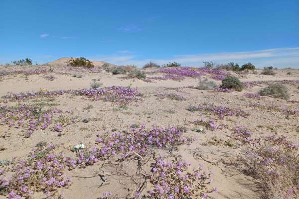
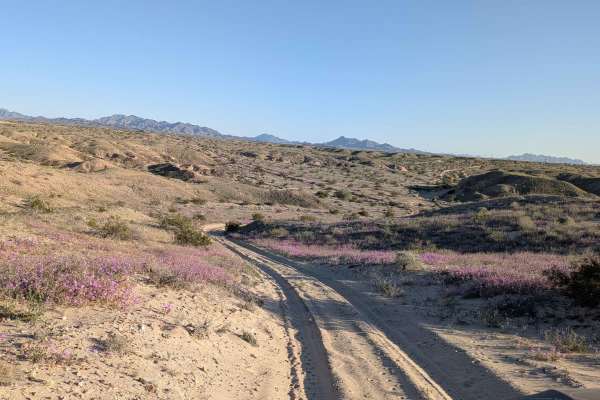
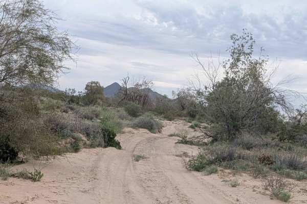
Flower Hill
During the blooming season, this road offers beautiful views of multiple different flowers. This road runs through Bureau Land Management, a mixed surface of gravel, rock, and sand, with some sections more rutted, rocky, and washed out. One section will be difficult for a long wheelbase. Be aware th...
Learn more about Flower Hill
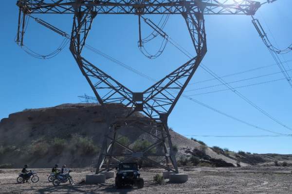
Pole Line Trail
This trail follows a high-voltage transmission line and can be easily completed in any 4x4 vehicle. The trail winds along the power lines and has some washes to look out for. This trail is very nice when it gets groomed for large trucks to work on the lines, but can get rough over time. The washes a...
Learn more about Pole Line Trail
EC1332
This 1.5-mile trail is part of the Ehrenberg Sand Bowl OHV area and climbs over 150 feet as it winds through the terrain. The surface is very sandy with lots of whoops throughout. The trail is 1 to 2.5 vehicles wide, giving you plenty of room to navigate. You'll enjoy great views of the surrounding ...
Learn more about EC1332
Levee Road
Generally, it is a scenic drive along the Colorado River from Ehrenberg, AZ, to Cibola National Wildlife Refuge. Technically, it is not a challenging trail, and much is graded dirt, but beware of precipitation as it crosses several washes north of Cibola that could be hazardous if raining. It is a b...
Learn more about Levee Road
EC164
This trail starts at Levee Road and connects to EC1177, beginning in a large sandy wash. A quarter mile in, it exits the wash on a steep incline and winds its way through a very deep sandy area filled with lots of brush and trees. You'll encounter some steep inclines into and out of small washes as ...
Learn more about EC164
EC1184
This 1.5-mile trail (3 miles out and back) climbs over 200 feet, starting on Levee Road. The surface is sandy and features lots of trees and brush to maneuver around, with some sections pretty tight that may pinstripe wider vehicles. The trail gets less and less used as you go on and becomes narrowe...
Learn more about EC1184
EC1179
This 1.6-mile out-and-back trail climbs 100 feet through a deep sandy wash with mostly soft sand throughout. There are alternate branches you can take to reach the same spot, giving you options for navigation through the wash. You'll encounter quite a few large trees to maneuver around as you work y...
Learn more about EC1179
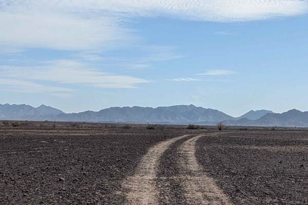
EC1191
This out-and-back trail crosses a flat, barren wasteland, connecting EC1187 and EC1195. The surface is hard-packed sand with embedded rocks and gravel providing solid traction across the desolate terrain. You'll enjoy views of surrounding mountain ranges in all directions, including the Trigo Mounta...
Learn more about EC1191
EC1243 West
This 2.6-mile trail climbs 150 feet through a deep sand and rocky wash filled with lots of debris from recent storms. The trail eases up after half a mile from the main road on the east side, making the initial section the most challenging. The wash follows a mud wall on the east side as it winds th...
Learn more about EC1243 West
EC1177
This 1.64-mile out-and-back trail climbs 155 feet and is located on BLM land, ending at the Yuma Proving Grounds, which is part of the Department of Defense, where no entry is allowed. The surface is hard-packed sand with some gravel and rocks, and the trail is lined with creosote bushes throughout....
Learn more about EC1177
EC1328
This trail is located within the Ehrenberg Sandbowl OHV area and features a sandy surface with lots of washboards throughout. You'll enjoy beautiful views of the canyons below and desert flowers at seasonal times add color to the landscape. The trail includes one very steep hill that's a 100-foot cl...
Learn more about EC1328
EC1238 Loop
This loop trail is located within the Ehrenberg Sandbowl OHV Area, down in the sandy dunes section. The surface is deep sand with some rocks scattered throughout, cutting around desert brush as it winds through the terrain. The trail is one vehicle wide with ruts and off-camber sections that demand ...
Learn more about EC1238 Loop
EC1233
This just under 2 mile trail climbs 120 feet and drops 120 feet as it navigates through terrain that's one vehicle wide. The surface is deep sand that's very bumpy due to heavy washboards throughout. The route cuts through a forest of desert brush and drops in and out of washes while running up and ...
Learn more about EC1233
EC1229
This 3+ mile trail (6.5 miles out and back) climbs 350 feet, starting in a big sandy and gravel wash that's lined with lots of desert brush and bushes. The wash can be wide at times, giving you room to navigate through the terrain. The trail runs along some mud walls, so be cautious during storms as...
Learn more about EC1229

EC1181
This 1.5-mile out-and-back trail climbs 130 feet, starting on EC1179 in a soft and sandy wash surrounded by trees and brush. The route quickly climbs out and runs along the lower level edges between the wash and hills, where the surface transitions to hard-packed sand. The trail heads to and through...
Learn more about EC1181
EC1219
This just over 3 mile trail (6 miles out and back) climbs over 250 feet and runs along a sand wash with mud walls. The surface is sandy wash with some small rocks and nice soft sand throughout. The route winds through lots of trees and brush, with some tight spots between trees and bushes that narro...
Learn more about EC1219
Beginner ATV trails near Mesa Verde, California
Explore ATV-friendly trails near you. These trails are accessible for vehicles up to 50 inches wide, perfect for ATVs and smaller off-road machines.
Blythe Junction Railroad
This trail is an old railroad route abandoned in 2011. It follows a smooth sandy path with sections of firm sandstone, making it manageable for most vehicles. Although the route parallels the former railbed, driving directly on the railbed is not recommended due to old railroad spikes that have caus...
Learn more about Blythe Junction Railroad
EC1187
This two-mile trail climbs over 200 feet, starting just off Levee Road in a large, wide sandy area. The trail quickly drops into a very fine sandy wash that alternates between a very wide wash and one vehicle-wide sections filled with lots of vegetation. The wash runs through a canyon with tall mud ...
Learn more about EC1187
Trigo Wash EC1209
This is just over a 5-mile trail (10 miles out and back) that climbs 377 feet, starting on Levee Road and dropping quickly into a tight wash that's completely lined with brush. The surface is hard-packed sand with a little gravel, alternating between light, soft sand and dark red rocks as you progre...
Learn more about Trigo Wash EC1209
Flower Hill
During the blooming season, this road offers beautiful views of multiple different flowers. This road runs through Bureau Land Management, a mixed surface of gravel, rock, and sand, with some sections more rutted, rocky, and washed out. One section will be difficult for a long wheelbase. Be aware th...
Learn more about Flower Hill
Beginner UTV/side-by-side trails near Mesa Verde, California
Find UTV and side-by-side trails near you. These trails accommodate vehicles up to 60 inches wide, ideal for UTVs, side-by-sides, and wider off-road rigs.
Blythe Junction Railroad
This trail is an old railroad route abandoned in 2011. It follows a smooth sandy path with sections of firm sandstone, making it manageable for most vehicles. Although the route parallels the former railbed, driving directly on the railbed is not recommended due to old railroad spikes that have caus...
Learn more about Blythe Junction Railroad
EC1187
This two-mile trail climbs over 200 feet, starting just off Levee Road in a large, wide sandy area. The trail quickly drops into a very fine sandy wash that alternates between a very wide wash and one vehicle-wide sections filled with lots of vegetation. The wash runs through a canyon with tall mud ...
Learn more about EC1187
Trigo Wash EC1209
This is just over a 5-mile trail (10 miles out and back) that climbs 377 feet, starting on Levee Road and dropping quickly into a tight wash that's completely lined with brush. The surface is hard-packed sand with a little gravel, alternating between light, soft sand and dark red rocks as you progre...
Learn more about Trigo Wash EC1209
Flower Hill
During the blooming season, this road offers beautiful views of multiple different flowers. This road runs through Bureau Land Management, a mixed surface of gravel, rock, and sand, with some sections more rutted, rocky, and washed out. One section will be difficult for a long wheelbase. Be aware th...
Learn more about Flower Hill
The onX Offroad Difference
onX Offroad combines trail photos, descriptions, difficulty ratings, width restrictions, seasonality, and more in a user-friendly interface. Available on all devices, with offline access and full compatibility with CarPlay and Android Auto. Discover what you're missing today!
Open Trail Map