
Beginner Off-Road Trails
Near McAdenville, North Carolina
Explore All Beginner Trails Near McAdenville, North Carolina
Beginner Off-Road Trails Near McAdenville, North Carolina
Discover the best beginner-friendly off-road trails near you. These easier, lower-rated trails are a great place to start — browse trail maps, check difficulty ratings, and find your next adventure.

South Carolina Adventure Route Segment 4
Segment 4 transits the "midlands" section of South Carolina, with the towns of Gaffney and Camden on each end. This section is mostly forested and contains a mixture of pavement, gravel, and clay roads. The clay can become quite slick and rutted when wet, and the ruts can hold their form when dry, s...
Learn more about South Carolina Adventure Route Segment 4
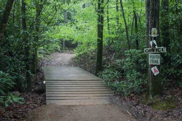
1C
This 1.4-mile off-road trail at Brushy Mountain Motorsports Park near Taylorsville, North Carolina, offers an easy, scenic ride for SxS vehicles, ATVs, and dirt bikes. Starting and ending at the main staging area, the loop features a gradual climb and descent under the pleasant cover of leafy ash an...
Learn more about 1C
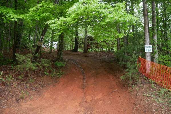
Youth Trail
The Youth Trail at Brushy Mountain Motorsports Park is a 2.1-mile loop starting and ending at the main staging area, featuring a gradual climb followed by a descent. The trail is wide, well-marked at intersections and shortcut points, and offers a very curvy, twisty ride. Riders will encounter small...
Learn more about Youth Trail
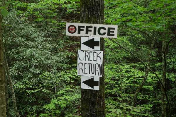
Creek Office Return
This two-way trail at Brushy Mountain Motorsports Park begins on the west side at the intersection of Trails 1A, 2A, and 1B. The route starts off narrow between dense bushes before opening slightly as it parallels a scenic creek. Minor loose and embedded rocks are present, but the trail surface is m...
Learn more about Creek Office Return
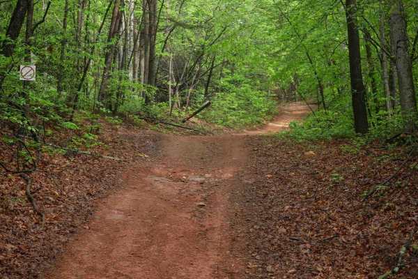
2C
Trail 2C at Brushy Mountain Motorsports Park is a 2.8-mile, easy SxS loop beginning and ending at the main staging area. Riders experience a gradual ascent for the first half, followed by a smooth descent, with one-way travel in a counterclockwise direction. The wide trail surface features mostly sm...
Learn more about 2C
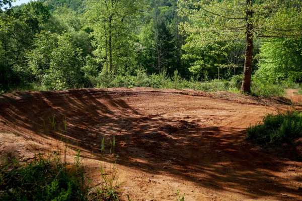
MX Track
Brushy Mountain's motocross track offers a natural terrain loop that's ideal for warming up or honing skills before hitting the trails. With hard pack red dirt and scenic views in the trees, it has medium-sized table jumps and banked berms. The track features split lines, sweeping corners, and natur...
Learn more about MX Track
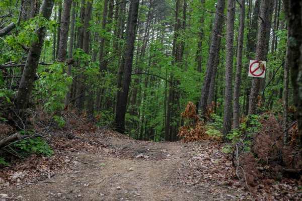
Shortcut
This shortcut provides a quick and efficient connection between the intermediate 1C OHV trail and the easy 1C OHV trail, also frequently used by dirt bikers on the 9C EXT single track. The trail is wide, with waterbars throughout the route, and features a steep ascent that gains 300 feet in just a t...
Learn more about Shortcut
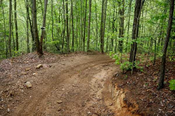
4B
Trail 4B at Brushy Mountain Motorsports Park is a directional, one-way route traveling northwest to southeast, serving as a bailout from Trail 1B to return toward the office and staging area. This half-mile trail features a steep descent, dropping approximately 350 feet in elevation with a few sweep...
Learn more about 4B
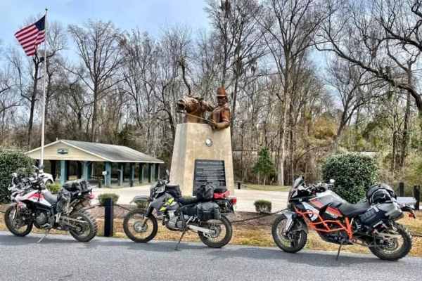
SCAR Northeast Alternate
Covering the northeast portion of the state, this significant addition transits Sandhills State Forest and the Carolina National Wildlife Refuge, providing an alternate route between Liberty Hill WMA and Francis Marion National Forest. Campsites marked along this route require reservations (see meta...
Learn more about SCAR Northeast Alternate
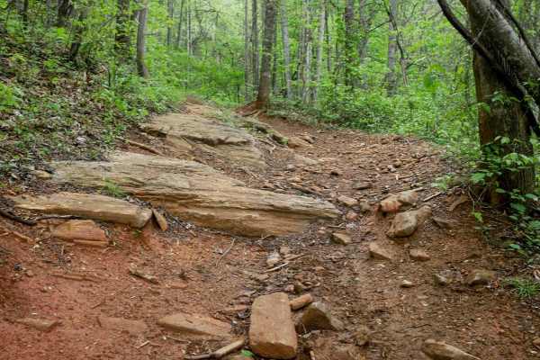
1B Shortcut
The 1B Shortcut is a short, less-than-quarter-mile connector trail linking two segments of Trail 1B. It cuts approximately two miles off the main 1B loop. The trail features a mostly smooth, gradual surface with one minor obstacle: an embedded rock layer creating a small 6-inch drop-off, which is ea...
Learn more about 1B Shortcut
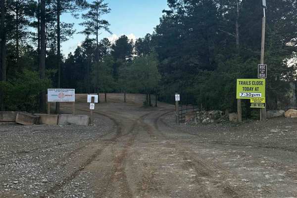
Service Road 4 (SR 4)
One of our main service roads that leads to trails, SR 4 is rocky in some areas. It's a very wide road that is very dusty if the ground is dry. The road is used by EMS/the Rescue Squad if needed. There are a couple of curves but it's mainly a straight road that leads to the bridge crossing. It's rea...
Learn more about Service Road 4 (SR 4)

Trail 6
This is the longest trail in the trail system with a lot of mergers onto other trails. It goes through the whole park on a mostly dirt road with some bedrock in certain spots. When it rains, there will be some mud spots on the trail. Though the trail can be windy in some sections, it's the easiest t...
Learn more about Trail 6
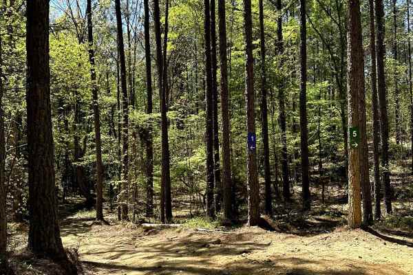
Trail 5
Trail 5 is a 2.5-mile easy-rated trail that begins off of Service Road 1. Trail 5 is a dirt trail with mild hills and some loose rock. The trail is very hard-packed, containing mild ruts that are all under 12 inches deep. Trail 5 crosses many other trails and service roads, making it an excellent pa...
Learn more about Trail 5
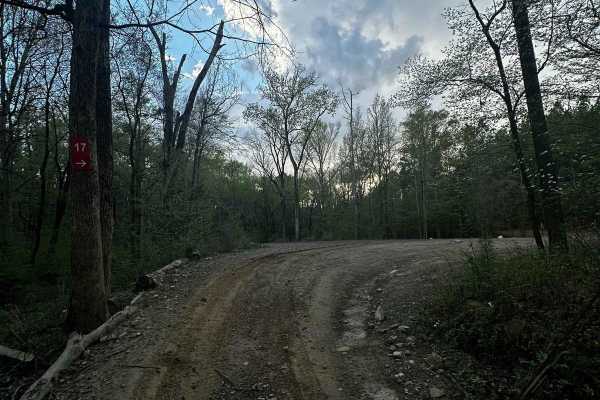
Service Road 17 (SR 17)
SR 17 is the road from the bridge crossing to SR 18. It's mainly a dirt road with some bedrock in one section. Trail 6, SR 18, the end of Trail 44, and a shortcut to SR 18 are accessed from this road. This service road is used for emergencies. It's a wide road that provides access to dirt bike Trail...
Learn more about Service Road 17 (SR 17)
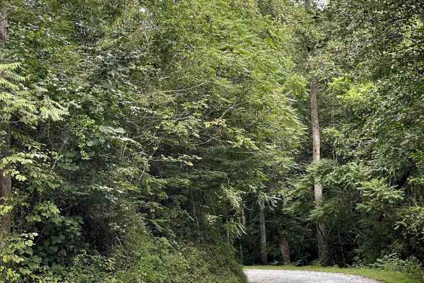
Shallow Creek Road
Shallow Creek Road is a well-maintained county road consisting primarily of hard-packed gravel and free from major obstacles. The road provides an easy and comfortable drive through the surrounding mountain countryside and is suitable for most vehicles. The gravel surface is generally smooth and doe...
Learn more about Shallow Creek Road
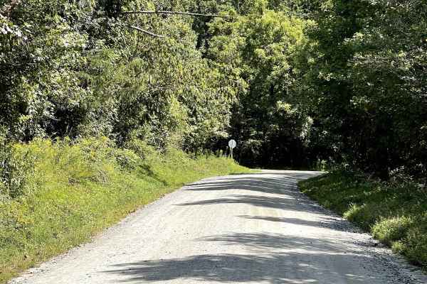
Playmore Beach Road
Playmore Beach Road is a through route consisting of hard-packed dirt that is approximately two lanes wide and free from major obstacles. The trail provides an easy and enjoyable drive through the surrounding area and is suitable for most vehicles. Along the route, users can enjoy the scenery of a n...
Learn more about Playmore Beach Road
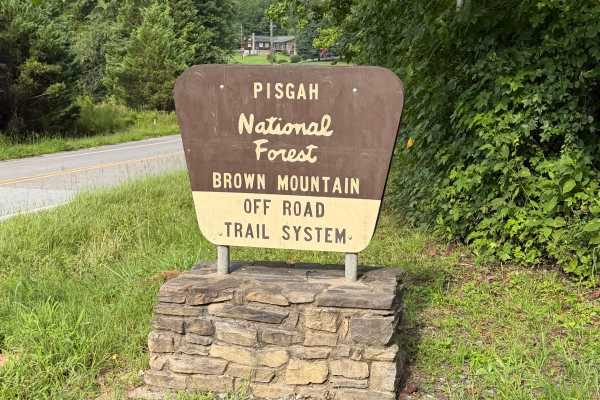
Brown Mountain - FS 299
Brown Mountain Road (Forest Service Road 299) serves as the primary access route to the Brown Mountain OHV Trail System in Pisgah National Forest. This Forest Service road extends approximately 1.25 miles from Brown Mountain Beach Road (SR 1405) to the main OHV trailhead, providing access to parking...
Learn more about Brown Mountain - FS 299
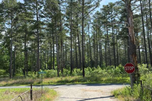
Ross Road
Ross Road is a wide, Forest Service-style road that provides direct access to the Pee Dee National Wildlife Refuge. As one of the longest trails winding through the area, it primarily runs through dense woodlands with the occasional clearing of open farm fields. The trail is predominantly a gravel d...
Learn more about Ross Road
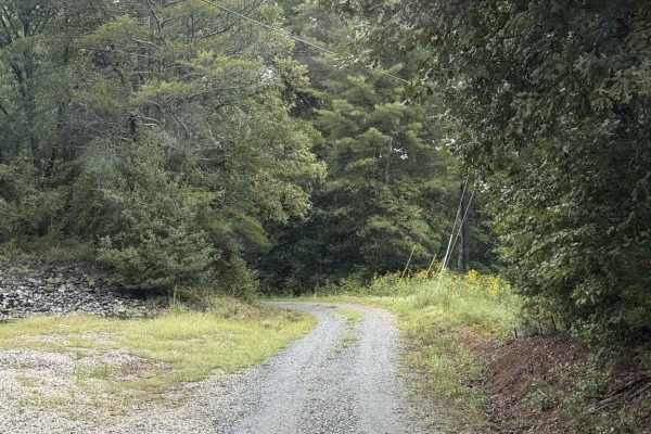
Pearcy Creek - FS 4101
Pearcy Creek - FS 4101 is a well-maintained Forest Service road with seasonal closure between 01/1 and 08/31. The road begins along private property and enters the Pisgah Game Land, where there can be many small streams from water runoff from the surrounding higher elevations, but none of them are e...
Learn more about Pearcy Creek - FS 4101
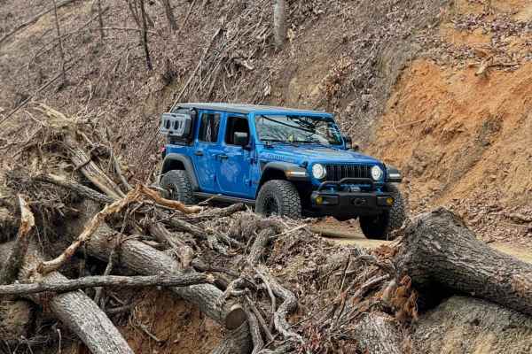
Roses Creek - FS 210
This Forest Service road through Pisgah National Forest offers access to stunning views, Table Rock, and the North Carolina Outward Bound School. The trail begins in a small town, passing through some private property before transitioning into a narrow shelf road with hard-packed gravel. Along the w...
Learn more about Roses Creek - FS 210
Beginner ATV trails near McAdenville, North Carolina
Explore ATV-friendly trails near you. These trails are accessible for vehicles up to 50 inches wide, perfect for ATVs and smaller off-road machines.
1C
This 1.4-mile off-road trail at Brushy Mountain Motorsports Park near Taylorsville, North Carolina, offers an easy, scenic ride for SxS vehicles, ATVs, and dirt bikes. Starting and ending at the main staging area, the loop features a gradual climb and descent under the pleasant cover of leafy ash an...
Learn more about 1C
Youth Trail
The Youth Trail at Brushy Mountain Motorsports Park is a 2.1-mile loop starting and ending at the main staging area, featuring a gradual climb followed by a descent. The trail is wide, well-marked at intersections and shortcut points, and offers a very curvy, twisty ride. Riders will encounter small...
Learn more about Youth Trail
Creek Office Return
This two-way trail at Brushy Mountain Motorsports Park begins on the west side at the intersection of Trails 1A, 2A, and 1B. The route starts off narrow between dense bushes before opening slightly as it parallels a scenic creek. Minor loose and embedded rocks are present, but the trail surface is m...
Learn more about Creek Office Return
2C
Trail 2C at Brushy Mountain Motorsports Park is a 2.8-mile, easy SxS loop beginning and ending at the main staging area. Riders experience a gradual ascent for the first half, followed by a smooth descent, with one-way travel in a counterclockwise direction. The wide trail surface features mostly sm...
Learn more about 2C
Beginner UTV/side-by-side trails near McAdenville, North Carolina
Find UTV and side-by-side trails near you. These trails accommodate vehicles up to 60 inches wide, ideal for UTVs, side-by-sides, and wider off-road rigs.
1C
This 1.4-mile off-road trail at Brushy Mountain Motorsports Park near Taylorsville, North Carolina, offers an easy, scenic ride for SxS vehicles, ATVs, and dirt bikes. Starting and ending at the main staging area, the loop features a gradual climb and descent under the pleasant cover of leafy ash an...
Learn more about 1C
Youth Trail
The Youth Trail at Brushy Mountain Motorsports Park is a 2.1-mile loop starting and ending at the main staging area, featuring a gradual climb followed by a descent. The trail is wide, well-marked at intersections and shortcut points, and offers a very curvy, twisty ride. Riders will encounter small...
Learn more about Youth Trail
Creek Office Return
This two-way trail at Brushy Mountain Motorsports Park begins on the west side at the intersection of Trails 1A, 2A, and 1B. The route starts off narrow between dense bushes before opening slightly as it parallels a scenic creek. Minor loose and embedded rocks are present, but the trail surface is m...
Learn more about Creek Office Return
2C
Trail 2C at Brushy Mountain Motorsports Park is a 2.8-mile, easy SxS loop beginning and ending at the main staging area. Riders experience a gradual ascent for the first half, followed by a smooth descent, with one-way travel in a counterclockwise direction. The wide trail surface features mostly sm...
Learn more about 2C
The onX Offroad Difference
onX Offroad combines trail photos, descriptions, difficulty ratings, width restrictions, seasonality, and more in a user-friendly interface. Available on all devices, with offline access and full compatibility with CarPlay and Android Auto. Discover what you're missing today!
Open Trail Map