
Beginner Off-Road Trails
Near Long View, North Carolina
Explore All Beginner Trails Near Long View, North Carolina
Beginner Off-Road Trails Near Long View, North Carolina
Discover the best beginner-friendly off-road trails near you. These easier, lower-rated trails are a great place to start — browse trail maps, check difficulty ratings, and find your next adventure.
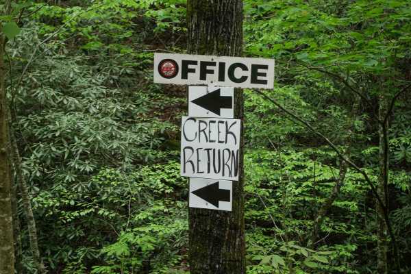
Creek Office Return
This two-way trail at Brushy Mountain Motorsports Park begins on the west side at the intersection of Trails 1A, 2A, and 1B. The route starts off narrow between dense bushes before opening slightly as it parallels a scenic creek. Minor loose and embedded rocks are present, but the trail surface is m...
Learn more about Creek Office Return
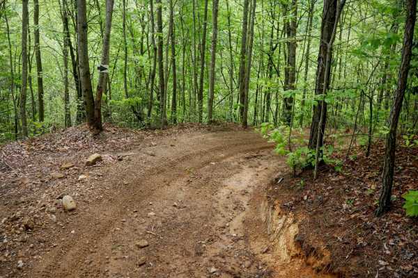
4B
Trail 4B at Brushy Mountain Motorsports Park is a directional, one-way route traveling northwest to southeast, serving as a bailout from Trail 1B to return toward the office and staging area. This half-mile trail features a steep descent, dropping approximately 350 feet in elevation with a few sweep...
Learn more about 4B
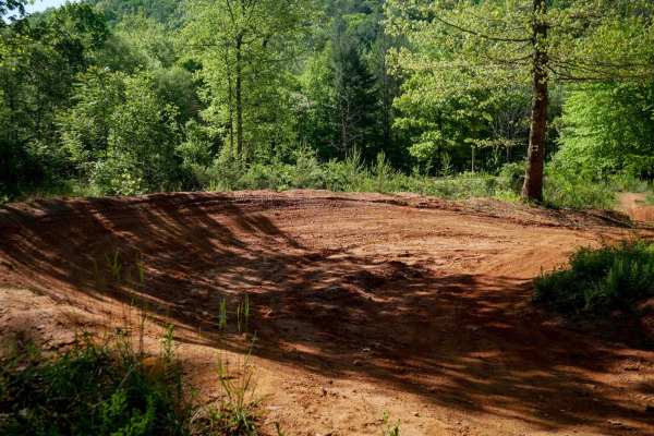
MX Track
Brushy Mountain's motocross track offers a natural terrain loop that's ideal for warming up or honing skills before hitting the trails. With hard pack red dirt and scenic views in the trees, it has medium-sized table jumps and banked berms. The track features split lines, sweeping corners, and natur...
Learn more about MX Track
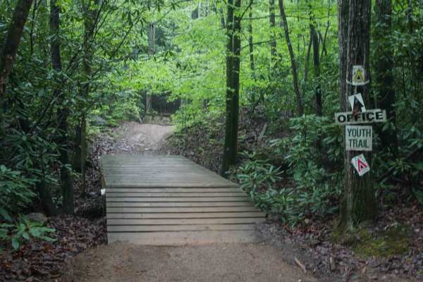
1C
This 1.4-mile off-road trail at Brushy Mountain Motorsports Park near Taylorsville, North Carolina, offers an easy, scenic ride for SxS vehicles, ATVs, and dirt bikes. Starting and ending at the main staging area, the loop features a gradual climb and descent under the pleasant cover of leafy ash an...
Learn more about 1C
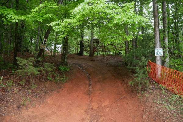
Youth Trail
The Youth Trail at Brushy Mountain Motorsports Park is a 2.1-mile loop starting and ending at the main staging area, featuring a gradual climb followed by a descent. The trail is wide, well-marked at intersections and shortcut points, and offers a very curvy, twisty ride. Riders will encounter small...
Learn more about Youth Trail
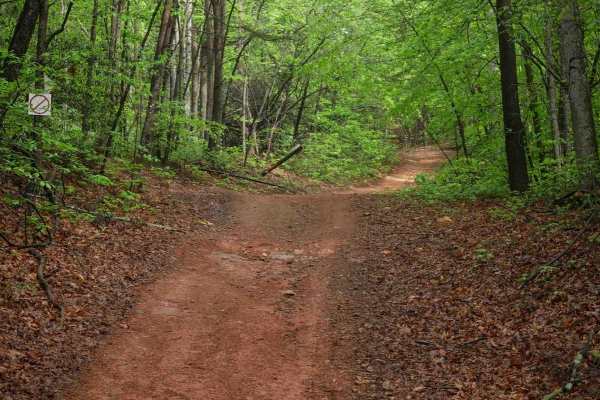
2C
Trail 2C at Brushy Mountain Motorsports Park is a 2.8-mile, easy SxS loop beginning and ending at the main staging area. Riders experience a gradual ascent for the first half, followed by a smooth descent, with one-way travel in a counterclockwise direction. The wide trail surface features mostly sm...
Learn more about 2C
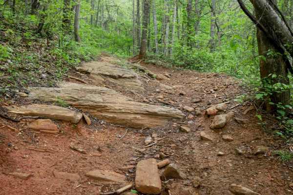
1B Shortcut
The 1B Shortcut is a short, less-than-quarter-mile connector trail linking two segments of Trail 1B. It cuts approximately two miles off the main 1B loop. The trail features a mostly smooth, gradual surface with one minor obstacle: an embedded rock layer creating a small 6-inch drop-off, which is ea...
Learn more about 1B Shortcut
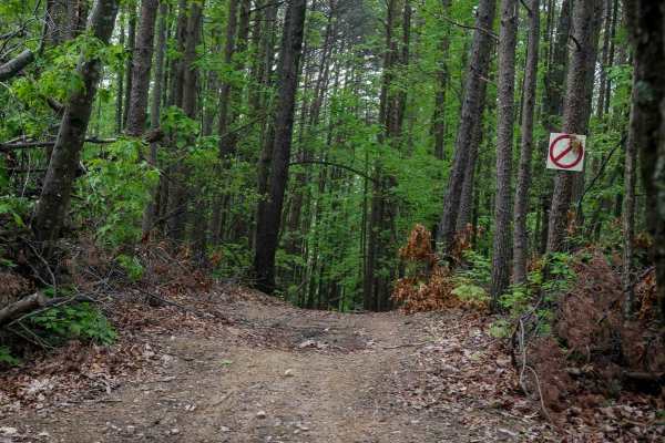
Shortcut
This shortcut provides a quick and efficient connection between the intermediate 1C OHV trail and the easy 1C OHV trail, also frequently used by dirt bikers on the 9C EXT single track. The trail is wide, with waterbars throughout the route, and features a steep ascent that gains 300 feet in just a t...
Learn more about Shortcut
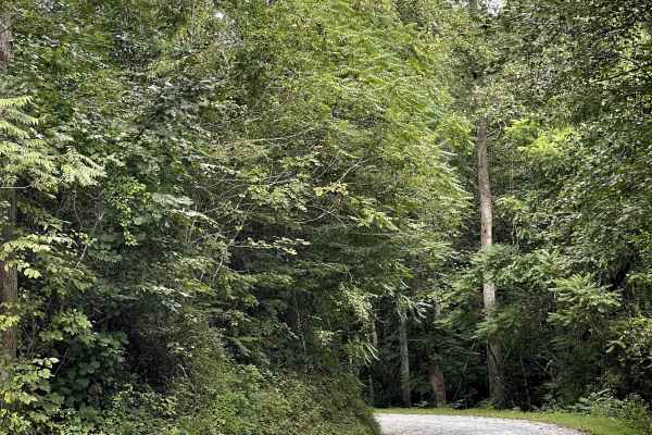
Shallow Creek Road
Shallow Creek Road is a well-maintained county road consisting primarily of hard-packed gravel and free from major obstacles. The road provides an easy and comfortable drive through the surrounding mountain countryside and is suitable for most vehicles. The gravel surface is generally smooth and doe...
Learn more about Shallow Creek Road
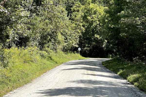
Playmore Beach Road
Playmore Beach Road is a through route consisting of hard-packed dirt that is approximately two lanes wide and free from major obstacles. The trail provides an easy and enjoyable drive through the surrounding area and is suitable for most vehicles. Along the route, users can enjoy the scenery of a n...
Learn more about Playmore Beach Road
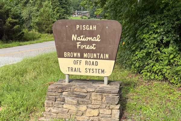
Brown Mountain - FS 299
Brown Mountain Road (Forest Service Road 299) serves as the primary access route to the Brown Mountain OHV Trail System in Pisgah National Forest. This Forest Service road extends approximately 1.25 miles from Brown Mountain Beach Road (SR 1405) to the main OHV trailhead, providing access to parking...
Learn more about Brown Mountain - FS 299
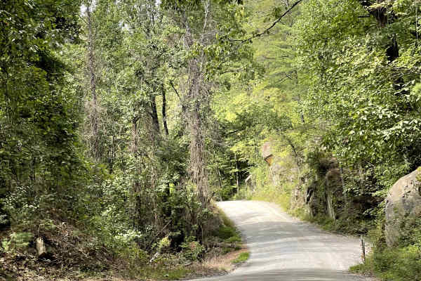
Brown Beach
Brown Beach is a hard-packed dirt trail that is approximately two lanes wide and free from major obstacles. The route provides an easy and enjoyable drive through a beautiful gorge, with the trail following alongside the river for much of the journey. The combination of the surrounding rock formatio...
Learn more about Brown Beach
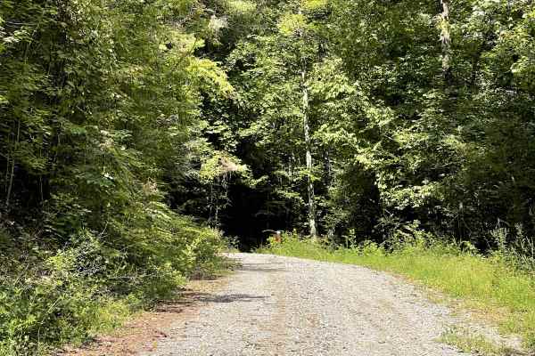
FS 4096
FS 4096 is accessed shortly after entering the Brown Mountain Offroad Trails area. Because users must pass through the BMOT entrance gate to reach this trail, a daily or annual permit is required, although FS 4096 is not officially part of the BMOT trail network. The trail itself is a gravel single-...
Learn more about FS 4096
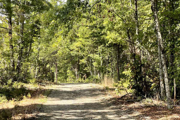
Green Rock
Green Rock Trail has a steep and narrow entrance just off the main road before opening into a gravel route. The trail is free from major obstacles but is very steep in sections, making traction an important consideration. AWD is recommended, as loose gravel and changing weather conditions could make...
Learn more about Green Rock
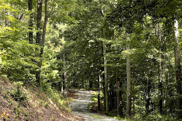
Cove Branch Road
Cove Branch Road is a well-maintained county gravel road that provides an easy and enjoyable route through the surrounding area. The trail is suitable for all vehicles and is free from major obstacles, making it a good option for stock trucks, SUVs, and other vehicles without specialized off-road eq...
Learn more about Cove Branch Road
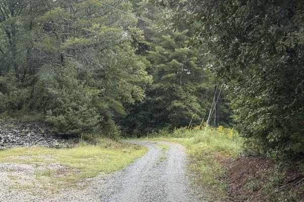
Pearcy Creek - FS 4101
Pearcy Creek - FS 4101 is a well-maintained Forest Service road with seasonal closure between 01/1 and 08/31. The road begins along private property and enters the Pisgah Game Land, where there can be many small streams from water runoff from the surrounding higher elevations, but none of them are e...
Learn more about Pearcy Creek - FS 4101
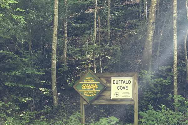
Buffalo Cove Game Lands
Buffalo Cove State Game Lands Trail offers users a scenic traverse along the top of a mountain, with opportunities to enjoy distant views of Grandfather Mountain along the route. Access to the trail begins at a seasonally opened gate, which is open from September 1 through March 1. From the access p...
Learn more about Buffalo Cove Game Lands
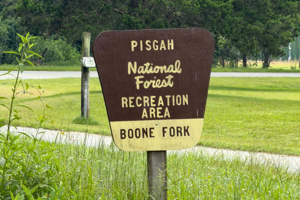
Boone Fork - FS 2055
Coming up onto the trail off of Mulberry Creek Road, you will be met with a gravel road that passes through private properties and eventually leads into the Pisgah National Forest. Upon entering, you will notice it's mainly one vehicle wide, so be sure to share the road. Soon you will be met with a ...
Learn more about Boone Fork - FS 2055
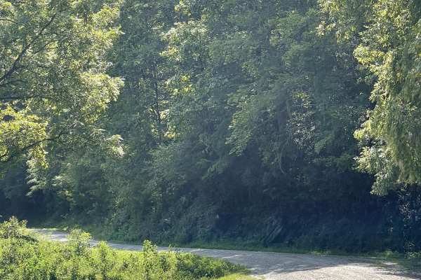
Mulberry Creek Road
Mulberry Creek Road is a scenic addition to the local gravel road network, offering users a relaxing drive through the mountains. This well-maintained, two-lane-wide, hard-packed gravel road follows alongside Mulberry Creek and passes beneath Sand Mountain, which reaches approximately 2,096 feet, an...
Learn more about Mulberry Creek Road
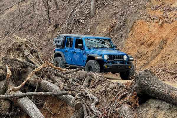
Roses Creek - FS 210
This Forest Service road through Pisgah National Forest offers access to stunning views, Table Rock, and the North Carolina Outward Bound School. The trail begins in a small town, passing through some private property before transitioning into a narrow shelf road with hard-packed gravel. Along the w...
Learn more about Roses Creek - FS 210
Beginner ATV trails near Long View, North Carolina
Explore ATV-friendly trails near you. These trails are accessible for vehicles up to 50 inches wide, perfect for ATVs and smaller off-road machines.
Creek Office Return
This two-way trail at Brushy Mountain Motorsports Park begins on the west side at the intersection of Trails 1A, 2A, and 1B. The route starts off narrow between dense bushes before opening slightly as it parallels a scenic creek. Minor loose and embedded rocks are present, but the trail surface is m...
Learn more about Creek Office Return
4B
Trail 4B at Brushy Mountain Motorsports Park is a directional, one-way route traveling northwest to southeast, serving as a bailout from Trail 1B to return toward the office and staging area. This half-mile trail features a steep descent, dropping approximately 350 feet in elevation with a few sweep...
Learn more about 4B
1C
This 1.4-mile off-road trail at Brushy Mountain Motorsports Park near Taylorsville, North Carolina, offers an easy, scenic ride for SxS vehicles, ATVs, and dirt bikes. Starting and ending at the main staging area, the loop features a gradual climb and descent under the pleasant cover of leafy ash an...
Learn more about 1C
Youth Trail
The Youth Trail at Brushy Mountain Motorsports Park is a 2.1-mile loop starting and ending at the main staging area, featuring a gradual climb followed by a descent. The trail is wide, well-marked at intersections and shortcut points, and offers a very curvy, twisty ride. Riders will encounter small...
Learn more about Youth Trail
Beginner UTV/side-by-side trails near Long View, North Carolina
Find UTV and side-by-side trails near you. These trails accommodate vehicles up to 60 inches wide, ideal for UTVs, side-by-sides, and wider off-road rigs.
Creek Office Return
This two-way trail at Brushy Mountain Motorsports Park begins on the west side at the intersection of Trails 1A, 2A, and 1B. The route starts off narrow between dense bushes before opening slightly as it parallels a scenic creek. Minor loose and embedded rocks are present, but the trail surface is m...
Learn more about Creek Office Return
4B
Trail 4B at Brushy Mountain Motorsports Park is a directional, one-way route traveling northwest to southeast, serving as a bailout from Trail 1B to return toward the office and staging area. This half-mile trail features a steep descent, dropping approximately 350 feet in elevation with a few sweep...
Learn more about 4B
1C
This 1.4-mile off-road trail at Brushy Mountain Motorsports Park near Taylorsville, North Carolina, offers an easy, scenic ride for SxS vehicles, ATVs, and dirt bikes. Starting and ending at the main staging area, the loop features a gradual climb and descent under the pleasant cover of leafy ash an...
Learn more about 1C
Youth Trail
The Youth Trail at Brushy Mountain Motorsports Park is a 2.1-mile loop starting and ending at the main staging area, featuring a gradual climb followed by a descent. The trail is wide, well-marked at intersections and shortcut points, and offers a very curvy, twisty ride. Riders will encounter small...
Learn more about Youth Trail
The onX Offroad Difference
onX Offroad combines trail photos, descriptions, difficulty ratings, width restrictions, seasonality, and more in a user-friendly interface. Available on all devices, with offline access and full compatibility with CarPlay and Android Auto. Discover what you're missing today!
Open Trail Map