
Beginner Off-Road Trails
Near LeChee, Arizona
Explore All Beginner Trails Near LeChee, Arizona
Beginner Off-Road Trails Near LeChee, Arizona
Discover the best beginner-friendly off-road trails near you. These easier, lower-rated trails are a great place to start — browse trail maps, check difficulty ratings, and find your next adventure.
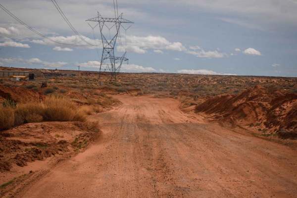
Powerline Perimeter
This is a 4-mile powerline road going along the north and west perimeter of this OHV area on City of Page land. The east end starts from Border Road at the end of the industrial park. The west end is off of Highway 89. It's a fast, straight, and flat powerline road, made of sand with lots of whoops....
Learn more about Powerline Perimeter
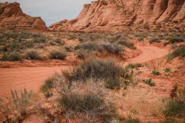
Page Trail
This 1.3-mile-long sand trail goes through City of Page land south of the town of Page, Arizona. It starts and ends off of the powerline road that starts at the entrance to the OHV area, at the end of the industrial complex. It goes through a red sandy desert with red cliffs in the distance. Most of...
Learn more about Page Trail
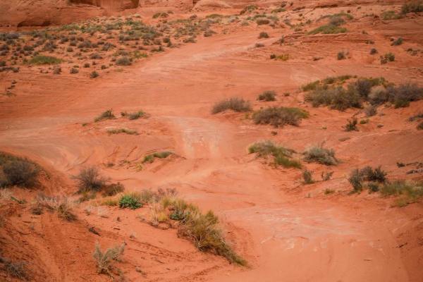
Cave View
This short sandy trail goes through City of Page land in a red sandy desert, right next to huge sandstone mesas and pink cliffs with cool views. The north end starts on a powerline road, and it goes south for 1.2 miles to the border with the Navajo Reservation. The track is elevated above a ravine b...
Learn more about Cave View
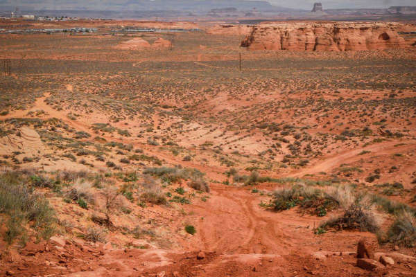
North Powerline
This is a 2-mile powerline trail in the desert south of the City of Page. The south end starts on top of one of the red sandstone mesas, at the intersection with Red Rim. On top of the mesa, it has a pretty cool view out over the whole valley. It has a slightly harder downhill to get off the mesa, w...
Learn more about North Powerline
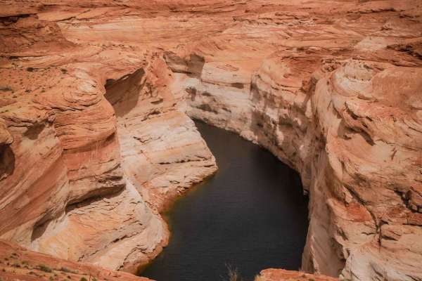
Lake Powell View Loop
This is a fun desert loop in Page, Arizona, that takes you out to a view of Lake Powell. It goes north from the dirt parking lot on Coppermine Road for 2 miles. Going counterclockwise from the south end, go past the RV park, and it's a red sandy track. Part of it is through a sandy wash between two ...
Learn more about Lake Powell View Loop
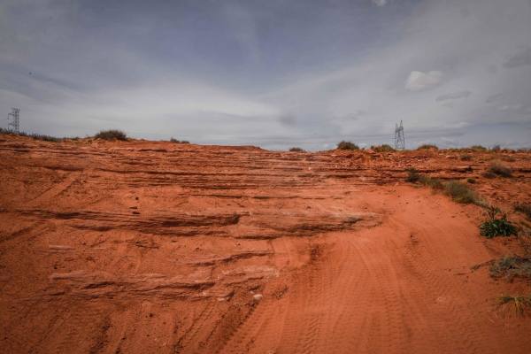
Red Rim
Red Rim is a 3-mile loop on top of one of the mesas in this red sandy desert by Page, Arizona. It has awesome views out towards Glen Canyon and toward the town of Page. The trail starts as easy sand under the powerlines and climbs up the mesa. The climb is not hard, but it is deep sand. Once you are...
Learn more about Red Rim
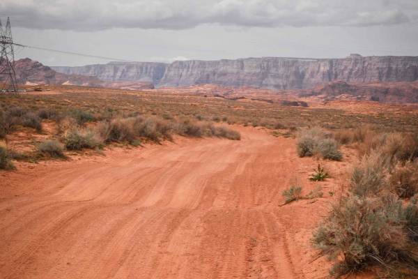
Diagonal Powerline
This is a 1.8-mile-long powerline road that diagonals through this red sandy desert and OHV area. The northwest end starts off of the perimeter powerline road and ends at the border of City of Page land, although the track keeps going into the Navajo Reservation. It's made of a mix of dirt and sand,...
Learn more about Diagonal Powerline
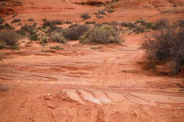
South Powerline
This trail starts as a powerline road on the southern border of the City of Page land bordering the Navajo Reservation, then turns north and goes along the red sandstone mesas. The powerline portion is red sand with lots of whoops. After the sharp turn north, it's still a sandy track with lots of wh...
Learn more about South Powerline
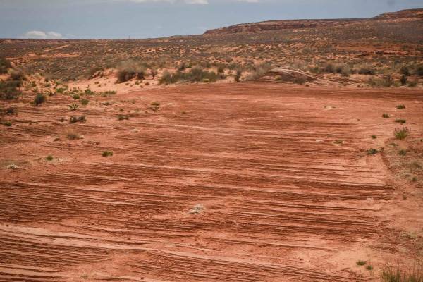
Powerline to Red Rim
This trail of just over a mile long goes through the red sandy desert on City of Page land. It cuts through the desert from northwest to southeast starting from the perimeter powerline road. It's sandy, whooped, and easy. Then it turns south towards the red sandstone mesa. It crosses lots of other t...
Learn more about Powerline to Red Rim
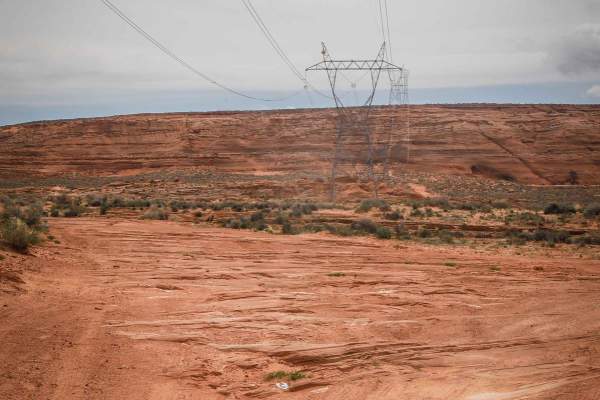
West Powerline
This 1.4-mile track is similar to the perimeter powerline trail, being mostly sand with lots of whoops. It has embedded rock slab sections, but the rock is all flat with no ledges, so it's still easy and it's very wide. This one has more sections of hardpacked dirt and isn't all completely sand, so ...
Learn more about West Powerline
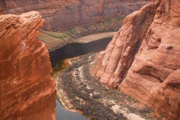
Colorado River View
This 1.8-mile track takes you from Highway 89 out to the canyon overlooking the Colorado River via a rocky powerline road. It starts out with slab rock on hardpacked sand and dirt underneath powerlines. It's flat and straight in the beginning, going over bumpy layers of slick rock. The slick rock cr...
Learn more about Colorado River View
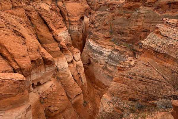
Antelope Slots Overlook
This short trail will take you to an unobstructed cliffside viewpoint of the slots in Antelope Canyon. A view with no other access road and would typically require a guided hiking tour to see from below, it is unrivaled. Just off of another trail, "Lake Powell View Loop", the trail to and from is ju...
Learn more about Antelope Slots Overlook
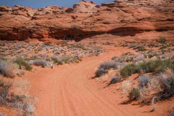
Wash ORV Route
The Wash ORV Route starts on the south end at the trail marker off of the Powerline ORV Loop and goes north through a red sandy wash made of fine smooth sand. It goes underneath really cool rock formations. Sometimes it has red rock slab in the trail, but it's mostly sand. It keeps going onto the Fe...
Learn more about Wash ORV Route
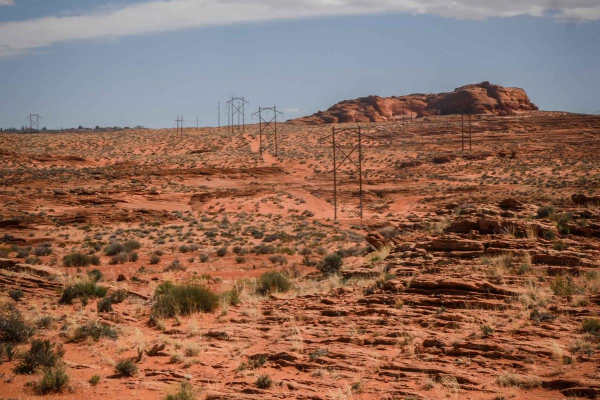
Powerline ORV Loop
The Powerline ORV Loop is a newly developed route in the Ferry Swale area of Glen Canyon National Recreation Area. It's mostly a wide sandy road under the powerlines, with two spurs out to viewpoints over the Colorado River. It goes up some small slab rock ledges and has lots of layers of slab rock ...
Learn more about Powerline ORV Loop
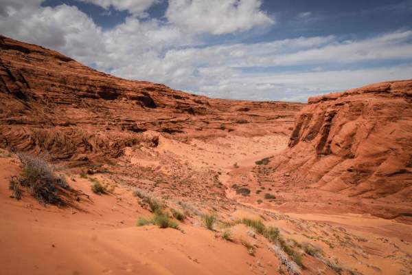
Ferry Swale
This is a really scenic out-and-back 2.2-mile road through the Vermilion Cliffs National Monument and the Ferry Swale area of Glen Canyon National Recreation Area. It's a sandy narrower trail through red desert, with layers of rock formations in the distance. It drops into a wide sandy wash that is ...
Learn more about Ferry Swale
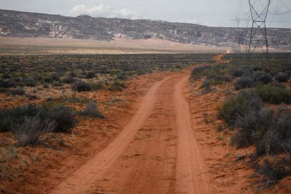
1405
1405 is a long powerline road made of dirt and sand that has been chopped up by cattle. It goes flat and straight for almost 4 miles, with scenic views in every direction. There are grey sandstone hills and the Vermillion Cliffs in the distance. The road ends when it tees up with another dirt road, ...
Learn more about 1405

Ferry Swale Road
Ferry Swale Road is accessed from Greenehaven Drive off of Highway 89, north of Page, Arizona. Going south from the highway on Greenehaven Drive, go past the concrete platform and through the gate, turn left on the graded road, then take an immediate right onto the dirt Ferry Swale Road. This will t...
Learn more about Ferry Swale Road

1098
1098 is an easy dirt road that goes from the intersection of Ferry Swale Road and 1097 to the Thousand Pockets Trailhead. It goes from BLM land into the Vermillion Cliffs National Monument. It's fast and straight in the beginning, with more corners later as it heads south. It's a mix of sand, hardpa...
Learn more about 1098

1411
1411 is a 3-mile easy road in the Vermillion Cliffs National Monument that is mostly flat, a mix of dirt and sand, with no obstacles. The road is pretty chopped up from cattle but goes pretty straight with a few easy curves. It ends at a fence that says no motor vehicles, so you can't go any further...
Learn more about 1411

Cat Crossing
This is a steep and rocky shortcut to get from US Route 89 to Stud Horse Point. Other routes require a lot of backtracking, so this saves both time and distance. There is a barbed wire gate that is sometimes open, so be prepared to stop for that gate before powering up or down the slope.
Learn more about Cat Crossing
Beginner ATV trails near LeChee, Arizona
Explore ATV-friendly trails near you. These trails are accessible for vehicles up to 50 inches wide, perfect for ATVs and smaller off-road machines.
Powerline Perimeter
This is a 4-mile powerline road going along the north and west perimeter of this OHV area on City of Page land. The east end starts from Border Road at the end of the industrial park. The west end is off of Highway 89. It's a fast, straight, and flat powerline road, made of sand with lots of whoops....
Learn more about Powerline Perimeter
Page Trail
This 1.3-mile-long sand trail goes through City of Page land south of the town of Page, Arizona. It starts and ends off of the powerline road that starts at the entrance to the OHV area, at the end of the industrial complex. It goes through a red sandy desert with red cliffs in the distance. Most of...
Learn more about Page Trail
Cave View
This short sandy trail goes through City of Page land in a red sandy desert, right next to huge sandstone mesas and pink cliffs with cool views. The north end starts on a powerline road, and it goes south for 1.2 miles to the border with the Navajo Reservation. The track is elevated above a ravine b...
Learn more about Cave View
North Powerline
This is a 2-mile powerline trail in the desert south of the City of Page. The south end starts on top of one of the red sandstone mesas, at the intersection with Red Rim. On top of the mesa, it has a pretty cool view out over the whole valley. It has a slightly harder downhill to get off the mesa, w...
Learn more about North Powerline
Beginner UTV/side-by-side trails near LeChee, Arizona
Find UTV and side-by-side trails near you. These trails accommodate vehicles up to 60 inches wide, ideal for UTVs, side-by-sides, and wider off-road rigs.
Powerline Perimeter
This is a 4-mile powerline road going along the north and west perimeter of this OHV area on City of Page land. The east end starts from Border Road at the end of the industrial park. The west end is off of Highway 89. It's a fast, straight, and flat powerline road, made of sand with lots of whoops....
Learn more about Powerline Perimeter
Page Trail
This 1.3-mile-long sand trail goes through City of Page land south of the town of Page, Arizona. It starts and ends off of the powerline road that starts at the entrance to the OHV area, at the end of the industrial complex. It goes through a red sandy desert with red cliffs in the distance. Most of...
Learn more about Page Trail
Cave View
This short sandy trail goes through City of Page land in a red sandy desert, right next to huge sandstone mesas and pink cliffs with cool views. The north end starts on a powerline road, and it goes south for 1.2 miles to the border with the Navajo Reservation. The track is elevated above a ravine b...
Learn more about Cave View
North Powerline
This is a 2-mile powerline trail in the desert south of the City of Page. The south end starts on top of one of the red sandstone mesas, at the intersection with Red Rim. On top of the mesa, it has a pretty cool view out over the whole valley. It has a slightly harder downhill to get off the mesa, w...
Learn more about North Powerline
The onX Offroad Difference
onX Offroad combines trail photos, descriptions, difficulty ratings, width restrictions, seasonality, and more in a user-friendly interface. Available on all devices, with offline access and full compatibility with CarPlay and Android Auto. Discover what you're missing today!
Open Trail Map