
Beginner Off-Road Trails
Near June Lake, California
Explore All Beginner Trails Near June Lake, California
Beginner Off-Road Trails Near June Lake, California
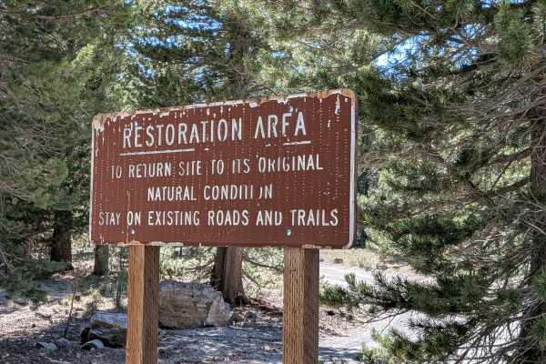
Discover the best beginner-friendly off-road trails near you. These easier, lower-rated trails are a great place to start — browse trail maps, check difficulty ratings, and find your next adventure.
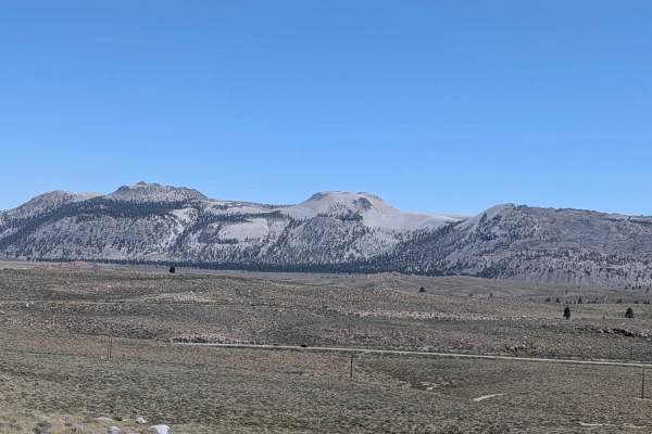
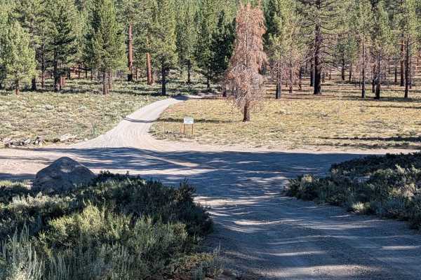
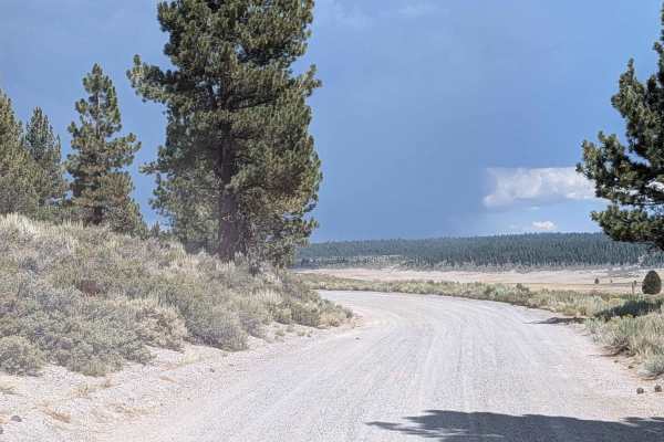
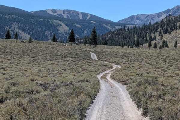
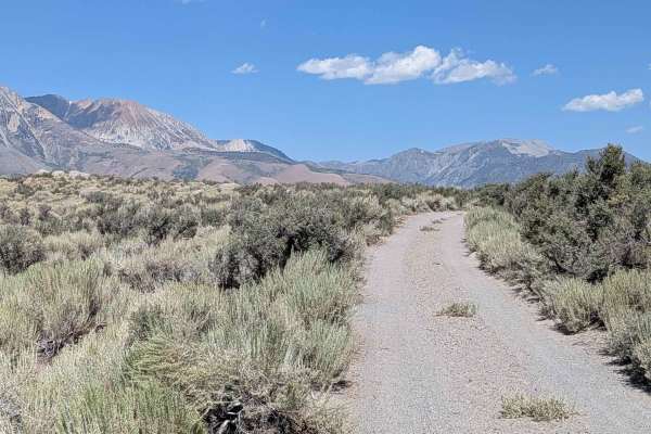
Reversed Peak - FS 1S31
This 8-mile out-and-back trail climbs 1,074 feet in just under 4 miles, transitioning from open meadows to pine forest terrain. The track starts one vehicle wide, lined with brush in the meadows, then widens as you enter a pine forest. Various spur trails branch off to explore the area, with dispers...
Learn more about Reversed Peak - FS 1S31
FS 1S105
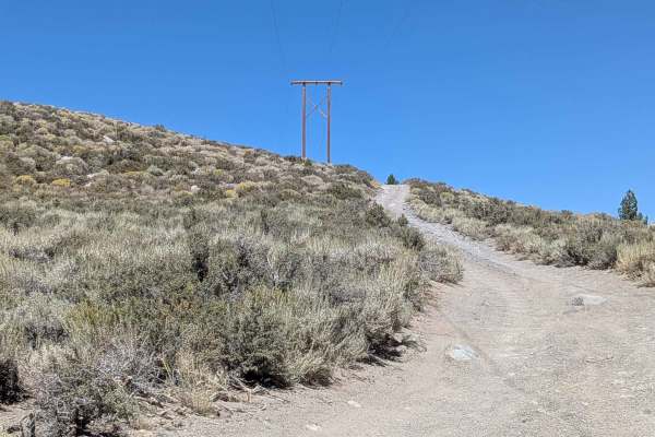
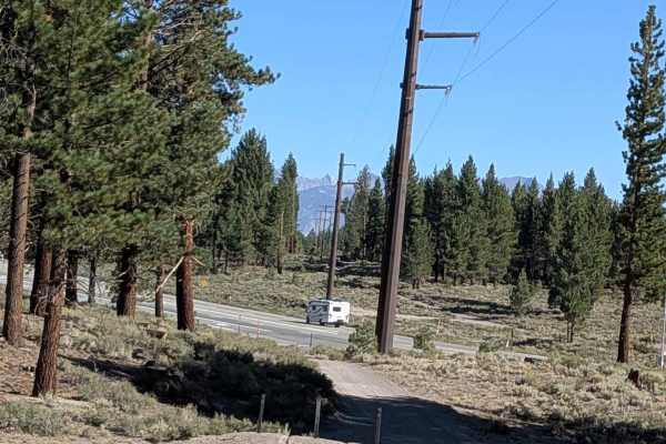
This route climbs almost 800 feet and drops almost 200 feet over just over 4.5 miles, following the power line from North Shore Drive. The trail runs parallel to Highway 395 and offers views of the Eastern Sierras, including June Lake ski resort, Crater Mountain, and Mono Lake throughout the journey...
Learn more about FS 1S105
Deadman Creek Road FS32E03-SNO
This sandy and pumice trail is just over one and a half vehicles wide and winds through a beautiful pine forest. Starting at Highway 395 near an open meadow, it slowly climbs almost 800 feet and passes near lower Deadman Campground, upper Deadman Campground, and a group campground (some of which clo...
Learn more about Deadman Creek Road FS32E03-SNO
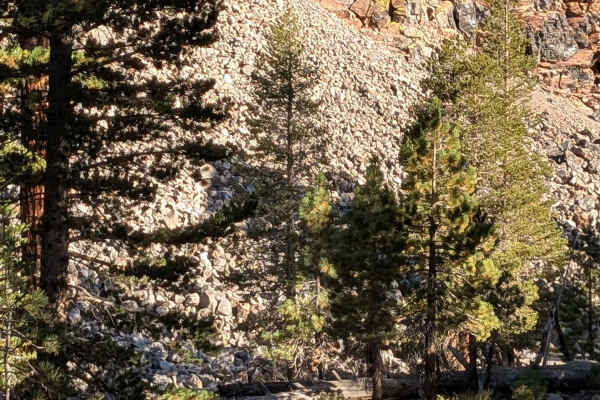
Obsidian Loop FS 2S79
This trail runs around the Obsidian Dome, offering an opportunity to learn about the history of this unique geological formation. The route climbs 132 feet and drops almost 200 feet in just over 1.66 miles, providing immediate glimpses of the Obsidian Dome through the pine trees as you travel. Obsid...
Learn more about Obsidian Loop FS 2S79
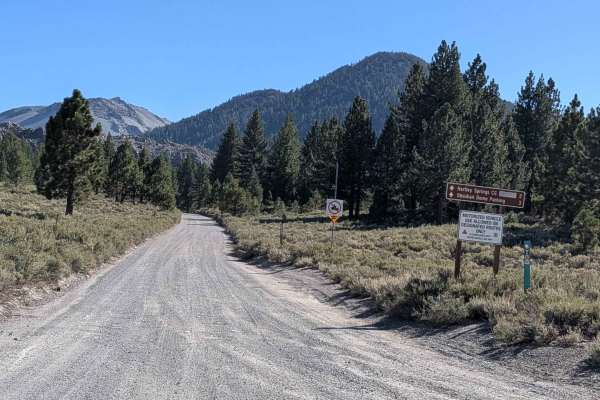
Hartley Springs - FS 2S78
This 6.25-mile point-to-point trail, part of the June to Mammoth Loop, starts at Highway 395 and ends at Obsidian Loop (FS 2S79). The trail surface consists of pumice and sand, which is very dusty throughout the route, reducing visibility, especially when traveling with other vehicles. Drivers will ...
Learn more about Hartley Springs - FS 2S78
FS 2S106
This sand and pumice trail runs parallel to Highway 395 on the west side, going up and down some steep hills while following the power lines. The trail is part of the larger Crater Loop and offers some views of the Eastern Sierras, including Morrison, Mini Morrison, and Sherwin Mountain throughout t...
Learn more about FS 2S106
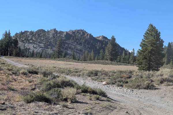
Wilson Butte Loop FS 2S22
This route begins on the west side of Highway 395, located two miles south of the June Lake Scenic Loop South entrance. The sandy and pumice trail winds through a large pine forest that has recently undergone forest trimming with planned fires to reduce the underbrush. The trail is part of the Hartl...
Learn more about Wilson Butte Loop FS 2S22
FS 2S11
This route is 1 to 1.5 vehicle widths wide, winding through pine tree forest alongside the obsidian dome. The very dusty trail made of sand and pumice runs partially along shelf roads above Glass Creek, requiring caution in these elevated sections. Various dispersed camp areas are available along th...
Learn more about FS 2S11
Pumice Mine Road - FS 1S40
This 9-mile out-and-back trail climbs over 700 feet toward the Pumice Mine. Access points include FS1S127, FS2S08, and FS1S122, with several spur trails to explore along the way. The trail travels through a mix of sparse forest and open meadows, offering expansive views of the Eastern Sierra mountai...
Learn more about Pumice Mine Road - FS 1S40
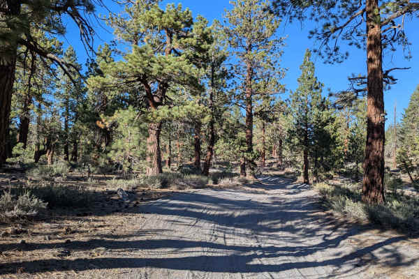
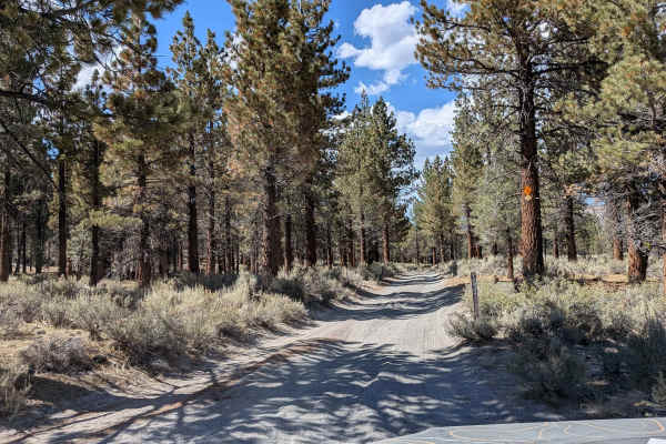
Obsidian Dome Road/Glass Flow Road - NF2S10
This route starts on the west side of Highway 395, located 3.7 miles south of the Lake Scenic Loop South entrance, and leads toward Hartley Campground and the Obsidian Dome. The track is two vehicles wide and lined with tall pine trees, creating a scenic forest corridor. Various spur trails branch o...
Learn more about Obsidian Dome Road/Glass Flow Road - NF2S10
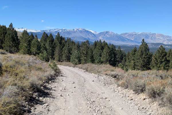
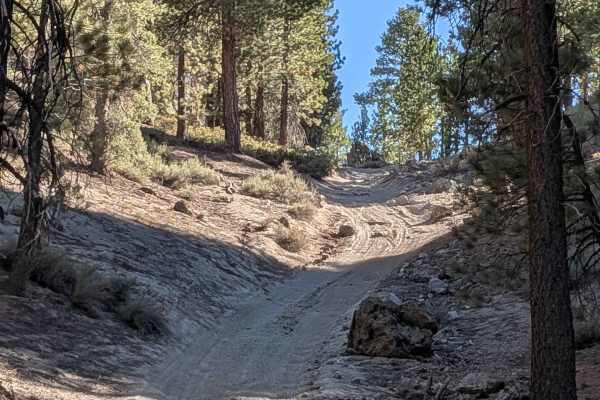
Bald Mountain - FS 32E604-SNO
This 11.2-mile out-and-back trail climbs over 1,200 feet from Highway 395 to Bald Mountain Lookout, serving as an artery to many spur trails. Starting as a 2.5 vehicle-wide gravel road lined with tall pines and sagebrush, the seasonally graded surface still has washboards from heavy use. After the f...
Learn more about Bald Mountain - FS 32E604-SNO
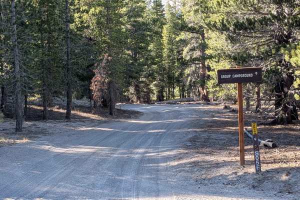
FS 2S05F Obsidian Flat Group Campground
This 2-mile, in-and-out trail leads to Obsidian Flat Group Campground and climbs 159 feet over just over a mile. The path is just over one vehicle wide and consists of dusty sand and pumice. Before reaching the hill toward the campground, there is a locked gate closing off the trail. Check with the ...
Learn more about FS 2S05F Obsidian Flat Group Campground
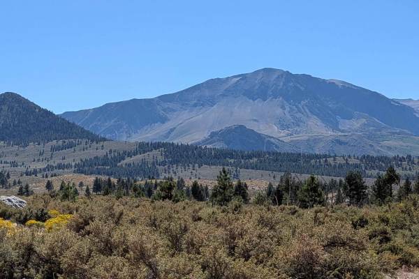
June Lake Shortcut - FS 1S32
This route runs parallel to Highway 395, winding back and forth through open meadows lined with bushes. The trail offers beautiful views of Crater Lake, Mono Lake, Reverse Peak, and the Eastern Sierra range, including the June Lake ski resort throughout the journey. The trail steadily climbs 300 fee...
Learn more about June Lake Shortcut - FS 1S32
FS 1S117
This route offers expansive views of Mono Lake and the Eastern Sierras while cutting through a thinned-out pine forest. The trail climbs almost 300 feet and drops over 200 feet as it travels up onto a ridge before ending at Highway 395. There's also an alternate start under Highway 395 via a tunnel ...
Learn more about FS 1S117
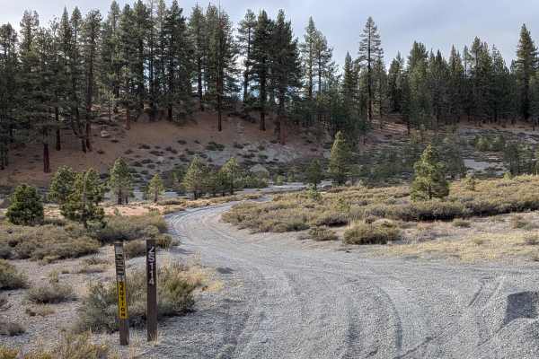
FS 2S114
Forest Service Road 2S114 is a 4-mile point-to-point trail that climbs almost 200 feet and drops nearly 300 feet. Starting near Pumice Mine Road (FS 1S40) just off FS 1S124, the trail begins in a large meadow with a gravel and sand surface lined with sagebrush. It is one vehicle wide and winds throu...
Learn more about FS 2S114
West Portal Road
This trail is accessed from two points on Highway 395 just south of Highway 120. It is a dusty gravel road, ranging from 1.5 to 2.5 vehicles wide, and is relatively smooth with occasional washboards. The trail winds through open meadows with heavy brush lining the route, providing a mix of shaded an...
Learn more about West Portal Road
Aeolian Butte - FS 1S128B / FS 128
This 3-mile out-and-back trail begins on a dusty gravel and pumice road. The first mile is relatively smooth, with occasional large rocks. After reaching FS 128, the trail narrows and is lined with sharp brush, which can scratch wide vehicles. Drivers should take caution when navigating this section...
Learn more about Aeolian Butte - FS 1S128B / FS 128
Glass Spur A FS 2S23A
Starting at Glass Creek Road, this trail climbs 126 feet and drops 308 feet over just over a mile, leading toward the Obsidian Flat Group Campground. It forms part of the June to Mammoth loop and features heavy washboards, whoops, and ruts caused by frequent side-by-side use. There are a few small d...
Learn more about Glass Spur A FS 2S23A
Punch Bowl Cutoff - FS 1S35
This scenic forest route winds through a beautiful pine forest, transitioning from highway access to backcountry exploration. The trail features very sandy and pumice surfaces with some sections of deep material that require careful navigation. Riders will encounter small ruts, washboards, and whoop...
Learn more about Punch Bowl Cutoff - FS 1S35
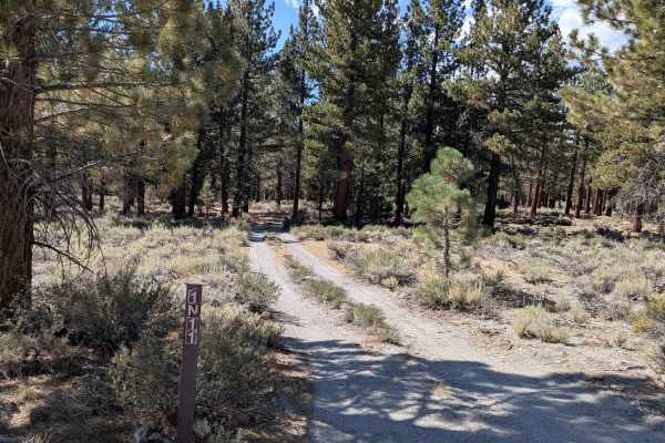
FS 1N11
This scenic descent drops almost 700 feet over just under 6 miles, offering spectacular views and diverse terrain. Starting from the south in a sparse pine forest, the route quickly opens to a huge meadow surrounded by beautiful hills, valleys, and mountains. The trail provides stunning views of the...
Learn more about FS 1N11
Beginner ATV trails near June Lake, California
Explore ATV-friendly trails near you. These trails are accessible for vehicles up to 50 inches wide, perfect for ATVs and smaller off-road machines.
Reversed Peak - FS 1S31
This 8-mile out-and-back trail climbs 1,074 feet in just under 4 miles, transitioning from open meadows to pine forest terrain. The track starts one vehicle wide, lined with brush in the meadows, then widens as you enter a pine forest. Various spur trails branch off to explore the area, with dispers...
Learn more about Reversed Peak - FS 1S31
FS 1S105
This route climbs almost 800 feet and drops almost 200 feet over just over 4.5 miles, following the power line from North Shore Drive. The trail runs parallel to Highway 395 and offers views of the Eastern Sierras, including June Lake ski resort, Crater Mountain, and Mono Lake throughout the journey...
Learn more about FS 1S105
Deadman Creek Road FS32E03-SNO
This sandy and pumice trail is just over one and a half vehicles wide and winds through a beautiful pine forest. Starting at Highway 395 near an open meadow, it slowly climbs almost 800 feet and passes near lower Deadman Campground, upper Deadman Campground, and a group campground (some of which clo...
Learn more about Deadman Creek Road FS32E03-SNO
Obsidian Loop FS 2S79
This trail runs around the Obsidian Dome, offering an opportunity to learn about the history of this unique geological formation. The route climbs 132 feet and drops almost 200 feet in just over 1.66 miles, providing immediate glimpses of the Obsidian Dome through the pine trees as you travel. Obsid...
Learn more about Obsidian Loop FS 2S79
Beginner UTV/side-by-side trails near June Lake, California
Find UTV and side-by-side trails near you. These trails accommodate vehicles up to 60 inches wide, ideal for UTVs, side-by-sides, and wider off-road rigs.
Reversed Peak - FS 1S31
This 8-mile out-and-back trail climbs 1,074 feet in just under 4 miles, transitioning from open meadows to pine forest terrain. The track starts one vehicle wide, lined with brush in the meadows, then widens as you enter a pine forest. Various spur trails branch off to explore the area, with dispers...
Learn more about Reversed Peak - FS 1S31
FS 1S105
This route climbs almost 800 feet and drops almost 200 feet over just over 4.5 miles, following the power line from North Shore Drive. The trail runs parallel to Highway 395 and offers views of the Eastern Sierras, including June Lake ski resort, Crater Mountain, and Mono Lake throughout the journey...
Learn more about FS 1S105
Deadman Creek Road FS32E03-SNO
This sandy and pumice trail is just over one and a half vehicles wide and winds through a beautiful pine forest. Starting at Highway 395 near an open meadow, it slowly climbs almost 800 feet and passes near lower Deadman Campground, upper Deadman Campground, and a group campground (some of which clo...
Learn more about Deadman Creek Road FS32E03-SNO
Obsidian Loop FS 2S79
This trail runs around the Obsidian Dome, offering an opportunity to learn about the history of this unique geological formation. The route climbs 132 feet and drops almost 200 feet in just over 1.66 miles, providing immediate glimpses of the Obsidian Dome through the pine trees as you travel. Obsid...
Learn more about Obsidian Loop FS 2S79
The onX Offroad Difference
onX Offroad combines trail photos, descriptions, difficulty ratings, width restrictions, seasonality, and more in a user-friendly interface. Available on all devices, with offline access and full compatibility with CarPlay and Android Auto. Discover what you're missing today!
Open Trail Map