
Beginner Off-Road Trails
Near Ida, Louisiana
Explore All Beginner Trails Near Ida, Louisiana
Beginner Off-Road Trails Near Ida, Louisiana
Discover the best beginner-friendly off-road trails near you. These easier, lower-rated trails are a great place to start — browse trail maps, check difficulty ratings, and find your next adventure.
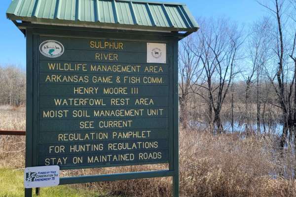
Boggy Creek Monster Trail
This is a maintained gravel road in Mercer Bayou Wildlife Area. Mercer Bayou is a gut located just 18.4 miles from Texarkana, in Miller County, in the state of Arkansas, United States, near Jonesville, AR. Sightings of the Boggy Creek Monster have been reported in this area. The road is normally in ...
Learn more about Boggy Creek Monster Trail
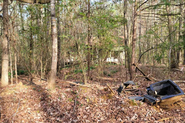
The Dead End Barrel
This trail has a bit of asphalt, dirt, and gravel. It goes to a cemetery and dead-ends at an oil structure. This trail is north of Ivan Lake and northwest of Williams Lake. You will also see an old deserted house on the right-hand side of the road.
Learn more about The Dead End Barrel
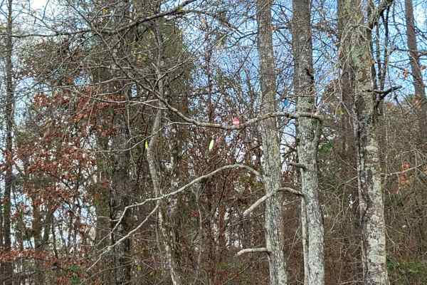
Ivan Lake Trail
This gravel road passes through the Ivan Lake area. There are a few primitive camping spots (permit required), a beautiful fishing lake, and restrooms. This trail exits the park area and heads Northwest towards Arkansas. This is in the Bayou Bodcau WMA, and all WMA rules apply. There is plenty of wi...
Learn more about Ivan Lake Trail
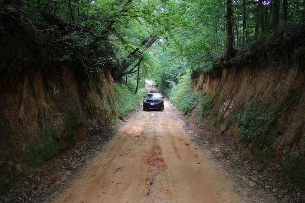
Old Stagecoach Road
Old Stagecoach road is made up of a mix of rock, sand, and dirt. When wet you get a red clay that can be slick as ice. There are some rocks in the road about 8 inches in diameter. Some narrow washouts across the road are 8-plus inches deep. Logging trucks have been traveling sections of the road an...
Learn more about Old Stagecoach Road
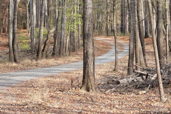
Enter Bodcau Wildlife Management Area
This easy-going, 7.8-mile scenic dirt and gravel route is perfect for beginners, scenic drivers, and outdoor enthusiasts looking to access the heart of the Bodcau Wildlife Management Area. Starting on the southeast side of the Bayou Bodcau Reservoir, the trail winds through dense bottomland hardwood...
Learn more about Enter Bodcau Wildlife Management Area
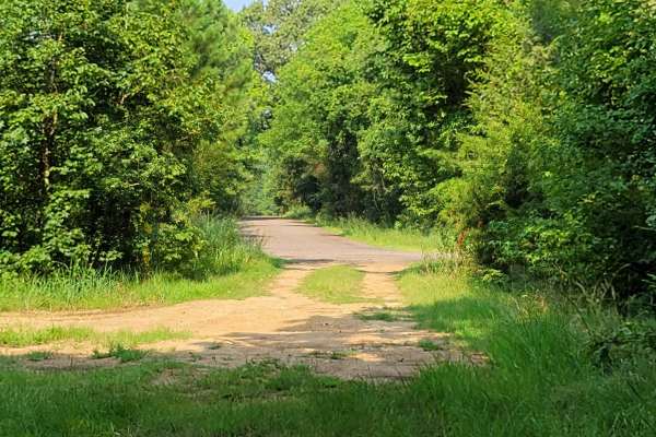
Low Water Bridge on Lake Wright Patman
This route starts off of Hwy 67 just west of Texarkana and goes to the low water bridge that crosses part of Wright Patman Lake. There are plenty of areas to fish. Bring a kayak because there is water access on each side of the bridge and plenty of parking. The low water bridge does close when heav...
Learn more about Low Water Bridge on Lake Wright Patman
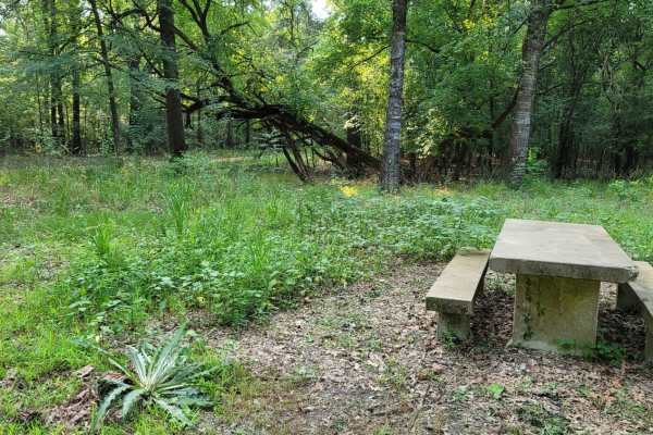
Trail to the Sulphur River
This easy scenic drive is ideal for beginners, families, and outdoor enthusiasts looking for convenient access to primitive camping and a boat launch on the Sulphur River. Starting at the intersection of Highway 67 and Highway 8 near Maud, Texas, this 4.4-mile route crosses railroad tracks and follo...
Learn more about Trail to the Sulphur River
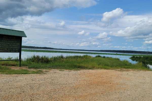
Bois d'Ark Arkansas Spillway & Dam
This 13,626-acre area is composed of 5,866 acres of state-owned land and 7,760 acres leased from International Paper and Potlatch timber companies.The primary objective of this management area is to provide high-quality wildlife habitat and public hunting opportunities. Bois d'Arc Lake provides exc...
Learn more about Bois d'Ark Arkansas Spillway & Dam
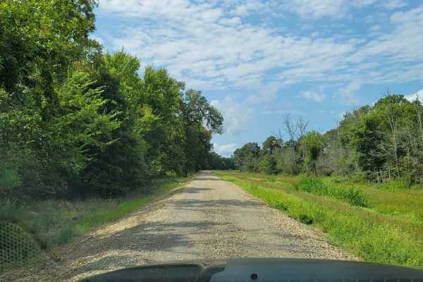
Tower Ends at Private Fishing Club
Tower Ends at Private Fishing Club is a 10.1-mile point-to-point gravel route near the Red River in southwest Arkansas. Suitable for beginners and high-clearance vehicles, this double-track road winds through flat agricultural fields and wooded lowlands. The route climbs gently from 231 feet to 403 ...
Learn more about Tower Ends at Private Fishing Club
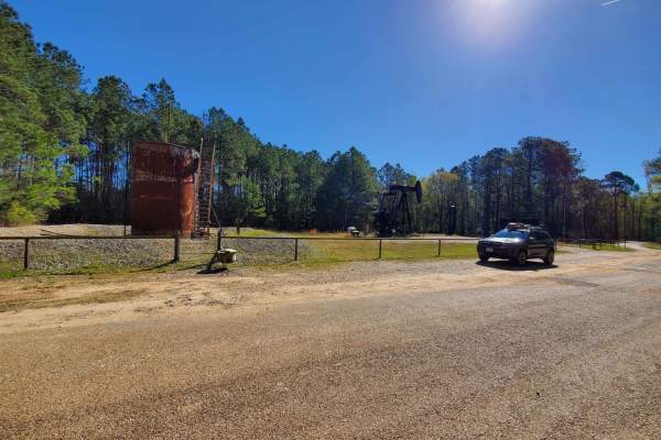
The Arkansas Overland Route - Section 1 - Falcon Bottoms Back Roads
The Arkansas Overland Route - Section 1 - Falcon Bottoms Back Roads is designed for overland beginners and scenic travelers looking for an easy, low-dust gateway into southern Arkansas's expansive backcountry. Starting off Highway 82 east of Texarkana, this 18-mile point-to-point track heads north a...
Learn more about The Arkansas Overland Route - Section 1 - Falcon Bottoms Back Roads
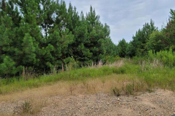
Bois d'Ark Trail back to Interstate 30
This 13,626-acre area is composed of 5,866 acres of state-owned land and 7,760 acres leased from International Paper and Potlatch timber companies.The primary objective of this management area is to provide high-quality wildlife habitat and public hunting opportunities. Bois d' Arc Lake provides ex...
Learn more about Bois d'Ark Trail back to Interstate 30
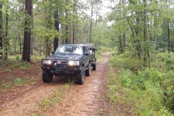
Kisatchie NF Spur Trail
Kisatchie NF Spur Trail is a short, secluded dirt offshoot ideal for campers and offroaders seeking a quiet, off-the-beaten-path lunch spot or a primitive campsite within the Caney Ranger District. Spanning just under 0.4 miles, this flat spur branches north off Road 815 (White Road) and leads direc...
Learn more about Kisatchie NF Spur Trail
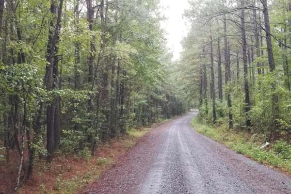
815 Road, Kisatchie NF
815 Road, Kisatchie NF is an easy, scenic dirt route through the Kisatchie National Forest, making it perfect for beginners, stock vehicles, and those looking for a relaxed cruise through Louisiana's pine woods. This basic fire road runs through rolling hills and beautiful pine forests, offering a s...
Learn more about 815 Road, Kisatchie NF

Dr. Lester Sitzes III Bois D'Arc WMA
This 13,626-acre area is composed of 5,866 acres of state-owned land and 7,760 acres leased from International Paper and Potlatch timber companies.The primary objective of this management area is to provide high-quality wildlife habitat and public hunting opportunities. Bois d' Arc Lake provides ex...
Learn more about Dr. Lester Sitzes III Bois D'Arc WMA
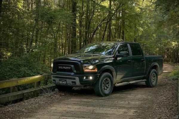
Butler Circle
This is a basic fire road within Kisatchie National Forest. It involves rolling hills through the Louisiana landscape. Hidden around the area are lookout towers for fire detection, a relic from past land management in the area. This area of the Kisatchie has a number of private in-holdings as well a...
Learn more about Butler Circle
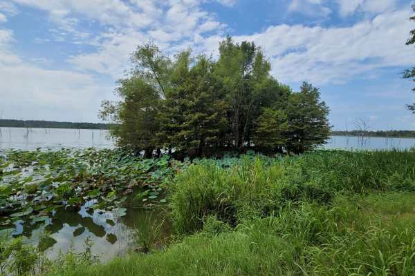
To Bois d'Arc Lake Finger Point Landing
This track takes you to Finger Point Landing on Bois d'Arc Lake in Arkansas. This 13,626-acre area is composed of 5,866 acres of state-owned land and 7,760 acres leased from International Paper and Potlatch timber companies. The primary objective of this management area is to provide high-quality wi...
Learn more about To Bois d'Arc Lake Finger Point Landing
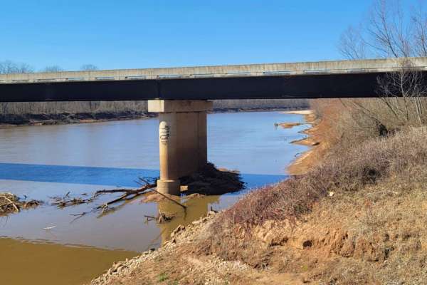
Follow the Red River
This 30-mile route follows along the Northside of the Red River. This East to West route is almost completely gravel roads. The roads are maintained but can be nasty after or during rains. Although you may not see a lot of the river, you will see lots of pasture land with livestock, creeks with brid...
Learn more about Follow the Red River
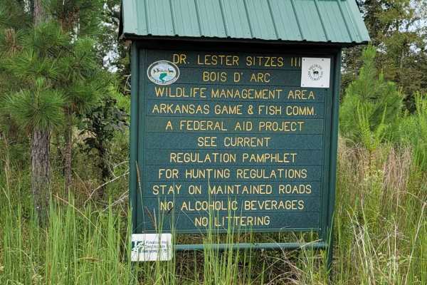
Bois D'Ark WMA from HWY 67
This 13,626-acre area is composed of 5,866 acres of state-owned land and 7,760 acres leased from International Paper and Potlatch timber companies.The primary objective of this management area is to provide high-quality wildlife habitat and public hunting opportunities. Bois d' Arc Lake provides ex...
Learn more about Bois D'Ark WMA from HWY 67
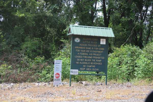
Allen's Ferry Road
This loose gravel road ends at the Little River. There is a boat ramp and dispersed camping on the riverside. Not far out of the small town of Fulton, Arkansas, this road provides beautiful views of the river, pasture, and plenty of livestock. This used to be a ferry site for Allen's Ferry. The Red...
Learn more about Allen's Ferry Road
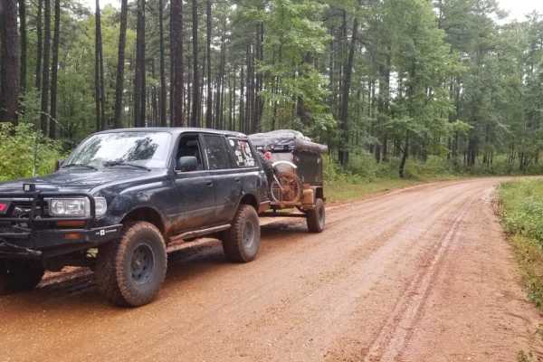
829 Road, Kisatchie NF
829 Road in the Caney Ranger District of the Kisatchie National Forest offers a relaxed, scenic dirt route perfect for beginners, overland travelers, and families looking to explore Louisiana’s rolling pine hills. This easily navigable forest road serves as an excellent entry point to the region's d...
Learn more about 829 Road, Kisatchie NF
Beginner ATV trails near Ida, Louisiana
Explore ATV-friendly trails near you. These trails are accessible for vehicles up to 50 inches wide, perfect for ATVs and smaller off-road machines.
Enter Bodcau Wildlife Management Area
This easy-going, 7.8-mile scenic dirt and gravel route is perfect for beginners, scenic drivers, and outdoor enthusiasts looking to access the heart of the Bodcau Wildlife Management Area. Starting on the southeast side of the Bayou Bodcau Reservoir, the trail winds through dense bottomland hardwood...
Learn more about Enter Bodcau Wildlife Management Area
Butler Circle
This is a basic fire road within Kisatchie National Forest. It involves rolling hills through the Louisiana landscape. Hidden around the area are lookout towers for fire detection, a relic from past land management in the area. This area of the Kisatchie has a number of private in-holdings as well a...
Learn more about Butler Circle
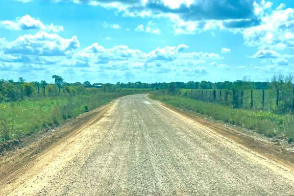
Tuckers Corner CR4306
This is a rural dirt road that winds through open cattle fields, featuring minor washes along the route. The road surface is a mix of gravel and red dirt, with narrow passing lanes in certain areas that require caution when meeting oncoming traffic. It is generally passable in dry conditions but can...
Learn more about Tuckers Corner CR4306
We Show
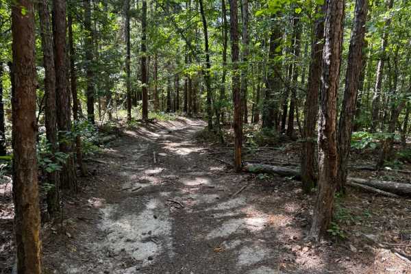
We Show ** Park Rating: 2/5 ** Technical Rating: 2/10 ** Detailed Notes ** Very tight, short trail designed for short wheelbase rigs. Not recommended for full-size rigs due to sharp turns and narrow lines. Multiple dirt bike crossings. A fun small obstacle at the end that requires a lift but has a b...
Learn more about We Show
Beginner UTV/side-by-side trails near Ida, Louisiana
Find UTV and side-by-side trails near you. These trails accommodate vehicles up to 60 inches wide, ideal for UTVs, side-by-sides, and wider off-road rigs.
Enter Bodcau Wildlife Management Area
This easy-going, 7.8-mile scenic dirt and gravel route is perfect for beginners, scenic drivers, and outdoor enthusiasts looking to access the heart of the Bodcau Wildlife Management Area. Starting on the southeast side of the Bayou Bodcau Reservoir, the trail winds through dense bottomland hardwood...
Learn more about Enter Bodcau Wildlife Management Area
Butler Circle
This is a basic fire road within Kisatchie National Forest. It involves rolling hills through the Louisiana landscape. Hidden around the area are lookout towers for fire detection, a relic from past land management in the area. This area of the Kisatchie has a number of private in-holdings as well a...
Learn more about Butler Circle
Tuckers Corner CR4306
This is a rural dirt road that winds through open cattle fields, featuring minor washes along the route. The road surface is a mix of gravel and red dirt, with narrow passing lanes in certain areas that require caution when meeting oncoming traffic. It is generally passable in dry conditions but can...
Learn more about Tuckers Corner CR4306
We Show
We Show ** Park Rating: 2/5 ** Technical Rating: 2/10 ** Detailed Notes ** Very tight, short trail designed for short wheelbase rigs. Not recommended for full-size rigs due to sharp turns and narrow lines. Multiple dirt bike crossings. A fun small obstacle at the end that requires a lift but has a b...
Learn more about We Show
The onX Offroad Difference
onX Offroad combines trail photos, descriptions, difficulty ratings, width restrictions, seasonality, and more in a user-friendly interface. Available on all devices, with offline access and full compatibility with CarPlay and Android Auto. Discover what you're missing today!
Open Trail Map