
Beginner Off-Road Trails
Near Heeney, Colorado
Explore All Beginner Trails Near Heeney, Colorado
Beginner Off-Road Trails Near Heeney, Colorado
Discover the best beginner-friendly off-road trails near you. These easier, lower-rated trails are a great place to start — browse trail maps, check difficulty ratings, and find your next adventure.
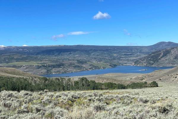
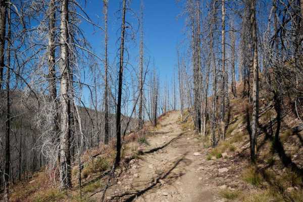
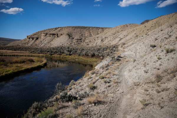
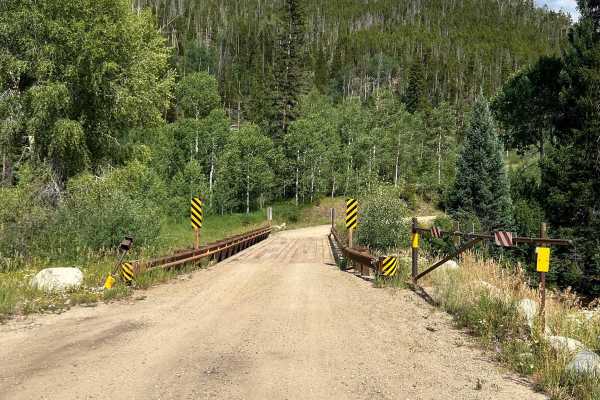
Mumford Gulch Trail
Mumford Gulch Trail is a loop trail that can be done in either direction. It is primarily dirt with 1 section with a moderate pitch. The trail goes around the perimeter of Cow Camp Gulch and Mumford Gulch. This trail features beautiful views of the Green Mountain Reservoir. There are a few camp...
Learn more about Mumford Gulch Trail
Williams Peak Road
This trail takes you up along a high ridge with amazing views of the valley and reservoir below. The top section has dispersed camping available set back in the trees, and if you're lucky you can get one with a view. ATVs and dirt bikes will love this trail, but there aren't too many side roads in t...
Learn more about Williams Peak Road
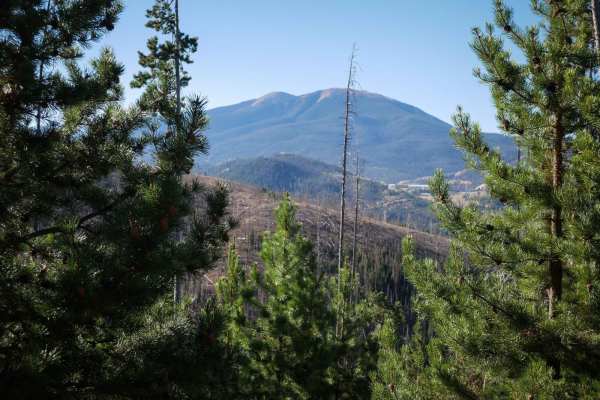
Sheephorn Mountain
Make your way up the side of this mountain on varied terrain. You'll see trees and a few glimpses of the valley below. End of the trail is an easy route passing some cool old farm structures. There are other backroads in the area. Most allow Unlicensed ATVs and UTVs.
Learn more about Sheephorn Mountain
No See Um ATV Trail
This is a 5.5-mile-long ATV trail through the Arapahoe National Forest. The west end starts out behind a gate off of Keyser Ridge Road. It looks like an old Jeep road that has been repurposed into an ATV Trail. It goes straight and flat for a long while through pine trees along the edge of a hillsid...
Learn more about No See Um ATV Trail

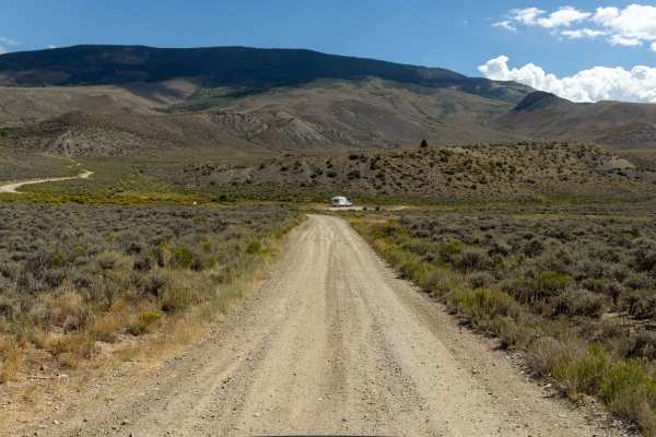
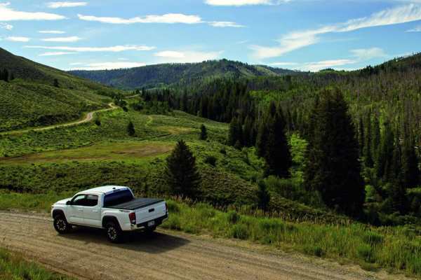
Williams Fork Road - FS 138
Williams Fork Road (County Road 30 / Forest Service Road 138) is a wide, well-graded gravel road that serves as a scenic and accessible route through a mix of public and private lands in Grand County. The road begins off County Road 3 and travels south through rolling forested terrain and open views...
Learn more about Williams Fork Road - FS 138
County Road 1
County Road 1 is a very easy, gravel, fun, and scenic road that connects you to other activities such as access to the Blue and Colorado River, Gore Canyon, and fall peeping. The entire CR-1 road is mostly unpaved. There will be a beautiful vista further down the road, the headwaters of the Colorado...
Learn more about County Road 1
Red Mountain Trail
Rutted and dusty, but easy in any stock SUV or Pickup. Great ride on an adventure bike to get your feet wet while you warm up for some of the more challenging trails around. This 1.9-mile road will have you climb 565 feet from US HWY 40 to the top of Red Mountain, where a beautiful view and a nice f...
Learn more about Red Mountain Trail
West Red Mountain
Off-road trail with some heavy rutting through Sate and BLM land. Lifted vehicles, adventure bikes, and other off-road capable machines only through here, as the rutting can get deep enough to high-center smaller vehicles. Pleasant ride while dry, but will be almost impassable in the wrong vehicle i...
Learn more about West Red Mountain
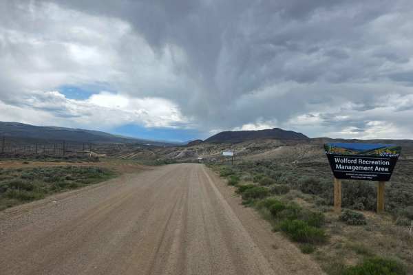
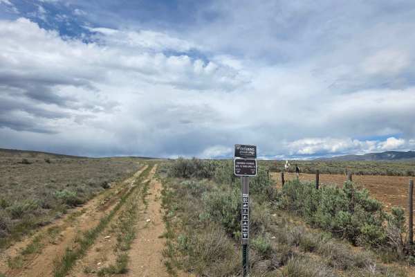
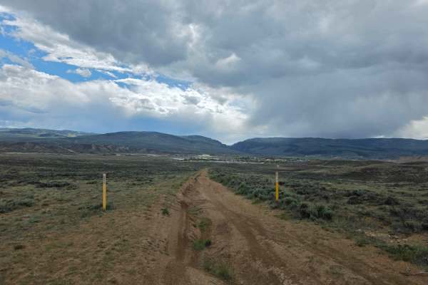
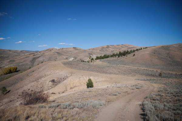
County Highway 224
County Highway 224 through the Wolford Open are and OHV Play area.
The route varies from well to poorly maintained and has potential for a water crossing. While there are no ledges or obstacles to be concerned about (other than the potential water crossing at 40.09633, --106.37961), caution should...
Learn more about County Highway 224
Richey Creek ATV Trail
Richey Creek is a wide two-track through pine trees, with small loose rocks in the trail. It has easy curves as it follows the edge of the mountain, with lots of branches and cut logs sticking out from the trees that you need to watch out for. It crosses a little muddy section, and goes pretty strai...
Learn more about Richey Creek ATV Trail
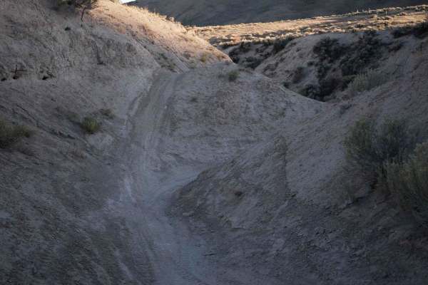
Ditch Loop
The Ditch Loop is a fun trail through Wolford that rides through a V-bottom ravine with banked corners and quick Star Wars-style turns. The west entrance to the trail starts in the ditch off of the 551 ATV trail, below tall dirt walls. There is a wider trail along the bottom of the ditch or a narrow...
Learn more about Ditch Loop
Blacktail Creek
Blacktail Creek Trail is a wide and mostly easy route that winds through northern Colorado’s alpine terrain. Drivers will encounter some washboard and rocky sections, as well as steep uphill climbs over loose rock and gravel, and equally steep downhills that require low gear for safe descent. The tr...
Learn more about Blacktail Creek
551 ATV
This is a 50" trail through the Wolford Riding Area. The north end starts as a wide two-track through the flat sagebrush valley, with whoops and shallow ruts. It goes up and over the dirt hills, and then goes into a ravine that is like a v-bottom ditch between tall dirt walls. The trail follows the ...
Learn more about 551 ATV
Cow Gulch
This single track starts the dirt County Highway 224 on a wide path in sagebrush desert terrain above a ravine, going flat and straight. It goes through a fence, then along the wall. The trail has whoops, ruts, loose rocks, and troughs down the middle of the path. It gets narrower as it heads west a...
Learn more about Cow Gulch
Beaver Creek, Muddy Creek
A cool loop that will test your mud bogging ability. It is likely you will get stuck, so this is a great trail to take with a few of your friends. It's also very handy to have a winch. There is some good camping along Beaver Creek. Open June 15 to November 15.
Learn more about Beaver Creek, Muddy Creek
Rim ATV
This is a short 50" trail that goes through the desert in the Wolford Mountain riding area. It's flat, straight and easy. The trail climbs up over the rolling desert hills, through a barren terrain of small sagebrush and sparse pinyon bushes on the hills. It descends back down, and goes along the ri...
Learn more about Rim ATV

South Fork Road - FS 142.1
South Fork Road (FS 142.1) begins just past the tunnels beneath the Henderson Mill conveyor at the southern end of Williams Fork Road (CR 30/FR 138). This narrow, single-lane forest road winds south along the South Fork of the Williams Fork River and offers a quieter, more remote experience. Dispers...
Learn more about South Fork Road - FS 142.1
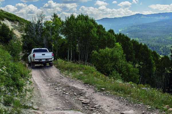
Lake Evelyn Road - FS 136
Forest Service Road 136, known as Lake Evelyn Road, branches off from Keyser Creek Road (FS 139) and heads east into a more remote and rugged section of the Arapaho National Forest. While it begins relatively smooth, the road quickly narrows to a single lane with limited pullouts, and the terrain be...
Learn more about Lake Evelyn Road - FS 136
Keyser Creek Road - FS 139
Forest Service Road 139, also known as Keyser Creek Road, offers a scenic and peaceful off-road experience through the heart of Grand County. The trail begins just off County Road 3 near the Horseshoe Campground, where a single-lane bridge crosses Keyser Creek. From the start, FS 139 closely follows...
Learn more about Keyser Creek Road - FS 139
Wolford Hills
This 1.4-mile-long single track goes through the rolling sagebrush hills and valleys of the Wolford Riding Area. As it leaves from the north end, it's an easy narrow trail in the flats, with the hills in the distance. It lightly snakes through the bushes, but pretty much goes straight and fast. It t...
Learn more about Wolford Hills
Beginner ATV trails near Heeney, Colorado
Explore ATV-friendly trails near you. These trails are accessible for vehicles up to 50 inches wide, perfect for ATVs and smaller off-road machines.
Sheephorn Mountain
Make your way up the side of this mountain on varied terrain. You'll see trees and a few glimpses of the valley below. End of the trail is an easy route passing some cool old farm structures. There are other backroads in the area. Most allow Unlicensed ATVs and UTVs.
Learn more about Sheephorn Mountain
No See Um ATV Trail
This is a 5.5-mile-long ATV trail through the Arapahoe National Forest. The west end starts out behind a gate off of Keyser Ridge Road. It looks like an old Jeep road that has been repurposed into an ATV Trail. It goes straight and flat for a long while through pine trees along the edge of a hillsid...
Learn more about No See Um ATV Trail
Red Mountain Trail
Rutted and dusty, but easy in any stock SUV or Pickup. Great ride on an adventure bike to get your feet wet while you warm up for some of the more challenging trails around. This 1.9-mile road will have you climb 565 feet from US HWY 40 to the top of Red Mountain, where a beautiful view and a nice f...
Learn more about Red Mountain Trail
West Red Mountain
Off-road trail with some heavy rutting through Sate and BLM land. Lifted vehicles, adventure bikes, and other off-road capable machines only through here, as the rutting can get deep enough to high-center smaller vehicles. Pleasant ride while dry, but will be almost impassable in the wrong vehicle i...
Learn more about West Red Mountain
Beginner UTV/side-by-side trails near Heeney, Colorado
Find UTV and side-by-side trails near you. These trails accommodate vehicles up to 60 inches wide, ideal for UTVs, side-by-sides, and wider off-road rigs.
Sheephorn Mountain
Make your way up the side of this mountain on varied terrain. You'll see trees and a few glimpses of the valley below. End of the trail is an easy route passing some cool old farm structures. There are other backroads in the area. Most allow Unlicensed ATVs and UTVs.
Learn more about Sheephorn Mountain
Red Mountain Trail
Rutted and dusty, but easy in any stock SUV or Pickup. Great ride on an adventure bike to get your feet wet while you warm up for some of the more challenging trails around. This 1.9-mile road will have you climb 565 feet from US HWY 40 to the top of Red Mountain, where a beautiful view and a nice f...
Learn more about Red Mountain Trail
West Red Mountain
Off-road trail with some heavy rutting through Sate and BLM land. Lifted vehicles, adventure bikes, and other off-road capable machines only through here, as the rutting can get deep enough to high-center smaller vehicles. Pleasant ride while dry, but will be almost impassable in the wrong vehicle i...
Learn more about West Red Mountain
County Highway 224
County Highway 224 through the Wolford Open are and OHV Play area.
The route varies from well to poorly maintained and has potential for a water crossing. While there are no ledges or obstacles to be concerned about (other than the potential water crossing at 40.09633, --106.37961), caution should...
Learn more about County Highway 224
The onX Offroad Difference
onX Offroad combines trail photos, descriptions, difficulty ratings, width restrictions, seasonality, and more in a user-friendly interface. Available on all devices, with offline access and full compatibility with CarPlay and Android Auto. Discover what you're missing today!
Open Trail Map