
Beginner Off-Road Trails
Near Hatfield, Pennsylvania
Explore All Beginner Trails Near Hatfield, Pennsylvania
Beginner Off-Road Trails Near Hatfield, Pennsylvania
Discover the best beginner-friendly off-road trails near you. These easier, lower-rated trails are a great place to start — browse trail maps, check difficulty ratings, and find your next adventure.
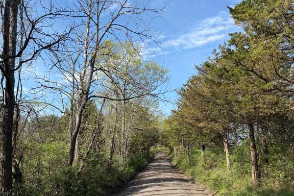
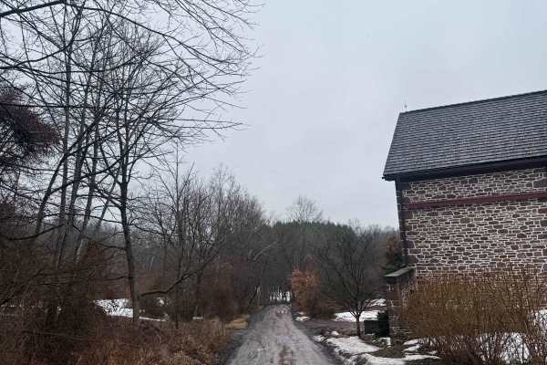
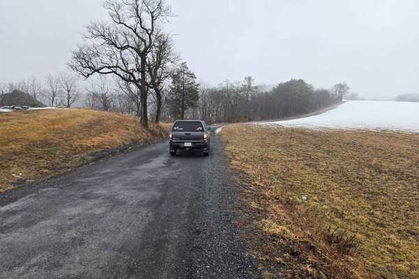
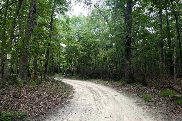
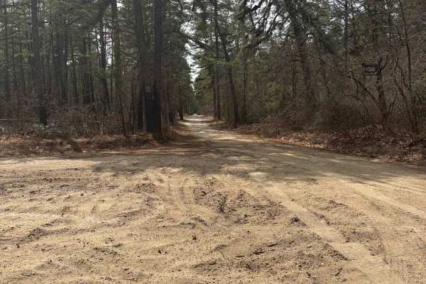
Oak Grove Road
While this is a mostly easy hardpack dirt road, it does feature a handful of very tight loose turns, steep inclines/declines, and is more narrow then most nearby dirt roads. This route is located in the woods of Upper Bucks County, close to 611, and is a public municipal road. At its northern end, ...
Learn more about Oak Grove Road
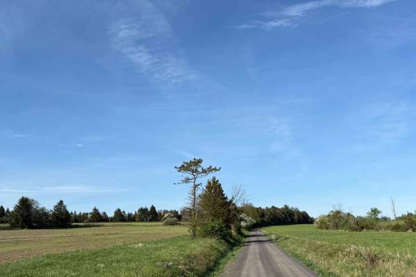
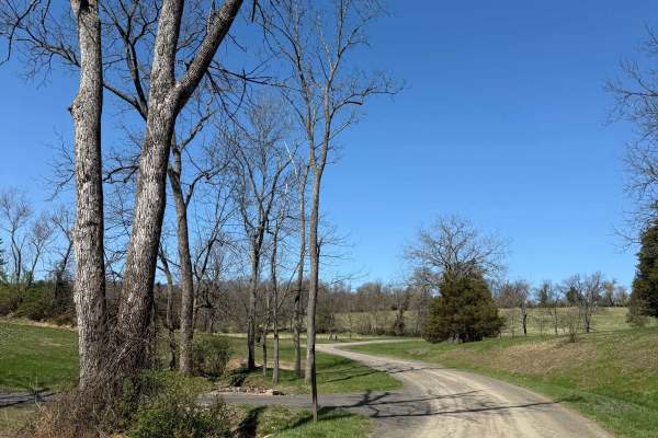
Randts Mill Road
This is an easy hard-pack dirt road located in Upper Bucks County. While not difficult, this trail and its scenery are incredibly aesthetic - go slow and enjoy the view. It is a municipal road, which means all vehicles must obey posted speed limits and be registered/insured. Open year-round, it does...
Learn more about Randts Mill Road
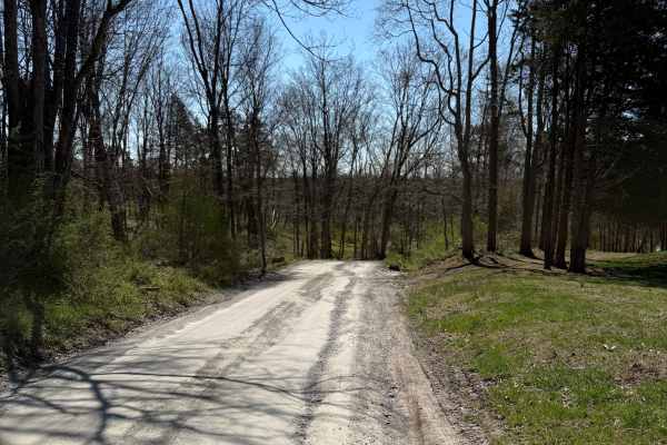
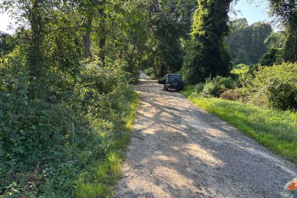
Possum Hollow
Quite possibly the only gravel road you'll find in a wide area! A fun one to check out any time of year, and you can count on it not being well maintained in winter. There are multiple old ruins to view (they are private property, please keep out) along the road, and a beautiful stream crosses under...
Learn more about Possum Hollow
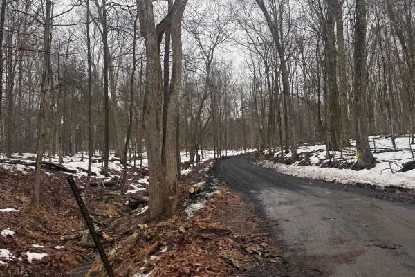
Tankhannen Road
This is an easy hardpack dirt road located in the woods of Upper Bucks County. It connects the paved Geigel Hill road to the Ridge Valley dirt road. It is a municipal road, which means all vehicles must obey posted speed limits and be registered/insured. Open year-round, it does receive winter maint...
Learn more about Tankhannen Road
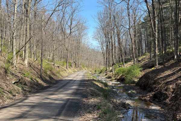
Ridge Valley Road
This is an easy hardpack dirt road located in the woods of Upper Bucks County. It is a municipal road, which means all vehicles must obey posted speed limits and be registered/insured. Open year-round, it does receive winter maintenance, but is usually plowed later than the surrounding paved roads. ...
Learn more about Ridge Valley Road
Tettemer Road
This is a mostly easy hard-pack dirt road located in the woods of Upper Bucks County. It is a municipal road, which means all vehicles must obey posted speed limits and be registered/insured. Open year-round, it does receive winter maintenance, but is usually plowed later than the surrounding paved ...
Learn more about Tettemer Road
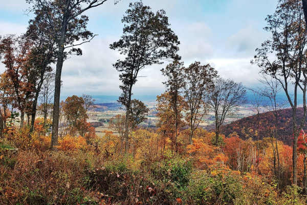
Mount Airy Road
This is a mostly easy hardpack dirt road located in the woods of Upper Bucks County. The Northeastern end of the trail is a steep climb out of the creek valley, which in any snow can be difficult, sometimes impassible. It is a municipal road, which means all vehicles must obey posted speed limits an...
Learn more about Mount Airy Road
Permanent School Road
This is a generally easy hard-pack dirt road located in the woods of Upper Bucks County. This route begins off of the paved Geigel Hill road on either end, being named Permanent School Road on the eastern end and turning into Tettemer Road on the western end. If driven east to west, it climbs in ele...
Learn more about Permanent School Road
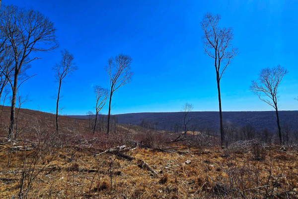
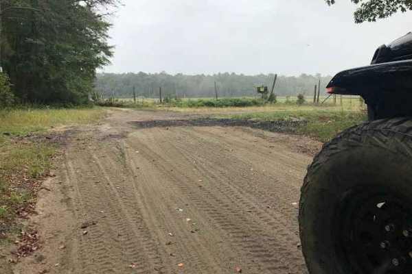
Game Preserve Road
Trail runs along the south border of state game lands #205. The north side of the trail is bordered by trees, and the south side is open fields on rolling hills. There is one overlook viewing the game lands about halfway down the trail. The trail surface is gravel with numerous potholes and a few mu...
Learn more about Game Preserve Road
Spooner Road
The trail surface is gravel with numerous potholes and a few muddy ruts along the side. The trail turns to pavement for a few hundred feet at the east end. There are state game lands on either side of the road, with a large parking lot halfway down the road to access the state game lands. A nice b...
Learn more about Spooner Road
Warden Road
Warden Road is a gravel road that is relatively well-maintained but has numerous potholes by the end of winter & after rain. There are several public gun ranges accessible by this road, and it borders state game lands. The gun ranges are clearly marked on the side where they meet the road. The west ...
Learn more about Warden Road
UTT Connector Trail
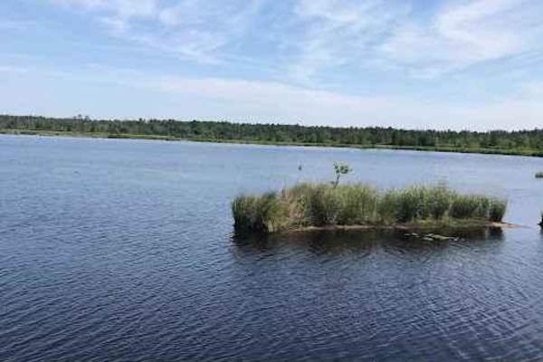
The route starts off on Eldridge Road, runs the side of Assunpink Lake, and the trail is mostly dirt and gravel with some sand, mostly flat, with nothing challenging. There are plenty of access areas to the lake, end of the trail, it loops back on itself, and exits on Hightstown road.
Learn more about UTT Connector Trail
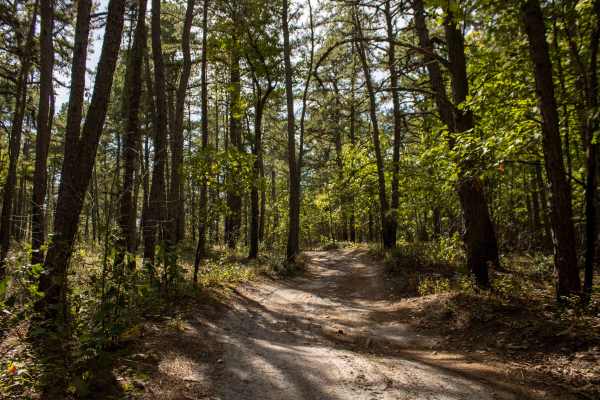
Slusser Rd
Slusser Road winds through the rugged, lesser-traveled Port Clinton Tract of Weiser State Forest, offering a peaceful gravel route surrounded by dense forest. This area is a gateway to several hiking trails that explore the rocky ridges and hardwood stands of the region, making it a favorite for hik...
Learn more about Slusser Rd
Oak Road
Oak Road winds through the rugged Port Clinton Tract of Weiser State Forest, providing access to top spots like the Port Clinton Fire Tower, the popular hiking destination of the Pinnacle Trail, and several other rewarding hiking adventures. Designated roadside campsites are available along the trai...
Learn more about Oak Road
Sleepy Creek Trail
The trail was a mix of everything. There are some washed-out sections and a bunch of deep water puddles, so you’ll want to take your time picking lines. Ground conditions change a lot — some spots are hard-packed dirt, then it switches to loose sand, which can get a little tricky. We went out the da...
Learn more about Sleepy Creek Trail
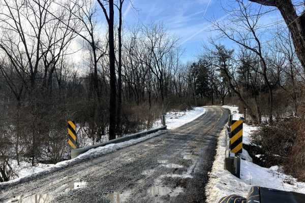
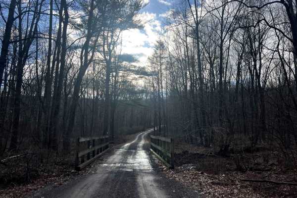
Goshen Bridge
The trail conditions were mixed and somewhat challenging. There were several washed-out sections throughout, along with multiple deep water puddles that required careful navigation. The terrain consisted of a combination of hard-packed dirt and loose sand. Visited the trail the day after a major sto...
Learn more about Goshen Bridge
Mitchell - Roosevelt Road
Gravel road, nothing to changeling, there are some slight elevation changes. There are some spots that are washed out with erosion off the sides of the trails, which may cause issues with heavy rain (potentially). Very scenic access road that would be great for a fall drive, this is also an access...
Learn more about Mitchell - Roosevelt Road
Three Bridge Road
Three Bridge Road is located in the western part of Wharton State Forest. Three Bridge Road is a sandy trail with minor potholes throughout the length of the trail. There are a few shoulders to stop at and let traffic through. The trail is mostly one vehicle wide. Three Bridge Road ends at an inters...
Learn more about Three Bridge Road
Little Mill Road
The northern half of the trail begins with moderately thick patches of sugar sand that can easily leave you stuck if you’re not careful. The middle section features a series of deep whoop-dee-doos that could cause low-clearance vehicles to bottom out. From there, the trail narrows, and full-size tru...
Learn more about Little Mill Road
Bear Creek Road
This road exists to provide access to State Game Lands 110 and the Bartram Trail. It is a beautiful drive down a rugged gravel road through the forest and across a mountain stream to a very remote area of Schuylkill County. There is a large parking lot at the end of the road. Don't be scared by the ...
Learn more about Bear Creek Road
Beginner ATV trails near Hatfield, Pennsylvania
Explore ATV-friendly trails near you. These trails are accessible for vehicles up to 50 inches wide, perfect for ATVs and smaller off-road machines.
Whitesbog Village Trail
This is an open easy trail through Whites Bog Village and the Bogs in the area. These are maintained bog roads that require no special skill or vehicle to navigate. Along this loop, you will encounter many other drivers, fishing, wildlife, and other colorful scenery. This trail is open only during d...
Learn more about Whitesbog Village Trail
Stokes Trail
Moderately easy trail running about 4-5 miles in length. The trail is rather smooth and easy when dry but is prone to flooding. The southern end of the trail contains heavily whooped sections that can make it easy for you to bottom out if you do not take your time. You can also access sections of th...
Learn more about Stokes Trail
Two Towers Loop
The trailhead for the Two Towers Loop is accessed from Reed Rd. You will see wild animals from the adjacent Six Flags safari park. Once you turn onto the trails you will be on soft Pine Barren sand and dirt. This terrain varies with the seasons-deep in the summer, loose in the fall and firm in sprin...
Learn more about Two Towers Loop
Tuckerton Road Trail
Tuckerton Road Trail is part of a network of trails within Wharton State Forest. This trail varies depending on the amount of rain. The difficulty of the trail is about a 3. It consists of a variety of terrain, from hard-packed sand to large spans of water (usually no more than 2 feet deep) to soft-...
Learn more about Tuckerton Road Trail
Beginner UTV/side-by-side trails near Hatfield, Pennsylvania
Find UTV and side-by-side trails near you. These trails accommodate vehicles up to 60 inches wide, ideal for UTVs, side-by-sides, and wider off-road rigs.
Sleepy Creek Trail
The trail was a mix of everything. There are some washed-out sections and a bunch of deep water puddles, so you’ll want to take your time picking lines. Ground conditions change a lot — some spots are hard-packed dirt, then it switches to loose sand, which can get a little tricky. We went out the da...
Learn more about Sleepy Creek Trail
Goshen Bridge
The trail conditions were mixed and somewhat challenging. There were several washed-out sections throughout, along with multiple deep water puddles that required careful navigation. The terrain consisted of a combination of hard-packed dirt and loose sand. Visited the trail the day after a major sto...
Learn more about Goshen Bridge
Whitesbog Village Trail
This is an open easy trail through Whites Bog Village and the Bogs in the area. These are maintained bog roads that require no special skill or vehicle to navigate. Along this loop, you will encounter many other drivers, fishing, wildlife, and other colorful scenery. This trail is open only during d...
Learn more about Whitesbog Village Trail
Dutch town to Burnt mill road
This one’s super easy and more about the scenery than anything else. The trail is mostly compacted sand, so it’s easy to drive on and doesn’t cause any trouble.
There are a few shallow water puddles here and there, but nothing deep or challenging. Honestly, you could get through this trail in a two...
Learn more about Dutch town to Burnt mill road
The onX Offroad Difference
onX Offroad combines trail photos, descriptions, difficulty ratings, width restrictions, seasonality, and more in a user-friendly interface. Available on all devices, with offline access and full compatibility with CarPlay and Android Auto. Discover what you're missing today!
Open Trail Map