
Beginner Off-Road Trails
Near Hampton, Georgia
Explore All Beginner Trails Near Hampton, Georgia
Beginner Off-Road Trails Near Hampton, Georgia
Discover the best beginner-friendly off-road trails near you. These easier, lower-rated trails are a great place to start — browse trail maps, check difficulty ratings, and find your next adventure.
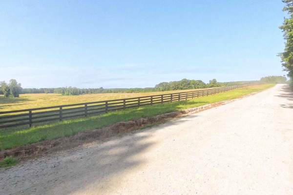
East Rocky Mountain Road
This is a county-maintained road, primarily gravel with some dirt sections where washouts have occurred. The road is generally smooth and suitable for most vehicles. It serves as an easy and scenic route, part of a network of back roads ideal for a relaxing day drive. Please note that while this is ...
Learn more about East Rocky Mountain Road
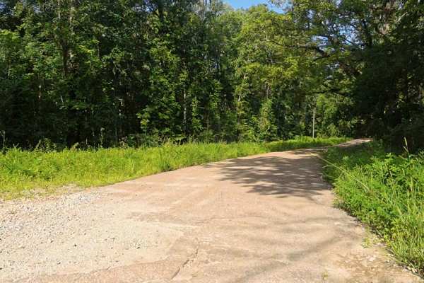
Rocky Mountain Road
This county-maintained road is primarily gravel with some dirt sections, especially where washouts have occurred. It features two small concrete bridges crossing creeks, one of which may flood during heavy rainfall and potentially overtake the road. Despite these spots, the road is generally smooth ...
Learn more about Rocky Mountain Road
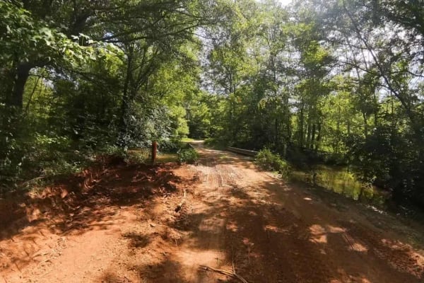
Moss Road
This is a county-maintained road, primarily gravel with some dirt sections where washouts have occurred. Roughly 500 yards after the pavement ends coming from Aviation Drive, there is a small concrete bridge with a very narrow and soft dirt/mud area that is very close to a drop-off into water on the...
Learn more about Moss Road
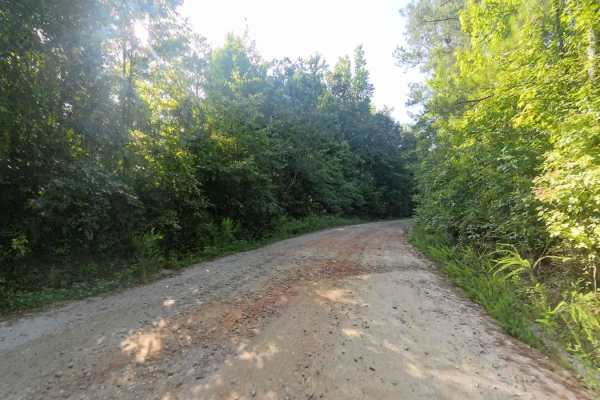
Bear Creek Road
This is a county-maintained road, primarily gravel with some dirt sections where washouts have occurred. The road is generally smooth and suitable for most vehicles. It serves as an easy and scenic route, part of a network of back roads ideal for a relaxing day drive. The road is mostly double-lane ...
Learn more about Bear Creek Road
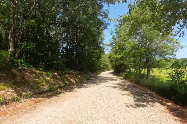
Panther Creek Road
This is a county-maintained road, primarily gravel with some dirt sections where washouts have occurred. The road is generally smooth and suitable for most vehicles. It serves as an easy and scenic route, part of a network of back roads ideal for a relaxing day drive. The road is mostly single lane ...
Learn more about Panther Creek Road
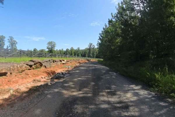
Whitten Lane
This is a county-maintained road, primarily gravel with some dirt sections where washouts have occurred. The road is generally smooth and suitable for most vehicles. It serves as an easy and scenic route, part of a network of back roads ideal for a relaxing day drive. The road is mostly single-lane,...
Learn more about Whitten Lane
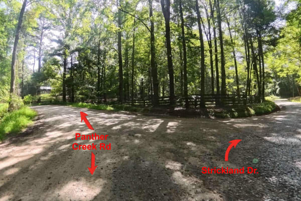
Strickland Drive
This is a county-maintained road, primarily gravel with some dirt sections. This mostly two lane road is generally smooth and suitable for most vehicles. It serves as an easy and scenic route, part of a network of back roads ideal for a relaxing day drive. Please note that while this is a public roa...
Learn more about Strickland Drive
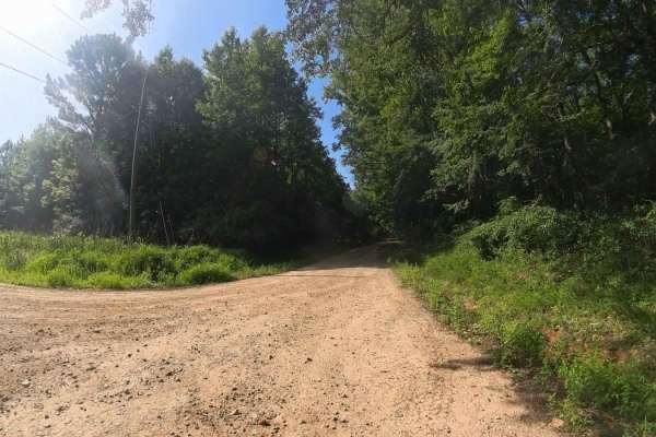
Bethel Church Road
This county-maintained road offers a smooth and easy drive, primarily composed of gravel with occasional dirt sections where washouts have occurred. It's generally suitable for most vehicles and is part of a network of scenic back roads--perfect for a relaxing day trip. The road is mostly two-lane w...
Learn more about Bethel Church Road
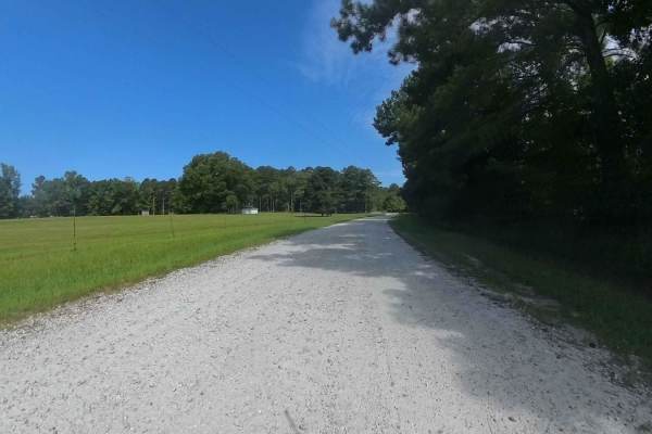
Bishop Road
This is a county-maintained road, primarily gravel with some dirt sections where washouts have occurred. The north side of Bishop Road off of Strickland Town Road is an out-and-back with a small turnaround in a private driveway. The south side continues to other roads. The road is generally smooth ...
Learn more about Bishop Road
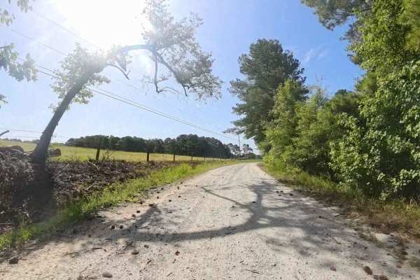
Lion Lane
This is a county-maintained road, primarily gravel with a large dirt section where washouts have occurred. At the south entrance, the road is a very nicely maintained gravel road, but on the opposite side is very rough and washed, creating a rough ride. It serves as an easy and scenic route, part of...
Learn more about Lion Lane
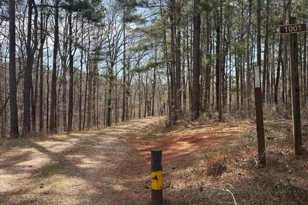
Smith Mill Road (FS 1001)
The trail begins as a graded gravel road with gentle curves and enough width for two vehicles to pass in most areas, with the entrance clearly marked by an FS 1001 sign. This section continues to a large turnaround capable of accommodating trailers, making it a convenient staging or regrouping point...
Learn more about Smith Mill Road (FS 1001)
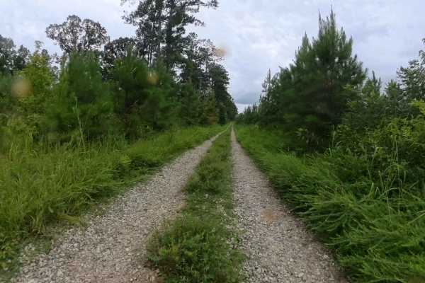
Lower Concord - FS 1017
This out-and-back trail is situated within the Oconee National Forest and features a typical terrain for the area—primarily gravel with intermittent water and mud holes along the route. At the southern end of the trail, there is a large turnaround area. Beyond this point, the trail continues but nar...
Learn more about Lower Concord - FS 1017
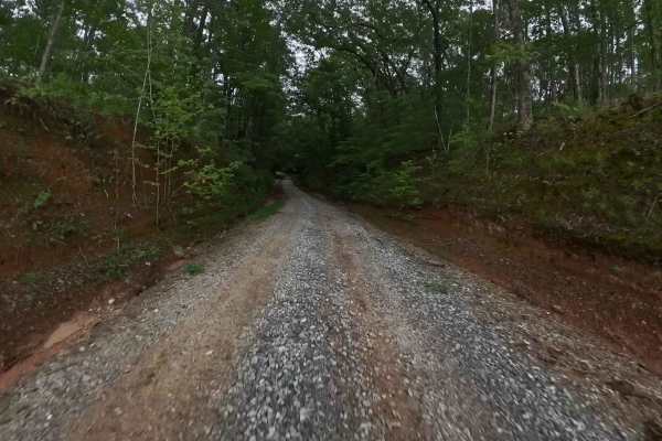
Monroe Tyler Road
This trail extends partly through the Oconee National Forest and showcases the characteristic terrain of the area—predominantly gravel with scattered water and mud holes that may vary in size depending on recent weather conditions. Portions of the route traverse private property, making it essential...
Learn more about Monroe Tyler Road
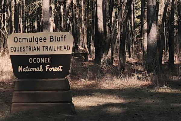
Saddler's Path
This beginner-friendly, two-way, through connector trail winds through a quiet equestrian corridor of gravel, sand, and packed dirt. Conditions are generally easy but can become slick and washed after rain, so steady driving is recommended. This trail runs through the Oconee National Forest and pass...
Learn more about Saddler's Path
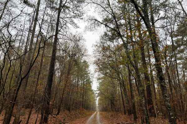
Ocmulgee Camp Loop
Ocmulgee Camp Loop is a great short trail of well-maintained gravel road with large-sized gravel chunks. It is complete with a nice dispersed camping area at the Ocmulgee multi-use trailhead for hiking, equestrian, and biking. The multi-use trail is a nice trail that follows the clean and clear Ocmu...
Learn more about Ocmulgee Camp Loop
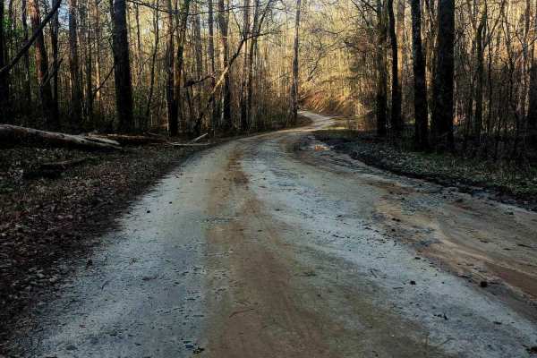
Upper Pope Trail
Wind through Oconee National Forest on this beginner-friendly trail that delivers terrain rarely found in the area. Rolling inclines, dips, and winding stretches reveal scenic ridge views as the route shifts between gravel, sand, and scattered rock shelves and can become slick after rain. Evidence ...
Learn more about Upper Pope Trail
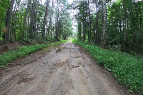
Dan Gun - FS 1016
This trail winds its way through portions of the Oconee National Forest, offering visitors a firsthand experience of the region’s landscape. The route is composed primarily of gravel and some dirt/mud, with the occasional water puddles, mud holes, and minor washouts that can vary in depth and size d...
Learn more about Dan Gun - FS 1016
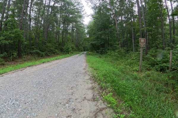
Harmon Rye - FS 1111
This trail meanders through sections of the Oconee National Forest, providing visitors with an immersive experience of the region’s natural landscape. Approximately halfway along the route, there is a quarter-mile stretch bordered by private property on both sides; visitors are advised to respect th...
Learn more about Harmon Rye - FS 1111
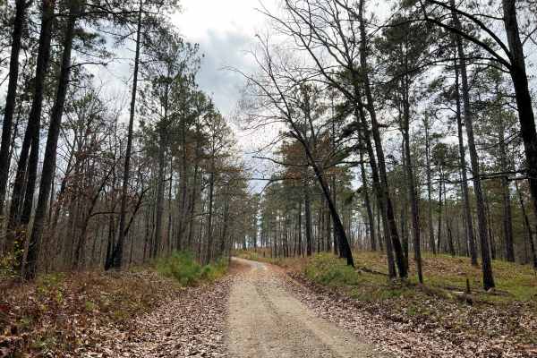
Scenic Juliette
Scenic Juliette stands true to its name, passing through highland forests of southern pines before slowly descending down to hardwood forest with revealing views of the Ocmulgee River. This fun drive is best started from the North in Ocmulgee National Forest before entering Piedmont National Wildlif...
Learn more about Scenic Juliette
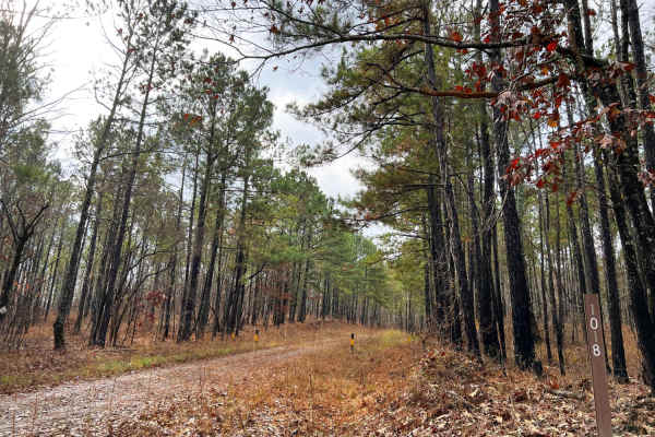
Pope Loop
Pope Loop is an easy meandering drive through southern pine forests with harvested areas creating ideal hunting locations. This loop is topped off with a designated dispersed hunt camp called Gladesville. Pope Loop is a well-maintained gravel road that has only a few potholes that hold water. They a...
Learn more about Pope Loop
Beginner ATV trails near Hampton, Georgia
Explore ATV-friendly trails near you. These trails are accessible for vehicles up to 50 inches wide, perfect for ATVs and smaller off-road machines.
Saddler's Path
This beginner-friendly, two-way, through connector trail winds through a quiet equestrian corridor of gravel, sand, and packed dirt. Conditions are generally easy but can become slick and washed after rain, so steady driving is recommended. This trail runs through the Oconee National Forest and pass...
Learn more about Saddler's Path
Upper Pope Trail
Wind through Oconee National Forest on this beginner-friendly trail that delivers terrain rarely found in the area. Rolling inclines, dips, and winding stretches reveal scenic ridge views as the route shifts between gravel, sand, and scattered rock shelves and can become slick after rain. Evidence ...
Learn more about Upper Pope Trail
Alexander Hollow Trail
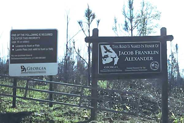
Alexander Hollow Trail in the Jacob Franklin Alexander tract of Sprewell Bluff Wildlife Management Area follows a canopy below the ridgeline in the scenic foothills. This 2.5-mile out-and-back gravel and dirt route has little rutting and washouts along the route, with some ridge grass growth along t...
Learn more about Alexander Hollow Trail
Alexander Ridge Trail
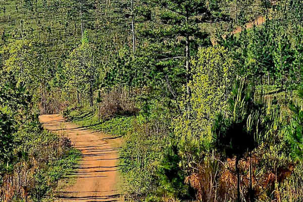
This mostly gravel with packed dirt single trail winds 4.4 miles in-and-back through Sprewell Bluff WMA across rolling ridges and foothills near the Flint River. Expect steep climbs, sharp descents, ruts, wash-outs, and loose rocky terrain. Scenic vistas reward the effort, with the landscape changin...
Learn more about Alexander Ridge Trail
Beginner UTV/side-by-side trails near Hampton, Georgia
Find UTV and side-by-side trails near you. These trails accommodate vehicles up to 60 inches wide, ideal for UTVs, side-by-sides, and wider off-road rigs.
Saddler's Path
This beginner-friendly, two-way, through connector trail winds through a quiet equestrian corridor of gravel, sand, and packed dirt. Conditions are generally easy but can become slick and washed after rain, so steady driving is recommended. This trail runs through the Oconee National Forest and pass...
Learn more about Saddler's Path
Upper Pope Trail
Wind through Oconee National Forest on this beginner-friendly trail that delivers terrain rarely found in the area. Rolling inclines, dips, and winding stretches reveal scenic ridge views as the route shifts between gravel, sand, and scattered rock shelves and can become slick after rain. Evidence ...
Learn more about Upper Pope Trail
Alexander Hollow Trail
Alexander Hollow Trail in the Jacob Franklin Alexander tract of Sprewell Bluff Wildlife Management Area follows a canopy below the ridgeline in the scenic foothills. This 2.5-mile out-and-back gravel and dirt route has little rutting and washouts along the route, with some ridge grass growth along t...
Learn more about Alexander Hollow Trail
Alexander Ridge Trail
This mostly gravel with packed dirt single trail winds 4.4 miles in-and-back through Sprewell Bluff WMA across rolling ridges and foothills near the Flint River. Expect steep climbs, sharp descents, ruts, wash-outs, and loose rocky terrain. Scenic vistas reward the effort, with the landscape changin...
Learn more about Alexander Ridge Trail
The onX Offroad Difference
onX Offroad combines trail photos, descriptions, difficulty ratings, width restrictions, seasonality, and more in a user-friendly interface. Available on all devices, with offline access and full compatibility with CarPlay and Android Auto. Discover what you're missing today!
Open Trail Map