
Beginner Off-Road Trails
Near Hall, Montana
Explore All Beginner Trails Near Hall, Montana
Beginner Off-Road Trails Near Hall, Montana
Discover the best beginner-friendly off-road trails near you. These easier, lower-rated trails are a great place to start — browse trail maps, check difficulty ratings, and find your next adventure.
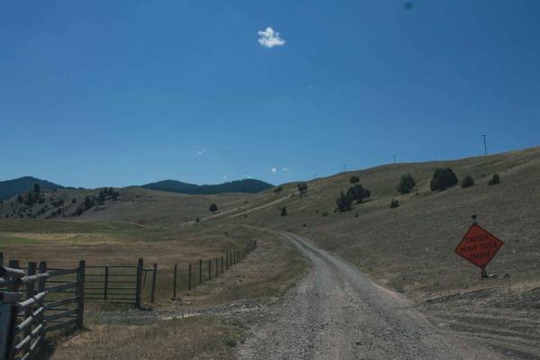
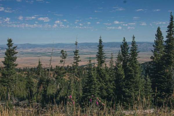
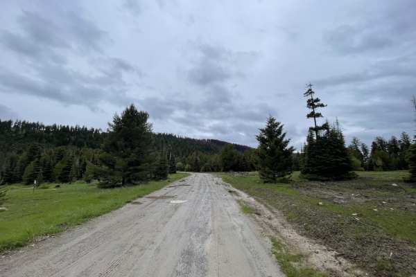
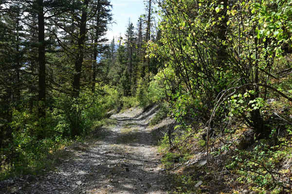
Smart Creek
Beautiful road with amazing views to enjoy, there isn't much for camping, maybe a spot or two. Road can be muddy when wet, with some water puddles. Dirt or rocky road, typically unmaintained after rain or snow. You may encounter shallow water crossings and obstacles under 12" on the trail, including...
Learn more about Smart Creek
North Fork Gold Creek
You will enjoy this road with its amazing views. There are a few spots that look like they would be good for camping. The road can be muddy when wet, with some water puddles. This road offers access to other roads and has lots of cows! It's a dirt or rocky road with gentle grades that is safe for mo...
Learn more about North Fork Gold Creek
Henderson
Beautiful road with amazing views to enjoy, there isn't much for camping, maybe a spot or two. Offers access to many roads, and they should provide other camp options. Dirt or rocky road with gentle grades. Safe for most 4WD and high-clearance 2WD vehicles. Roads are typically two vehicles wide.
Learn more about Henderson
Jackson Park
Beautiful road with amazing views to enjoy, there aren't many spots for camping, maybe a spot or two and not very big. This road does offer access to other roads which will have more camping spots.Dirt or rocky road with gentle grades. Safe for most 4WD and high-clearance 2WD vehicles. Roads are typ...
Learn more about Jackson Park
Gold Creek
Beautiful road with views to enjoy, some points you can see the town below. There isn't much for camping, maybe a spot or two. Dirt or rocky road, typically unmaintained after rain or snow. You may encounter shallow water crossings and obstacles under 12" on the trail, including small ledges. Roads ...
Learn more about Gold Creek
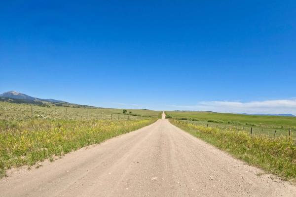
Deer Lodge MT-Gold Creek Ranch
Route begins at the South Old Stage Road leaving Deer Lodge. The route is mainly a 2 vehicle wide gravel roadway. Long straight aways with very wide gentle curves make up the route. You will encounter some rocky areas of road with a few mud holes here and there. The countryside is mostly open and us...
Learn more about Deer Lodge MT-Gold Creek Ranch
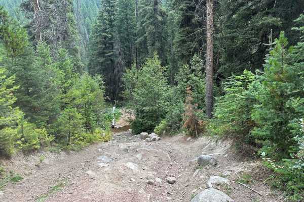
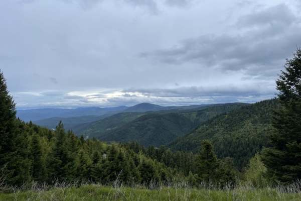
South Boulder Creek Loop
This is a fun and scenic loop with a lot of elevation change. It crosses South Boulder Creek nine times and goes by a few old mining remnants while on this loop. The trail is fairly easy although it has had a couple of recent washouts that can be tricky and there are a couple of rocky areas.
Learn more about South Boulder Creek Loop
Marshall Creek
There are a couple gates that are unlocked, please close them behind you. Road dead ends, gets very tight and over grown after second gate. Not recommended for large rigs. Road has views to enjoy, but there isn't much for camping, maybe a small spot.Dirt or rocky road, typically unmaintained after r...
Learn more about Marshall Creek
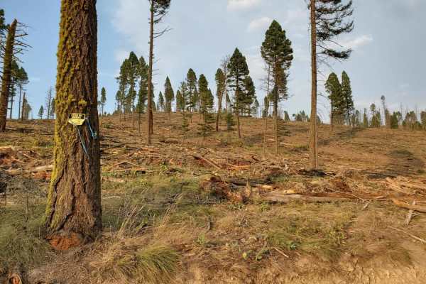
Summit Cabin Road
This narrow road cuts through a section of burned forest and passes through many private parcels. Please be respectful of their land and stick to the trail. On the map, there is one dispersed camping spot right along the outside of a private property line. Otherwise, there aren't too many places to ...
Learn more about Summit Cabin Road
Upper Cave Gulch Road
This narrow, short upper section leads into the hills to pass right by the well-preserved Garnet Ghost Town. It runs along a ridgeline with exceptional views of the valley below. It passes through a dense forest and massively deep potholes full of water when wet. There was one decent dispersed campi...
Learn more about Upper Cave Gulch Road
First Chance Gulch To Bear Gulch
This is a great connector trail with amazing views of the canyons below. It connects the well-preserved Garnet Ghost Town to Bear Town. There are plenty of switchbacks and a creek running alongside the whole way. There's even a lovely, well-preserved set of older buildings right in a switchback with...
Learn more about First Chance Gulch To Bear Gulch
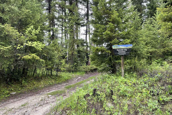
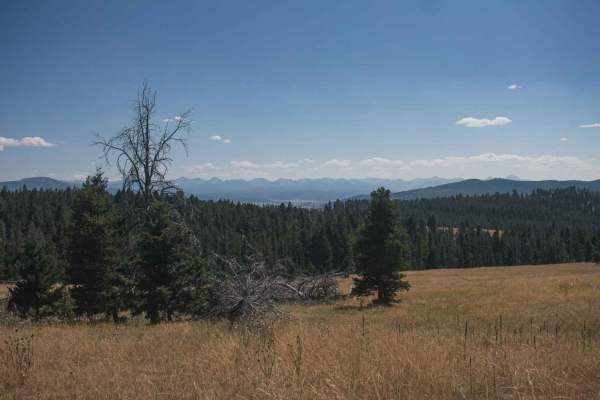
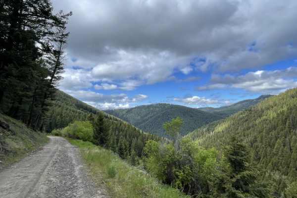
Eastern Garnet Range Road
This easy section twists and turns through the hills and offers a lot of offshoots that have been blocked off with gates and a few pullouts with evidence of camping. If that is your jam, then there are spots for you. The trail passes by the access to the old Reynolds city cemetery as it twists and t...
Learn more about Eastern Garnet Range Road
Granite Mine Ghost Town
This unimproved and fairly steep dirt road leads from Phillipsburg, MT, east into the mountains to the Granite ghost town and mine, and the Bimetalllic mine complex, now a state park property. Roads require high clearance in some areas due to boulders in the road, and 4WD is mandatory for wet or sno...
Learn more about Granite Mine Ghost Town
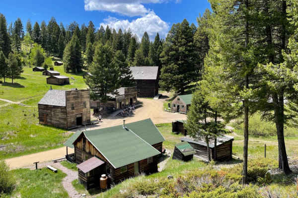
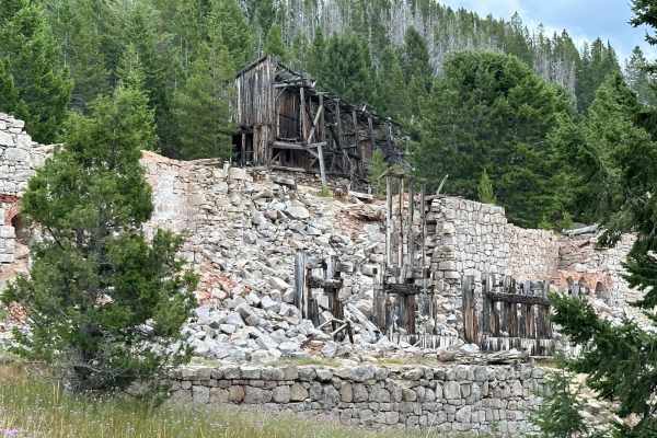
Garnet Ghost Town
This very potholed and deeply washboard trail leads from the beginning of the dirt section to Montana's best-preserved Ghost Town, Garnet. This site features some of the best-kept historical buildings of its kind. The trail ends at the parking area, and a three-dollar fee per person is well worth it...
Learn more about Garnet Ghost Town
Nevada-Ogden Road
The Nevada-Ogden road is an thrilling, yet easy route that can be used to explore the Helena National Forest. While it is not routinely maintained, it sees enough seasonal use to be in good general condition. Just about any vehicle could be used to enjoy this trail with no fear of extreme terrain or...
Learn more about Nevada-Ogden Road
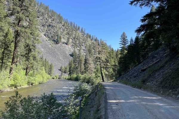
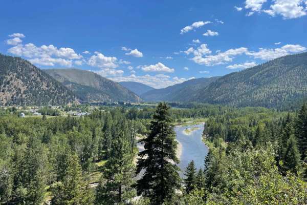
Rock Creek
This dirt road follows Rock Creek and connects I-90 near Clinton, MT, to Highway 1, leading to Philipsburg. This area is busy with anglers and rafters in the Spring, Summer, and Fall but experiences less traffic in the winter. The trail is very well graded and smooth for the most part. There are no ...
Learn more about Rock Creek
Blackfoot Mine Loop
Sometimes it's not about the trail, but the exploration! Montana has a rich and illustrious history of mining, dating back hundreds of years. This loop, accessed off of Nevada-Ogden Road (FS 1163), is a prime example of what's out there that you could easily drive by and never see unless you know it...
Learn more about Blackfoot Mine Loop
Dalton Mountain Road
The Dalton is an especially fun and scenic logging road for all modes of travel. Most fun on a large-class ADV bike. Nothing inherently difficult, just fast and flowy, depending on the season. Depending on your direction, it starts in the town of Lincoln, heads up into beautiful forest, over the mou...
Learn more about Dalton Mountain Road
Verdy Moccasin Ridge
This moderate shelf road leads from the valley below near Connor and heads up into the Sapphire Mountains. The beginning is a shelf road with a steep dropoff with tight turns, loose rocky switchbacks, and ever-changing outstanding views of the valley as you make your ascent. There are a few pullouts...
Learn more about Verdy Moccasin Ridge
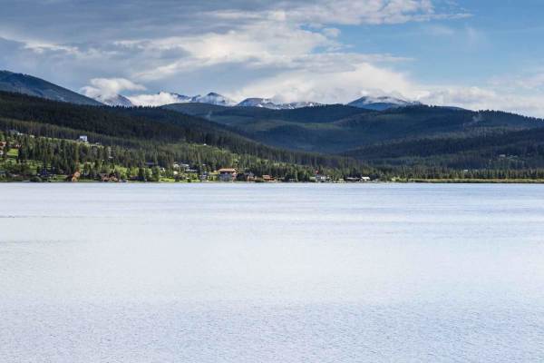
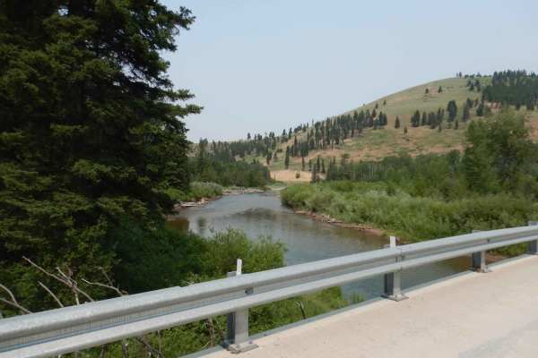
East Fork Reservoir
This is a scenic route from Georgetown Lake to the East Fork Reservoir. The route starts on Old Lake Road along the west side of Georgetown Lake. After turning on Georgetown Lake Road you will travel through thick sections of lodgepole pines and also wide meadows. The road surface is gravel and very...
Learn more about East Fork Reservoir
Beginner ATV trails near Hall, Montana
Explore ATV-friendly trails near you. These trails are accessible for vehicles up to 50 inches wide, perfect for ATVs and smaller off-road machines.
Smart Creek
Beautiful road with amazing views to enjoy, there isn't much for camping, maybe a spot or two. Road can be muddy when wet, with some water puddles. Dirt or rocky road, typically unmaintained after rain or snow. You may encounter shallow water crossings and obstacles under 12" on the trail, including...
Learn more about Smart Creek
North Fork Gold Creek
You will enjoy this road with its amazing views. There are a few spots that look like they would be good for camping. The road can be muddy when wet, with some water puddles. This road offers access to other roads and has lots of cows! It's a dirt or rocky road with gentle grades that is safe for mo...
Learn more about North Fork Gold Creek
Henderson
Beautiful road with amazing views to enjoy, there isn't much for camping, maybe a spot or two. Offers access to many roads, and they should provide other camp options. Dirt or rocky road with gentle grades. Safe for most 4WD and high-clearance 2WD vehicles. Roads are typically two vehicles wide.
Learn more about Henderson
Jackson Park
Beautiful road with amazing views to enjoy, there aren't many spots for camping, maybe a spot or two and not very big. This road does offer access to other roads which will have more camping spots.Dirt or rocky road with gentle grades. Safe for most 4WD and high-clearance 2WD vehicles. Roads are typ...
Learn more about Jackson Park
Beginner UTV/side-by-side trails near Hall, Montana
Find UTV and side-by-side trails near you. These trails accommodate vehicles up to 60 inches wide, ideal for UTVs, side-by-sides, and wider off-road rigs.
Smart Creek
Beautiful road with amazing views to enjoy, there isn't much for camping, maybe a spot or two. Road can be muddy when wet, with some water puddles. Dirt or rocky road, typically unmaintained after rain or snow. You may encounter shallow water crossings and obstacles under 12" on the trail, including...
Learn more about Smart Creek
North Fork Gold Creek
You will enjoy this road with its amazing views. There are a few spots that look like they would be good for camping. The road can be muddy when wet, with some water puddles. This road offers access to other roads and has lots of cows! It's a dirt or rocky road with gentle grades that is safe for mo...
Learn more about North Fork Gold Creek
Henderson
Beautiful road with amazing views to enjoy, there isn't much for camping, maybe a spot or two. Offers access to many roads, and they should provide other camp options. Dirt or rocky road with gentle grades. Safe for most 4WD and high-clearance 2WD vehicles. Roads are typically two vehicles wide.
Learn more about Henderson
Jackson Park
Beautiful road with amazing views to enjoy, there aren't many spots for camping, maybe a spot or two and not very big. This road does offer access to other roads which will have more camping spots.Dirt or rocky road with gentle grades. Safe for most 4WD and high-clearance 2WD vehicles. Roads are typ...
Learn more about Jackson Park
The onX Offroad Difference
onX Offroad combines trail photos, descriptions, difficulty ratings, width restrictions, seasonality, and more in a user-friendly interface. Available on all devices, with offline access and full compatibility with CarPlay and Android Auto. Discover what you're missing today!
Open Trail Map