
Beginner Off-Road Trails
Near Greycliff, Montana
Explore All Beginner Trails Near Greycliff, Montana
Beginner Off-Road Trails Near Greycliff, Montana
Discover the best beginner-friendly off-road trails near you. These easier, lower-rated trails are a great place to start — browse trail maps, check difficulty ratings, and find your next adventure.
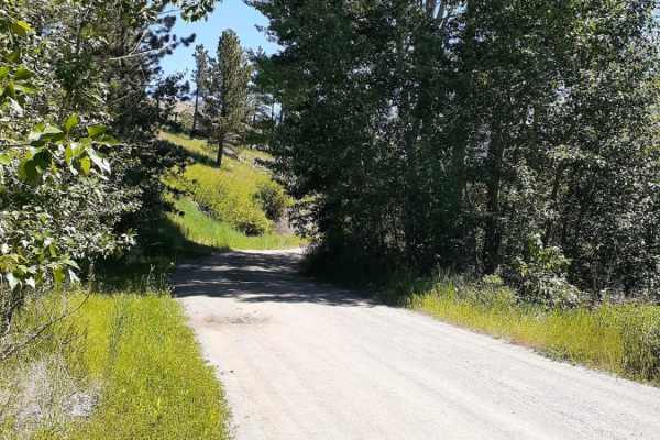
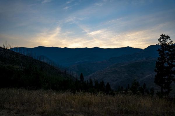
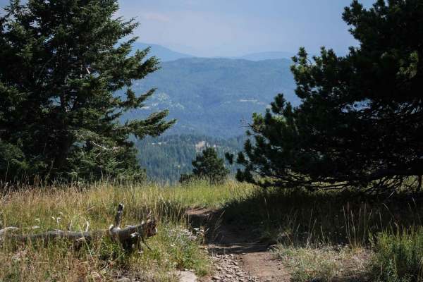
West Bridger Creek Cruise
A well-established trail, with some paved and gravel patches leading to the National Forest, the last 5 miles are the main dirt trail. The trail can be driven up to the Tie Cutter Gulch TH; from that point, vehicle width is restricted to less than 50 inches and dates of use. One will encounter some ...
Learn more about West Bridger Creek Cruise
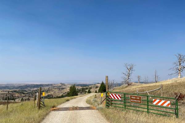
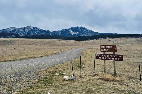
Iron Mountain Road
Iron Mountain Road is a very scenic gravel road that becomes slightly narrower the further along you drive. Once passing the entrance gate you officially enter Gallatin National Forest and dispersed campsites can be found along the road with fire rings. From the entrance is at 7.6 miles to campsite ...
Learn more about Iron Mountain Road
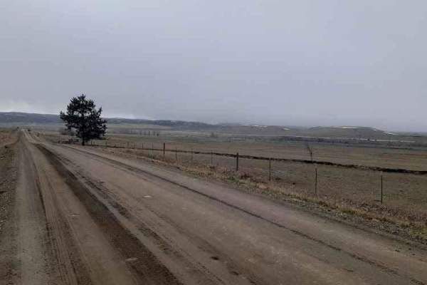
Stillwater River Road
This is a well-maintained gravel road that follows the Stillwater River. It's open year-round with limited access during heavy snowy weather. The first 6.5 miles is a paved two-lane road west of Absarokee before turning into gravel and then back into pavement 1.2 miles before the junction with Nye R...
Learn more about Stillwater River Road
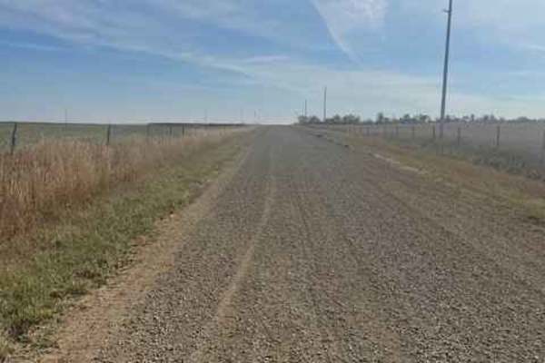
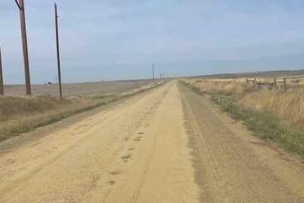
Rapelje Road
This is a gravel road connector from Big Timber to Rapelje. You will see more antelope and cows than cars or people along this route. Most of the road is surrounded by private property, so zero camping opportunities exist. There are services in Big Timber, but none in Rapelje, so be prepared. There...
Learn more about Rapelje Road
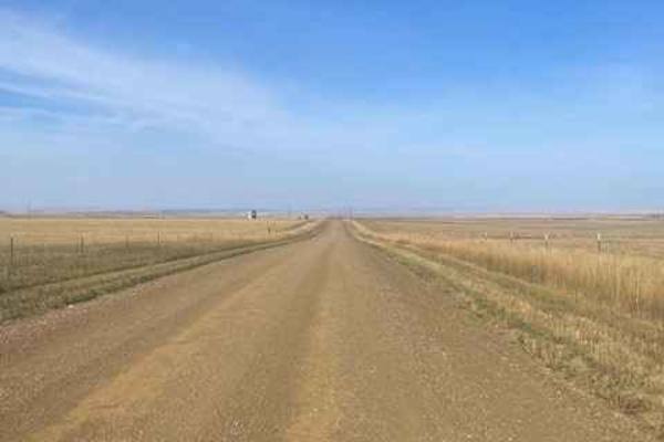
Columbus Molt Road
This is a gravel road connector from Columbus to Molt. You will see more antelope and cows than cars or people along this route. Most of the road is surrounded by private property, so zero camping opportunities exist. There are services in Columbus, but none in Molt, so be prepared. There is fairly ...
Learn more about Columbus Molt Road
Livingston Peak Road
The trailhead is located just minutes from the historic downtown of Livingston, with plenty of opportunities to get fuel and other supplies. The trailhead is also roughly 29 miles from Chico Hot Springs and Resort. The trail consists mostly of gravel but does degrade into a dirt road toward the top ...
Learn more about Livingston Peak Road
Molt Rapelje Road
This is a gravel road connector from Molt to Rapelje. You will see more antelope and cows than cars or people along this route. Most of the road is surrounded by private property, so there are no camping opportunities on this route. There are no services between the two small towns, so be prepared w...
Learn more about Molt Rapelje Road
Willow Creek South ATV
Willow Creek South is a less trafficked and easy ATV trail through the Gallatin National Forest. The east entrance to this trail is on Willow Creek Divide Road #6957 when the road fades and it turns into more of a two-track, but there is no sign right at the beginning. If you keep following the trac...
Learn more about Willow Creek South ATV
Willow Creek North Spur ATV
This is an easy ATV route through the Gallatin National Forest. This trail connects North Fork Willow Creek Road #6901 and Willow Creek Road #6600. From the north end, the first 2 miles climb up several hundred feet elevation, with several steeper spots. It's overall an easy two-track though, with s...
Learn more about Willow Creek North Spur ATV
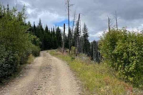
Mill Creek Road
Mill Creek Road is a very well-maintained gravel road that accesses several trailheads and campgrounds in the Gallatin National Forest. This road is a wide gravel road, except for the last three miles, in which the road narrows down to a single-vehicle-width road. This part of the road is very narro...
Learn more about Mill Creek Road
Willow Creek North ATV
The Willow Creek North ATV Trail connects Jackson Creek Road #977 to the North Fork Willow Creek Road #6901. Most of the 3 miles go along a wide shelfy path cutting across the grassy mountainside full of tall skinny pine trees. A couple of sections have more embedded rock surfaces and chunky loose r...
Learn more about Willow Creek North ATV

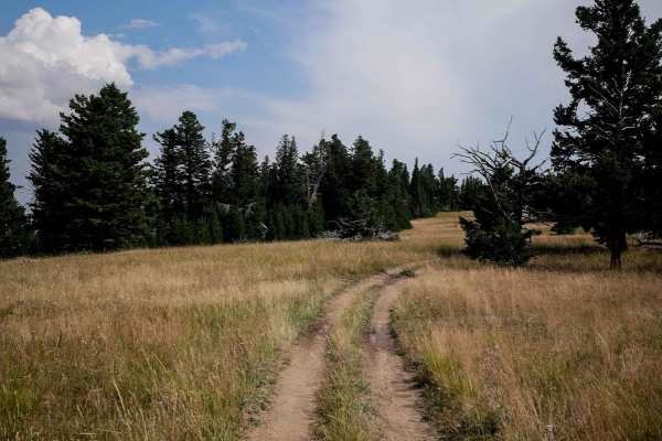
Jackson Divide ATV
Jackson Divide Trail is a 1-mile connector ATV trail between the Willow Creek North ATV Trail and the Bishop Park ATV Trail. It's very easy, the majority of it being a smooth dirt two-track that is very similar to the rest of the ATV trails in the area. There are small loose rocks on the surface of ...
Learn more about Jackson Divide ATV
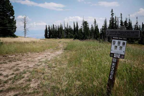
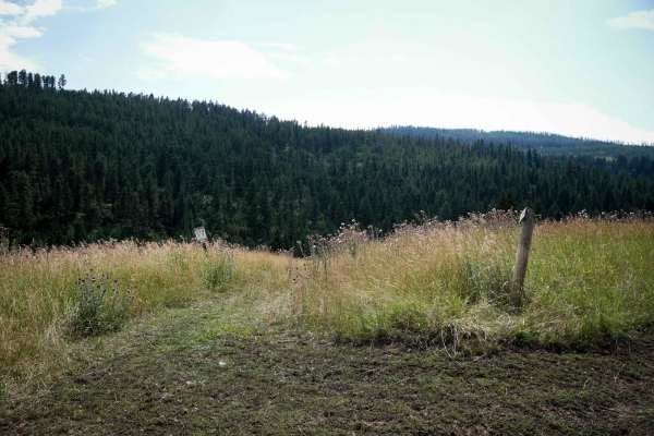
Bangtail Creek Loop ATV
The Bangtail Creek Loop Trail is a straightforward ATV trail open June 16th to Oct 14th to vehicles 50" or less. It starts on a mountain top as a grassy, overgrown two-track. The trail's most challenging part is small ruts, small loose rocks, and wide gradual switchbacks. Sometimes, there are sudden...
Learn more about Bangtail Creek Loop ATV
Pine Creek
This is a really pretty drive to some nice views and campsites. Nothing technical to worry about, a car could make it through with some determination. There is a small water crossing and some ruts, but nothing to be concerned about. It's a nice spot to watch the sunset or get out of town for a nigh...
Learn more about Pine Creek
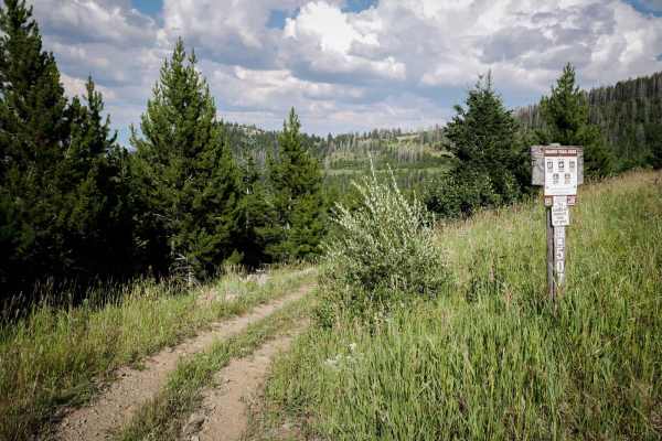
Jackson Creek ATV
Jackson Creek is an 11-mile ATV loop in the Gallatin National Forest that is open to vehicles 50" or less from 6/16 - 10/14. There is a staging area on the west side of the loop at the Jackson Creek Trailhead. You can access several other easy ATV trails in the area off of this loop. This trail is o...
Learn more about Jackson Creek ATV
Olsen Creek
This is a nice drive through the Bridger range that most vehicles can do. The trail forks to Skunk Creek, which has some deep puddles, but nothing a stock truck or SUV wouldn't be able to handle. There are nice views of the Bangtail divide and Crazy Mountains when you reach the top.
Learn more about Olsen Creek
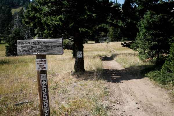
Bishop Park ATV
Bishop Park ATV trail is almost 7 miles long running north to south through the Gallatin National Forest. The north end starts on Miles Creek Road, and it ends at the intersection with the Jackson Creek ATV Loop. The majority is a very easy and wide two-track on smooth dirt. It gradually climbs up f...
Learn more about Bishop Park ATV
Bishop Park Connector
This is a half mile long single track that connects the Bishop Park ATV trail to the Bangtail Divide single track. It's easy, fast, flowy, and smooth, with no rocks. It goes through grassy meadows, and has some braided lines up some of the steeper hills. The first quarter mile is flat, and then it g...
Learn more about Bishop Park Connector
Bangtail Divide
This is a 2.7-mile segment of the Bangtail Divide single track that parallels the Bishop Park ATV Trail. The south end starts at the intersection with the Bishop Park Connector Trail and a nonmotorized trail that goes to the Doyle Cabin. It goes north as a narrow trail through pine trees along the e...
Learn more about Bangtail Divide
Canyon Creek Trail
This 3.4-mile-long ATV trail goes through the Gallatin National Forest and makes a loop off of Miles Creek Road. This trail is more faint and overgrown and less trafficked compared to the other ATV trails in the area. It's very curvy along the shelfy edge of a mountain, lined with lots of pine trees...
Learn more about Canyon Creek Trail
Beginner ATV trails near Greycliff, Montana
Explore ATV-friendly trails near you. These trails are accessible for vehicles up to 50 inches wide, perfect for ATVs and smaller off-road machines.
West Bridger Creek Cruise
A well-established trail, with some paved and gravel patches leading to the National Forest, the last 5 miles are the main dirt trail. The trail can be driven up to the Tie Cutter Gulch TH; from that point, vehicle width is restricted to less than 50 inches and dates of use. One will encounter some ...
Learn more about West Bridger Creek Cruise
Stillwater River Road
This is a well-maintained gravel road that follows the Stillwater River. It's open year-round with limited access during heavy snowy weather. The first 6.5 miles is a paved two-lane road west of Absarokee before turning into gravel and then back into pavement 1.2 miles before the junction with Nye R...
Learn more about Stillwater River Road
Rapelje Road
This is a gravel road connector from Big Timber to Rapelje. You will see more antelope and cows than cars or people along this route. Most of the road is surrounded by private property, so zero camping opportunities exist. There are services in Big Timber, but none in Rapelje, so be prepared. There...
Learn more about Rapelje Road
Columbus Molt Road
This is a gravel road connector from Columbus to Molt. You will see more antelope and cows than cars or people along this route. Most of the road is surrounded by private property, so zero camping opportunities exist. There are services in Columbus, but none in Molt, so be prepared. There is fairly ...
Learn more about Columbus Molt Road
Beginner UTV/side-by-side trails near Greycliff, Montana
Find UTV and side-by-side trails near you. These trails accommodate vehicles up to 60 inches wide, ideal for UTVs, side-by-sides, and wider off-road rigs.
West Bridger Creek Cruise
A well-established trail, with some paved and gravel patches leading to the National Forest, the last 5 miles are the main dirt trail. The trail can be driven up to the Tie Cutter Gulch TH; from that point, vehicle width is restricted to less than 50 inches and dates of use. One will encounter some ...
Learn more about West Bridger Creek Cruise
Iron Mountain Road
Iron Mountain Road is a very scenic gravel road that becomes slightly narrower the further along you drive. Once passing the entrance gate you officially enter Gallatin National Forest and dispersed campsites can be found along the road with fire rings. From the entrance is at 7.6 miles to campsite ...
Learn more about Iron Mountain Road
Stillwater River Road
This is a well-maintained gravel road that follows the Stillwater River. It's open year-round with limited access during heavy snowy weather. The first 6.5 miles is a paved two-lane road west of Absarokee before turning into gravel and then back into pavement 1.2 miles before the junction with Nye R...
Learn more about Stillwater River Road
Rapelje Road
This is a gravel road connector from Big Timber to Rapelje. You will see more antelope and cows than cars or people along this route. Most of the road is surrounded by private property, so zero camping opportunities exist. There are services in Big Timber, but none in Rapelje, so be prepared. There...
Learn more about Rapelje Road
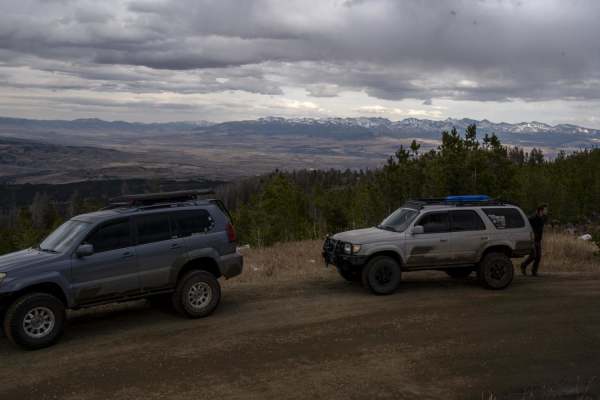
The onX Offroad Difference
onX Offroad combines trail photos, descriptions, difficulty ratings, width restrictions, seasonality, and more in a user-friendly interface. Available on all devices, with offline access and full compatibility with CarPlay and Android Auto. Discover what you're missing today!
Open Trail Map