
Beginner Off-Road Trails
Near Federal Dam, Minnesota
Explore All Beginner Trails Near Federal Dam, Minnesota
Beginner Off-Road Trails Near Federal Dam, Minnesota
Discover the best beginner-friendly off-road trails near you. These easier, lower-rated trails are a great place to start — browse trail maps, check difficulty ratings, and find your next adventure.
4
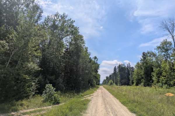
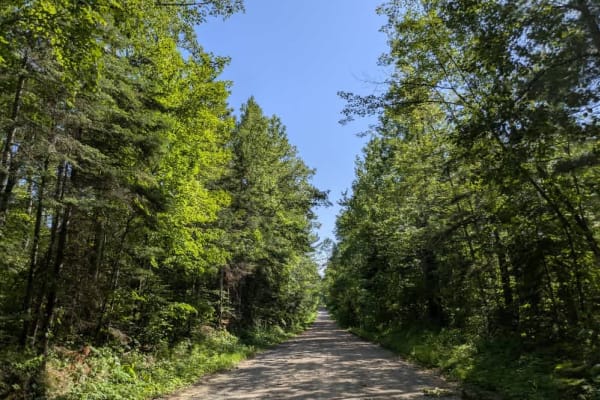
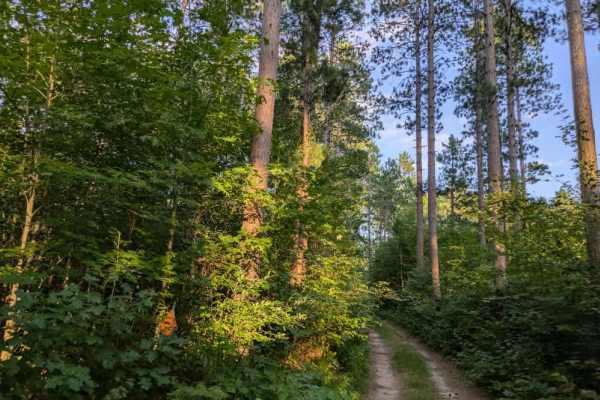
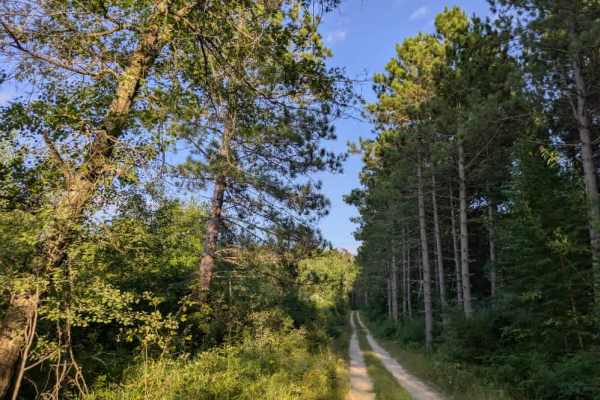
This trail is a wide, well-maintained gravel road. The main route is broad enough for easy travel, but it branches into several side trails that offer distinct experiences. One of the most notable connections is the Soo Line ATV trail, which is a popular destination for riders in the area. Another s...
Learn more about 4
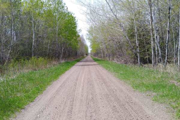
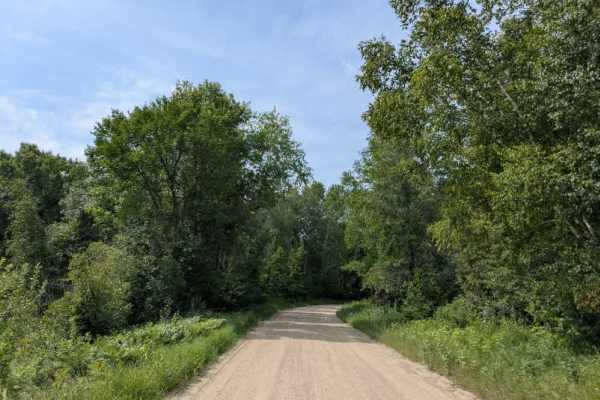
Boy River to Ketchum Road Northwest
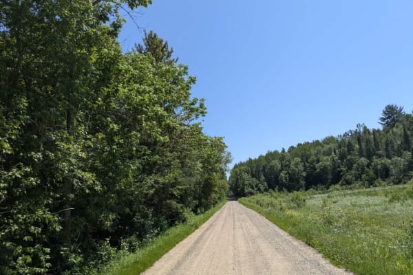
Boy River to Ketchum Road Northwest on the Soo Line North is a section of converted rail grade that is 19.3 miles long and takes about 1 hour with an average speed of 20.3 MPH. It's a great trail to run if you are in the area during a wet period or springtime, when other trails may be water-logged. ...
Learn more about Boy River to Ketchum Road Northwest
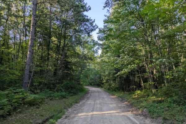
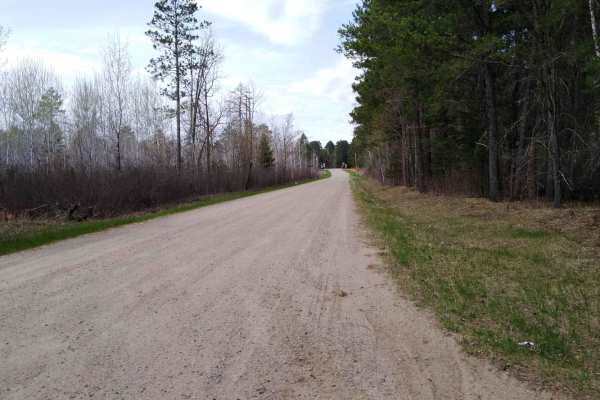
2341
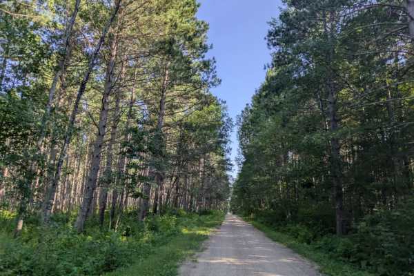
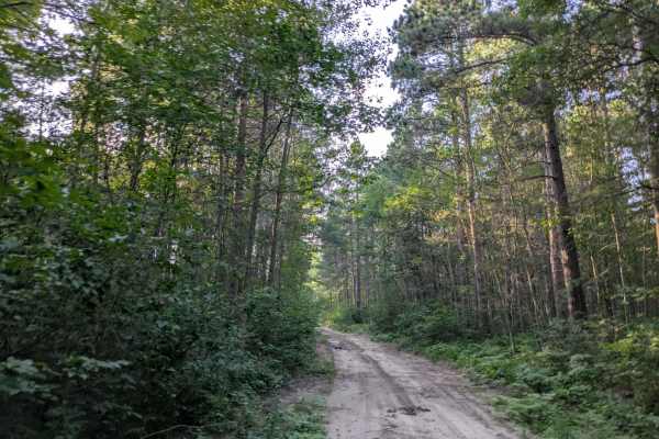
This trail is a wide, single-lane, two-track route that winds through the forest, providing a quiet and scenic drive. The trail surface varies, with some bumpy stretches and occasional potholes, though it is mostly smooth and manageable. Fallen trees are scattered along the way, some resting off to ...
Learn more about 2341
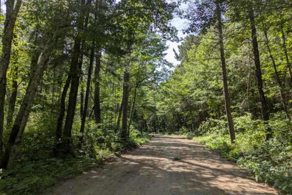
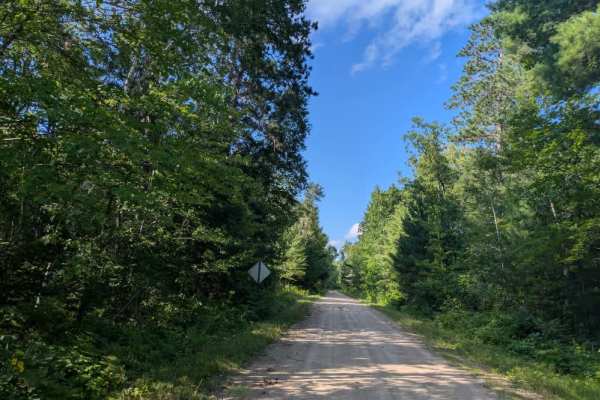
FS 2102
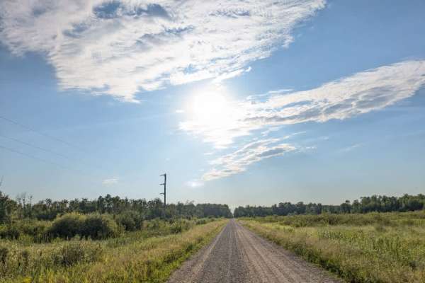
This trail winds through a densely wooded area and is divided into two distinct sections. The first half is well-maintained and provides a smooth drive through the forest, passing a number of attractive homes along the way. The second half is designated as "unmaintained" and reflects that status wit...
Learn more about FS 2102
2131
This trail begins at Highway 2 and crosses a set of railway tracks before continuing toward the private New Leech campground. Along the way, it passes what appears to be an old resort. The gravel surface is heavily corrugated, likely due to frequent local traffic, so careful driving is recommended. ...
Learn more about 2131
Richards Drive Northeast
This trail is a two-vehicle-wide track made up of well-maintained gravel and sand that winds through the surrounding forest. Because it is a popular route, the surface is often corrugated, which can result in a rougher ride in certain areas. Drivers should also be mindful of local traffic, as the tr...
Learn more about Richards Drive Northeast
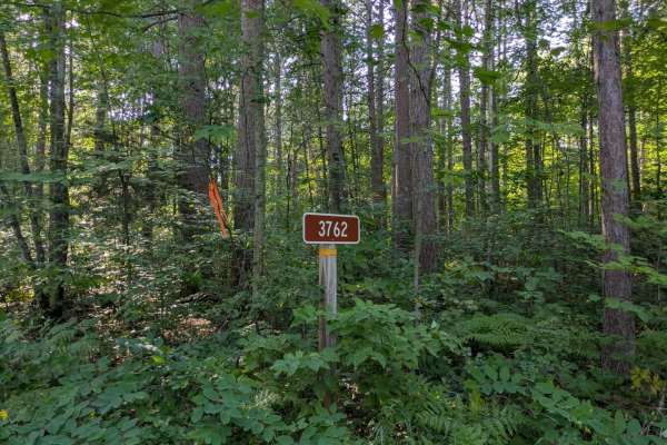
3762
This trail quickly transitions into a mixture of gravel and sandy surfaces. It is a narrow, single-vehicle two-track route that winds its way through dense forest, offering a secluded and often rugged drive. The path is uneven in places, with frequent bumps, potholes, and muddy patches that require ...
Learn more about 3762
2343
The trail begins as a smooth two-track, generally wide enough for a single vehicle, with a surface of well-maintained gravel and stretches of sand. The route winds steadily through the forest with a series of gentle ascents and descents, making for an easy drive. The surrounding landscape is mostly ...
Learn more about 2343
Converse Road
This trail is accessed directly from the paved US 2 Highway and offers a quiet drive through a heavily forested area. The route is a mix of gravel and sand and features a winding path that passes through tall grass and stretches of overgrown vegetation, making pinstriping on vehicles possible. Falle...
Learn more about Converse Road
County Road 128
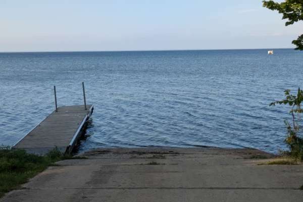
This trail offers a scenic drive through forested terrain as it gradually descends toward a lakeshore. The surface is wide, smooth gravel, and well-maintained, making for an easy and pleasant ride. Winding gently through the trees, the trail eventually reaches a lake with public boat access. Several...
Learn more about County Road 128
2348
This trail is very similar in character to trail 2169 and offers a straightforward drive through a forested setting. The surface is well-maintained and generally smooth, though there are occasional bumps to navigate. The width alternates between single-vehicle and two-vehicle sections, providing eno...
Learn more about 2348
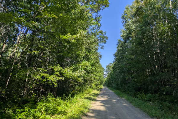
135
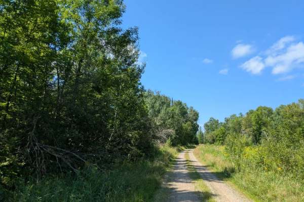
This trail is long and wide, beginning and ending at County 63, which is a paved road. It is a well-maintained two-vehicle route that offers a leisurely drive through a mix of forested areas and open fields. Residences are scattered along parts of the trail, so drivers should be mindful of local tra...
Learn more about 135
FS 2162
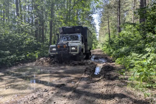
This trail is narrow, overgrown, and becomes extremely muddy following heavy June storms. Fallen branches and trees are scattered along the route, with some hanging low over the trail and others partially blocking the path. The surface includes deep, muddy ruts and patches of thick sand, which can m...
Learn more about FS 2162
2948
This trail is composed mainly of sand, with some sections of gravel, and in specific stretches, the sand becomes quite thick, making driving more challenging. The route is narrow and winds through forested terrain, with much of it suitable for single-vehicle passage. Overgrown vegetation often brush...
Learn more about 2948
2971
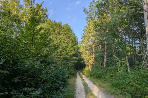
This trail quickly transitions into a sandy two-track suitable for single-vehicle passage. The route runs mostly straight, with gentle ascents and descents along the way. Tall grass often grows up through the track, and sections are overgrown, with trees arching over parts of the trail. The surface ...
Learn more about 2971
62nd Avenue Northeast
This trail follows a two-track path that is generally suited for single-vehicle use. The route is well-maintained but has a ditch running along one side, so drivers should use caution when passing through narrower sections. The trail leads toward Goose Lake and passes by private property along the w...
Learn more about 62nd Avenue Northeast
2347
This trail varies in width, ranging from single-vehicle to two-vehicle, and is composed of a mix of gravel and sand. It is well-suited for side-by-sides and ATVs, and winds its way through a forested landscape with moderate ascents and descents. The surface is uneven in places, with muddy and bumpy ...
Learn more about 2347
County Road 127
This trail is a paved road that begins as a well-maintained two-lane track, winding through forested terrain. The surface is smooth and free of potholes, making it an easy route to travel. The main trail continues to connect with County Road 39, providing a straightforward link between the two paved...
Learn more about County Road 127
Ketchum Road Northwest to Cass Lake
Ketchum Road Northwest to Cass Lake on the Soo Line North follows an active railroad and US Highway 2, is 12.3 miles long, and takes about 40 minutes with an average speed of 19.3 MPH. A note to OHM riders--Cass County sections of the Soo Line North trail do not allow OHM per MN DNR information: htt...
Learn more about Ketchum Road Northwest to Cass Lake
2169
This trail is well-maintained and generally very smooth, though there are occasional bumps along the way. The width varies, with some stretches accommodating two vehicles and others narrowing to single-vehicle passage. The trail is quiet and secluded, with no residences along the route and very litt...
Learn more about 2169
Beginner ATV trails near Federal Dam, Minnesota
Explore ATV-friendly trails near you. These trails are accessible for vehicles up to 50 inches wide, perfect for ATVs and smaller off-road machines.
Boy River to Ketchum Road Northwest
Boy River to Ketchum Road Northwest on the Soo Line North is a section of converted rail grade that is 19.3 miles long and takes about 1 hour with an average speed of 20.3 MPH. It's a great trail to run if you are in the area during a wet period or springtime, when other trails may be water-logged. ...
Learn more about Boy River to Ketchum Road Northwest
2341
This trail is a wide, single-lane, two-track route that winds through the forest, providing a quiet and scenic drive. The trail surface varies, with some bumpy stretches and occasional potholes, though it is mostly smooth and manageable. Fallen trees are scattered along the way, some resting off to ...
Learn more about 2341
FS 2102
This trail winds through a densely wooded area and is divided into two distinct sections. The first half is well-maintained and provides a smooth drive through the forest, passing a number of attractive homes along the way. The second half is designated as "unmaintained" and reflects that status wit...
Learn more about FS 2102
Richards Drive Northeast
This trail is a two-vehicle-wide track made up of well-maintained gravel and sand that winds through the surrounding forest. Because it is a popular route, the surface is often corrugated, which can result in a rougher ride in certain areas. Drivers should also be mindful of local traffic, as the tr...
Learn more about Richards Drive Northeast
Beginner UTV/side-by-side trails near Federal Dam, Minnesota
Find UTV and side-by-side trails near you. These trails accommodate vehicles up to 60 inches wide, ideal for UTVs, side-by-sides, and wider off-road rigs.
Boy River to Ketchum Road Northwest
Boy River to Ketchum Road Northwest on the Soo Line North is a section of converted rail grade that is 19.3 miles long and takes about 1 hour with an average speed of 20.3 MPH. It's a great trail to run if you are in the area during a wet period or springtime, when other trails may be water-logged. ...
Learn more about Boy River to Ketchum Road Northwest
2341
This trail is a wide, single-lane, two-track route that winds through the forest, providing a quiet and scenic drive. The trail surface varies, with some bumpy stretches and occasional potholes, though it is mostly smooth and manageable. Fallen trees are scattered along the way, some resting off to ...
Learn more about 2341
FS 2102
This trail winds through a densely wooded area and is divided into two distinct sections. The first half is well-maintained and provides a smooth drive through the forest, passing a number of attractive homes along the way. The second half is designated as "unmaintained" and reflects that status wit...
Learn more about FS 2102
Richards Drive Northeast
This trail is a two-vehicle-wide track made up of well-maintained gravel and sand that winds through the surrounding forest. Because it is a popular route, the surface is often corrugated, which can result in a rougher ride in certain areas. Drivers should also be mindful of local traffic, as the tr...
Learn more about Richards Drive Northeast
The onX Offroad Difference
onX Offroad combines trail photos, descriptions, difficulty ratings, width restrictions, seasonality, and more in a user-friendly interface. Available on all devices, with offline access and full compatibility with CarPlay and Android Auto. Discover what you're missing today!
Open Trail Map