
Beginner Off-Road Trails
Near East Bank, West Virginia
Explore All Beginner Trails Near East Bank, West Virginia
Beginner Off-Road Trails Near East Bank, West Virginia
Discover the best beginner-friendly off-road trails near you. These easier, lower-rated trails are a great place to start — browse trail maps, check difficulty ratings, and find your next adventure.
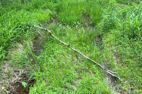
Q62A
Quincy Trail 62A is an out-and-back spur trail off of Q62, which ultimately leads to a well site, then continues but quickly reaches a property boundary beyond that. Along the way, there is one major mud area that can be tricky to navigate in wet seasons. There is plenty of room to turn around at th...
Learn more about Q62A
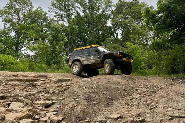
Q63
Quincy Trail 63 is a nearly 1.5-mile-long connector between Q6/Q7 and Q65. This is a smooth, easy-to-travel trail with two switchback turns that are easy to navigate. The trail surface is smooth dirt and small rocks, with the possibility of minor ruts and washouts. At the intersection with Q6/Q7, th...
Learn more about Q63
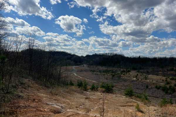
Q56
Quincy Trail 56 connects Q55 and Q1. The track is relatively narrow and lined with young tree growth and some underbrush. Though the majority of the trail is a slope, it can often be quite wet and muddy with some ruts and minor mud holes or puddles. Where the route joins Q1, there is a large clearin...
Learn more about Q56
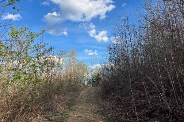
Q39A
Quincy Trail 39A is a spur trail off Q39, which is a short out-and-back adventure to a well site. The track is primarily narrow and shelved with some overgrown vegetation, and as such, there are minimal opportunities to pass safely. There are a few sections that are relatively steep, and you're also...
Learn more about Q39A
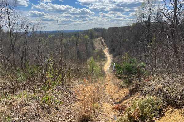
Q55
Quincy Trail 55 connects Q6, Q39, and Q56 as it traverses the property in a generally north-south direction. Towards the northern end, Q55 intersects Q39 before ascending to the peak elevation along the track. Heading south beyond that crossing, the next intersection is with Q56, which can be used t...
Learn more about Q55
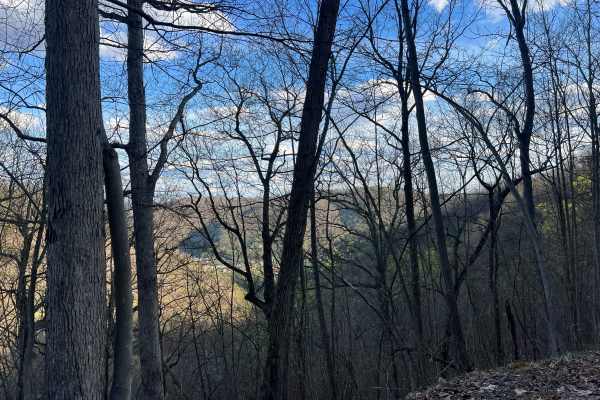
Q39B
Quincy Trail 39B is a spur trail off Q39, which is a short out-and-back adventure to a well site. The track is primarily narrow and shelved with some overgrown vegetation, and as such there are minimal opportunities to pass safely. Though not particularly steep, the trail is a steady slope from end ...
Learn more about Q39B
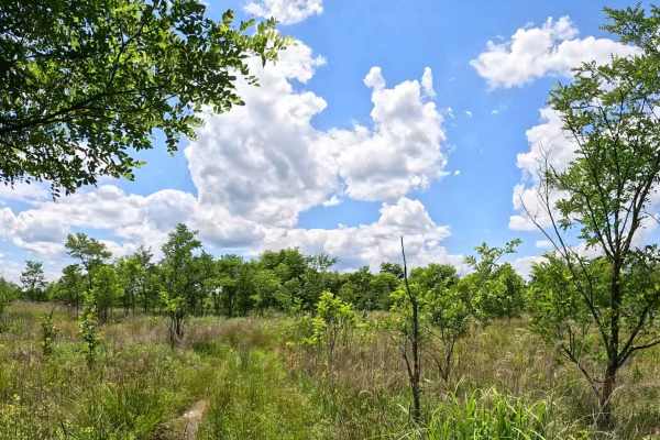
Q13A
Q13A is an easy connector that splits the Q13 loop trail, providing riders with a shorter route back to the beginning of Q13. It serves as a convenient exit option for those wishing to bypass the remainder of the loop. The trail consists of a mix of grass and dirt with gentle grades and minimal obst...
Learn more about Q13A
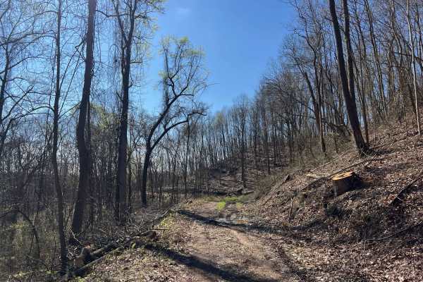
Q41
Trail Q41 is an easy ride out to an old hunting blind on the Quincy Sector of AOT. The trailhead can be very muddy, and may be particularly difficult for large rigs when approaching this while driving north on Q6/Q7 due to it being a hairpin turn. It may be best to pass the trail and turn around, as...
Learn more about Q41
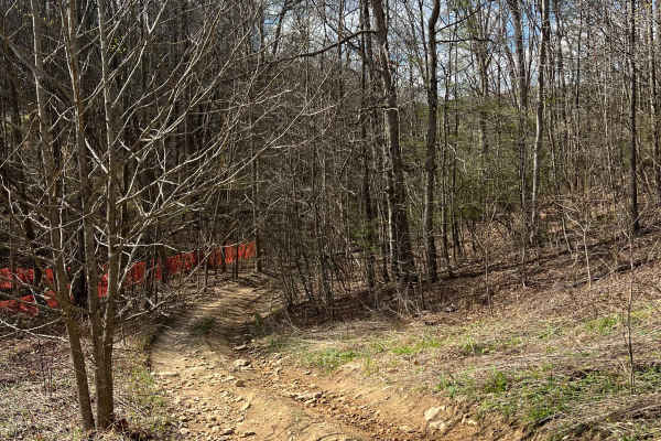
Q40
Trail Q40 is an easy ride that is a narrow winding trail connecting Q2 to Q6/Q7. Sections of the trail are narrow enough that they should be carefully navigated with a full-width or wider high clearance 4x4s. Aside from some ruts and minor washes, this is a beautiful and easy drive. The creek that r...
Learn more about Q40
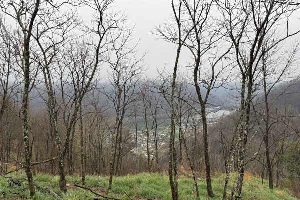
Q13
Q13 is an easy, green-rated loop trail located in the eastern Quincy sector and connects at the end of trail Q1. This trail is ideal for kids and new riders looking to build confidence while learning to navigate off-road terrain. The trail consists primarily of grassy vegetation and natural surface....
Learn more about Q13
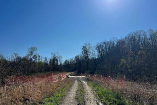
Q39
Trail Q39 is a rugged, rutted, and muddy route through the Quincy Sector of AOT. There are several deep mud holes, significant ruts, climbs, and descents. This road serves as a connector between Q4 and Q6/Q7. The trail surface is mostly dirt, which will become mud in wet seasons. There are several o...
Learn more about Q39
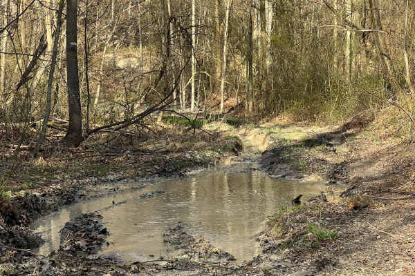
Q42A
Quincy Trail 42A is a dead-end spur trail off Q42 that is deeply rutted and muddy, with one significant mud hole and several smaller puddles. Ultimately, the track leads to an old well site, where there is ample room to turn around. The trail is relatively narrow with minimal opportunity to pass; ho...
Learn more about Q42A
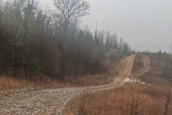
Q4
Q4 runs from the Quincy Playground area and connects to Q1 on the southern side, serving as a key access route into the Northeast Quincy sector. This trail provides a smooth and reliable connection between multiple trail systems. The trail is primarily a gravel road with a larger rock base, offering...
Learn more about Q4
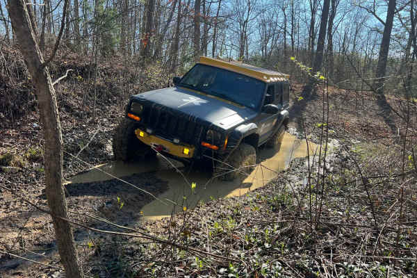
Q45
Trail Q45 in the Quincy Sector of AOT connects Q44 and Q4. There is one very deep mud hole, which could be surprisingly deep for dirt bikes and ATVs. There are some significant washes/ruts in the lower area, which should be navigated carefully with high clearance and full-size 4x4s. This is a short ...
Learn more about Q45
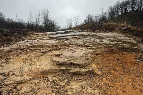
Q2A
Q2A is an alternate line branching off the main Q2 route, offering riders a more technical option while still staying close to the primary corridor. This short segment provides a quick challenge for those looking to step things up. The trail features a rock ledge section combined with a gradual incl...
Learn more about Q2A
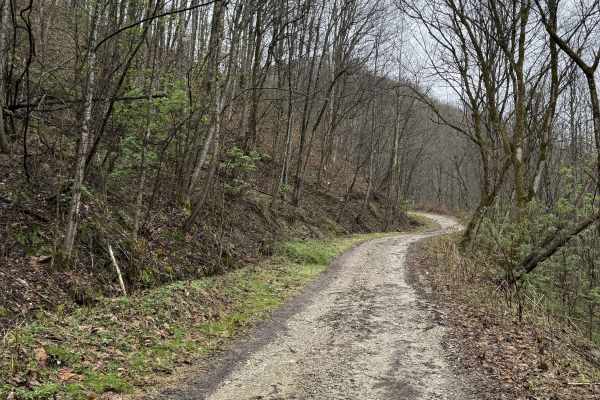
Q9
Q9 is an easy connector trail branching from Q8 that provides access to Kelley’s Creek Road and the Kelley’s Creek sector. This route also leads to the historic Ward Cemetery when traveling southbound. The trail consists of a hard-packed gravel road, offering a smooth and consistent ride. It serves ...
Learn more about Q9
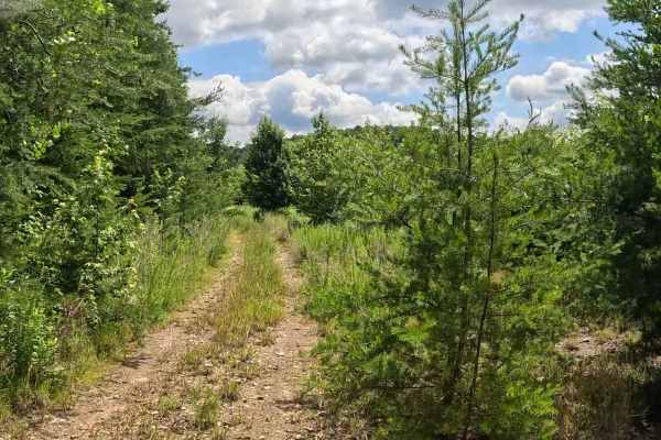
Q50D
Q50D is an easy connector trail linking Q50 and Q1. It provides a straightforward route between the two trails and is suitable for riders of all experience levels. The trail consists of a gravel base with sections of natural vegetation. Grades are gentle with minimal obstacles, providing a smooth ri...
Learn more about Q50D
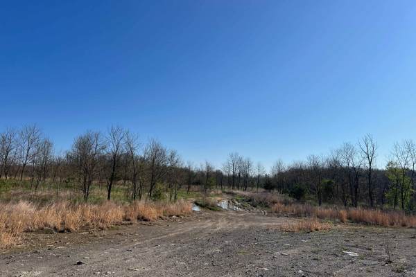
Q44
Trail Q44 in the Quincy Sector of AOT connects Q1 to Q7 and Q4. The lower section has several mud holes, which can be deep but are mostly water. There are some significant ruts in the lower area as well, though the trail is wide enough that these obstacles may be avoidable. The upper section of the ...
Learn more about Q44
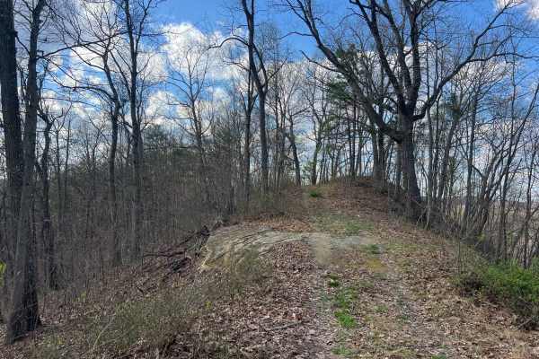
Q54
Quincy Trail 54 is a short, easy connector trail between Q42 and Q7. Q54 can be used as a bypass to a steep, rocky hill climb section of Q7, or a shorter way to reach Q42 towards Witcher when heading south on Q7. The track follows a ridge, and while it is comfortably wide, there is not much opportun...
Learn more about Q54
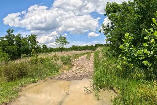
Q50E
Q50E is an easy connector trail linking Q1 with Q50. This short cut-through also provides access to Q44 at its intersection with Q1, making it a convenient route between several trails in the Quincy trail system. The trail consists of a well-maintained gravel surface with gentle grades and minimal o...
Learn more about Q50E
Beginner ATV trails near East Bank, West Virginia
Explore ATV-friendly trails near you. These trails are accessible for vehicles up to 50 inches wide, perfect for ATVs and smaller off-road machines.
Q62A
Quincy Trail 62A is an out-and-back spur trail off of Q62, which ultimately leads to a well site, then continues but quickly reaches a property boundary beyond that. Along the way, there is one major mud area that can be tricky to navigate in wet seasons. There is plenty of room to turn around at th...
Learn more about Q62A
Q63
Quincy Trail 63 is a nearly 1.5-mile-long connector between Q6/Q7 and Q65. This is a smooth, easy-to-travel trail with two switchback turns that are easy to navigate. The trail surface is smooth dirt and small rocks, with the possibility of minor ruts and washouts. At the intersection with Q6/Q7, th...
Learn more about Q63
Q56
Quincy Trail 56 connects Q55 and Q1. The track is relatively narrow and lined with young tree growth and some underbrush. Though the majority of the trail is a slope, it can often be quite wet and muddy with some ruts and minor mud holes or puddles. Where the route joins Q1, there is a large clearin...
Learn more about Q56
Q39A
Quincy Trail 39A is a spur trail off Q39, which is a short out-and-back adventure to a well site. The track is primarily narrow and shelved with some overgrown vegetation, and as such, there are minimal opportunities to pass safely. There are a few sections that are relatively steep, and you're also...
Learn more about Q39A
Beginner UTV/side-by-side trails near East Bank, West Virginia
Find UTV and side-by-side trails near you. These trails accommodate vehicles up to 60 inches wide, ideal for UTVs, side-by-sides, and wider off-road rigs.
Q62A
Quincy Trail 62A is an out-and-back spur trail off of Q62, which ultimately leads to a well site, then continues but quickly reaches a property boundary beyond that. Along the way, there is one major mud area that can be tricky to navigate in wet seasons. There is plenty of room to turn around at th...
Learn more about Q62A
Q63
Quincy Trail 63 is a nearly 1.5-mile-long connector between Q6/Q7 and Q65. This is a smooth, easy-to-travel trail with two switchback turns that are easy to navigate. The trail surface is smooth dirt and small rocks, with the possibility of minor ruts and washouts. At the intersection with Q6/Q7, th...
Learn more about Q63
Q56
Quincy Trail 56 connects Q55 and Q1. The track is relatively narrow and lined with young tree growth and some underbrush. Though the majority of the trail is a slope, it can often be quite wet and muddy with some ruts and minor mud holes or puddles. Where the route joins Q1, there is a large clearin...
Learn more about Q56
Q39A
Quincy Trail 39A is a spur trail off Q39, which is a short out-and-back adventure to a well site. The track is primarily narrow and shelved with some overgrown vegetation, and as such, there are minimal opportunities to pass safely. There are a few sections that are relatively steep, and you're also...
Learn more about Q39A
The onX Offroad Difference
onX Offroad combines trail photos, descriptions, difficulty ratings, width restrictions, seasonality, and more in a user-friendly interface. Available on all devices, with offline access and full compatibility with CarPlay and Android Auto. Discover what you're missing today!
Open Trail Map