
Beginner Off-Road Trails
Near Danvers, Massachusetts
Explore All Beginner Trails Near Danvers, Massachusetts
Beginner Off-Road Trails Near Danvers, Massachusetts
Discover the best beginner-friendly off-road trails near you. These easier, lower-rated trails are a great place to start — browse trail maps, check difficulty ratings, and find your next adventure.
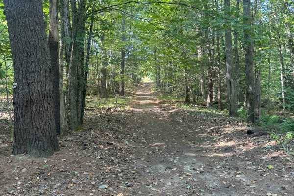
Hersey Road
This is a Class VI road in Danville, New Hampshire. You can access the trail from the east off of State Route 111A, turning onto the Hersey Road paved section. Trail access is to the left at the split (GH Carter Drive goes right), up into the woods. Follow signage for Beehive Hut at the split for th...
Learn more about Hersey Road
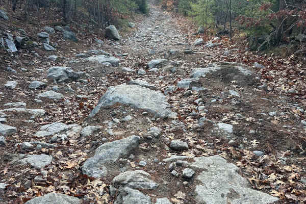
Hutchinson Hill
Hutchinson Hill is a class 6 road consisting of dirt, gravel, and some areas of large boulders. Both ends of the road consist mostly of flat areas of dirt and gravel with a hill section in the center. The hill section consists of large rocks, some sticking up as much as 12 to 16 inches, and will req...
Learn more about Hutchinson Hill
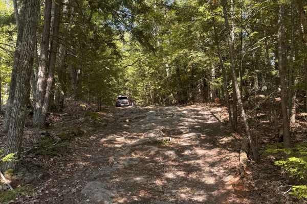
Mountain Road
Mountain Road is a New Hampshire Class VI road. Coming from the south, the route stays right, indicated by a Class VI sign, as Swamp Road goes left. Cow Pastures can be seen to the right as you begin your first climb onto Mountain Road. You will come back down to an intersection for Mountain View Sp...
Learn more about Mountain Road

Race Point North Entrance
Race Point North is a great starting point for driving the Cape Cod National Seashore. A permit will need to be acquired at this entrance, as well as watching a short video, vehicle inspection, and checklist to make sure you have all required safety items. Items include;a shovel, fire extinguisher, ...
Learn more about Race Point North Entrance
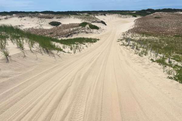
Race Point South Entrance
Race Point South is at the park entrance to Cape Cod National Seashore. A permit will need to be acquired along with a vehicle inspection and checklist to make sure you have all required safety items before driving the beach. Items include; a shovel, fire extinguisher, recovery strap, full-size spar...
Learn more about Race Point South Entrance
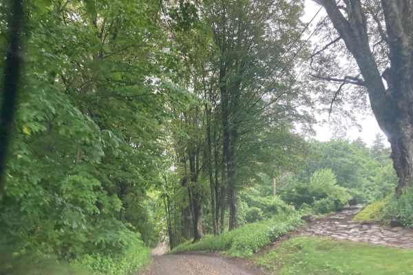
Natty's Route
This public and maintained dirt/gravel route starts in Farmington, New Hampshire, and ends in Strafford. Please be considerate of the residents and stick to the public throughways. Full-width tracks branching off the main throughway are more than likely private property and should never be traversed...
Learn more about Natty's Route
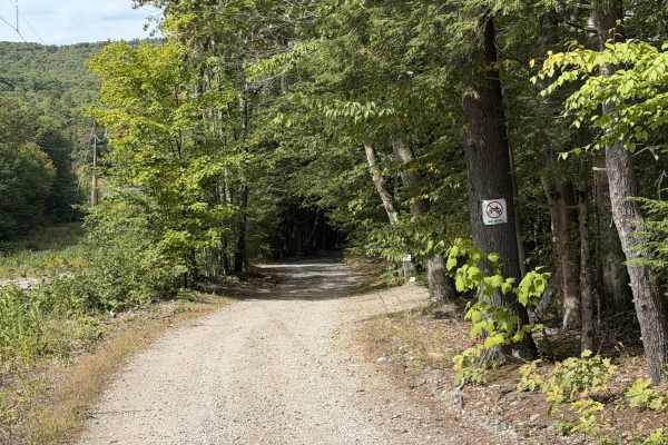
Mountain Road
Mountain Road is a smooth residential dirt road that winds its way through the power lines, crossing power line maintenance roads and meandering around several ponds in the area. The road is relatively well maintained, seeing as sections of it are shared with the power company. There are a few areas...
Learn more about Mountain Road
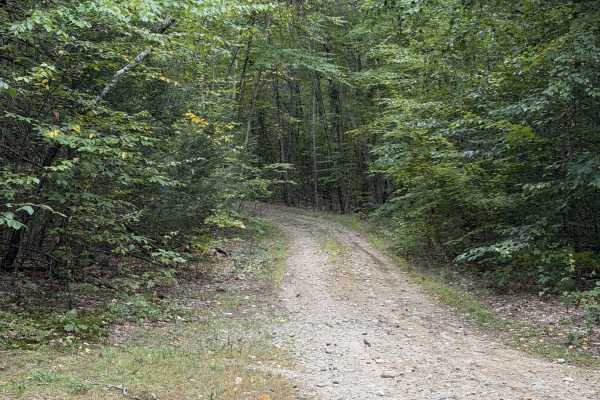
Marsh Ridge Road
Marsh Ridge Road is a short lollipop trail that comes off of Eden Page Road. About 0.4 miles in, the route splits and can be traveled in either direction, with both options looping back to this same point. We recommend staying left first, as this direction takes you up a short climb with loose rock.
Learn more about Marsh Ridge Road
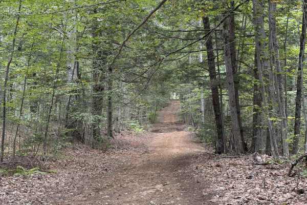
Jewett Road
Jewett Road is a short Class VI route that travels along the back side of residential properties. The route is fairly smooth with no noteworthy features other than some loose rock sections. This route continues south, ending at a neighborhood, and connects with Mountain Road and plenty of other trai...
Learn more about Jewett Road
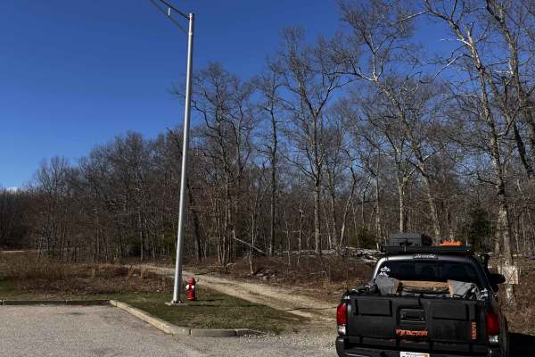
Hanton City Road
Public road that is no longer maintained. Can approach from west off of Decotis Farm Road or from East off of West Reservoir Road. Approaching from Decotis, the road begins at the cul-de-sac. Parts of the road still have remnants of pavement before it was abandoned. The route was dry when mapped and...
Learn more about Hanton City Road
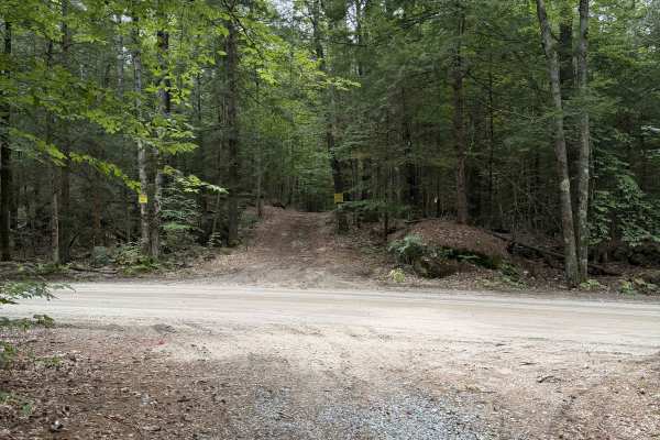
Homestead Road - West
The western Section of Homestead Road is a gentle ride through the woods on a shared route with snowmobile trails. The road is smooth and easygoing. No serious obstacles; some sections have loose rock and root networks.
The trail does end at a residential property. Property lines indicate that it ...
Learn more about Homestead Road - West
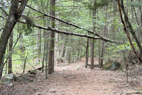
Sawyer Road
The entrance to Sawyer Road is very well hidden in some overgrowth off of Route 149. It is directly across from Cake Road. The route goes between two residential properties and climbs through some coniferous trees, whose needles and deadfall cover the trail. The trail veers right and continues towar...
Learn more about Sawyer Road
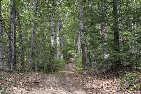
Old Francistown Road
Old Francistown Road is a smooth dirt road that begins at Bartlett Hill Road and makes its way towards the Piscataquog River, where it terminates. This Route follows old property lines, with old stone walls on your left and right for most of the route. There is a lot of deadfall on this trail, with ...
Learn more about Old Francistown Road
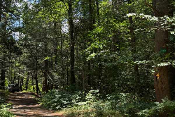
Tracy Lane
This is a short dirt road connecting Coldbrook Road to Brigham Road. From Brigham Road, Tracy Lane follows along the west bank of the Ware River's west branch. Looking southeast, you will have great views of the wetlands comprising the Ware River watershed. Coming out of the trees, there will be a p...
Learn more about Tracy Lane
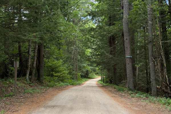
Coldbrook Road
Coldbrook Road offroad section begins just south of Barre Falls Dam at Parker Cemetery. Nearly the entire route is a gradual downhill grade. There are plenty of clearings along the route. The road is in great shape and, according to Department of Conservation and Recreation, is intended to be open y...
Learn more about Coldbrook Road
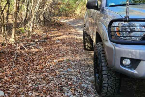
Copicut - Quanapoag Connector
Take a ride through the historically haunted Freetown State Forest with this easy off-road route. The route is on public roads and all vehicles running this trail must be road registered. Trail conditions can vary drastically based on how much rain has fallen, large frost heaves have caused mud hole...
Learn more about Copicut - Quanapoag Connector
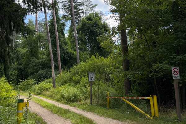
Crossover Road
Crossover Road or Gate 122-2 Road is a short spur connecting Coldbrook Springs with Pine Road. Gated on both ends with intermittent access. With dense forest on all sides, this trail is short but really encourages you to slow down and take in how diverse New England forests can be.
Learn more about Crossover Road
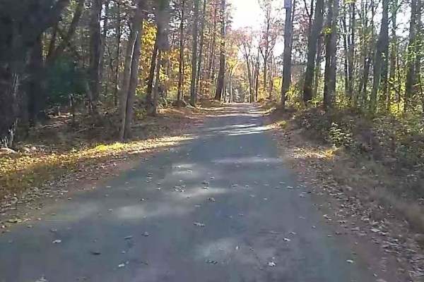
Wakefield Pond & Silver Brook Roads
This trail starts with a "1" rating until you pass the two houses (slowly please), then becomes an upper "3" rating as it is poorly maintained and often muddy until it enters Rhode Island which is better at maintaining it. The trail terminates at the junction of Border Trail and Munyon Trail in the ...
Learn more about Wakefield Pond & Silver Brook Roads
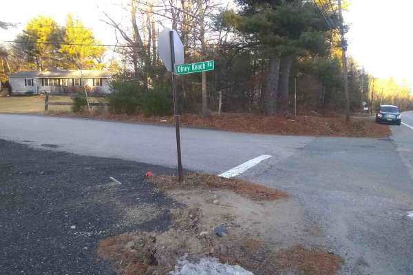
Olney Keach Road
Head down Onley Keach Road and begin once the pavement turns to dirt just after the houses. This trail is a dirt and gravel road. It will loosen your filings and shed parts from your vehicle. The trail's main redeeming value is that it forms the Eastern border of the Northeast Rhode Island Trail Net...
Learn more about Olney Keach Road
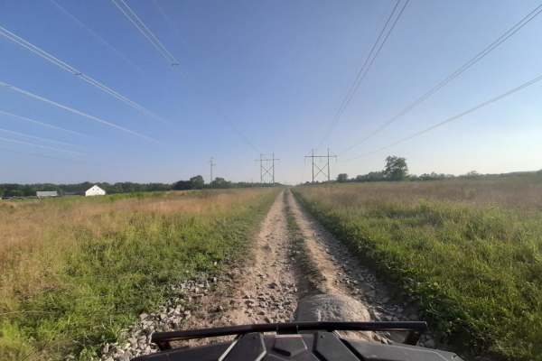
Sanford Maine ATV Club & Rail Trail
Sanford's Rail Trail follows the old Portland and Rochester Railroad Company railbed, passing through many scenic areas in Sanford. This well-maintained, multi-use, flat gravel-topped trail is easily walked and used year round, with stores, ponds and rivers, marshlands, scenic stone bridges and fore...
Learn more about Sanford Maine ATV Club & Rail Trail
Beginner ATV trails near Danvers, Massachusetts
Explore ATV-friendly trails near you. These trails are accessible for vehicles up to 50 inches wide, perfect for ATVs and smaller off-road machines.
Hersey Road
This is a Class VI road in Danville, New Hampshire. You can access the trail from the east off of State Route 111A, turning onto the Hersey Road paved section. Trail access is to the left at the split (GH Carter Drive goes right), up into the woods. Follow signage for Beehive Hut at the split for th...
Learn more about Hersey Road
Mountain Road
Mountain Road is a New Hampshire Class VI road. Coming from the south, the route stays right, indicated by a Class VI sign, as Swamp Road goes left. Cow Pastures can be seen to the right as you begin your first climb onto Mountain Road. You will come back down to an intersection for Mountain View Sp...
Learn more about Mountain Road
Hanton City Road
Public road that is no longer maintained. Can approach from west off of Decotis Farm Road or from East off of West Reservoir Road. Approaching from Decotis, the road begins at the cul-de-sac. Parts of the road still have remnants of pavement before it was abandoned. The route was dry when mapped and...
Learn more about Hanton City Road
Sanford Maine ATV Club & Rail Trail
Sanford's Rail Trail follows the old Portland and Rochester Railroad Company railbed, passing through many scenic areas in Sanford. This well-maintained, multi-use, flat gravel-topped trail is easily walked and used year round, with stores, ponds and rivers, marshlands, scenic stone bridges and fore...
Learn more about Sanford Maine ATV Club & Rail Trail
Beginner UTV/side-by-side trails near Danvers, Massachusetts
Find UTV and side-by-side trails near you. These trails accommodate vehicles up to 60 inches wide, ideal for UTVs, side-by-sides, and wider off-road rigs.
Hersey Road
This is a Class VI road in Danville, New Hampshire. You can access the trail from the east off of State Route 111A, turning onto the Hersey Road paved section. Trail access is to the left at the split (GH Carter Drive goes right), up into the woods. Follow signage for Beehive Hut at the split for th...
Learn more about Hersey Road
Mountain Road
Mountain Road is a New Hampshire Class VI road. Coming from the south, the route stays right, indicated by a Class VI sign, as Swamp Road goes left. Cow Pastures can be seen to the right as you begin your first climb onto Mountain Road. You will come back down to an intersection for Mountain View Sp...
Learn more about Mountain Road
Hanton City Road
Public road that is no longer maintained. Can approach from west off of Decotis Farm Road or from East off of West Reservoir Road. Approaching from Decotis, the road begins at the cul-de-sac. Parts of the road still have remnants of pavement before it was abandoned. The route was dry when mapped and...
Learn more about Hanton City Road
Sanford Maine ATV Club & Rail Trail
Sanford's Rail Trail follows the old Portland and Rochester Railroad Company railbed, passing through many scenic areas in Sanford. This well-maintained, multi-use, flat gravel-topped trail is easily walked and used year round, with stores, ponds and rivers, marshlands, scenic stone bridges and fore...
Learn more about Sanford Maine ATV Club & Rail Trail
The onX Offroad Difference
onX Offroad combines trail photos, descriptions, difficulty ratings, width restrictions, seasonality, and more in a user-friendly interface. Available on all devices, with offline access and full compatibility with CarPlay and Android Auto. Discover what you're missing today!
Open Trail Map