
Beginner Off-Road Trails
Near Crane, Oregon
Explore All Beginner Trails Near Crane, Oregon
Beginner Off-Road Trails Near Crane, Oregon
Discover the best beginner-friendly off-road trails near you. These easier, lower-rated trails are a great place to start — browse trail maps, check difficulty ratings, and find your next adventure.
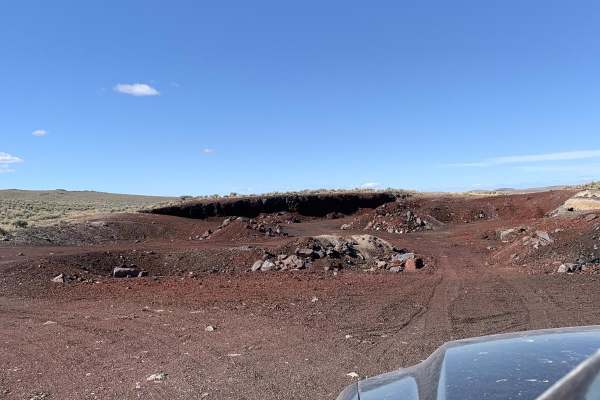
Virginia valley cinder pile
This is a 5-mile loop on state land. If the gates are closed, close them behind you, otherwise you can leave them open. The trail is rutted year-round in most places. It is muddy, with some mud holes in the winter, but solid in the spring. It goes from Virginia Valley to a cinder pit and then to som...
Learn more about Virginia valley cinder pile
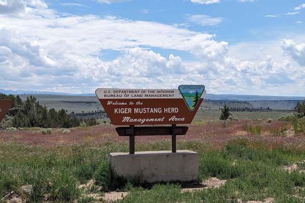
Kiger Mustang Viewing Area Road
This route takes you deep into the Steens Mountains to a nice viewing area. The road is easy when dry and extremely difficult when wet as evidenced by the large ruts from people getting stuck in the wet season. If the road is dry and in good condition this is an easy high clearance AWD or 4x4 trail....
Learn more about Kiger Mustang Viewing Area Road

Riddle Mountain
Riddle Mountain Trail reaches the top of Mountain at the BLM fire lookout. The trail crosses public land for much of the route. Please treat the private land sections with care and leave every gate as you found it. There are several fences and gates, which may be open or closed seasonally.The trail ...
Learn more about Riddle Mountain
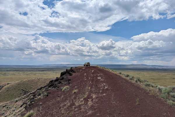
Diamond Craters Auto Tour Route
This dirt road takes you through the basaltic lava flows and cinder cones formed sometime in the last 25,000 years. There are many side roads out to specific craters and it looks like there are several nice camp spots. The road has a couple of water crossings depending on the time of year.
Learn more about Diamond Craters Auto Tour Route
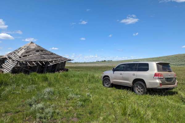
Virginia Valley to Stone House Road (Oregon BDR)
This remote section of two tracks through the Northern Steens takes you past several old settlement cabins and along a section of the lesser traveled optional Oregon BDR route loop. The trail is beautiful and the two track is overgrown at points. The only difficult sections are possible through the ...
Learn more about Virginia Valley to Stone House Road (Oregon BDR)
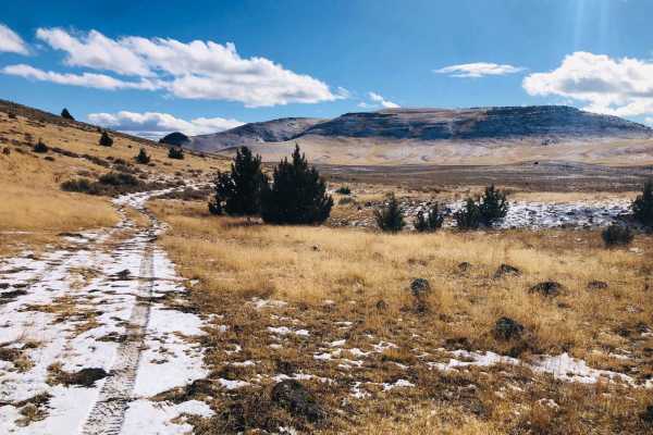
Wild Horse Tank Road
Wild Horse Tank Road is a scenic 1.5-mile out-and-back trail ideal for drivers seeking a quick detour with excellent dispersed camping opportunities and the chance to spot wild horse herds in southeastern Oregon. Navigating between Quail Creek Reservoir and North Quail Creek Reservoir, this route cl...
Learn more about Wild Horse Tank Road

Skull Creek to Horton Mill Connector
The Skull Creek to Horton Mill Connector is an ideal route for offroaders seeking a scenic, mildly challenging high-desert adventure with sweeping vistas of the Harney Basin. Stretching approximately 14.8 miles through the high desert of eastern Oregon near Burns, this trail features a maximum eleva...
Learn more about Skull Creek to Horton Mill Connector
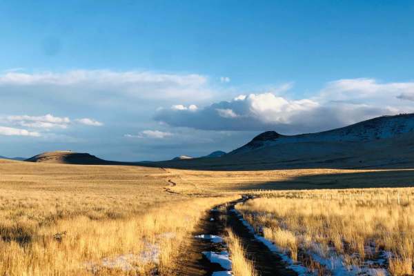
Mahan Reservoir Quail Creek
This trail is a perfect way to get up into the Steens Mountains from Alvord valley below. It starts as a well-maintained gravel trail and becomes a short shelf road with a few steep sections. The view of the upper valley when one crests the top is outstanding. Once on top, a vast network of trail fa...
Learn more about Mahan Reservoir Quail Creek
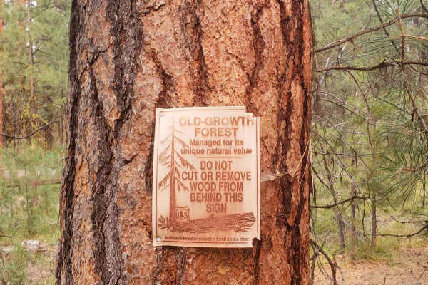
37 Spring Trail
37 Spring Trail is an ideal, short, and rugged offroad route for beginners and experienced four-wheel-drive owners seeking unmatched solitude in a beautiful old-growth Ponderosa Pine forest. Stretching approximately 0.85 miles, this path offers a quick but scenic detour that leads directly to the pe...
Learn more about 37 Spring Trail
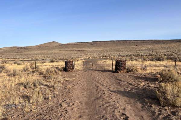
Entrance to Burnt Flat Road
This short section is the smoother, more heavily traveled access road to Burnt Flat Road. It passes through a cattle gate with a nice cheater bar to make stringing it back up easier. Then it easily crosses the lakebed. There are lots of tall grasses, and they may be impassable when wet. Be sure to w...
Learn more about Entrance to Burnt Flat Road
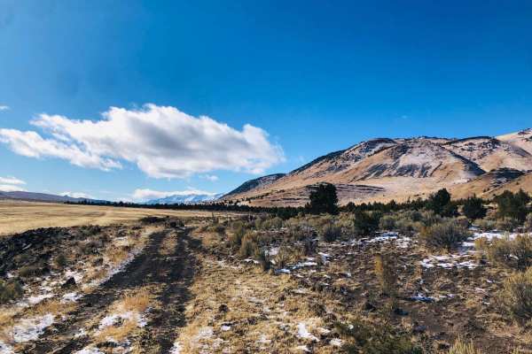
Lakebed Cutover
This bumpy little trail leads across the lower mountainside of the valley along the sides of the dry lake beds. There are quite a few nice offshoots for exploring and finding flat spots to camp. There is also plenty of livestock and wildlife to observe along the way. Some springs feed livestock trou...
Learn more about Lakebed Cutover

Moon Hill to Dust Bowl Road
This track takes you up to Moon Hill as the high point and creates a loop that is open year-round. (Some of the Steens Mountains are behind a locked gate some of the year) The track is a seldom used trail with grass growing in the tracks of the lesser visited sections. Many camping opportunities alo...
Learn more about Moon Hill to Dust Bowl Road

Burnt Flat Road
This trail ascends from the valley below into a network of trails in the Steens Mountains. The trail begins down in the lakebed area and the lower valley. Then it ascends a steep rocky shelf road with expansive views of the valley and a few epic dispersed camping spots. There are a few Verizon LTE c...
Learn more about Burnt Flat Road
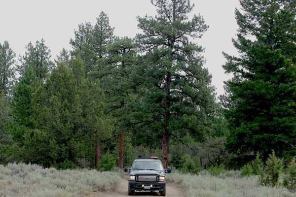
Lost Creek
This trail goes through an old-growth ponderosa pine forest above the Silvies River, near the small town of Burns. Between the river and the road are some high rimrocks, which make up the cliffs and canyons in the area. Near the end of the trail is Rimrock Springs, which goes down an interesting slo...
Learn more about Lost Creek
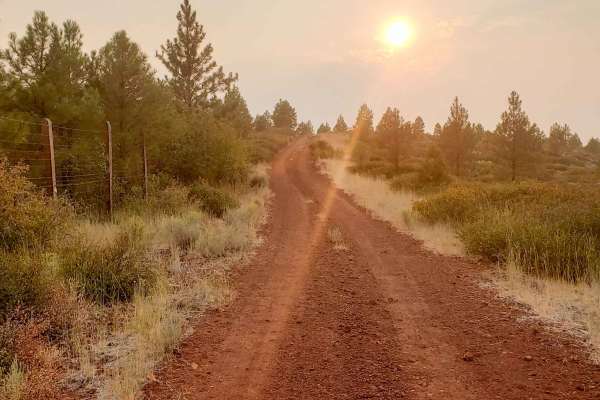
Recovery Ridge
This road travels mostly over bright red cinder cobbles through a large burned area from fires in 1990 and 2007. The area offers an interesting look at how Ponderosa pine forests recover after a large scale fire. This route is easy but a little bumpy and not too rugged, any 4x4 or AWD vehicle should...
Learn more about Recovery Ridge

Antelope Crossing
This bumpy out and backcrosses the long, dried grassy fields as it ascends into the hills. The entire time herds of Antelope were crossing the path ahead. Once at the top, it's clear to see why. There's a majestic spring bubbling its way down the side of the hill with some strange mossy-looking gras...
Learn more about Antelope Crossing
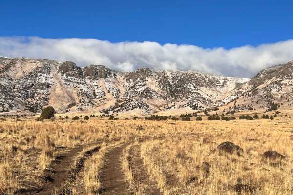
Cow Tracks
This easy out and back provides access into the hills and passes through two very tight cattle gates. These are two-person operation gates, although the first one has a handy cheater bar to open it. From the bottom are great views of the Steens Mountains as you pass through long grassy meadows and c...
Learn more about Cow Tracks
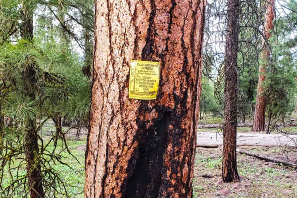
Bald Butte Lookout
This trail is easy and short. It is the closest and most easily accessible fire lookout from the town of Burns. The trail is dirt, with no difficult obstacles beyond some very deep ruts and water drainage ruts. There are large rocks at the top loop but are easily avoided. The only weather that makes...
Learn more about Bald Butte Lookout
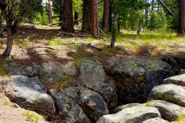
Myrtle Park Ice Cave
The Myrtle Park Ice Cave trail is an ideal route for offroaders seeking a remote, lesser-known forest journey that leads to a unique geological ice cave and a scenic overlook. Covering approximately 3.9 miles through the Malheur National Forest near the Grant and Harney County line, this relatively ...
Learn more about Myrtle Park Ice Cave
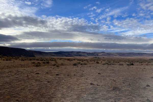
East Fish Creek Road
This route is a bumpy out-and-back that ends abruptly. It begins in rolling hills with fields of sagebrush. There are three cattle gates you need to open and close behind once you pass through;some muscle is required as the wires are pretty tight. There are plenty of Lava rocks to navigate around, a...
Learn more about East Fish Creek Road
Beginner ATV trails near Crane, Oregon
Explore ATV-friendly trails near you. These trails are accessible for vehicles up to 50 inches wide, perfect for ATVs and smaller off-road machines.
Virginia valley cinder pile
This is a 5-mile loop on state land. If the gates are closed, close them behind you, otherwise you can leave them open. The trail is rutted year-round in most places. It is muddy, with some mud holes in the winter, but solid in the spring. It goes from Virginia Valley to a cinder pit and then to som...
Learn more about Virginia valley cinder pile
Kiger Mustang Viewing Area Road
This route takes you deep into the Steens Mountains to a nice viewing area. The road is easy when dry and extremely difficult when wet as evidenced by the large ruts from people getting stuck in the wet season. If the road is dry and in good condition this is an easy high clearance AWD or 4x4 trail....
Learn more about Kiger Mustang Viewing Area Road
Riddle Mountain
Riddle Mountain Trail reaches the top of Mountain at the BLM fire lookout. The trail crosses public land for much of the route. Please treat the private land sections with care and leave every gate as you found it. There are several fences and gates, which may be open or closed seasonally.The trail ...
Learn more about Riddle Mountain
Diamond Craters Auto Tour Route
This dirt road takes you through the basaltic lava flows and cinder cones formed sometime in the last 25,000 years. There are many side roads out to specific craters and it looks like there are several nice camp spots. The road has a couple of water crossings depending on the time of year.
Learn more about Diamond Craters Auto Tour Route
Beginner UTV/side-by-side trails near Crane, Oregon
Find UTV and side-by-side trails near you. These trails accommodate vehicles up to 60 inches wide, ideal for UTVs, side-by-sides, and wider off-road rigs.
Kiger Mustang Viewing Area Road
This route takes you deep into the Steens Mountains to a nice viewing area. The road is easy when dry and extremely difficult when wet as evidenced by the large ruts from people getting stuck in the wet season. If the road is dry and in good condition this is an easy high clearance AWD or 4x4 trail....
Learn more about Kiger Mustang Viewing Area Road
Riddle Mountain
Riddle Mountain Trail reaches the top of Mountain at the BLM fire lookout. The trail crosses public land for much of the route. Please treat the private land sections with care and leave every gate as you found it. There are several fences and gates, which may be open or closed seasonally.The trail ...
Learn more about Riddle Mountain
Diamond Craters Auto Tour Route
This dirt road takes you through the basaltic lava flows and cinder cones formed sometime in the last 25,000 years. There are many side roads out to specific craters and it looks like there are several nice camp spots. The road has a couple of water crossings depending on the time of year.
Learn more about Diamond Craters Auto Tour Route
Virginia Valley to Stone House Road (Oregon BDR)
This remote section of two tracks through the Northern Steens takes you past several old settlement cabins and along a section of the lesser traveled optional Oregon BDR route loop. The trail is beautiful and the two track is overgrown at points. The only difficult sections are possible through the ...
Learn more about Virginia Valley to Stone House Road (Oregon BDR)
The onX Offroad Difference
onX Offroad combines trail photos, descriptions, difficulty ratings, width restrictions, seasonality, and more in a user-friendly interface. Available on all devices, with offline access and full compatibility with CarPlay and Android Auto. Discover what you're missing today!
Open Trail Map