
Beginner Off-Road Trails
Near Coulterville, California
Explore All Beginner Trails Near Coulterville, California
Beginner Off-Road Trails Near Coulterville, California
Discover the best beginner-friendly off-road trails near you. These easier, lower-rated trails are a great place to start — browse trail maps, check difficulty ratings, and find your next adventure.
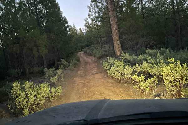
The Rut
This is a lightly traveled trail with a dirt floor. Uneven, rutted dirt trail with erosion. Potential water crossings up to a foot deep, in the winter, and in some spots the rut is 3ft deep steep grades. Roads are typically one vehicle wide with places to pass. The wet season sky rockets the rating ...
Learn more about The Rut
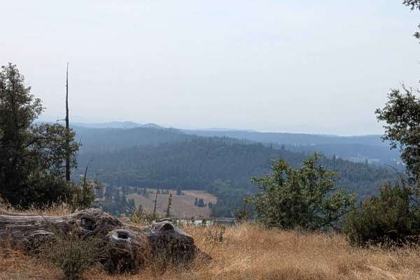
Wagner Ridge Road - FS 2S08
This trail climbs over 600 feet and drops almost 1,200 feet across just over 5 miles of diverse terrain that spans BLM land and Stanislaus National Forest, though it begins on private land requiring respectful passage. Starting at Smith Station Road and ending on Wild Rose Road, the route begins as ...
Learn more about Wagner Ridge Road - FS 2S08

FS 2S37
This trail is a 3.5-mile out-and-back trail that drops almost 700 feet and climbs over 100 feet in just under 2 miles. The trail sometimes runs along shelf roads lined with trees and brush, providing natural corridors and periodic exposure as it descends toward the valley floor. Pleasant views of fa...
Learn more about FS 2S37

Jordan Creek Road - FS 2S17
This trail drops over 800 feet in just over 4.5 miles, starting on Smith Station Road (FS J132). The route begins in a neighborhood area requiring respectful behavior, initially following a crushed granite gravel road surface. After the first mile, private land ends and the trail continues through t...
Learn more about Jordan Creek Road - FS 2S17
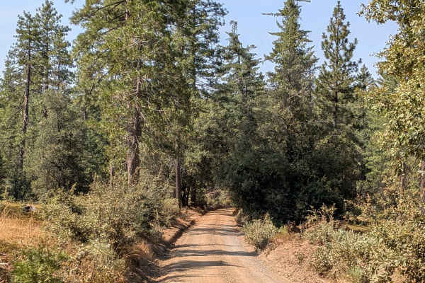
Boneyard Road - FS 1S07
This trail starts just off Highway 120, located 2.7 miles east of the Groveland District Ranger Office, and begins as a 1.5-vehicle-wide gravel trail with some sand sections. Lined with Ponderosa pine trees and bushes, the route provides a pleasant forest driving experience within the Stanislaus Nat...
Learn more about Boneyard Road - FS 1S07
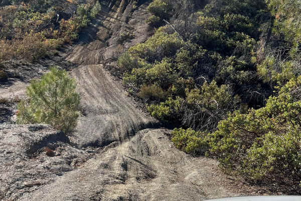
High Times
Discover an exciting off-road trail tailored to 4x4 vehicles, combining moderate terrain with thrilling elements. While mostly easy to navigate, you'll encounter occasional gentle inclines and 12-inch deep ruts, adding a dash of excitement without overwhelming the adventure. Perfect for those seekin...
Learn more about High Times
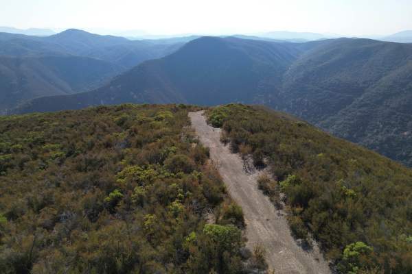
Low Times
This short but intense spur descends nearly 1,500 feet in just over a mile. The trail is narrow, rocky, and exposed, featuring loose shale and shelf sections that demand careful driving. While suitable for high-clearance 4x4 vehicles, drivers should anticipate tight lines, steep grades, and minimal ...
Learn more about Low Times
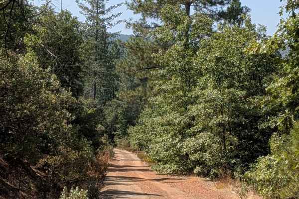
FS 1S15
This trail climbs over 1,200 feet and drops 100 feet across just over 4 miles, creating a sustained and challenging ascent from Smith Peak Lookout Road 1S16 to Jordan Creek Road. The sandy surface varies from one and a half vehicles wide to single vehicle width, surrounded by dense forests that some...
Learn more about FS 1S15
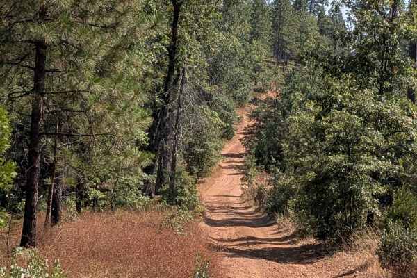
Smith Ridge - FS 1S28
This trail climbs over 400 feet and drops almost 400 feet across almost 3 miles of forested terrain, starting near the junction of Forest Service Roads 2S28 and 1S15 and ending at FS1S29. The sandy surface creates very dusty conditions throughout the journey, with numerous trees surrounding the trai...
Learn more about Smith Ridge - FS 1S28
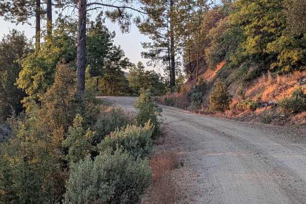
Pilot Ridge - FS 1S14
This trail starts just off the south side of Bucks Meadow Road, right after the road turns to dirt, climbing over 1,300 feet and dropping just over 300 feet across just under 6 miles of varied terrain. The route begins as a one and a half to two vehicles wide hard-packed dirt surface that is relativ...
Learn more about Pilot Ridge - FS 1S14
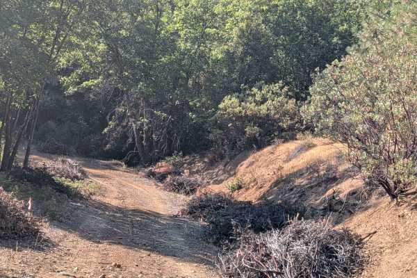
FS 2S09
This trail starts and stops on Buck Meadows Road, creating a point-to-point route that climbs almost 800 feet and drops just under 600 feet over just under 4 miles of challenging terrain. From the south entrance, the trail features hard-packed sand and dirt that has been recently graded, though the ...
Learn more about FS 2S09

Tolumne Road/120 Bypass
This 5-mile point-to-point trail runs along HWY 120. The trail runs along the ridge of the Tolumne River Valley and gives excellent views of the valley below. The trail is mostly one vehicle with shallow mud holes less than 12" in depth. There is a short section of HWY 120 which must be traveled. Th...
Learn more about Tolumne Road/120 Bypass
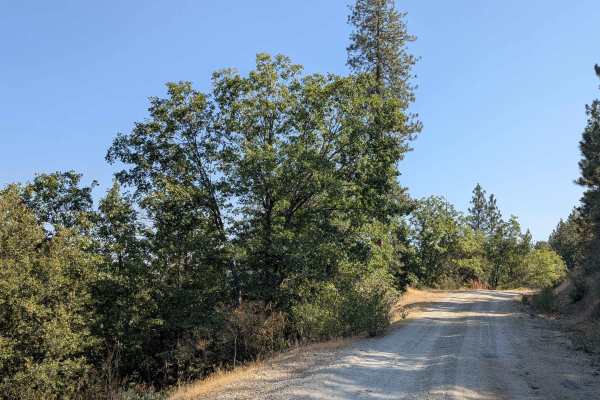
Moore Creek Road - FS 1S29
This trail climbs over 600 feet and drops over 450 feet across just over 5 miles, but has become a 10-mile in-and-out trail due to the closure of the north side bridge, eliminating through-passage options. Starting just off Bucks Meadow Road, 3 miles south of Bucks Meadow, the route immediately cros...
Learn more about Moore Creek Road - FS 1S29

Smith Peak Lookout - FS 1S16
This trail climbs almost 500 feet in just under 3 miles, though the entrance on the Smith Station side is now closed due to private land restrictions. Access is available behind the Groveland Ranger Station at the Pines Campground, transforming this into an out-and-back trail configuration unless yo...
Learn more about Smith Peak Lookout - FS 1S16
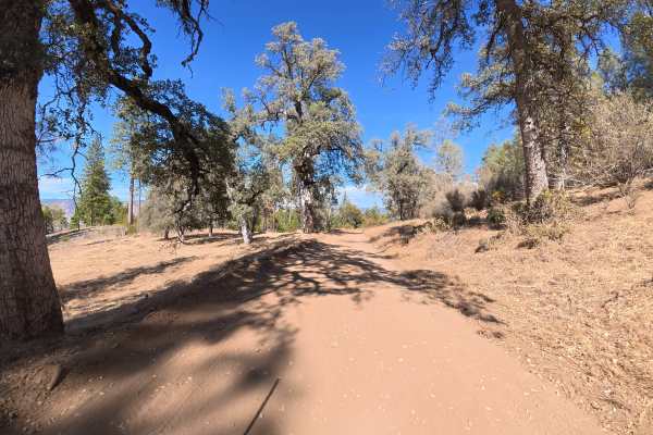
FS 1S08Y
This narrow, fine-dirt trail is a one-way-in, one-way-out route that leads to a spring. There is little room for vehicles to pass, with ruts remaining around 4–6 inches deep throughout. The fine-dirt surface can become considerably more difficult when wet. Camping is plentiful, with more than six le...
Learn more about FS 1S08Y

Old Yosemite Coulterville Road
The original road leading into Yosemite Valley, this trail first opened in 1874. Enjoy panoramic views as you climb a well-maintained Forest Service road to Pilot Peak and follow a ridgeline towards Trumbull Peak. The surroundings become lush as you make a fun, short, and twisty descent to Little Ne...
Learn more about Old Yosemite Coulterville Road
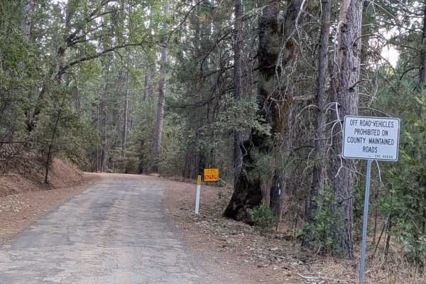
Bucks Meadow Road
This trail begins in Bucks Meadow just off Highway 120 and ends at Bull Creek Road, covering a primarily downhill route that drops almost 800 feet while gaining only 185 feet over just under 6 miles when traveling north to south. As a county-maintained road, only street-legal vehicles are permitted,...
Learn more about Bucks Meadow Road
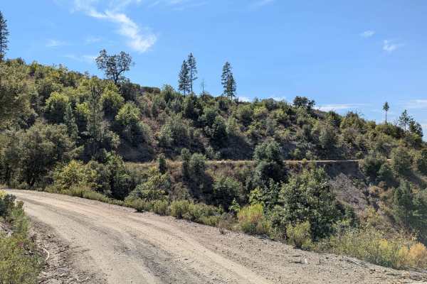
Moore Pilot Ridge - FS 2S14
This trail begins at Buck Meadows Road and ends at the Pilot Ridge Road and Forest Service Road 2S33 junction, climbing over 1,300 feet and dropping almost 600 feet across just under 7 miles of varied terrain. The hard-packed dirt and sand surface maintains one and a half to two vehicles in width, f...
Learn more about Moore Pilot Ridge - FS 2S14
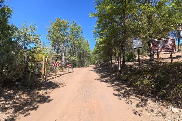
FS 1S48Y
This narrow trail begins directly off the main paved road and travels over fine, loose red dirt that can become considerably more difficult when wet. There is little room for vehicles to pass, with overgrown vegetation along the route, although pinstriping is generally avoidable. Around 0.4 miles, a...
Learn more about FS 1S48Y
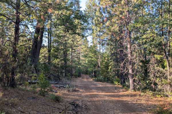
FS 1S22
This trail climbs over 200 feet and drops over 200 feet across just over 2.4 miles, starting conveniently just off Highway 120 within the Stanislaus National Forest. The first section features a previously paved surface that is quickly deteriorating to dirt, providing a transition from highway condi...
Learn more about FS 1S22
Beginner ATV trails near Coulterville, California
Explore ATV-friendly trails near you. These trails are accessible for vehicles up to 50 inches wide, perfect for ATVs and smaller off-road machines.
The Rut
This is a lightly traveled trail with a dirt floor. Uneven, rutted dirt trail with erosion. Potential water crossings up to a foot deep, in the winter, and in some spots the rut is 3ft deep steep grades. Roads are typically one vehicle wide with places to pass. The wet season sky rockets the rating ...
Learn more about The Rut
FS 2S37
This trail is a 3.5-mile out-and-back trail that drops almost 700 feet and climbs over 100 feet in just under 2 miles. The trail sometimes runs along shelf roads lined with trees and brush, providing natural corridors and periodic exposure as it descends toward the valley floor. Pleasant views of fa...
Learn more about FS 2S37
Jordan Creek Road - FS 2S17
This trail drops over 800 feet in just over 4.5 miles, starting on Smith Station Road (FS J132). The route begins in a neighborhood area requiring respectful behavior, initially following a crushed granite gravel road surface. After the first mile, private land ends and the trail continues through t...
Learn more about Jordan Creek Road - FS 2S17
Boneyard Road - FS 1S07
This trail starts just off Highway 120, located 2.7 miles east of the Groveland District Ranger Office, and begins as a 1.5-vehicle-wide gravel trail with some sand sections. Lined with Ponderosa pine trees and bushes, the route provides a pleasant forest driving experience within the Stanislaus Nat...
Learn more about Boneyard Road - FS 1S07
Beginner UTV/side-by-side trails near Coulterville, California
Find UTV and side-by-side trails near you. These trails accommodate vehicles up to 60 inches wide, ideal for UTVs, side-by-sides, and wider off-road rigs.
The Rut
This is a lightly traveled trail with a dirt floor. Uneven, rutted dirt trail with erosion. Potential water crossings up to a foot deep, in the winter, and in some spots the rut is 3ft deep steep grades. Roads are typically one vehicle wide with places to pass. The wet season sky rockets the rating ...
Learn more about The Rut
FS 2S37
This trail is a 3.5-mile out-and-back trail that drops almost 700 feet and climbs over 100 feet in just under 2 miles. The trail sometimes runs along shelf roads lined with trees and brush, providing natural corridors and periodic exposure as it descends toward the valley floor. Pleasant views of fa...
Learn more about FS 2S37
Jordan Creek Road - FS 2S17
This trail drops over 800 feet in just over 4.5 miles, starting on Smith Station Road (FS J132). The route begins in a neighborhood area requiring respectful behavior, initially following a crushed granite gravel road surface. After the first mile, private land ends and the trail continues through t...
Learn more about Jordan Creek Road - FS 2S17
Boneyard Road - FS 1S07
This trail starts just off Highway 120, located 2.7 miles east of the Groveland District Ranger Office, and begins as a 1.5-vehicle-wide gravel trail with some sand sections. Lined with Ponderosa pine trees and bushes, the route provides a pleasant forest driving experience within the Stanislaus Nat...
Learn more about Boneyard Road - FS 1S07
The onX Offroad Difference
onX Offroad combines trail photos, descriptions, difficulty ratings, width restrictions, seasonality, and more in a user-friendly interface. Available on all devices, with offline access and full compatibility with CarPlay and Android Auto. Discover what you're missing today!
Open Trail Map