
Beginner Off-Road Trails
Near Coalfield, Tennessee
Explore All Beginner Trails Near Coalfield, Tennessee
Beginner Off-Road Trails Near Coalfield, Tennessee
Discover the best beginner-friendly off-road trails near you. These easier, lower-rated trails are a great place to start — browse trail maps, check difficulty ratings, and find your next adventure.
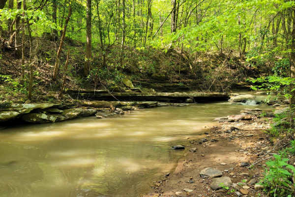
Trail 27 - Kener Gap
Trail 27- Kener Gap begins at the Rock Solid Pavilion at the end of Trail 26. This trail is much like its counterpart, but does not boast as many rock step formations. Expect more dirt roads with ruts and a minor rock bulge from the side of the trail. Water does quickly run off the mountain, and ha...
Learn more about Trail 27 - Kener Gap
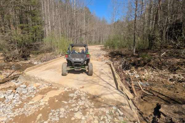
G6
G6 is a haul road that has a few small washouts and rock ledges. There are rocks along the trail up to 12 inches in size. This trail includes a long slow elevation change. There are many in and out trails along this route. The north end of this trail ends on New River Highway at a cemetery.
Learn more about G6
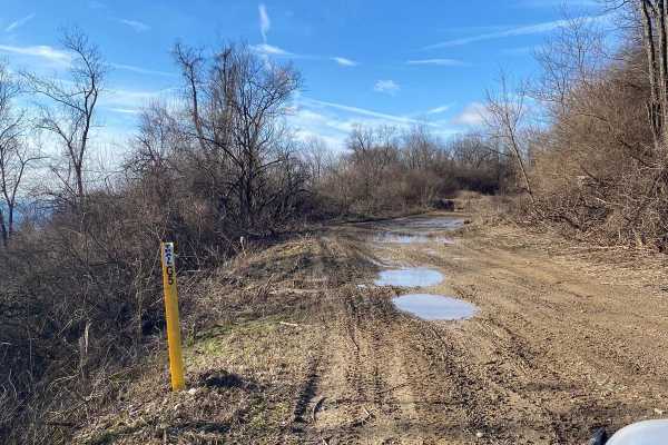
G5 Windrock
Trail G5 is mostly two-lane dirt with some mud holes. This trail will lead you to multiple trails at Windrock park. G5 is an easy trail and takes you to upper Windrock. G roads are usually easy but with heavy rains, things can change so please wheel with a friend.
Learn more about G5 Windrock
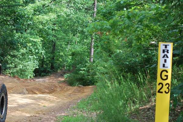
Trail G23 Windrock Park
Trail 23 will offer a pleasant and easy off-road experience for off-roaders of all skill levels. Nestled off of the long Trail 22 in Windrock Park, this trail provides a refreshing escape into nature without demanding advanced technical skills or equipment which takes you down to Indian Creek and Al...
Learn more about Trail G23 Windrock Park
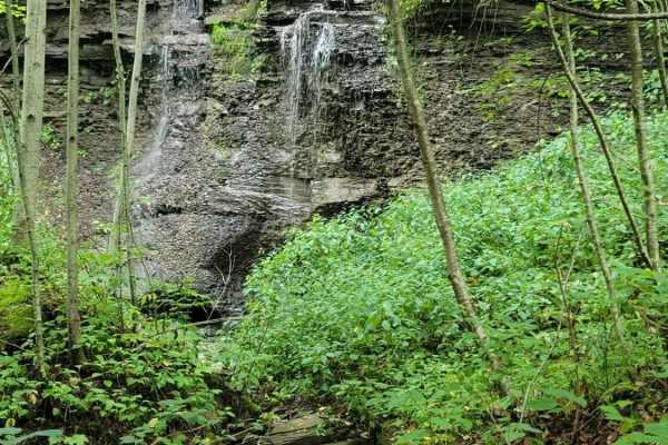
Trail 5 - Flat Gap
Trail 5 - Flat Gap begins at the major intersection of G37, G3, and G33. There isn't much elevation change on this trail, hence its name. This easy blue according to the Park's Map is smooth sailing and preferred by some to avoid the higher traveled G5 and G6 as they have gotten significantly worse ...
Learn more about Trail 5 - Flat Gap
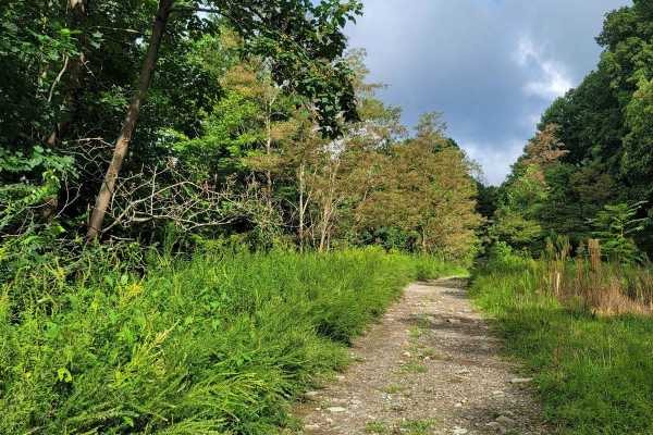
G3
This gravel trail lives up to its name with minimal troubles, but like all trails, they have unexpected occurrences such as down trees or washouts. Trail G3 is not to be confused with Trail 3, as there are major differences. Trail G3 is a mild gravel road; hence the "G" designation, and stays well m...
Learn more about G3
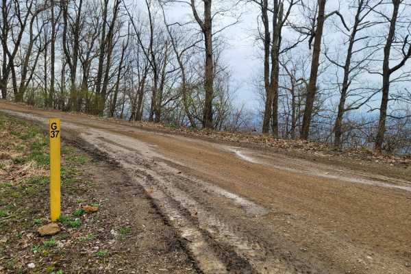
G37
Windrock's G37 is an easy Green connector trail that starts at the east side on trail G20 and provides access to the major intersection of trail numbers: G5, 5, G3, 33, and 45. In the middle of the trail, it gives access to trails 4 and 19. It is a simple gravel trail that will provide a beautiful v...
Learn more about G37
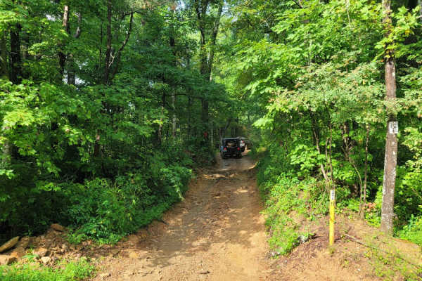
Trail 19 - Wolf Ridge
Trail 19 - Wolf Ridge gives a more challenging path to travel to get off the easy gravel trails. It features bumpy rock faces, medium-depth mud holes, and small washouts. Windrock's map states this is a blue trail in difficulty, which could be broken down to an easy blue trail. If you choose the co...
Learn more about Trail 19 - Wolf Ridge

Campground Connector
Campground Connector is a fun way of getting from Windrock Park's Campground to the general store on P1. Make the most of your time winding through the woods. This trail also requires a land use permit, so if you're just camping, then you would not be allowed to take this route. Be advised that it c...
Learn more about Campground Connector

G24 - Wildflowers
Get away from the hustle and bustle of the park with this less-than-traveled trail. You won't find even the most basic obstacle on Trail G24, but what you will find is serenity. In the springtime, you will find pops of color at this dead-end trail. It is smooth with the slightest mudhole. Bring a sa...
Learn more about G24 - Wildflowers
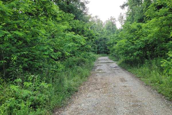
Trail G20
G20 is a connector trail from G2. This trail gives access to trail 4,19, and G37. The trail is a gravel roadway with shallow mud holes and blind curves on the trail with steep drop offs on the sides of the roadway. Roadway is only one lane wide.
Learn more about Trail G20
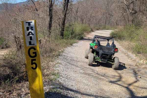
G5
G5 is a stone hall road that leads to many other trails including trails 22 and 38. There aren't any significant elevation changes. There are rock bottom mud puddles and small rocks around 6 inches in size. Otherwise, this is just a gravel road that can be travelled in any high clearance 4-wheel dri...
Learn more about G5
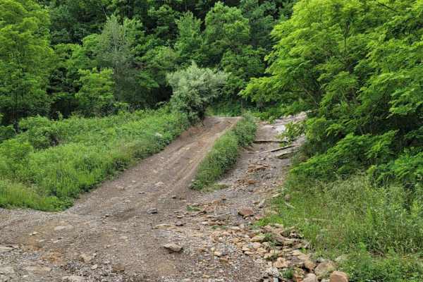
Trail G2
From the General Store Trail Head travel up the Mountain on P1. You will come to an intersection, keep going straight on G2 which leads to the windmills and accesses several trails on the South West of the property. At the end of the trail you will find the windmill farm on the peak of the mountain....
Learn more about Trail G2
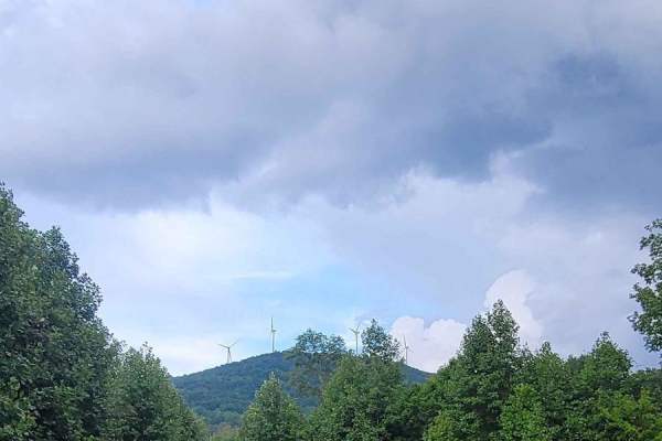
G38 - Snorkel Snatcher
Trail G38 - Snorkel Snatcher is a great trail to get away from the crowds or lead a group ride for lunch. This Y-shaped trail has dead ends at both sides but allows you to spread out if you have a larger crowd. One dead-end section of the trail features a view of the backside of the windmills from t...
Learn more about G38 - Snorkel Snatcher
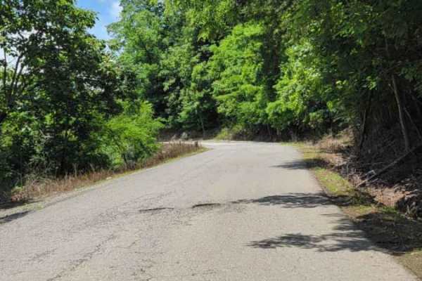
Trail P1
P1 is one of the main trail access roads from the General Store Parking lot. As you go up the mountain, be cautious of oncoming traffic. Several areas of the paved road have deteriorated over time. Most places coming down the mountain have no shoulder, or the roadway has given way. On the right side...
Learn more about Trail P1
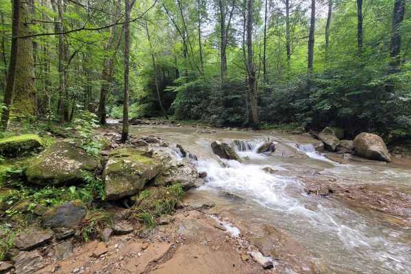
G39 - Wedding Day
Trail G39 brings the beauty of Tennessee with easy trail riding. So much that one of Windrock Park's workers had their wedding at the end of the trail where the water rushes over the over it. The park map considers this an easy "Blue" trail. This ride is a popular one for everyone, as well as being ...
Learn more about G39 - Wedding Day
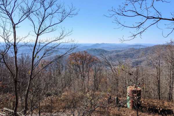
Trail 2
The trail is visibly marked and crosses paths with many other trails--a really nice slow climb winding up the small mountain. There are small to moderate mud holes, rocks 6-12 inches in size, and a couple of small rock ledges. There are harder and easier lines on the ledges. The views are amazing!
Learn more about Trail 2
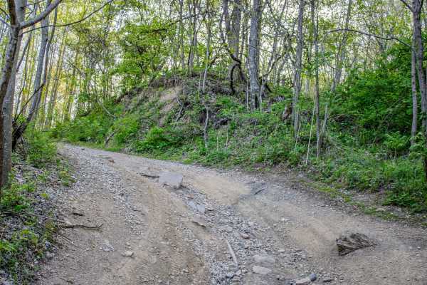
S6
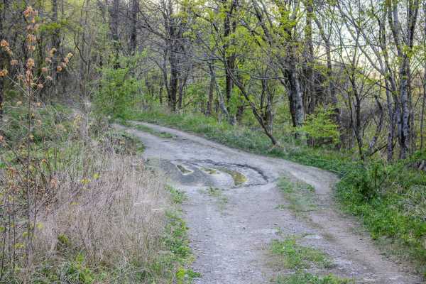
S6 is a two-way dirt trail that connects S2, S4, and S5. This trail works well as a connector route, but it also has enough scenery and small obstacles to make it worth taking your time on. The trail is mostly dirt with several areas where water flows across the trail from nearby springs. These spri...
Learn more about S6
S5
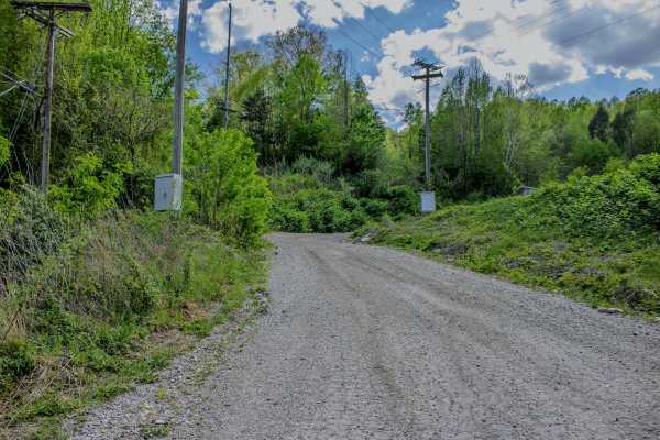
S5 is a two-way trail that connects S6 back to S4 and also provides access to 4 Lane. This trail works well as a primary connector route in the area, giving drivers several options for building a longer loop or moving between nearby trails. The surface is primarily gravel, which makes it more stable...
Learn more about S5
4 Lane
4 Lane is a long, two-way trail made up mostly of dirt with some gravel mixed in. The trail connects from Moores Camp off Road 116 on the west side and runs toward the WMA boundary. At the fork near the end, the route continues, but that point marks the start of a different trail. This makes 4 Lane ...
Learn more about 4 Lane
Beginner ATV trails near Coalfield, Tennessee
Explore ATV-friendly trails near you. These trails are accessible for vehicles up to 50 inches wide, perfect for ATVs and smaller off-road machines.
Trail 27 - Kener Gap
Trail 27- Kener Gap begins at the Rock Solid Pavilion at the end of Trail 26. This trail is much like its counterpart, but does not boast as many rock step formations. Expect more dirt roads with ruts and a minor rock bulge from the side of the trail. Water does quickly run off the mountain, and ha...
Learn more about Trail 27 - Kener Gap
G6
G6 is a haul road that has a few small washouts and rock ledges. There are rocks along the trail up to 12 inches in size. This trail includes a long slow elevation change. There are many in and out trails along this route. The north end of this trail ends on New River Highway at a cemetery.
Learn more about G6
Trail G23 Windrock Park
Trail 23 will offer a pleasant and easy off-road experience for off-roaders of all skill levels. Nestled off of the long Trail 22 in Windrock Park, this trail provides a refreshing escape into nature without demanding advanced technical skills or equipment which takes you down to Indian Creek and Al...
Learn more about Trail G23 Windrock Park
Trail 5 - Flat Gap
Trail 5 - Flat Gap begins at the major intersection of G37, G3, and G33. There isn't much elevation change on this trail, hence its name. This easy blue according to the Park's Map is smooth sailing and preferred by some to avoid the higher traveled G5 and G6 as they have gotten significantly worse ...
Learn more about Trail 5 - Flat Gap
Beginner UTV/side-by-side trails near Coalfield, Tennessee
Find UTV and side-by-side trails near you. These trails accommodate vehicles up to 60 inches wide, ideal for UTVs, side-by-sides, and wider off-road rigs.
Trail 27 - Kener Gap
Trail 27- Kener Gap begins at the Rock Solid Pavilion at the end of Trail 26. This trail is much like its counterpart, but does not boast as many rock step formations. Expect more dirt roads with ruts and a minor rock bulge from the side of the trail. Water does quickly run off the mountain, and ha...
Learn more about Trail 27 - Kener Gap
G6
G6 is a haul road that has a few small washouts and rock ledges. There are rocks along the trail up to 12 inches in size. This trail includes a long slow elevation change. There are many in and out trails along this route. The north end of this trail ends on New River Highway at a cemetery.
Learn more about G6
Trail G23 Windrock Park
Trail 23 will offer a pleasant and easy off-road experience for off-roaders of all skill levels. Nestled off of the long Trail 22 in Windrock Park, this trail provides a refreshing escape into nature without demanding advanced technical skills or equipment which takes you down to Indian Creek and Al...
Learn more about Trail G23 Windrock Park
Trail 5 - Flat Gap
Trail 5 - Flat Gap begins at the major intersection of G37, G3, and G33. There isn't much elevation change on this trail, hence its name. This easy blue according to the Park's Map is smooth sailing and preferred by some to avoid the higher traveled G5 and G6 as they have gotten significantly worse ...
Learn more about Trail 5 - Flat Gap
The onX Offroad Difference
onX Offroad combines trail photos, descriptions, difficulty ratings, width restrictions, seasonality, and more in a user-friendly interface. Available on all devices, with offline access and full compatibility with CarPlay and Android Auto. Discover what you're missing today!
Open Trail Map