
Beginner Off-Road Trails
Near Bunkerville, Nevada
Explore All Beginner Trails Near Bunkerville, Nevada
Beginner Off-Road Trails Near Bunkerville, Nevada
Discover the best beginner-friendly off-road trails near you. These easier, lower-rated trails are a great place to start — browse trail maps, check difficulty ratings, and find your next adventure.
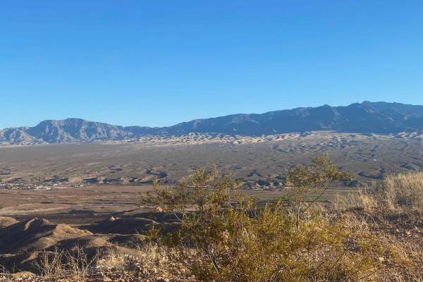
Flat Top Mesa Loop Trail
As you start on the trail, a wide panorama of Mesquite, Nevada, and Scenic, Arizona, makes a beautiful view. Behind these townships, you can see Virgin Peak and much of the Virgin River. Many short offshoot trails will get closer to the edge, but beware that much of the mesa is undercut and a long w...
Learn more about Flat Top Mesa Loop Trail
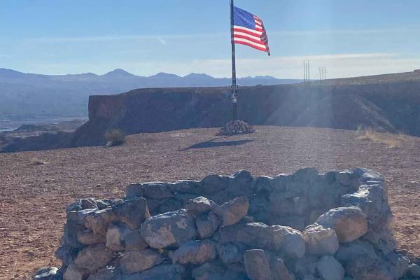
Mesquite American Flag Overlook
This short trip offers great views of Mesquite, Nevada, and Scenic, Arizona. Behind these towns, you will see Virgin Peak and much of the Virgin River. There is a bench along the way to sit and take in the picturesque sites. At the American Flag, there is also a stone firepit, making it a great plac...
Learn more about Mesquite American Flag Overlook
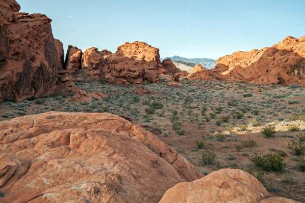
Gold Butte to Little Finland
This is a one way, in-and-out trail through the Gold Butte National Monument. The trail passes several park highlights including; Whitney Pockets, the Devil's Throat sinkhole and the Little Finland area. The trail is an easy, graded dirt road suitable for 4x4 and AWD vehicles. Several washboard sec...
Learn more about Gold Butte to Little Finland
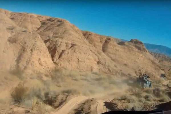
Policemans' Wash
Policemans' Wash is an exhilarating sand-wash route designed for offroaders seeking a dynamic, fast-paced desert ride with banked turns and beautiful desert scenery just north of Mesquite. This trail features a constantly shifting sandy bottom with high banked turns, meaning the track layout evolves...
Learn more about Policemans' Wash
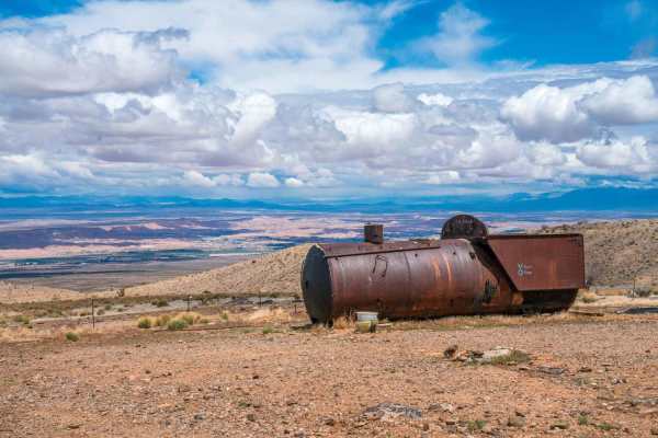
Bunkerville Choo Choo
The Bunkerville Choo Choo trail runs along the Virgin Mountain foothills. As you travel along the washes and mountain ridges, be on the lookout for cattle, as this is free range land. Along the way you will pass the remains of the Key West Mine and the Great Eastern Mine. You will also pass throu...
Learn more about Bunkerville Choo Choo
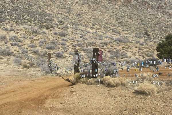
Beer Can Fence
Starting on Cabin Canyon Road, turn on Hen Springs Road. This road quickly becomes a one-lane trail. As you climb up and around the mountainous terrain, you will be surrounded by the Virgin Mountains. The beauty will surround you, and you will find yourself taking many pictures. Upon arrival at Beer...
Learn more about Beer Can Fence
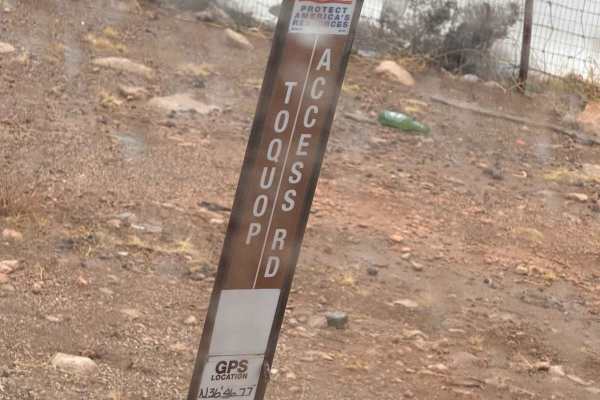
Toquop Access Road
Toquop Access Road is a rocky, slow-going trail that winds through remote desert terrain. The route is rocky and uneven, requiring patience and careful navigation. Loose stones and rough patches make for a technical ride, so high-clearance vehicles are recommended. Along the way, you'll experience t...
Learn more about Toquop Access Road

Nickel Falls
This trail starts at the Bunkerville Choo Choo Trail at the Nickle Creek Wash. The trail will head up into the mountain and follow the wash, either directly in the wash or alongside it. The trail will dead-end with a small area for 4-6 machines to park. Depending on the recent rainfall or snow melt,...
Learn more about Nickel Falls
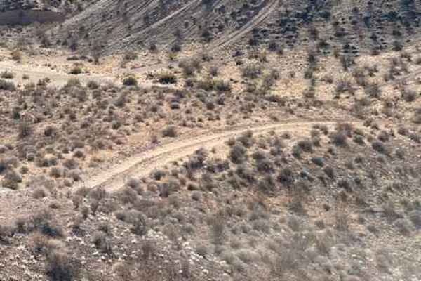
Where's Phil
The trail starts from a huge wash on the North side of Interstate 15. After the first climb, there will be beautiful views where it will connect up to the Three Corners trail. The rating comes from one steep climb, which may be a little challenging for some due to the soft sand. The rest of the trai...
Learn more about Where's Phil
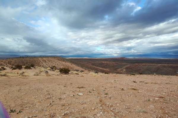
Mixer
This route features varied terrain, hill climbs, rocks, gravel and sand. This trail covers a good portion of the area and includes a mix of nearly paved quality gravel roads, two-track Jeep/SxS and single track. Initially it's mostly easy gravel, then single track, then cross country wash riding, an...
Learn more about Mixer
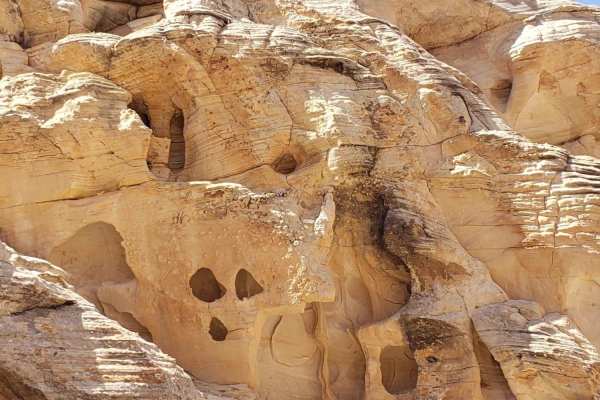
Kohta Circus Ride
Kohta Circus Ride offers a scenic and accessible desert journey through the dramatic sandstone landscapes of Gold Butte National Monument, making it an ideal adventure for stock four-wheel-drive vehicles, SxSs, and dirt bikes looking to explore historic rock art and rugged vistas. Spanning approxima...
Learn more about Kohta Circus Ride
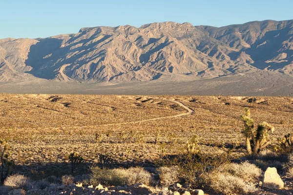
Diagonal Alley
This dirt road cuts across the desert and connects to several other trails in the area. This route is pretty rocky and bumpy, with several rough washboard sections. It ends/starts just West of the Beaver Dam highway exit. Summer months will reach triple-digit temperatures - plan accordingly with ple...
Learn more about Diagonal Alley
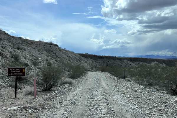
Fisherman Cove Road
Fisherman Cove Road is a 9.1-mile point-to-point trail that follows a wash down to the Virgin River. The name Fisherman Cove was when this trail ended at a cove on Lake Mead, which has since receded several miles down the Virgin River valley. This road is a single-vehicle trail with rocky sections a...
Learn more about Fisherman Cove Road
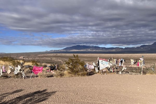
Thelma and Louise Trail
Many have heard of the movie Thelma and Louise. Come see the jump site and some surrounding additions to the adjacent fence. This is a fun, easy trail that can be added to a visit to the Three Corners Monument. There are also lots of other things to see, including some beautiful Joshua tree forested...
Learn more about Thelma and Louise Trail
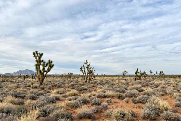
Joshua Trees and Cliffsides
Joshua Trees and Cliffsides is a captivating trail that immerses you in a magical forest of soft sand and dense Joshua trees, creating a unique and enchanting environment. This picturesque route gracefully runs alongside majestic cliffs, offering breathtaking views of the surrounding landscape as yo...
Learn more about Joshua Trees and Cliffsides
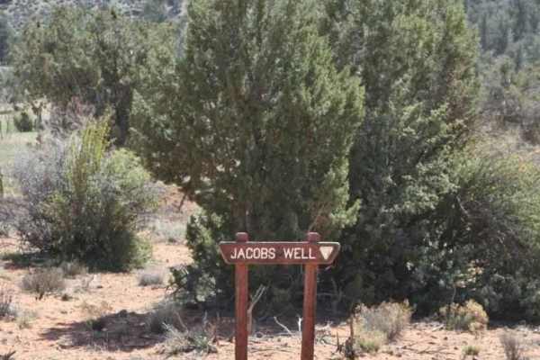
Jacobs Well to Brumley Well (County 101)
Jacobs Well to Brumley Well (County 101) is a 6.0-mile point-to-point trail rated 2 of 10 located in Mohave County, Arizona. The trail is a major access route within the Grand Canyon- Parashant National Monument. Jacobs Well is still an active working cattle ranch that has grazing rights on the surr...
Learn more about Jacobs Well to Brumley Well (County 101)
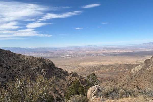
Mesquite Overlook
This trail starts at the four-way intersection of Lime Kiln Canyon, CR 101 and BLM 1041. Head north from this intersection on BLM 1041. This part of the route is a dirt road that winds its way through the Grand Canyon Parashant National Monument. You are surrounded by amazing beauty in every directi...
Learn more about Mesquite Overlook
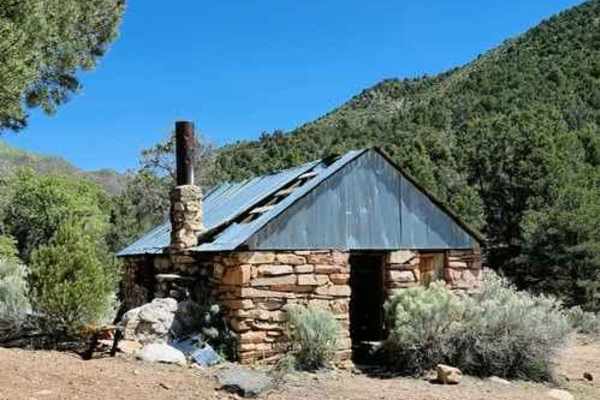
Stone Cabin to Jacobs Well (Black Rock Road 1004)
Stone Cabin to Jacobs Well (Black Rock Road 1004) is a 9.5-mile point-to-point trail rated 3 of 10 located in Mohave County, Arizona. This is a little-used section of Black Rock Road that connects Elbow Canyon with County 101. Located on the north end is the Stone House which appears to have been us...
Learn more about Stone Cabin to Jacobs Well (Black Rock Road 1004)

Pakoon Basin BLM Airstrip
Starting at the four-way intersection, head east on BLM 101/Cottonwood Ridge. This trail will run next to the Cottonwood wash, with mountains on both sides that are full of black boulders and a mix of red-rock areas. Continue on trail BLM 1027/Wayne Well. From here, you can head north on the Big Hol...
Learn more about Pakoon Basin BLM Airstrip
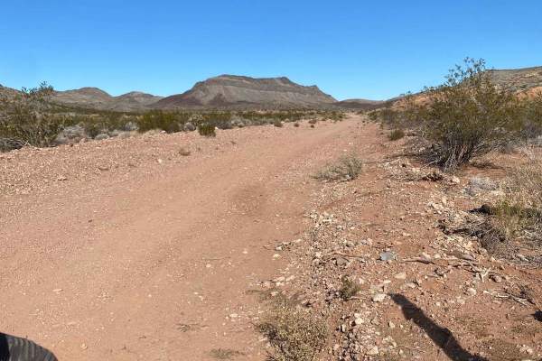
Beaver Dam to Caliente
This is a fun and very scenic route from Beaver Dam, Arizona, to Caliente, Nevada that is 100% dirt and a perfect mix of fast open desert, twisty mountain roads, and a lot of elevation changes from 1,800 feet to over 6,600 feet. This route is also very close to the three corners where Nevada, Utah, ...
Learn more about Beaver Dam to Caliente
Beginner ATV trails near Bunkerville, Nevada
Explore ATV-friendly trails near you. These trails are accessible for vehicles up to 50 inches wide, perfect for ATVs and smaller off-road machines.
Flat Top Mesa Loop Trail
As you start on the trail, a wide panorama of Mesquite, Nevada, and Scenic, Arizona, makes a beautiful view. Behind these townships, you can see Virgin Peak and much of the Virgin River. Many short offshoot trails will get closer to the edge, but beware that much of the mesa is undercut and a long w...
Learn more about Flat Top Mesa Loop Trail
Mesquite American Flag Overlook
This short trip offers great views of Mesquite, Nevada, and Scenic, Arizona. Behind these towns, you will see Virgin Peak and much of the Virgin River. There is a bench along the way to sit and take in the picturesque sites. At the American Flag, there is also a stone firepit, making it a great plac...
Learn more about Mesquite American Flag Overlook
Gold Butte to Little Finland
This is a one way, in-and-out trail through the Gold Butte National Monument. The trail passes several park highlights including; Whitney Pockets, the Devil's Throat sinkhole and the Little Finland area. The trail is an easy, graded dirt road suitable for 4x4 and AWD vehicles. Several washboard sec...
Learn more about Gold Butte to Little Finland
Policemans' Wash
Policemans' Wash is an exhilarating sand-wash route designed for offroaders seeking a dynamic, fast-paced desert ride with banked turns and beautiful desert scenery just north of Mesquite. This trail features a constantly shifting sandy bottom with high banked turns, meaning the track layout evolves...
Learn more about Policemans' Wash
Beginner UTV/side-by-side trails near Bunkerville, Nevada
Find UTV and side-by-side trails near you. These trails accommodate vehicles up to 60 inches wide, ideal for UTVs, side-by-sides, and wider off-road rigs.
Flat Top Mesa Loop Trail
As you start on the trail, a wide panorama of Mesquite, Nevada, and Scenic, Arizona, makes a beautiful view. Behind these townships, you can see Virgin Peak and much of the Virgin River. Many short offshoot trails will get closer to the edge, but beware that much of the mesa is undercut and a long w...
Learn more about Flat Top Mesa Loop Trail
Mesquite American Flag Overlook
This short trip offers great views of Mesquite, Nevada, and Scenic, Arizona. Behind these towns, you will see Virgin Peak and much of the Virgin River. There is a bench along the way to sit and take in the picturesque sites. At the American Flag, there is also a stone firepit, making it a great plac...
Learn more about Mesquite American Flag Overlook
Policemans' Wash
Policemans' Wash is an exhilarating sand-wash route designed for offroaders seeking a dynamic, fast-paced desert ride with banked turns and beautiful desert scenery just north of Mesquite. This trail features a constantly shifting sandy bottom with high banked turns, meaning the track layout evolves...
Learn more about Policemans' Wash
Bunkerville Choo Choo
The Bunkerville Choo Choo trail runs along the Virgin Mountain foothills. As you travel along the washes and mountain ridges, be on the lookout for cattle, as this is free range land. Along the way you will pass the remains of the Key West Mine and the Great Eastern Mine. You will also pass throu...
Learn more about Bunkerville Choo Choo
The onX Offroad Difference
onX Offroad combines trail photos, descriptions, difficulty ratings, width restrictions, seasonality, and more in a user-friendly interface. Available on all devices, with offline access and full compatibility with CarPlay and Android Auto. Discover what you're missing today!
Open Trail Map