
Beginner Off-Road Trails
Near Barstow, California
Explore All Beginner Trails Near Barstow, California
Beginner Off-Road Trails Near Barstow, California
Discover the best beginner-friendly off-road trails near you. These easier, lower-rated trails are a great place to start — browse trail maps, check difficulty ratings, and find your next adventure.
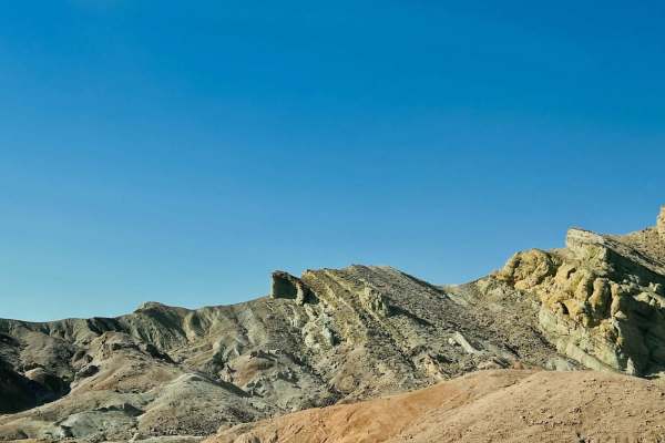
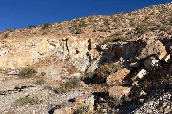
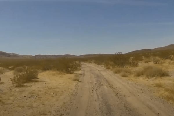
Rainbow Basin Loop
This trail begins off a nice paved highway and can be somewhat easy to miss at first glance. There is an established campground a couple of miles off this trail with pit toilets, pergolas for shade, cement picnic tables, and metal fire rings. There is also a large group sight that doubles as an equi...
Learn more about Rainbow Basin Loop
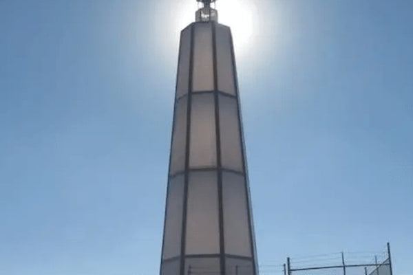
Hinkley Desert Lighthouse
This is the trail that takes you to the Hinkley Desert Lighthouse. The lighthouse was built in 2017 by artist Daniel Hawkins. The entire Lighthouse is lit at night. The route is an easy dirt road/trail that can be traversed by almost any vehicle. There is a small hill climb required to reach the Lig...
Learn more about Hinkley Desert Lighthouse
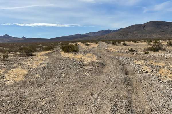
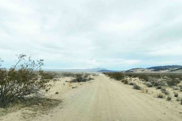
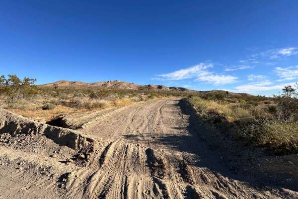
The Main North to South Access Wash
A sandy run from the central valley to the northern open section. The wash is wide and allows for oncoming traffic to pass. The sand is generally more on the coarse side, lending to an easier ride. That being said, the track can become whooped out and bermed up as ore popular trails crisscross the w...
Learn more about The Main North to South Access Wash
Stoddard Mountain Road
This is the main graded trail into the OHV area. It is mostly well-graded with plenty of washboard bumps and mild transitions to make life easier for those towing trailers. There is a pit toilet on the way in, and once you pass the quarry, the trail becomes a little more narrow and more whooped out....
Learn more about Stoddard Mountain Road
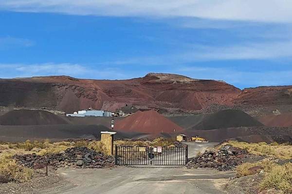
Pipken Cindercone
This track starts at the Base Camp Sawtooth Canyon Camp Grounds located 15 miles south of Barstow California. You run the gas line road East to Pipkin Cindercone Road to the Volcano. There are lots of mines out in this area of the Ord Mountains and Rodman Mountains. This is also close to Johnson Val...
Learn more about Pipken Cindercone
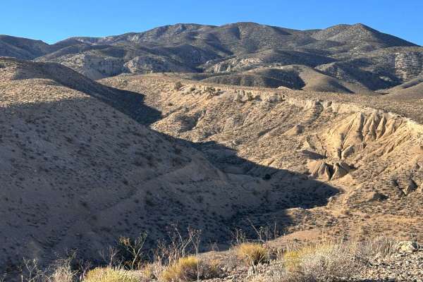
Black Mountain Wilderness Route
This secluded route is perfect for a day trip or a dispersed overnighter. You'll explore lava flow regions, an opal mine, the Tuffa Cave House, and Inscription Canyon filled with petroglyphs. The route (clockwise) starts in the fast and flowy desert section, then traverses across Black Mountain, and...
Learn more about Black Mountain Wilderness Route
Cady Mountain Loop - Part 3
Part 3 of the Cady Mountain Loop begins after you make the hard left turn from AC9476 (Loop 2) onto BI9470. It continues for about 11 miles east on a hard-packed trail with some fun S-Turns and a couple of soft sections but a minimal amount of whoops. It ends near an old abandoned oil well which mak...
Learn more about Cady Mountain Loop - Part 3
Rattlesnake Loop
This wide-open trail is the ideal spot to get your bearings, offering a clear and predictable path that works perfectly as a warm-up loop. The layout is expansive, giving you plenty of room to stand up, stretch out, and find your rhythm before heading into more demanding terrain. Because the visibil...
Learn more about Rattlesnake Loop

Sunburn Ridge
This scenic double-track route is all about the atmosphere, offering wide-open vistas of the distant desert floor as you cruise along the ridgeline. The highlight of the ride is passing by a series of mysterious concrete structures—remnants of old mining operations or forgotten desert infrastructure...
Learn more about Sunburn Ridge
Coyote Campout
This fun little offshoot is a great spot if you’re looking for a quick escape with a solid campsite at the end. It’s clearly a hangout, with signs that people use the area for target practice, so stay aware of your surroundings. The access is straightforward and makes for a perfect pit stop or an ea...
Learn more about Coyote Campout
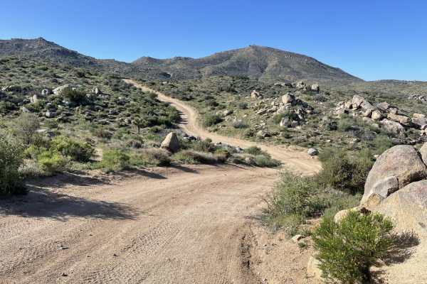
Juniper Pass
This is a key BLM entry point that serves as a main gateway to the surrounding off-road networks. It’s primarily a double-track road, providing plenty of breathing room as you transition from the pavement into the dirt. While it isn't the most technical stretch, it’s a reliable route for getting you...
Learn more about Juniper Pass
Cady Mountain Loop - Part 1
This is the first section of a loop that takes you from the Mojave Trail near Afton Canyon Campground around the Cady Mountains. This is an easy loop that can add another day of riding in the Afton Canyon area. Each part connects at sections of the trail that merge with another trail or make an obvi...
Learn more about Cady Mountain Loop - Part 1
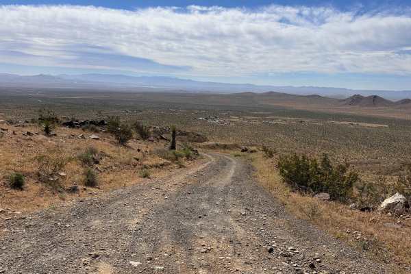
Radio Summit
This is the main access road leading down from the radio towers, offering a much more relaxed pace than the climb up. It’s a great way to cool down while soaking in the expansive views of the desert floor stretching out below. The path is wide and straightforward, making it an easy cruise back to th...
Learn more about Radio Summit
Cady Mountain Loop - Part 2
This section of the loop starts where Loop 1 (AC9602) meets trail AC9476. Make a sharp right turn and continue southwest for 7 miles. The terrain remains mostly hard-packed but this section has some small drops in the trail and some whoops. This is again an easy track that is mostly straight with a ...
Learn more about Cady Mountain Loop - Part 2
Japatul Road
This trail heads up toward Juniper flats and splits to either Flagpole trail or continues to the flats. The valley views below are pretty great once you ascend to the ridgeline. Once you pass the residential section, the lower section of trail has some heavily rutted and washed-out sections. If you ...
Learn more about Japatul Road
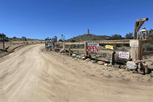
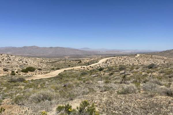
Bowen Ranch
This wide washboard trail heads up into the hills passing private property and open BLM land. It ends at the Bowens Ranch and hot springs (more info below). There are a few dispersed camping spots along the way. Just be sure you are not on private property. There is also "pay for camping" available ...
Learn more about Bowen Ranch
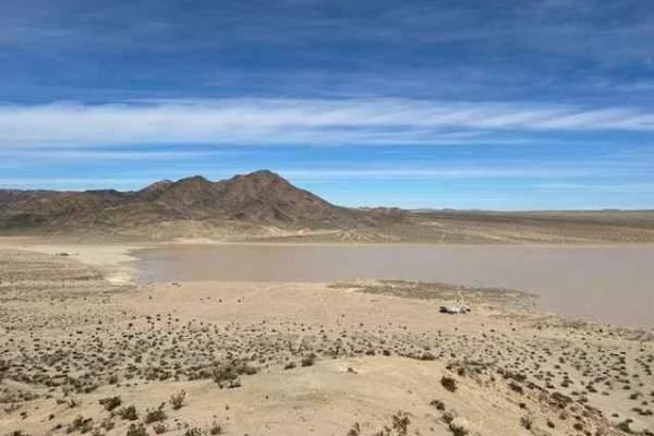
Soggy Dry Lake to Cougar Buttes
This trail takes you from the Soggy Dry Lake in Johnson Valley to Cougar Buttes. It's a fun ride for the whole family. It's all dirt and two-track, with some sand and some rocks that are all easily navigable by even the most novice rider. It's recommended to do it before noon so as not to have the s...
Learn more about Soggy Dry Lake to Cougar Buttes
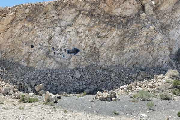
The "Shooting Range" Quarry
This out and back trail ends at a small turnaround loop with a great view. A short side trail heads up to the old abandoned mine, which features a few flat dispersed camping spots and an unofficial shooting range. There's broken glass and sharp objects scattered about, so be careful of potential tir...
Learn more about The "Shooting Range" Quarry
Falcon Ridge
This epic desert road delivers some of the best scenery in the area without making you work too hard for it. Ride along deep canyons, wide-open desert landscapes, and endless views that seem to go on forever. Easy access makes it a perfect route whether you're passing through or exploring.
Learn more about Falcon Ridge
Psycho Ranch Turnout
This trail tears off from the main route of Coxey into the hills. There are a few singletrack turnoffs for those looking for some adventure. There were no natural camping spots noticed on this route. There are, however, two pretty decently long steep hill climbs with some loose rocks to add to the c...
Learn more about Psycho Ranch Turnout
Beginner ATV trails near Barstow, California
Explore ATV-friendly trails near you. These trails are accessible for vehicles up to 50 inches wide, perfect for ATVs and smaller off-road machines.
Hinkley Desert Lighthouse
This is the trail that takes you to the Hinkley Desert Lighthouse. The lighthouse was built in 2017 by artist Daniel Hawkins. The entire Lighthouse is lit at night. The route is an easy dirt road/trail that can be traversed by almost any vehicle. There is a small hill climb required to reach the Lig...
Learn more about Hinkley Desert Lighthouse
The Main North to South Access Wash
A sandy run from the central valley to the northern open section. The wash is wide and allows for oncoming traffic to pass. The sand is generally more on the coarse side, lending to an easier ride. That being said, the track can become whooped out and bermed up as ore popular trails crisscross the w...
Learn more about The Main North to South Access Wash
Pipken Cindercone
This track starts at the Base Camp Sawtooth Canyon Camp Grounds located 15 miles south of Barstow California. You run the gas line road East to Pipkin Cindercone Road to the Volcano. There are lots of mines out in this area of the Ord Mountains and Rodman Mountains. This is also close to Johnson Val...
Learn more about Pipken Cindercone
Cady Mountain Loop - Part 3
Part 3 of the Cady Mountain Loop begins after you make the hard left turn from AC9476 (Loop 2) onto BI9470. It continues for about 11 miles east on a hard-packed trail with some fun S-Turns and a couple of soft sections but a minimal amount of whoops. It ends near an old abandoned oil well which mak...
Learn more about Cady Mountain Loop - Part 3
Beginner UTV/side-by-side trails near Barstow, California
Find UTV and side-by-side trails near you. These trails accommodate vehicles up to 60 inches wide, ideal for UTVs, side-by-sides, and wider off-road rigs.
The Main North to South Access Wash
A sandy run from the central valley to the northern open section. The wash is wide and allows for oncoming traffic to pass. The sand is generally more on the coarse side, lending to an easier ride. That being said, the track can become whooped out and bermed up as ore popular trails crisscross the w...
Learn more about The Main North to South Access Wash
Stoddard Mountain Road
This is the main graded trail into the OHV area. It is mostly well-graded with plenty of washboard bumps and mild transitions to make life easier for those towing trailers. There is a pit toilet on the way in, and once you pass the quarry, the trail becomes a little more narrow and more whooped out....
Learn more about Stoddard Mountain Road
Pipken Cindercone
This track starts at the Base Camp Sawtooth Canyon Camp Grounds located 15 miles south of Barstow California. You run the gas line road East to Pipkin Cindercone Road to the Volcano. There are lots of mines out in this area of the Ord Mountains and Rodman Mountains. This is also close to Johnson Val...
Learn more about Pipken Cindercone
Cady Mountain Loop - Part 3
Part 3 of the Cady Mountain Loop begins after you make the hard left turn from AC9476 (Loop 2) onto BI9470. It continues for about 11 miles east on a hard-packed trail with some fun S-Turns and a couple of soft sections but a minimal amount of whoops. It ends near an old abandoned oil well which mak...
Learn more about Cady Mountain Loop - Part 3
The onX Offroad Difference
onX Offroad combines trail photos, descriptions, difficulty ratings, width restrictions, seasonality, and more in a user-friendly interface. Available on all devices, with offline access and full compatibility with CarPlay and Android Auto. Discover what you're missing today!
Open Trail Map