Ready to explore this trail?
View Trail Map in AppNo permit required, but the approach road is private gravel shared with ATV traffic and has deteriorated in recent years; a high-clearance vehicle is strongly recommended, and road conditions should be checked before visiting. The upper ridge is fully exposed alpine terrain with no cover from wind or lightning.
Path Type
There and Back
This route starts and ends at an ATV gate on a private gravel road south of the mountain, reaching Saddleback Mountain from the opposite side of ski resort's lift-served trails.
From the gate, follow the ATV trail 0.9 mile, then turn sharply left onto the Fly Rod Crosby multi-use trail. At 1.4 miles, reach the Berry Picker's Trail proper near a bridge over Winship Stream — a route used by locals for over 150 years to reach the alpine ridge to pick blueberries and mountain cranberries.
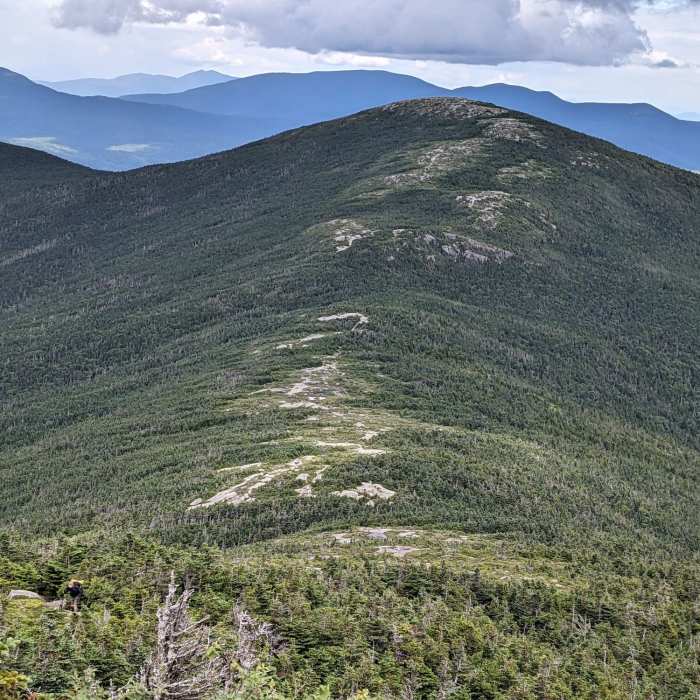
The trail climbs along the stream through mixed forest, steepens and turns away from the stream around 1.7 miles, passes Boundary Ledge at 2.1 miles and a large glacial boulder called the Erratic at 2.6 miles, then reaches the Appalachian Trail at the top of the ridge at 3 miles. Turn left (south) and climb 0.6 mile to Saddleback Mountain's open, ledgy summit, within one of the largest alpine zones in Maine. You'll reach a false summit first, with the true summit, marked with a sign, a short distance further.
To return, retrace your steps to the junction with the AT and the Berry Picker's Trail and either head back down or continue straight ahead to summit the Horn. The alpine sections above treeline are exposed to wind and weather with little cover.
No Condition Reports
Saddleback Mountain via Ski Lodge
Saddleback Mountain via Ski Lodge
Saddleback Mountain and The Horn via Appalachian Trail
Saddleback Mountain and The Horn via Appalachian Trail
Sugarloaf Mountain via Appalachian Trail
Sugarloaf Mountain via Appalachian Trail
Sugarloaf and Spaulding via Appalachian Trail
Sugarloaf and Spaulding via Appalachian Trail
Appalachian Trail - Bigelow Preserve
Appalachian Trail - Bigelow Preserve
Tumbledown Mountain Out and Back
Tumbledown Mountain Out and Back
Contributors

