Trail Overview
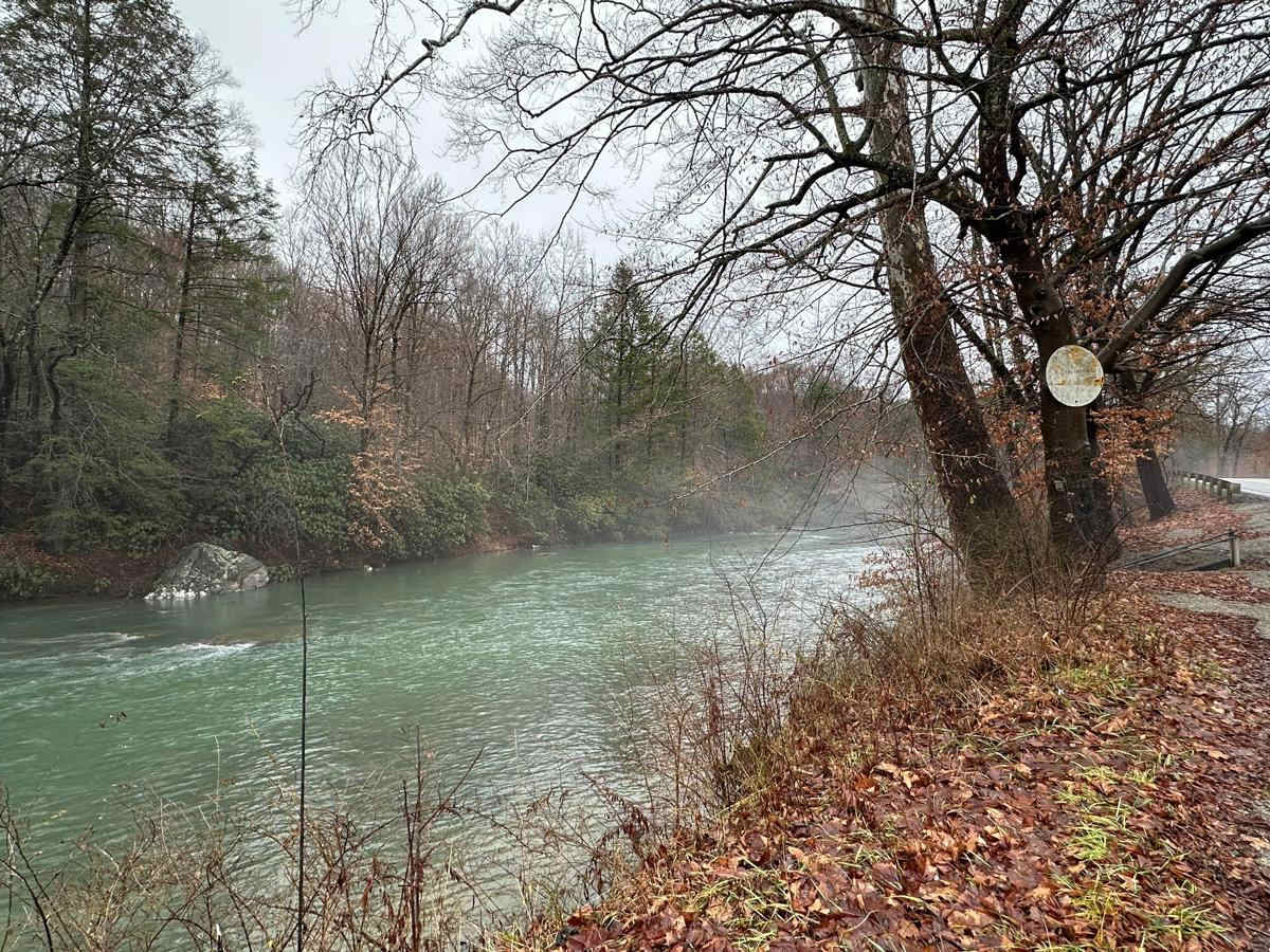
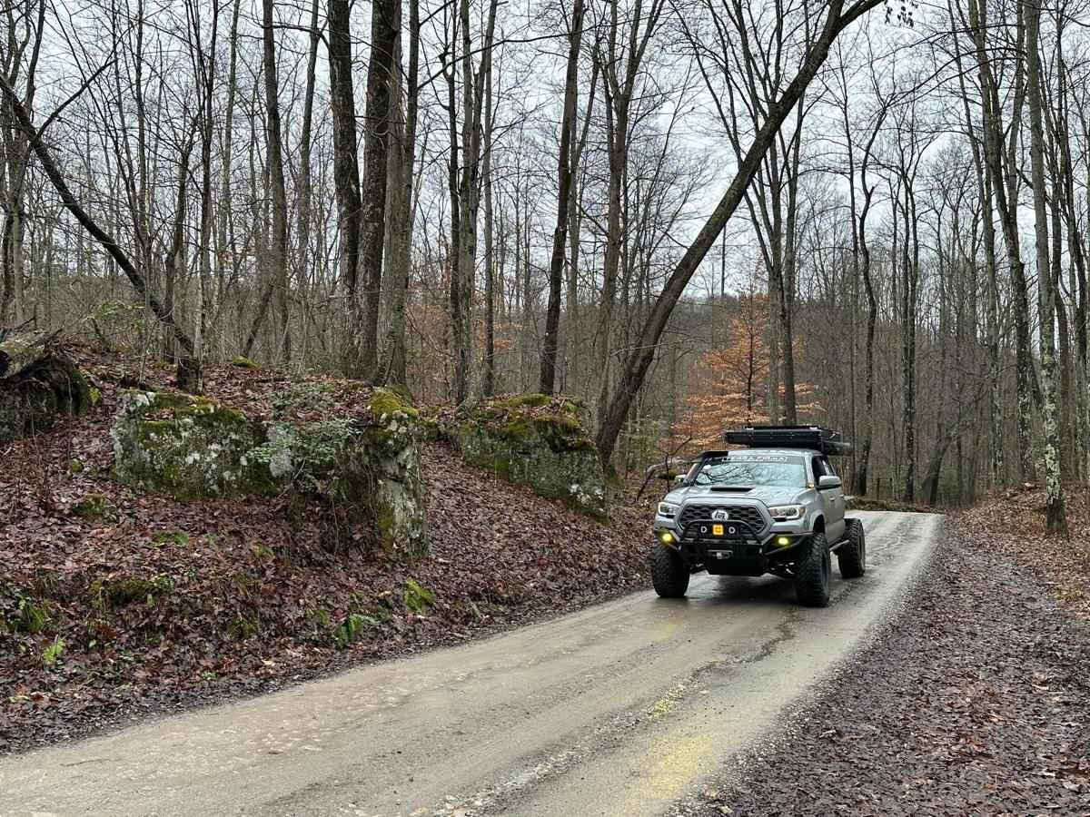
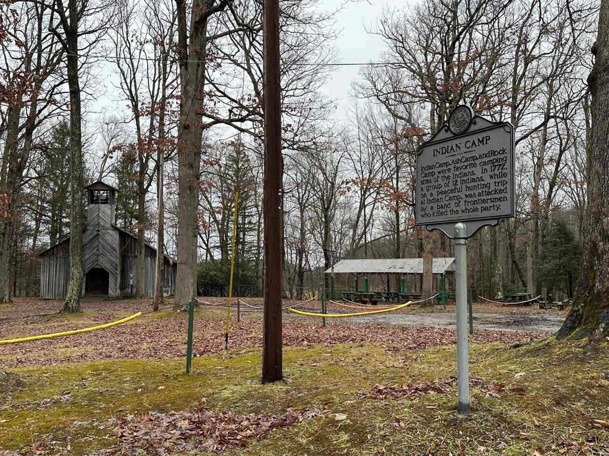
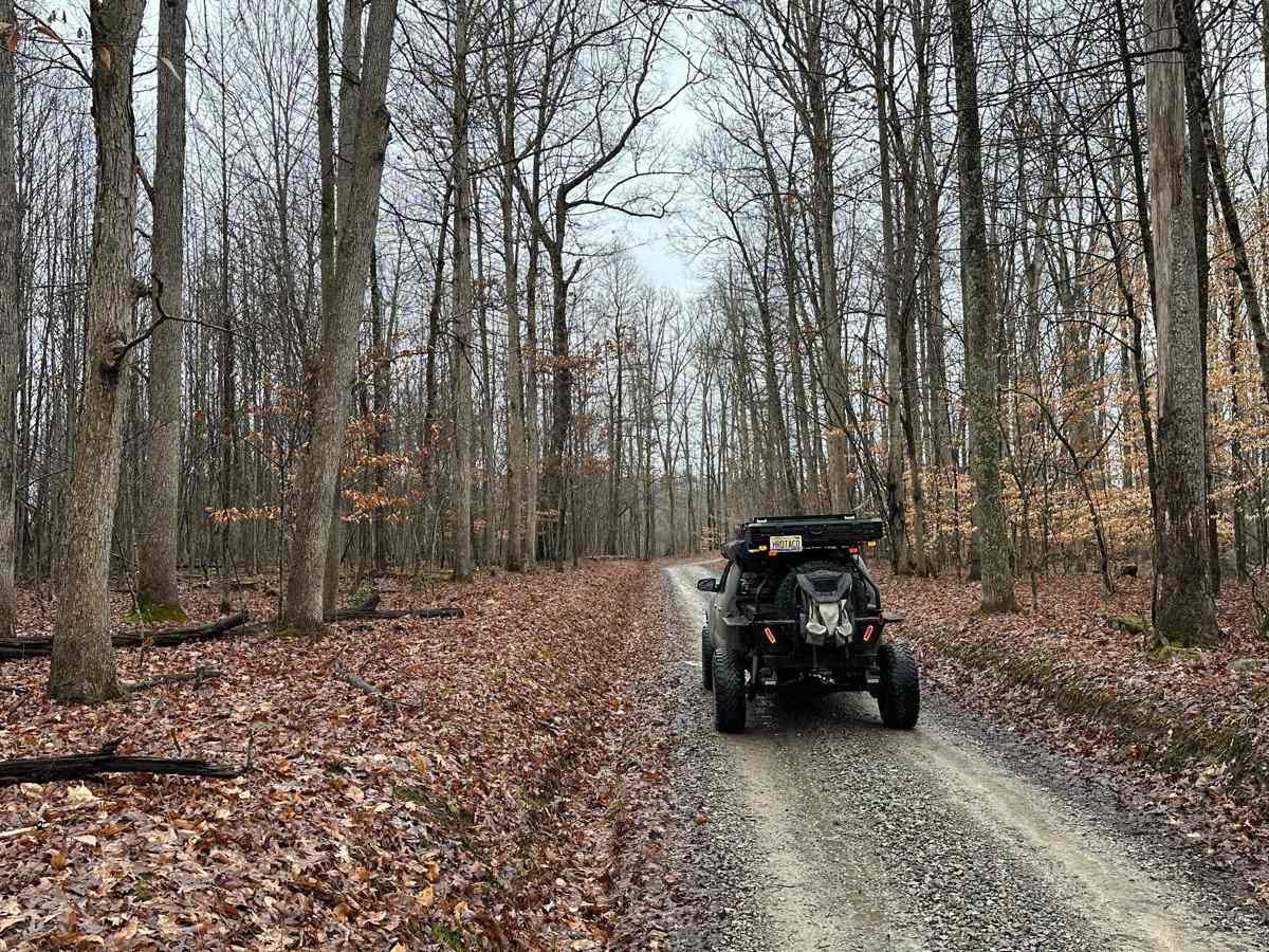
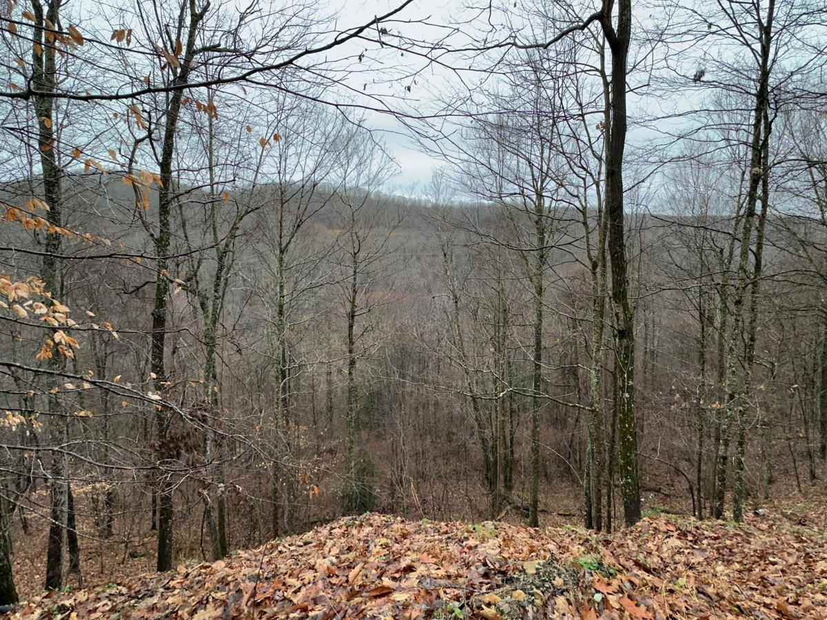
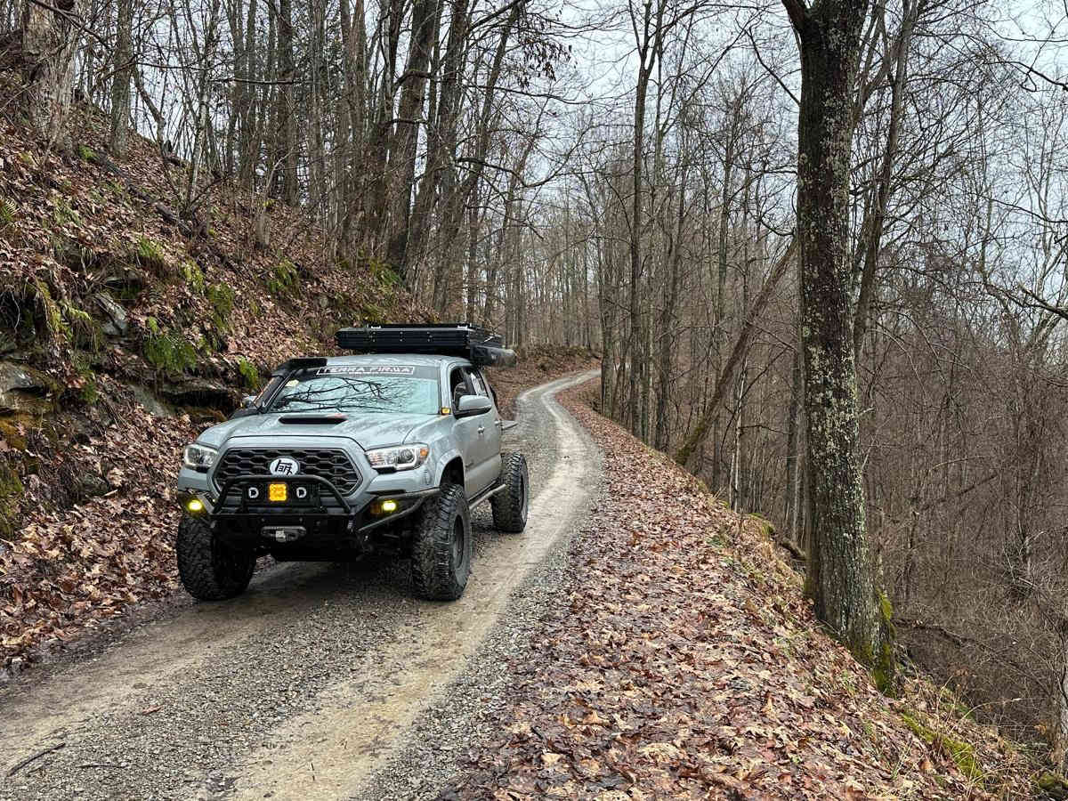
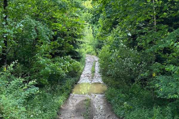
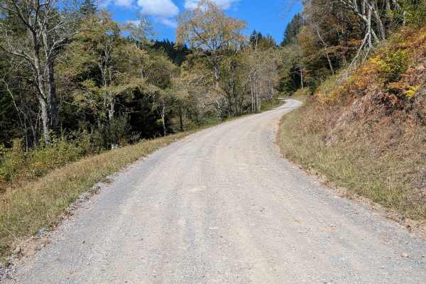
Start this route in Buckhannon by taking WV-20 south to Sago Road for 5 miles. This section is paved but scenic, running alongside the emerald-hued Buckhannon River. The road transitions to dirt and gravel. At Big Bend Church (38.88129, -80.21359), take the road perpendicular to the parking lot called Big Ben WV-30/9. The church parking lot is a perfect place to air down. After a few miles, use caution around the sharp left to remain on Big Ben, then make a right onto Beans Mill Road (CR 32/17). Along the way, respect private property as you'll encounter numerous gates and signs. Always stay on the designated trail and public roads. This route is 100% dirt and mud, with occasional rocky sections--airing down before proceeding is recommended. Expect water in the valleys with several crossings, diverse wildlife such as deer and birds, and scenic patches of evergreens and rhododendrons. Shortly after turning onto Beans Mill Road (trailhead: 38.8488, -80.21699), you'll pass Indian Camp, a landmark with a dark history. At 0.6 miles, turn left before the light blue house. The next section follows a steep hillside, offering an overlook at 38.84097, -80.20633--listen closely, and you'll hear water below. At the bottom of the hill, you'll encounter a railroad crossing and two bridges. Before crossing the first bridge, there's space to park on the left along the tracks or across the bridge and further up in an open area. This spot is worth exploring on foot or taking a break for a meal. There are also obstacles to navigate for those seeking a challenge. Note that this area often accumulates trash--leave it better than you found it. Beyond the bridges, conditions become muddy, especially after rain. Even in dry weather, expect large mud holes in this section. High-clearance 4WD vehicles with all-terrain tires are recommended, along with a winch or group travel for added safety. Starting the route from Buckhannon is advised--if coming from the opposite direction, a slick uphill climb can be problematic after rainfall.For those seeking some fun in the mud, there's an optional spot along the way at 38.84604, -80.19259. It's easily bypassed for those preferring to keep their vehicles clean.
Difficulty
The majority of the trail would be fairly easy for a stock 4x4 truck or SUV, however, due to the occasional and moderately deep mud holes, I recommend slightly bigger all-terrain or mud-terrain tires and high clearance. Weather such as rain or snow can drastically increase the difficulty in a few places.