Sandi G
May 09, 2026
Open
DustyRough/Deteriorated
South side descent is very steep. It’s not a 4, more like a 6. The trail was super fun with the streams
Matt H
Feb 09, 2026
Open
Muddy/Wet
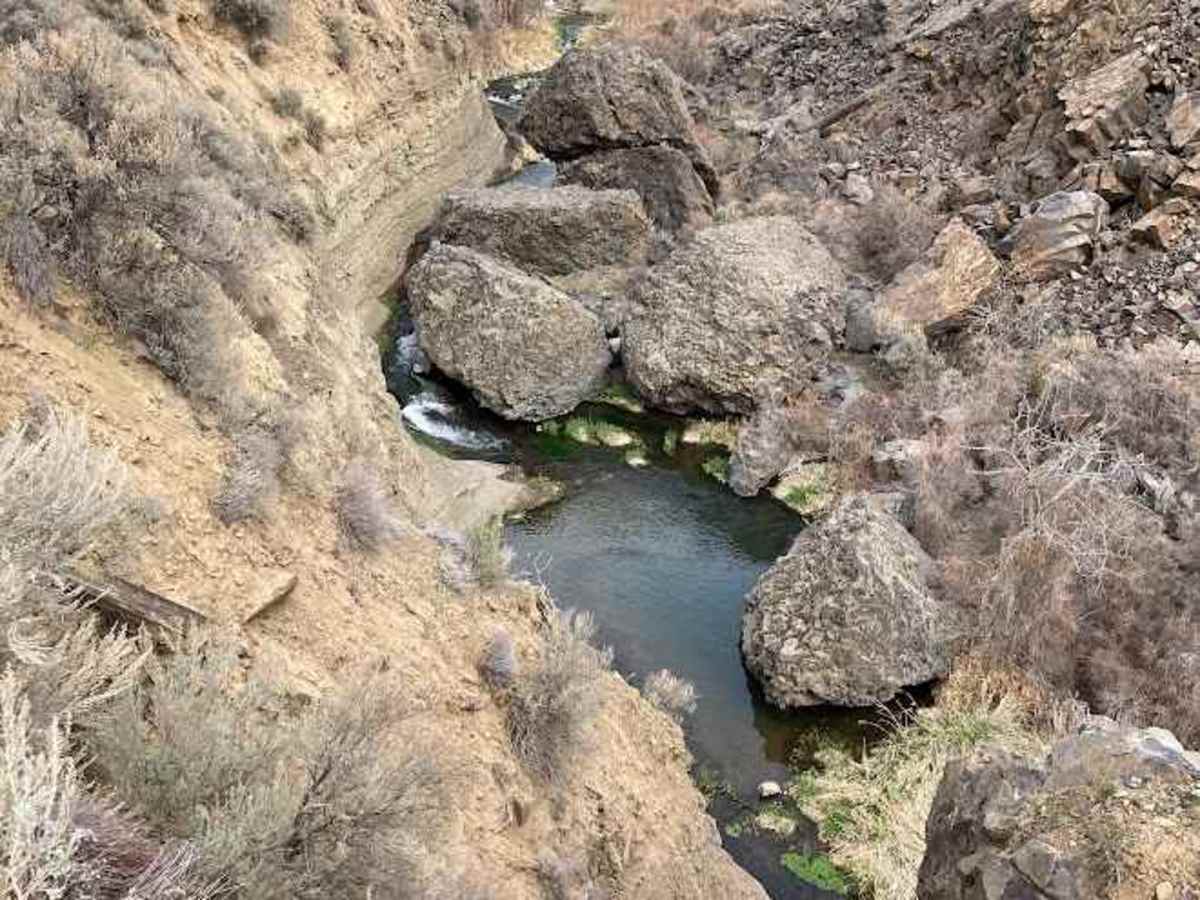
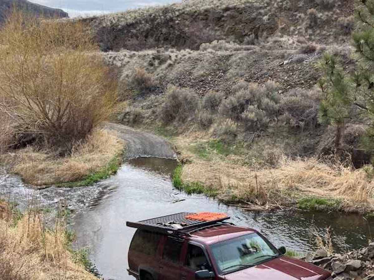
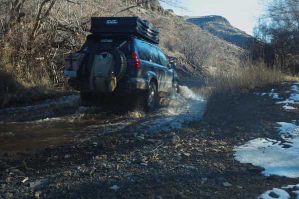
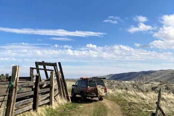
Creek crossings are maybe up to 12" deep with river rock creek beds, not mud, so they don't pose a problem. One spot mid-trail has a hump a few feet tall that may be challenging to longer wheelbase vehicles without a good breakover angle. Spots are muddy, but without recent rain, the vast majority of the trail is in good condition.
I took the liberty to prune the sage brush and willows alongside the trail with the goal of making it possible for a full-sized pickup to travel the length without pin striping. I believe I've succeeded here using a pruning saw, loppers and a few hours of light effort on a beautiful day.
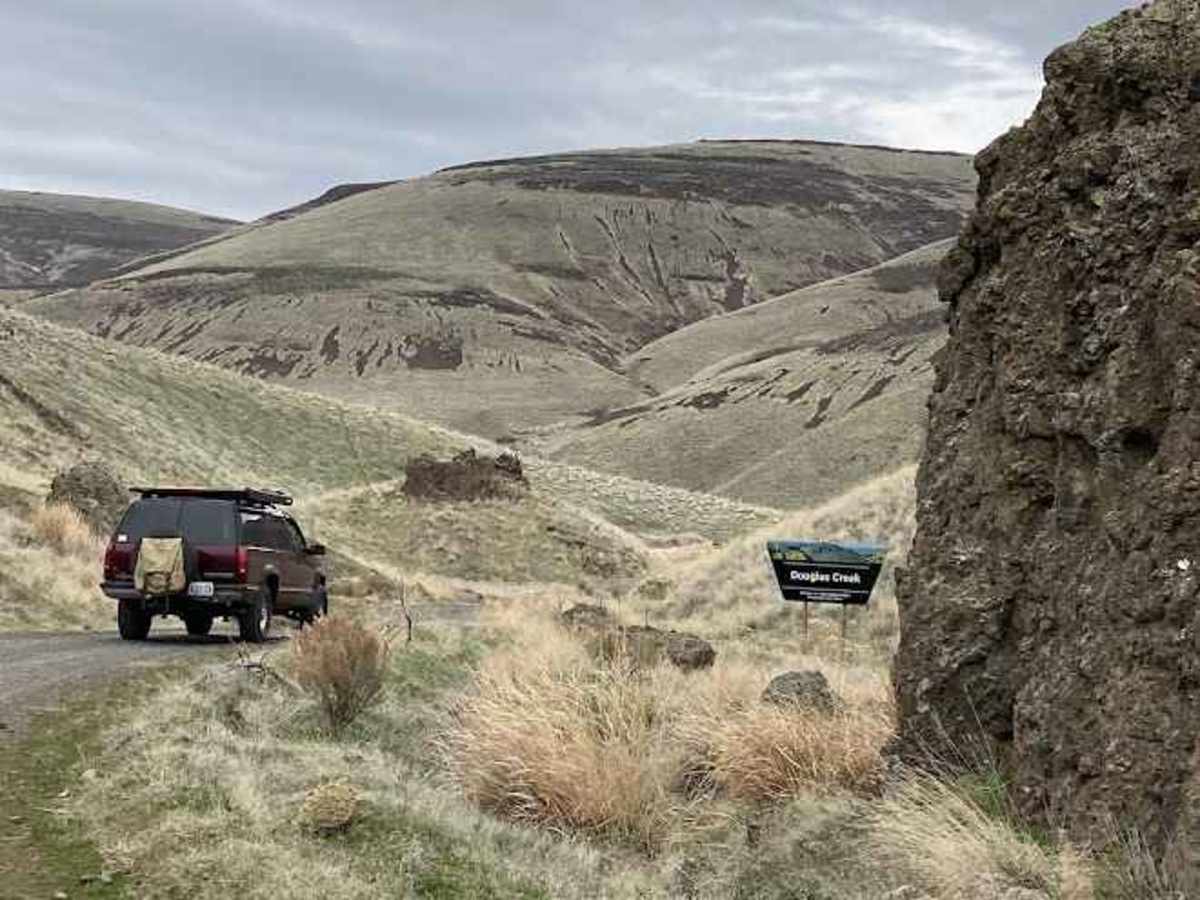
Avoid approaching/departing via Rock Island Grade in the Columbia Valley as this gravel road has become a greasy mud fest that will cover your vehicle in our wet winters. Good access can be had from the north via Route 2 or from the south viai Pallisades Road.
Cooper @vagrantoptimists
Mar 30, 2025
Open
Normal
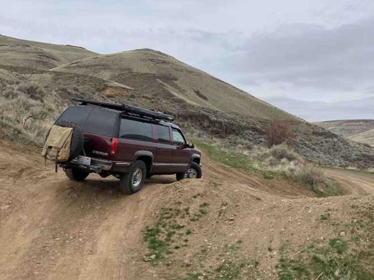
From north to south a steep decline into a stream crossings. The decline was loose and rocky. We had no problem going down in our big rig and a stock truck/suv would be fine. Going up would probably require 4x4 and some all terrain tires. At the falls take the highest of the 3 roads to switch back up a loose, rutted, rocky climb. The low road would require 4x4, 35”+ tires, and probably a locker. The middle road is washed out. A few stream crossings less than 18” deep and no major mud in late March.
Nicholas Huerta
Jan 25, 2025
Open
Muddy/WetSnow/Ice
Paul Thompson
Jul 07, 2024
2023 Toyota Tacoma
Open
NormalDusty
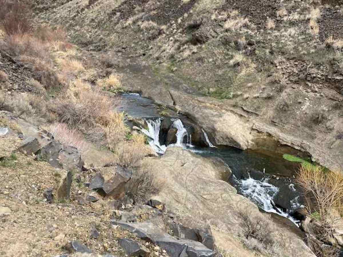
Fun trail! Tons of great water crossings, maybe 12 to 18 inches deep. At the end of the day, we jumped in the creek had the waterfall beautiful little area.
Matt Engel
May 25, 2024
2023 Toyota 4Runner
Open
If you follow the blue route it’s a 4 in difficulty but if you bypass the steep drop down to the falls it’s probably a 2. The one water crossing to get to the falls was less than a foot deep.
Felix Oliva
Apr 20, 2024
2022 Jeep Gladiator
Open
DustyMuddy/WetRough/DeterioratedWashboard
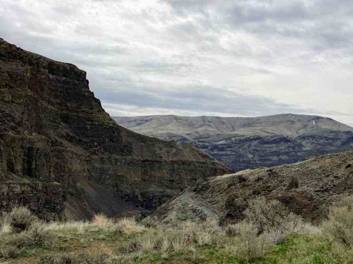
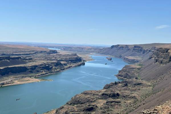
Few water crossings to go across. Beautiful canyon views, gets super windy at night if you plan to camp out. You will see bats at night. Around the 1.7 mile mark there are many spots that can get technical, but there is a bypass. Don’t stay on the blue trail, take the bypass that takes you up and over. It’s only one car wide so look ahead! You can see a water fall, but if you take the bypass, turn right to see it or you’ll miss it.
Brandon Eberhardt
Apr 14, 2024
Open
DustyRough/DeterioratedMuddy/Wet
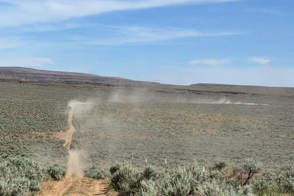
Coming from the south, Trail was gravel to the top of the hill, then a small maze of intersecting offshoots all with steep declines, 4L is your friend, once at the bottom nothing else technical, lots of 1.5-2' deep water crossings leaving north. then TONS of dust on the road between fields.
Conner Alt
Apr 09, 2024
2016 Toyota 4Runner
Open
Normal
Trail had light mud on the offcamber sections. dry other than that. water crossing were deeper than normal. A little past half way up on the tires 31"
freedom born diesel
Dec 30, 2023
1992 Jeep Cherokee
Open
NormalMuddy/WetRough/DeterioratedWashboard
Primarily compact dirt roads with occasional washouts. At the trailhead, two paths converge, both washed out. To the right of the four different trails, two steep options await; descending is manageable, but ascending is challenging. Overall, an enjoyable trail featuring a scenic creek and entertaining water crossings.
Matt Harris
Nov 25, 2023
Open
Normal
travis hurd
May 21, 2023
Open
Muddy/WetDustyNormal
Basalt Overland
Apr 09, 2023
1999 Chevrolet Suburban
Open
Karl Blackman
Mar 19, 2023
Open