German River

Total Miles 8.7
Technical Rating
4 Moderate
Best Time Spring, Summer, Fall
Trail Type Full-Width Road
Accessible By
Open Trail Map

Trail Overview

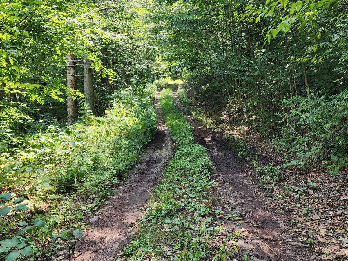
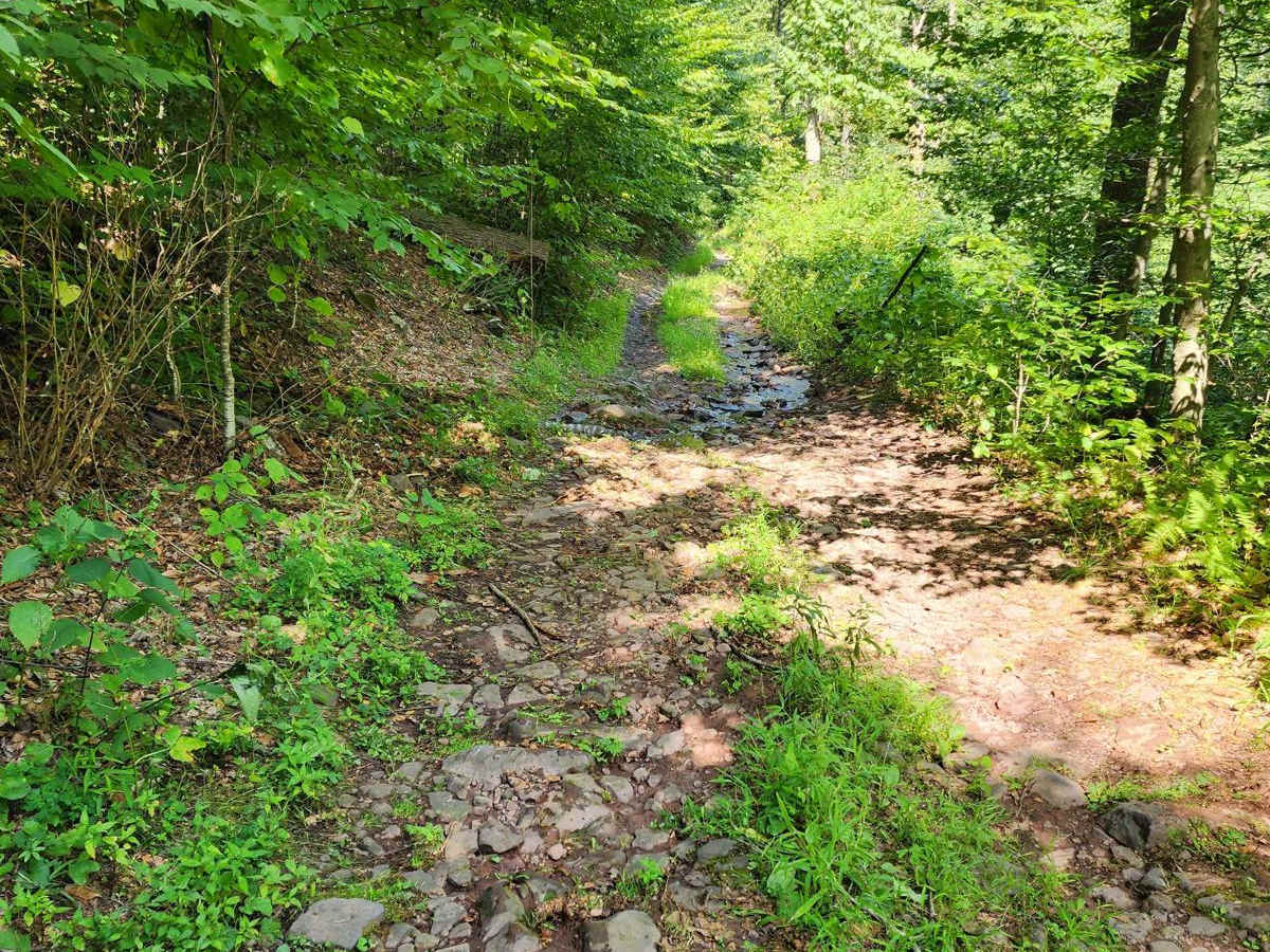
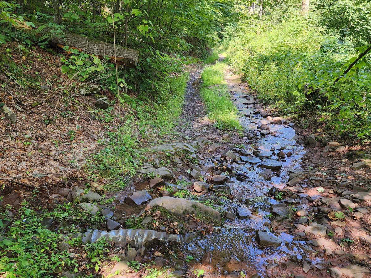
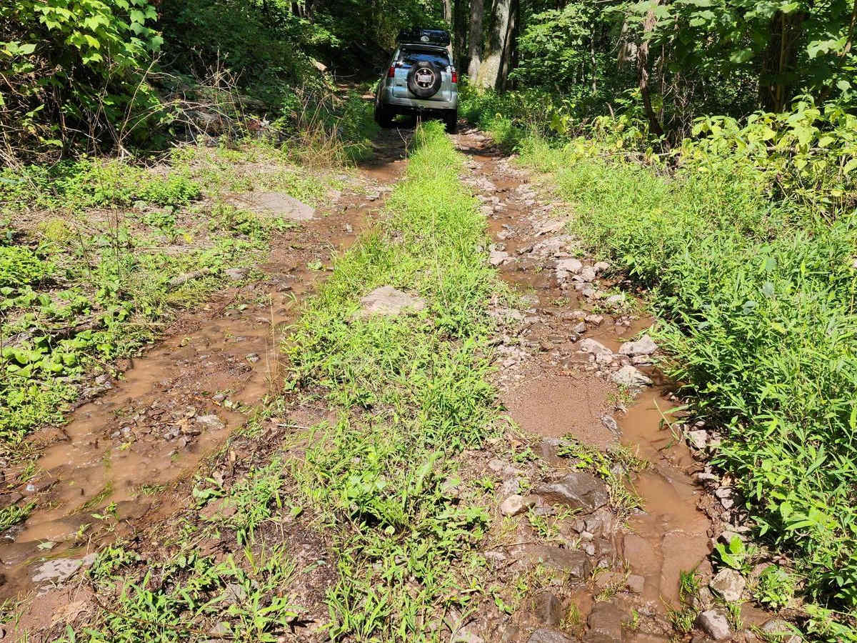
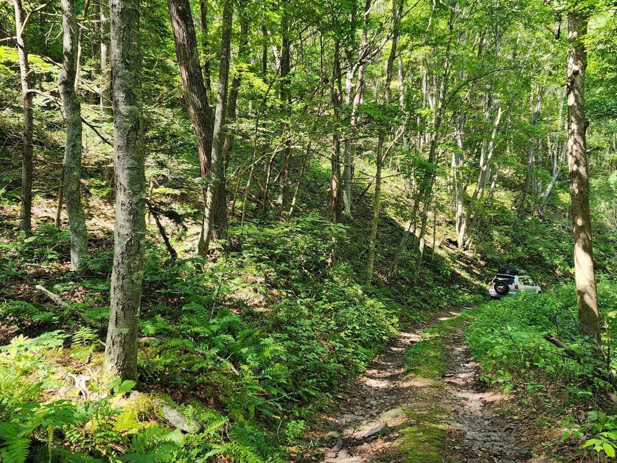
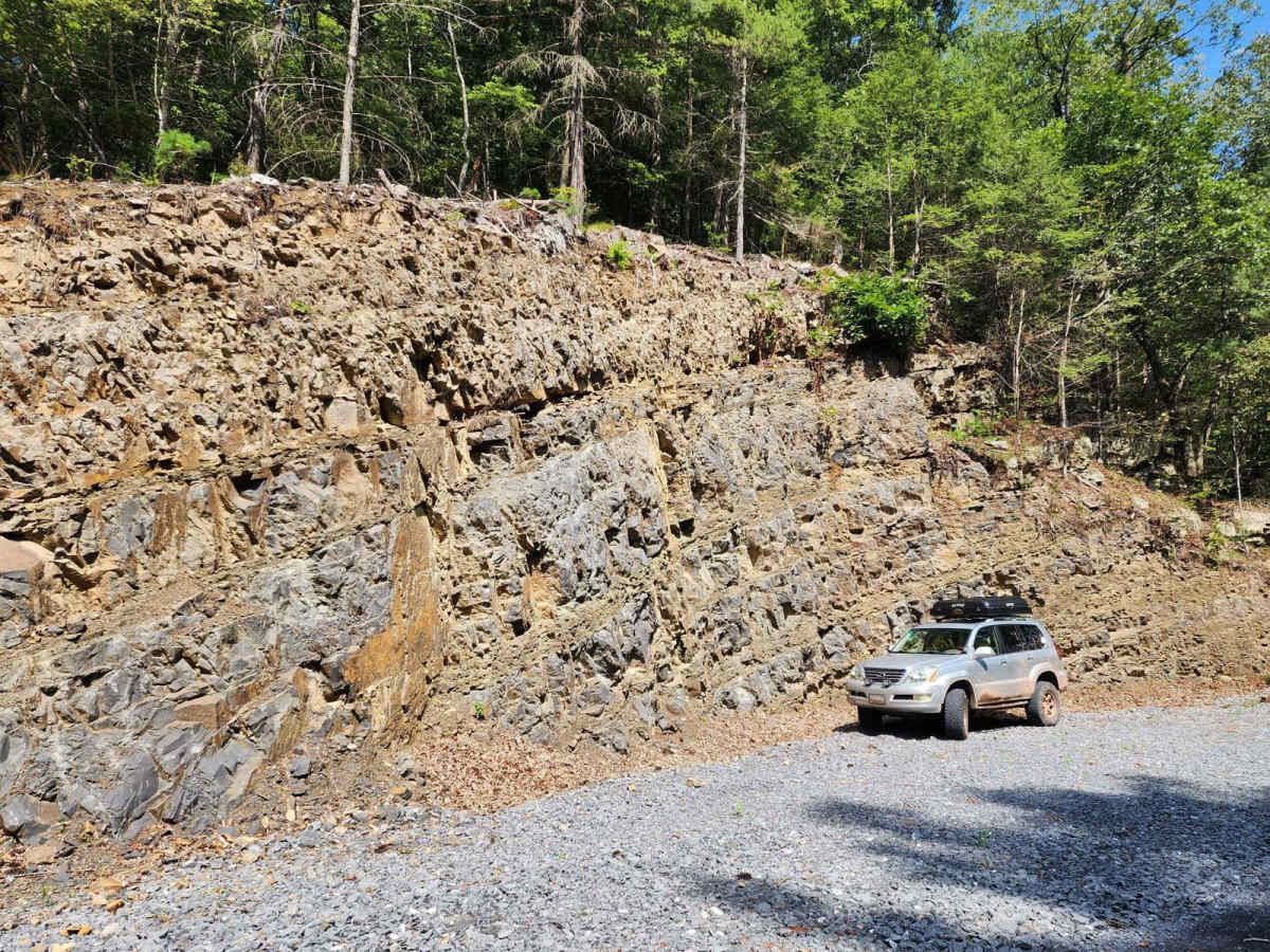
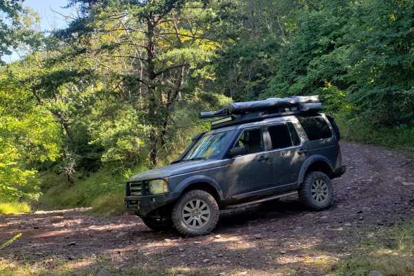
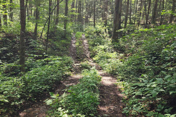
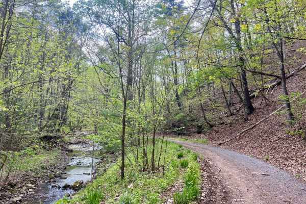
This is a semi-challenging trail that winds through valleys along the German River. As you pass through the more densely vegetated portions of the lower valleys, you can hear the German River if you leave a window down. When traveling south to north, you start with some large puddles that make up much of this trail's challenge rating. The trail then progresses through tight and rough terrain with vegetation that will commonly touch both sides of your vehicle. Although there are no particular obstacles past the puddles, the terrain is notably rough, and 4WD is necessary. As you progress, the trail becomes easier and there are several stream crossings until you come to a gravel road. Resist the urge to "let'er'rip" as the speed limit is 10mph, and much of that portion has sheer drop-offs of over 40 feet just off the road.

Photos of German River

Difficulty

This trail presents its only notable challenges on the southern end, where large puddles can be deep at the center and are best navigated along the outer edges. The remainder of the southern portion is rough and typically requires four-wheel drive. The northern half transitions to a straightforward gravel road with no technical obstacles.

Technical Rating

4

Status Reports

Add Status Report
Thomas P
Aug 08, 2025
Open
Admittedly I only ran this trail from where it connects to Old Man Run south to the Fort Seybert Trail. Other reports say this is the roughest section, however it is no where near a 5 rating. This trail is a 2. I was really looking forward to a challenge, but I was severely disappointed. There are a couple of mud holes, but they weren't deep. Even if they were completely full it would only upgrade it to a 3. The rest of the trail is fairly easy, so again in my opinion this trail is a 2. A variety of vehicles will not have a problem with this trail.
Tyler Miller
Apr 26, 2025
Open
Run the trail from south to north. Very washed out and narrow some spots had some deep mud and if you aren’t careful one mistake could send you off the edge of the ridge. Halfway through you come to the “maintained” portion of the trail very easy from there to pavement. Southern end of the trail is definitely the worse end
Red Dirt Rokon
Apr 24, 2025
Open
Tree has been removed from trail.
Max Sobol
Apr 19, 2025
Open
Running the trail north-south… north portion was gravel through private property. Got about halfway, very little trail, encountered a downed tree. Three guys couldn’t move or cut through it. Had to take the exit and went further down 81 to Union Springs to camp.
Russ Myers
Feb 01, 2025
Open
We ran the trail north to south. North half is well maintained gravel and it’s obvious that the locals don’t want through traffic. About halfway through the gravel ends and the trail can be very narrow with steep drop offs. Vegetation will touch your vehicle at times. We did slide at times in the ice and snow. There are stream crossings and mud puddles that made the trail fun. As for camping we only noticed one campsite on the trail and it is where Old Man Run intersects German River. We camped about a half mile from the southern end of the trail in a big open field. Both campsites are marked in picture.
Mark Baldwin
Jan 01, 2025
Open
Great trail.
April Upton
Dec 20, 2024
Open
The leaves are all down, so great views of the river. This trail is not hard, not a “5”
Will Garrett
Nov 25, 2024
Open
Trail was open and passable. Rating of "5" is a gross over-rating of the difficulty.
Christian Baylocq
Nov 23, 2024
Open
Bryan Dillehay
Nov 17, 2024
Open
Mud holes on the south end, but not more than 12” deep and seemed to have a hard bottom. The south end was fun, little bit of mud and rocks, tight through some trees. However 3/4 of the trail is a gravel road - just north of Old Man trail is all gravel towards the north. I plan to check out Old Man Trail next time, it’s not been reviewed in OnX yet.
Ed Murphy
Nov 09, 2024
Open
Started from the south. Tight in spots with a cliff that had us hugging the right hand side of the trail.

German River Trail can be accessed by the following ride types:

  • High Clearance
  • Full Width

German River Map

The onX Offroad Difference

onX Offroad combines trail photos, descriptions, difficulty ratings, width restrictions, seasonality, and more in a user-friendly interface. Available on all devices, with offline access and full compatibility with CarPlay and Android Auto. Discover what you're missing today!

Open Trail Map