Matt M
Jul 04, 2026
Open
Normal
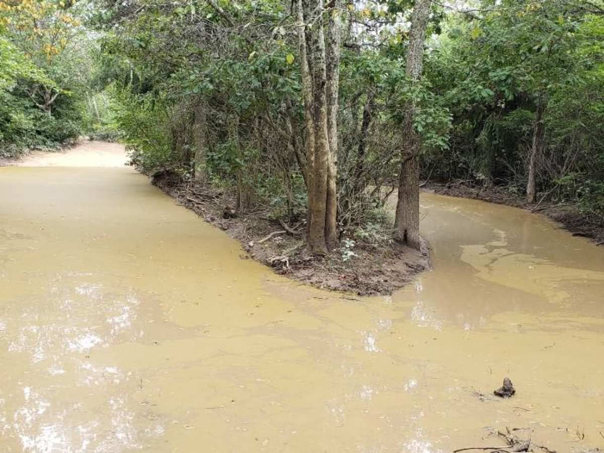
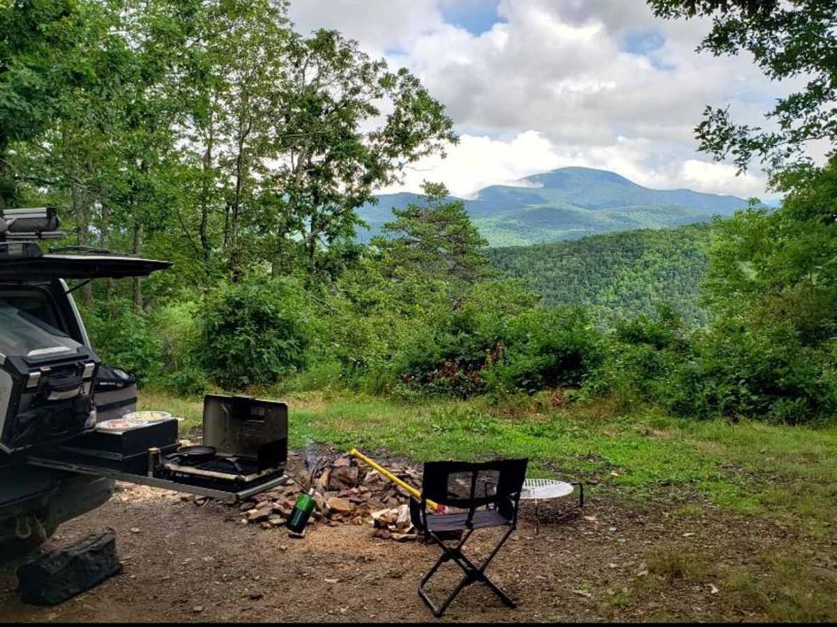
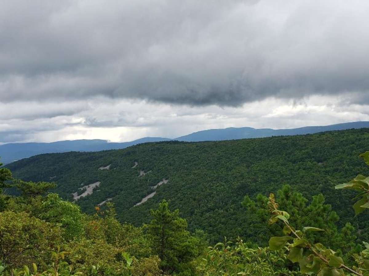
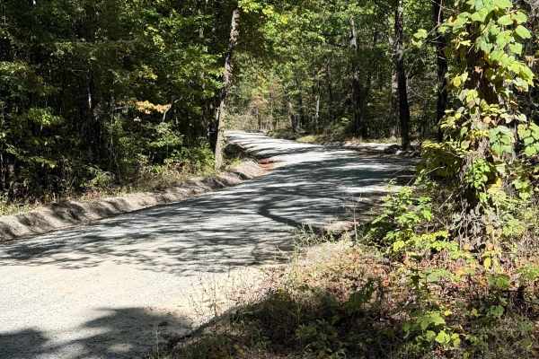
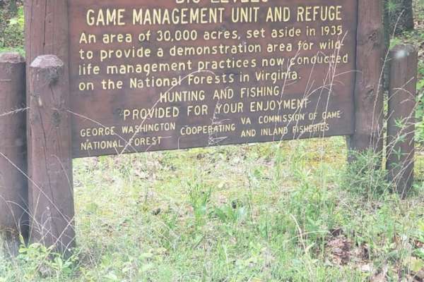
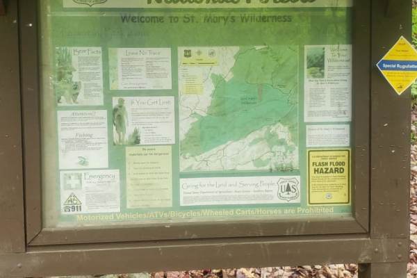
Drove Bald Mountain Jeep Trail (we always call it Big Levels) on July 4th. Found the trail to be in typical condition, if you stay away from the optional tough stuff it can be driven in just about any stock 4x4. The mud puddles at the bottom were also very shallow, our group of 5 mildly build vehicles had no issues.
Michael D
Jun 26, 2026
2023 Toyota Tacoma TRD Pro
Open
Dusty
Ran the trail north to south, starting at Coal Road. As others have noted, drought has been particularly tough on this trail. The notorious mud puddle towards the southern end with multiple bypasses was probably a quarter (or less) of what it is in the photo on OnX. No concern about flooding out or anything. Still fun to power through and definitely still the risk of getting stuck in the mud, but no risk of flooding.
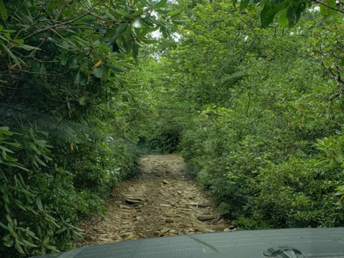
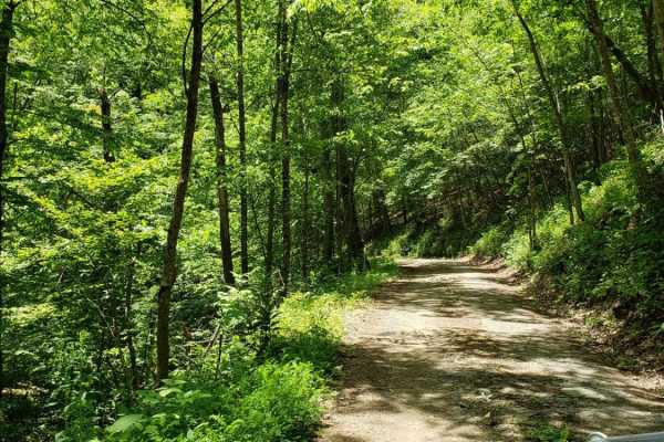
Trail is VERY dry. Plenty of obstacles, clearance is a must, however I don't think it's as bad as people say. We ran it with a stock Wrangler Sahara in our group and while there were a couple spots that required a spotter and he did skid his side rails, nothing that wasn't doable. Southern part of the trail is VERY overgrown, expect a lot of pin stripes as others have reviewed. Not a lot of places to let someone buy, so would also recommend running on a weekday. We only encountered 4-5 vehicles being on the trail for 5 hours (1 hour lunch break on the southern half).
Latham Fell
Jun 25, 2026
2018 Toyota 4Runner
Open
Fantastic trail, although a very slow one. There are small offshoots and connectors that are would be rated 7+
Jason Farneth
Jun 20, 2026
2026 Ford Ranger
Open
Dusty
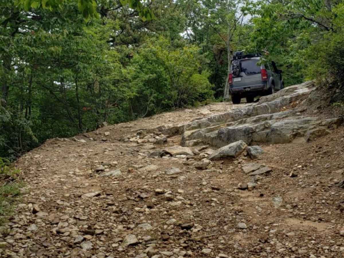
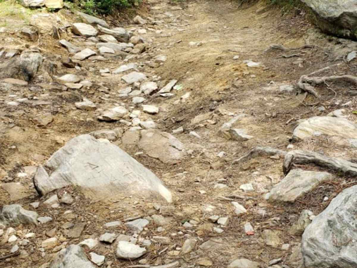
This trail was awesome! Lots of cool obstacles to clear while climbing up that required good clearance. This was our first time off-roading in my stock Ranger Raptor. I only caught the skid plate once the entire trail, and a rock rail took a little ding. Overall pretty easy to navigate for a first timer.
I knew we would be getting some pin striping, and it was pretty bad. Worth keeping in mind, a truck that wide was almost impossible to avoid the brush (mostly on the second half of the trail).
Water was mostly dried up which worked out well for a solo vehicle. Brought the entire family as a Father’s Day trip and my boys loved it.
Corbin Sanders
Jun 07, 2026
2021 Jeep Gladiator
Open
Dusty
Trail is particularly dry. Large puddles that would usually pose a challenge are rather shallow. Otherwise very dusty. We were pretty much alone on the trail. As others mentioned the brush is very narrow in spots leading to a good amount of pin striping. If the area gets more rain later in the summer overgrowth could be really bad. If you care about your paint job, this trail is not for you.
Nathan Williams
Jun 06, 2026
2024 Jeep Wrangler
Open
NormalDusty
Weather has been dry so the trail is a little dusty generally. Still has some mud puddles but they’re mostly shallow. Per usual expect pinstriping due to overgrowth. It’s not as bad right now as it will be by end of summer.
Only did the upper 1/3rd of the trail due to stopping to help not 1, but 2 broken down people at different points (I know they’d do the same for me if roles were reversed!
Mike D
May 25, 2026
Open
Muddy/Wet
The mud puddles are back! Well sort of. Not as deep as when I ran the trail on 3Jan26 but not empty like has been reported. And mostly clear water vice mud. But this remains one of my favorite trails and is close enough to make a last minute decision to head out. I took the alternate trail that cut off the first big switchback and it was the most fun part and most challenging rock crawling wise. I stopped to reconnoiter my line a couple of times but the 4Runner (with 35s) had no problem. Highly recommend the cut-off if you've got the vehicle for it.
Santa
May 16, 2026
Open
Dusty
Very dry. Water holes are just moist mud now. Pin striping should be expected.
Andrew Voorhees
May 13, 2026
Open
Normal
My first time on this trail, my friend I brought with me said all the water holes were about a foot less deep than he’s seen in the past. Lots of the more rough optional side trails have been destroyed/blocked with big rocks I assume by the forest service, but nothing to report on the main trail.
rob smith
May 02, 2026
2024 Jeep Wrangler
Open
DustyNormal
Got out early with a friend and had a great trip with almost no one else encountered. We started at the bottom and went up to the BRP. Some mud/water but not nearly as deep as they could be. Plan on pinstripes as the spring growth is coming in but definitely worth the trip. As noted, need a bit more lift and clearance on a few sections but stock 33s could make this by taking it easy. We ran on 35s and no problems.
Thomas P
Apr 26, 2026
2002 Jeep Grand Cherokee
Open
Normal
Had a lot of fun on this trail. Unfortunately all the famous mud holes were completely dry. So if you have avoided this trail due to that, now's the time to go. I will definitely be back later in the year after they fill up. It will be like a whole new trail. The alternate routes on the northern end are a bit more challenging. Definitely need a bit more clearance and articulation than the standard trail.
andy thomas
Apr 18, 2026
2015 Chevrolet Silverado
Open
DustyRough/Deteriorated
Started off of coal road. The trail is rocky from start to finish. We had a stock vw touareg with us and he needed spotted in a few spots. The rest of the group were in modified vehicles on 33s and 35s and were able to take some of the bigger steps and ledges. There was very little water in any of the water holes. You can tell drought has been bad. Quite a few sections are typical virginia trail tight so pinstriping is inevitable for most vehicles. Overall a great moderate trail that can be done in most stock high clearance 4x4s.
Jeff Staples
Apr 12, 2026
2009 Chevorlet Silverado 1500 LS
Open
Normal
All in all a pretty good time. Me and a buddy took our vehicles (Jeep and Shitverado) up the trail, pretty good rock climbs that we had to get up with standard suspension but not impossible. Not too deep of waterholes either and the mud was managable (one of the mudholes had a hidden rock and I hit my undercarriage though). We got through it though and had a ton of fun.
Barry Parham
Apr 11, 2026
2017 Jeep Wrangler
Open
Dusty
Fun, rocky trail that requires some clearance.
Water holes were dry.
Chris B
Apr 04, 2026
Open
Normal
6 dirt bikes and very little water. As always I enjoy this trail. Some pinstripes should be expected.