Brian Wimberly
Jun 16, 2026
Open
Beautiful ride. I thought the trail was more technical than a typical 4. Had the family in tow, which is our norm. Throughout much of the trail, you’re riding on the edge of a steep drop off with no rails or barriers. There are a few different sections that are challenging for a stock Teryx, but manageable. Even with very slow speed and choosing our lines, we rubbed a number of times. - However, when you get to the upper section of the trail, about 3/4 of the way in, the trail becomes technical enough that I was not comfortable proceeding.
Tyson Clay
Jun 14, 2026
Open
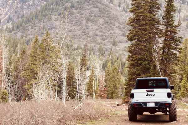
Just wrapped up the first shakedown run in the '04 GX! Aired the 33s down to 20 PSI, but definitely found the truck's current limits. The center locker is great, but when the suspension got fully flexed, the open front/rear diffs left me spinning tires. I kissed a few rocks with the lower control arms and picked up some trail pinstripes—nothing major, but skid plates are officially moving to the top of the list.
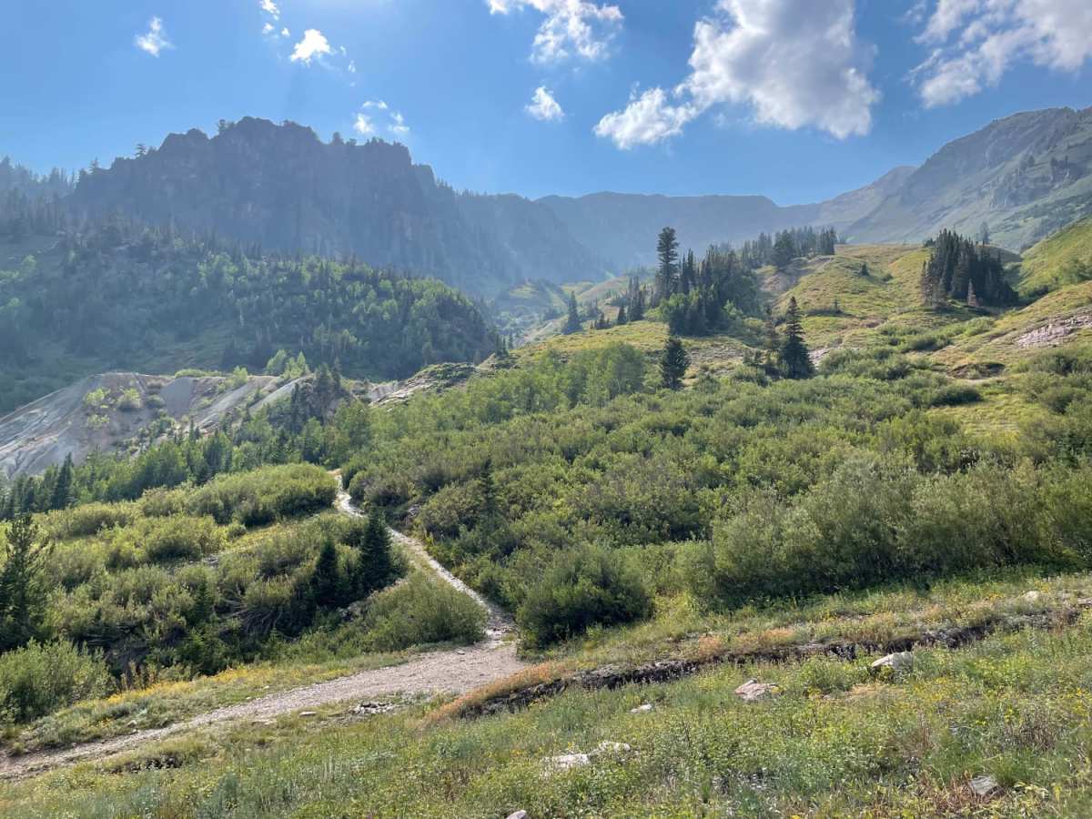
I pushed about 100 yards past the meadow and mine tailings near the top where the trail gets real nasty, and finally met my match at a steep rock obstacle. My approach angle and lack of true lockers stopped me cold. Backing down that tight 100-yard section took a brutal hour and a half! I realized even if I stacked rocks, the next ledge required lockers anyway, so I called it before getting stuck too deep. Super fun day, but now I've got a build list to work on! 2 Pictures showing said obstacle that persuaded me to back down.
Tyler Sauer
May 31, 2026
Open
Snow over the road near the top. Gorgeous trail!
Mike walker
May 24, 2026
Open
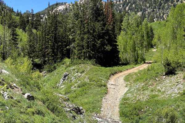
We figured we could tackle this trail with the description and the rating of a 4/10. I do not have the most experience but we have been on some 5-6 rated trails so we thought we would be ok. Quickly realized it was way more than we wanted. Definitely a small single track trail. No real areas to let other pass. Once we found the big rock (about 1.5-1.75 miles in) to turn around at we did. It was like a 6 point turn but we made it. Highly recommend a lift. We hit twice and i really thought my angles were good to prevent it.
Patrick Jorgenson
May 17, 2026
Open
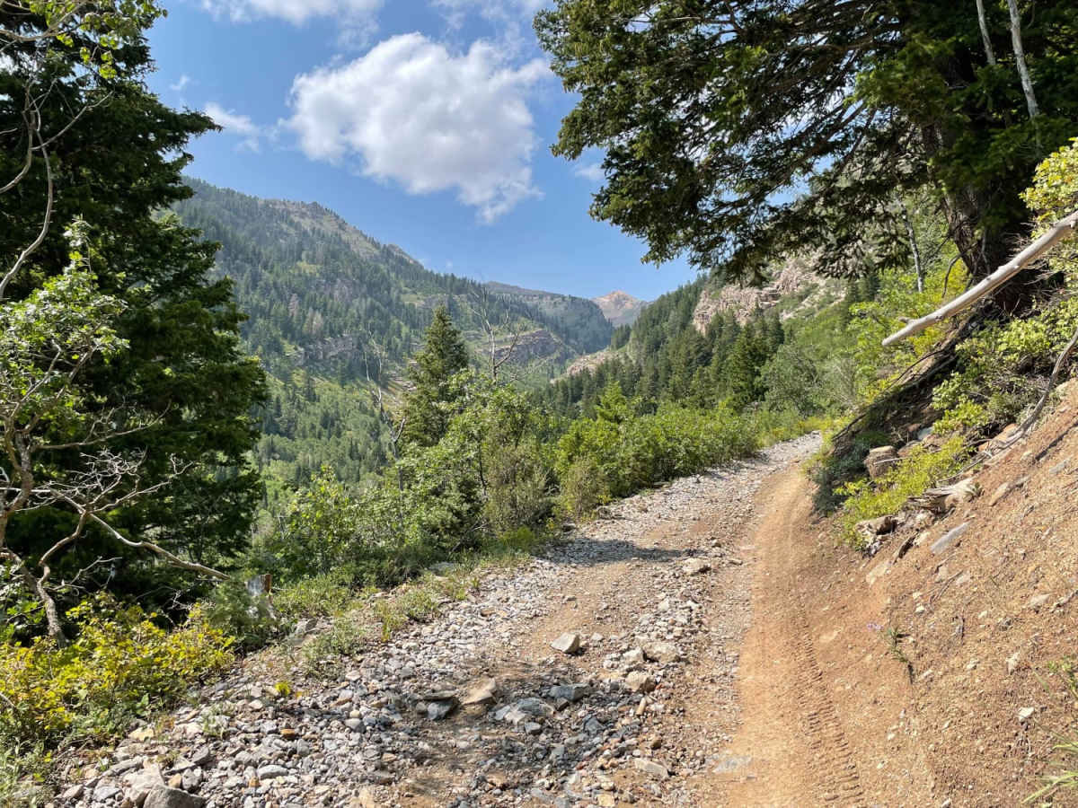
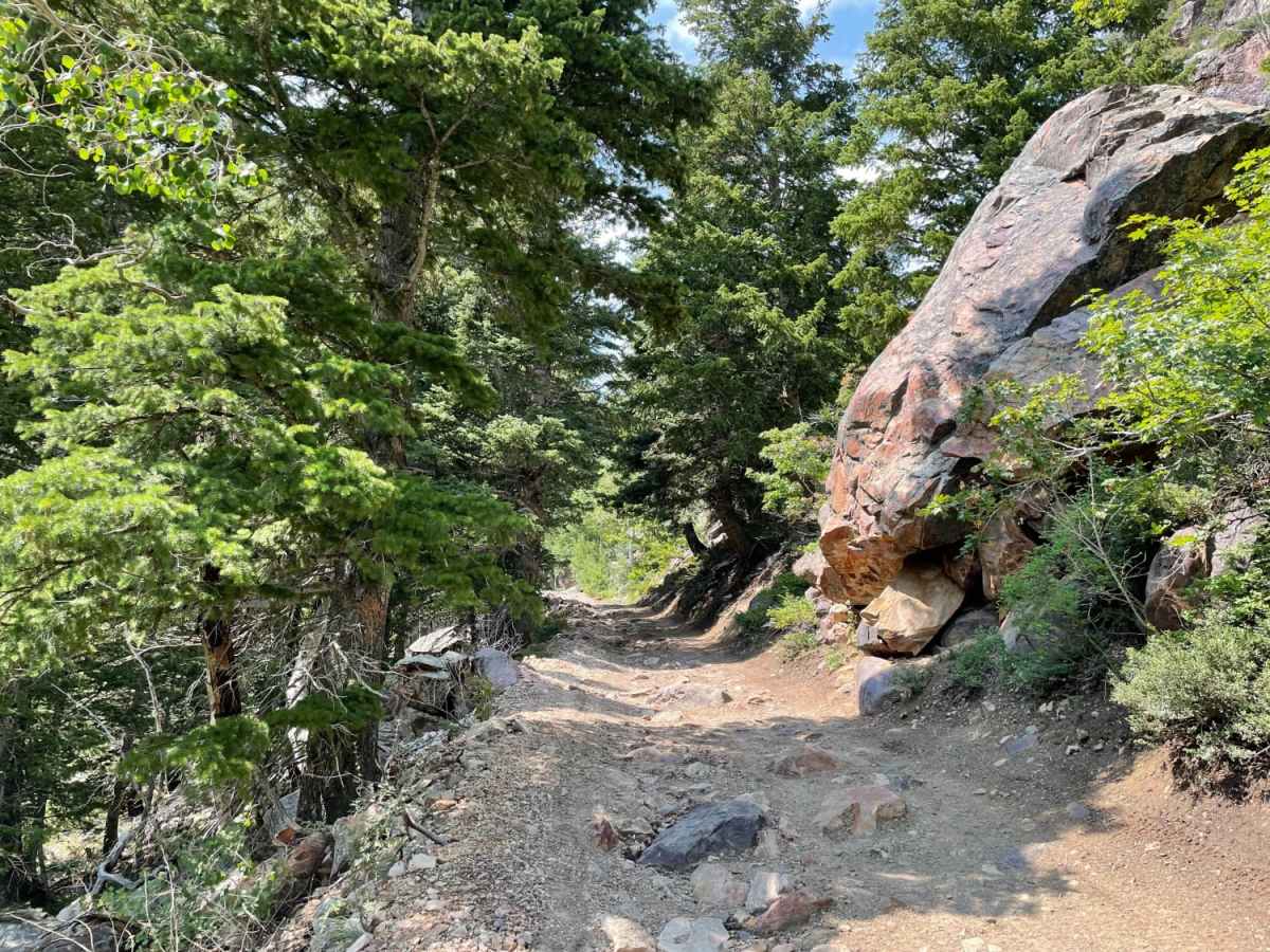
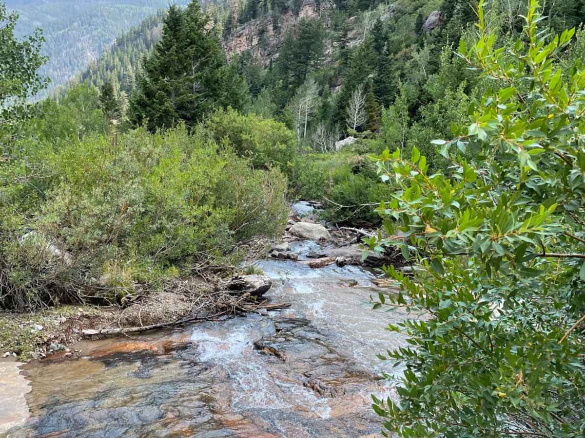
This trail is very rocky for the vast majority of the trail. Once you get past the beginning of the trail it’s a one car length road with very few turn offs to let others pass. This is also a very rocky trail. Many sections with big boulders and pointy rocks that need proper tire placement. We did not make it all the way. We turned around at a spot where there is a massive boulder as we were told after that it gets very steep and sketchy by a SxS that passed us. If you don’t like rocky trails this is not for you. There is also a big section with a steep fall off. Good views though.
Travis Anderson
Nov 27, 2025
Open
This better fits a 5/10 rating at least from what the description says. Most of the trail is pretty rough, it’s decently tight and almost no turn around or passing points. You’ll pass through a gate after around 300 yards, and it progressively gets harder while still being a shelf road. The final turn around point before it gets up towards being a 5-6 rating is a huge rock on the mountain side. It gets into shelf rocks and yoga ball sized boulders down to basketball sized rocks. Tacoma with 2” lift and 32s scraped in a good couple spots. Also used my rock sliders in a couple places. This is a good challenging trail. Past the mine turnoffs it gets even more difficult and we turned around at that point. A short hike partially through the river up to the mines gives you quite the view of the canyon you just came up. Expect some pinstripes and scrapes. Pick your lines carefully and be aware of your tire placement so as not to fall off the road.
Brent Roper
Nov 01, 2025
Open
Trail has a few challenging obstacles during the first third but gets much more challenging past the mine area. Not really passable beyond that without a rear locking differential. Having 35” tires and good clearance is highly recommended. DO NOT go to the very end of where this trail is marked. Loose rock from a rockslide makes it extremely dangerous to turn around on. I witnessed a SxS go to the end, slip and roll/flip down the mountain about 600 feet and 175 ft vertical decent. A 6-point harness, sufficient roll cage, and more than a few angels allowed the driver (no passengers) to survive with two deep head lacerations and a concussion. 🙏🏻
Christopher Patterson
Sep 27, 2025
Open
First off road trail in our bronco Sasquatch. Was pretty scary not gonna lie but the rig was capable. We got a late start so turned around at the first option. Made it like 1/3 of the way up. Beautiful trail in. Did Cummings in to American Snake then Mill Flat out. Lowered to 21 psi. Def plan 3 hours for Mary Ellen Gulch. Going down is slower going than going up.
jake collings
Jun 01, 2025
Open
Ben Randle
Jun 01, 2025
Open
Mark Adams
Sep 21, 2024
Open
Last portion of the trail is obstructed due to multiple rockslides. Unable to see down into Mineral Basin. Other than that trail is in good shape!
Z B
Aug 17, 2024
Open
The trail was a little bit rougher than expected, but eas for a land cruiser on 37" mud tires and high clearance. There was one obstacle where I had to get out of my rig and be selective about my line. An '88 Toyota pickup on 31" AT tires was able to make it to the top and limped off the trail with a torn CV boot.
Dylan Jensen
Jun 09, 2024
Open
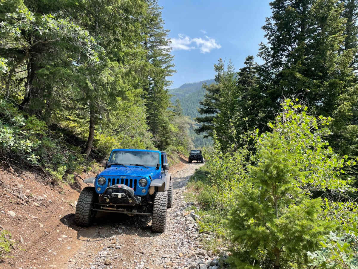
Trail was rough… super overgrown. We had a group of 9 rigs including 4 ford raptors and it was a squeeze. Unfortunately only made it about 60% of the trail. Had to turn back due to time.
Solomon Enis
Nov 04, 2023
Open