
Off-Road Trails in Nebraska
Discover off-road trails in Nebraska
Off-Road Trails in Nebraska
Discover the best off-road trails in Nebraska. Browse trail maps, check difficulty ratings, and find your next adventure — whether you're looking for a quick ride or an all-day expedition.
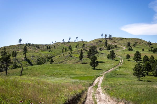
Little Wolves
The three trails that comprise this route are all at or just under 3 miles long. The first two-thirds (Little Wolf East and Highline) are well-maintained gravel;most of the last third is dirt - a portion of which washes out and creates deep, wide ruts. Several areas of the trail also collect runoff ...
Learn more about Little Wolves
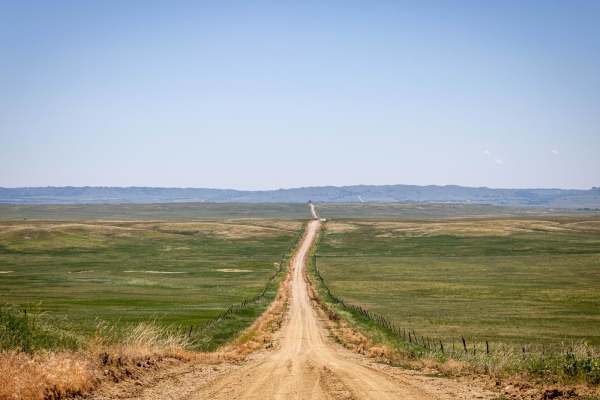
Pants Butte Road
From north to south, Pants Butte Road takes you through part of western Nebraska that makes you feel like you're driving through a painting. At both ends of the road, you're able to see for miles and miles, and the views do not disappoint. The road surface on the north half is mostly graded dirt, ev...
Learn more about Pants Butte Road
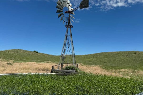
Sandhills Mills (NFR 261)
Typical of several national forest roads in the Bessey Ranger District, this trail serves primarily to provide access to water sources for livestock being maintained on the property. Care should be taken to avoid startling any cattle while driving the trail. The trail itself is a two-track sand and ...
Learn more about Sandhills Mills (NFR 261)
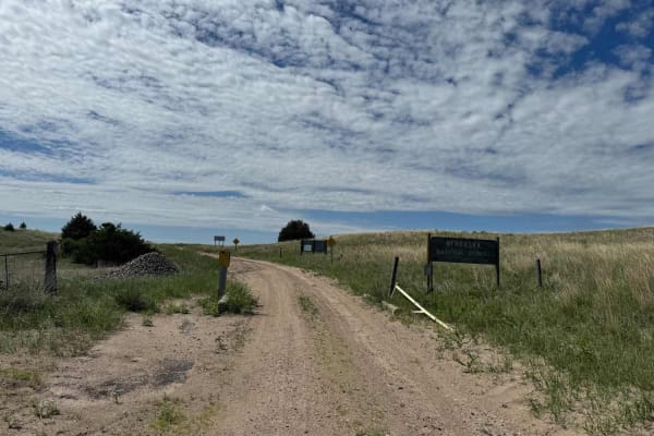
Gaston Road - NFR 259
Gaston Road is a scenic trail that runs primarily north-south near the western border of the Bessey Ranger District of the Nebraska National Forest and Grassland (near Halsey, NE). Although there are occasional reminders that the surface was once asphalt, the road surface varies between sand, gravel...
Learn more about Gaston Road - NFR 259
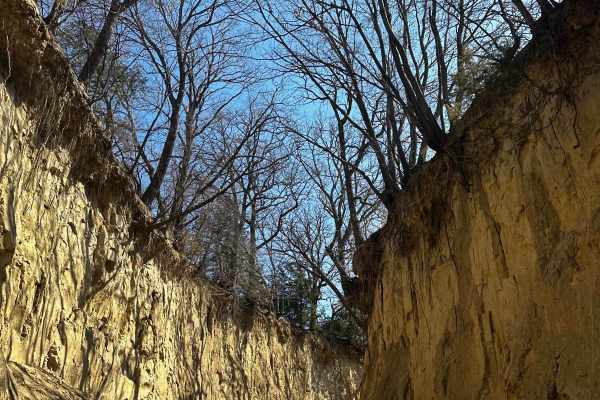
Waubonsie Creek Trail - Pathfield Road
This trail has beautiful side walls that go up to 20 feet on some parts. There is a bridge at the halfway mark that crosses Waubonsie Creek. On the other side of the bridge, the trail goes to an incline at a steep angle that, if muddy, you will need 4WD.
Learn more about Waubonsie Creek Trail - Pathfield Road
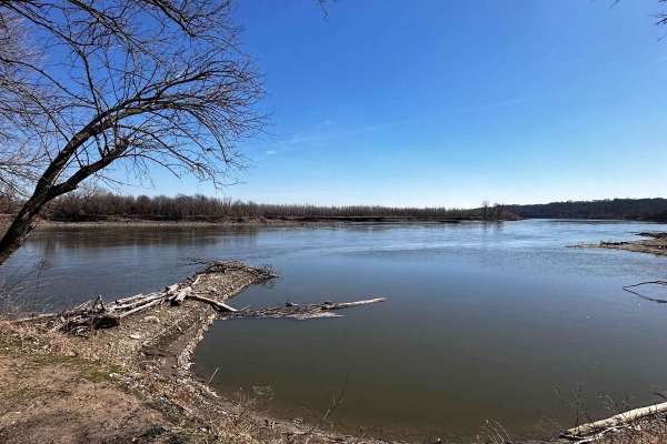
Riverside Dirt Trail - 735A Road
The start of the trail is easy to get to--right outside of the Peru town and the Peru College campus. The Missouri River can be easily viewed and accessed throughout the trail. There is a boat ramp that's easily accessible when in dry conditions. Camping and fishing are free around this location. Pa...
Learn more about Riverside Dirt Trail - 735A Road
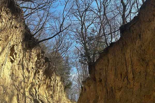
Mud Slinging Trail - Raleigh Road
At the beginning of the trail, there is a small bridge. Halfway into the trail, there is a small stream that makes a small drop down that can catch you off guard. After the small stream, there is a 35-degree incline that can be very difficult when the ground is muddy. This trail also has beautiful s...
Learn more about Mud Slinging Trail - Raleigh Road
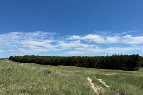
Tree Line
Tree Line is very near the center of the Bessey Ranger District of the Nebraska National Forest and Grasslands (near Halsey, Nebraska). The trail connects with South Natick Road on the west, and Circle Road on the east. The trail surface is primarily sand with grass. The western third of the trail i...
Learn more about Tree Line
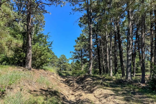
Horseshoe Bar
Horseshoe Bar runs east-west across the middle portion of the northern half of the Bessey Ranger District of the Nebraska National Forest and Grassland (near Halsey, NE). The trail has a seasonal restriction - it is closed to motor vehicle traffic from September 1 through November 30. The trail is t...
Learn more about Horseshoe Bar
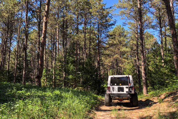
Three Camps (West) - NFR 201-2
Three Camps (West) runs east-west across the middle portion of the northern half of the Bessey Ranger District of the Nebraska National Forest and Grassland (near Halsey, NE). The trail has a seasonal restriction - it is closed to motor vehicle traffic from September 1 through November 30. The trail...
Learn more about Three Camps (West) - NFR 201-2
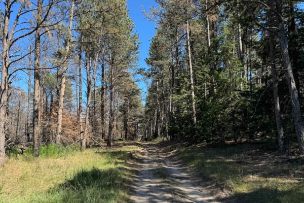
Three Camps (East)
Three Camps (East) is one of the few trails in the Bessey Ranger District of the Nebraska National Forest and Grassland (near Halsey, NE) that stays in the forested area for its entirety. Both ends of the trail connect to the eastern segment of Circle Road - the main loop around the 90,000-acre fore...
Learn more about Three Camps (East)
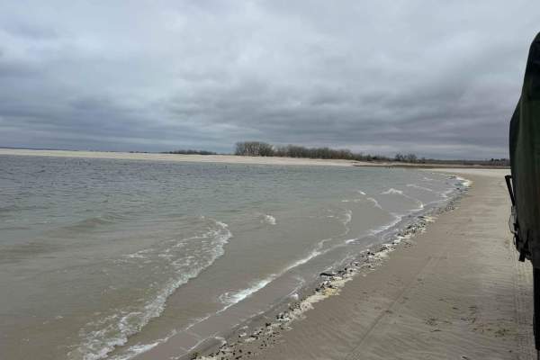
Lake Mac Shoreline Cruise
This is a quick, casual, scenic shoreline cruise at Lake McConaughy. Due to the soft sand, a 4x4 is required. Nebraska Game and Parks requires a park pass for lake use. This is an excellent path for beginners or those looking to take in some scenery leisurely.
Learn more about Lake Mac Shoreline Cruise

South Natick 212S
The trail is mostly sand, deep in several areas along it. It has overgrowth to its sides, and it will lead you through open prairies with some nice views off in the distance. A portion of the trail is marked by a sign as 4x4 only, but the USFS trail data makes no mention of this. There are some mino...
Learn more about South Natick 212S
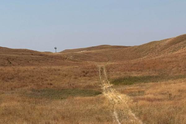
Double S - 263
This is a 2 track trail sandy that is overgrown in parts which makes identifying the trail tracks tricky at times. The middle section of this trail also has some very deep ruts and washouts to be on the lookout for. These deep ruts and washouts are hard to see due to the trail grass overgrowth so ca...
Learn more about Double S - 263
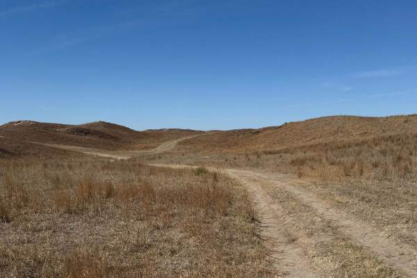
Pine Strip - Forest Road 202
This is mainly a sandy 2-track trail that is overgrown in many areas with minor washouts and ruts. The trail is comprised of medium-packed sand and loose semi-deep sand. The tracks are difficult to follow in some areas of the trail, so caution is advised. There are cattle gates that must be opened a...
Learn more about Pine Strip - Forest Road 202
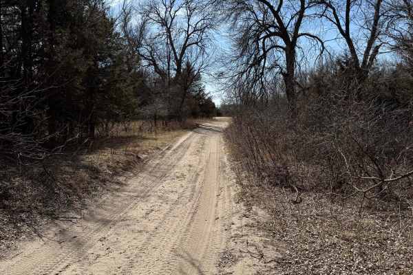
Forest Road 214-2 - County Line
Warning for those towing a camper or trailer: This trial starts or ends at Whitetail Campground. This is a very popular campground. There are several very steep ascents and descents with very deep and soft sand. There are also areas where the tail is very narrow with sloping berms on both sides. The...
Learn more about Forest Road 214-2 - County Line
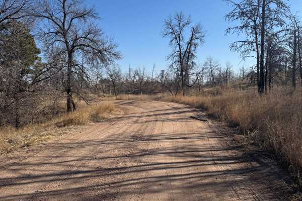
Forest Road 203 - Circle
This is a main trail in the Nebraska National Forest. It will allow access to many other trails in the forest network along with access, via offshoot trails, to Natick Campground and Whitetail Campground. The trail is mainly comprised of hard pack and medium to soft sand. There are areas of washboar...
Learn more about Forest Road 203 - Circle
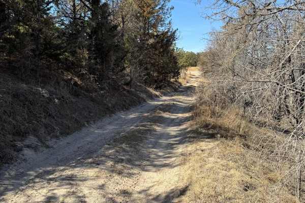
Forest Road 201-1
This is a short connecting trail that will lead you to other trails in the network of forest trails. The trail surface is primarily sand, with dirt and grass. The trail runs through a few spots of dense forest where pin striping is possible. Washouts and rutted areas are present. There may be tree d...
Learn more about Forest Road 201-1
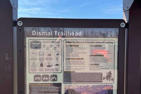
Forest Road 223 - Scenic
This is a main trail that will be accessed by many from the Bessey Recreation Center. The trail is short but caution should be used by those with a rooftop tent or a top-heavy vehicle as this trail will put you off-camber. The trail is very narrow with soft and deep sand. The trail also has a few ar...
Learn more about Forest Road 223 - Scenic
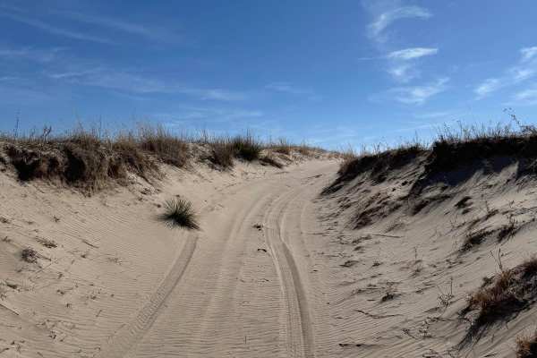
Forest Road 277 - Whitetail / Weggener
This trail will lead you to, or from, Whitetail Campground. The trail has areas of hard to medium-packed sand with areas of soft sand. There are a few areas where the sand is also semi-deep. Those pulling a camper or trailer should have no issue reaching the campground from this trail. The trail has...
Learn more about Forest Road 277 - Whitetail / Weggener
ATV trails in Nebraska
Explore ATV-friendly trails in Nebraska. These trails are accessible for vehicles up to 50 inches wide, perfect for ATVs and smaller off-road machines.
Little Wolves
The three trails that comprise this route are all at or just under 3 miles long. The first two-thirds (Little Wolf East and Highline) are well-maintained gravel;most of the last third is dirt - a portion of which washes out and creates deep, wide ruts. Several areas of the trail also collect runoff ...
Learn more about Little Wolves
Pants Butte Road
From north to south, Pants Butte Road takes you through part of western Nebraska that makes you feel like you're driving through a painting. At both ends of the road, you're able to see for miles and miles, and the views do not disappoint. The road surface on the north half is mostly graded dirt, ev...
Learn more about Pants Butte Road
Waubonsie Creek Trail - Pathfield Road
This trail has beautiful side walls that go up to 20 feet on some parts. There is a bridge at the halfway mark that crosses Waubonsie Creek. On the other side of the bridge, the trail goes to an incline at a steep angle that, if muddy, you will need 4WD.
Learn more about Waubonsie Creek Trail - Pathfield Road
Riverside Dirt Trail - 735A Road
The start of the trail is easy to get to--right outside of the Peru town and the Peru College campus. The Missouri River can be easily viewed and accessed throughout the trail. There is a boat ramp that's easily accessible when in dry conditions. Camping and fishing are free around this location. Pa...
Learn more about Riverside Dirt Trail - 735A Road
UTV/side-by-side trails in Nebraska
Find UTV and side-by-side trails in Nebraska. These trails accommodate vehicles up to 60 inches wide, ideal for UTVs, side-by-sides, and wider off-road rigs.
Little Wolves
The three trails that comprise this route are all at or just under 3 miles long. The first two-thirds (Little Wolf East and Highline) are well-maintained gravel;most of the last third is dirt - a portion of which washes out and creates deep, wide ruts. Several areas of the trail also collect runoff ...
Learn more about Little Wolves
Pants Butte Road
From north to south, Pants Butte Road takes you through part of western Nebraska that makes you feel like you're driving through a painting. At both ends of the road, you're able to see for miles and miles, and the views do not disappoint. The road surface on the north half is mostly graded dirt, ev...
Learn more about Pants Butte Road
Waubonsie Creek Trail - Pathfield Road
This trail has beautiful side walls that go up to 20 feet on some parts. There is a bridge at the halfway mark that crosses Waubonsie Creek. On the other side of the bridge, the trail goes to an incline at a steep angle that, if muddy, you will need 4WD.
Learn more about Waubonsie Creek Trail - Pathfield Road
Riverside Dirt Trail - 735A Road
The start of the trail is easy to get to--right outside of the Peru town and the Peru College campus. The Missouri River can be easily viewed and accessed throughout the trail. There is a boat ramp that's easily accessible when in dry conditions. Camping and fishing are free around this location. Pa...
Learn more about Riverside Dirt Trail - 735A Road
The onX Offroad Difference
onX Offroad combines trail photos, descriptions, difficulty ratings, width restrictions, seasonality, and more in a user-friendly interface. Available on all devices, with offline access and full compatibility with CarPlay and Android Auto. Discover what you're missing today!
Open Trail Map