Hunter Johnson
Mar 01, 2026
2023 Jeep Gladiator
Open
NormalMuddy/Wet
They have graded the climb up the mountain and down to the creek, which saves at least 30 minutes of time. 16 creeks is a very fun / mild trail for those wanting to get some off-roading experience. I would highly recommend at least 31 10.50’s and a small lift for this trail. Some sections could get a stock height rig hung up.
Ethan Rogers
Nov 15, 2025
Open
Muddy/Wet
tom s
Sep 21, 2025
Open
NormalRough/Deteriorated
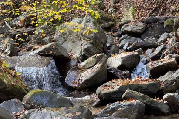
Only had time for few miles. creek Crossings are cool some spots the creek is the trail lots of rock gardens. Is roughish in Runner but all good cool area
David Berry
Aug 31, 2025
2022 Jeep Gladiator
Open
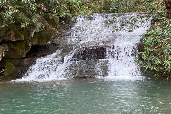
Great trail! The side trail to the top has the most amazing views. One washout that I shouldn’t have crossed but did. The trail had everything from rocks, to mud, to water.
Hunter Johnson
Aug 16, 2025
Open
Normal
Trail was rather easy / flowing with some technical sections. The wash out was a bit sketchy and had to use a makeshift bridge get over it. I would definitely recommend 35’s or bigger for this trail unless you wanna be on skids the whole time
Kyle Muller
Jul 24, 2025
Open
Muddy/WetRough/Deteriorated
Expect pinstripes. We got on the trail (North to South) at 6pm and we were on it until 11:30 at night granted we did get lost for about an hour… it was washed out and had puddles to the bottom of my doors no biggie would have felt a lot more comfortable with a winch tho we didn’t need it. The area we ended up lost in was the intersection of 16 creek and 16 creek Trl when you get to that 4 way take a left onto 16 creek Trl (the right dead ends and straight is overgrown) once you get back on 16 creeks a little ways down there is a tree down with a bypass up the hill after that it was pretty clear.
Jason Crownover
Jun 21, 2025
2023 Jeep Gladiator
Open
DustyMuddy/Wet
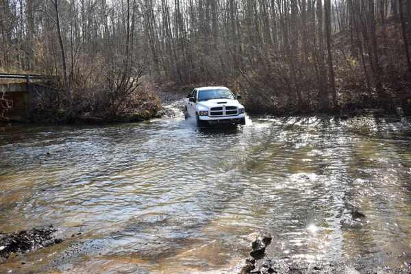
Trail started out fairly easy gravel road with an easy switch back. Then a washout / off camber section before you hit the more technical parts. You will then have several small rock sections, off camber, creek crossing (per the name) and mud puddles (hard bottoms) I suggest still checking the depth. The trail is tight for bigger vehicles, Gladiator received alot of new pin stripes. This is a two way trail. It took me 3ish hours with the removal of one down tree blocking the trail.
austin robinson
May 26, 2025
Obstructed
Washout
Had a group of 15 there’s a washout just before you get off the more well maintained gravel part just before you get down into the more technical parts we had no issues with the wash out one spotter and we all made it through was raining lightly when we went until the washout is cleared I’d avoid going alone
Matt Fallow
May 03, 2025
Obstructed
Washout
Large washout near the western end of the trail. Trail was muddy and sloped towards the washout. We had a group of five and were able to use a winch on the front to pull and one on the rear to keep it pulled uphill to get across. More rain will only make this section more treacherous.
dakota oakes
Apr 07, 2025
2008 Kia Sorento
Obstructed
Washout
garrison hurter
Mar 14, 2025
2017 Jeep Wrangler
Obstructed
Washout
16 creek trail was very washed out and rugged, and once you get to the top, or as you come in, depending on how you get to the trail, are two possible, impassable at this point after this rain, wash outs.
Neil Rasor
Feb 08, 2025
2019 Chevrolet Colorado
Open
Muddy/Wet
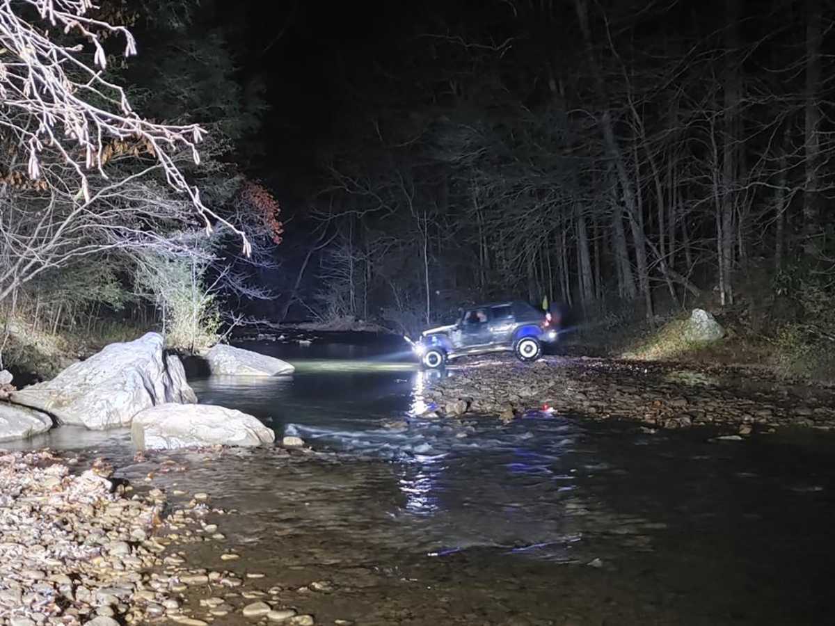
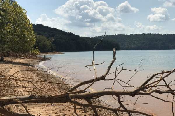
The trail was in good condition. Lots of mud and mud holes. Creek crossings were fun, the water level was normal for this time of year.
Richard Sears
Jan 02, 2025
Open
Muddy/WetRough/Deteriorated
Entered at Coal Plant working toward Pineville. Stopped several times for taking in the views and made trail in 2hrs total. Gravel road about a mile in had washed out ruts as you go up hill, easy placement kept things moving not any big deal. Long mud puddles with solid bottoms, some rather deep, likely due to fast drop-ins from others approaching half way in trail. Creek crossings were 12-18” deep in spots. Water levels seemed ok, was cautious going into trail but it was fine through the creek passes honestly. Some roads are misleading but obvious roads. Stay on the trail as there are places others have not.
Sierra Wallace
Nov 24, 2024
Open
Muddy/WetRough/Deteriorated
Ruts and rocks are pretty rough, DEFINITELY NOT A FOUR!!! Would not recommend bikes or anything lower than my stock. We made it about 1/3 way down from the pineville side and had to turn around due to the condition of the trail. Not well marked either with a lot of run off that can get you lost so pay attention. It was a fun and muddy time but I wouldn’t recommend for stock vehicles - go prepared to get stuck in thick mud. I would rate it a 6, 5 at minimum - 4 is very inappropriate for its current condition. Definitely has mud holes that simply don’t dry regardless of rain because it’s been a minute since it rained and the mud holes and stretches between were wet and juicy still. Four seater and lifted vehicles would have better luck.
Mark Napier
Nov 02, 2024
2015 Chevrolet Silverado
Open
NormalMuddy/Wet
Some technical rocky sections and large mud holes but was passable by a stock 4wd Silverado and Rivian R1T