Thaj
Dec 26, 2025
2018 Toyota 4Runner
Open
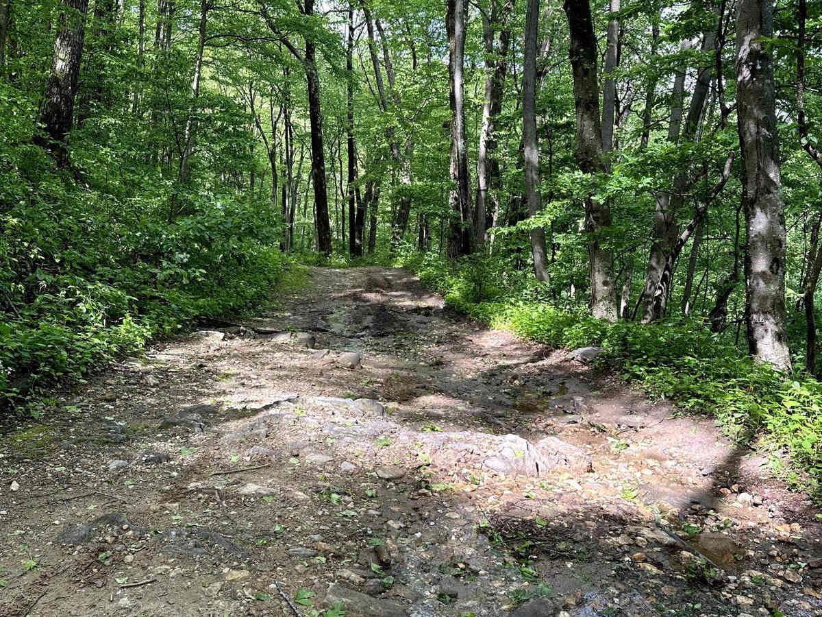
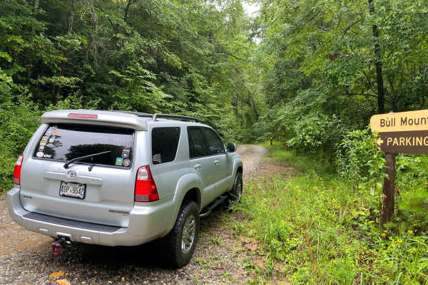
Started on Old Bucktown road going uphill. Starts off with a rutts that definitely require 4x4, but the stock 4Runner cleared it. Later up the trail there is a deeper rut with large rocks about 6-8 inches tall, but there is a bypass. It's took about 2.5 hours from Old Bucktown and exiting on Nimblewill Road. Old Bucktown is fairly rocky and has a few rutted areas. There were a few spots where we got pretty articulated. Definitely would be more challenging after rain. Once you get to the top there's a large clearing with a walking trail and connection to Nimblewill. Nimblewill is pretty flat, and mostly gravel with some rocks. 4x4 and high clearance required, but our stock 4Runner fully loaded did just fine. Super fun trail!
Nathanael Cordero
Dec 22, 2025
2024 Ford Bronco
Open
Normal
George
Dec 22, 2025
2023 Ford Bronco
Open
Rough/Deteriorated
Old Bucktown Road portion. At 34° 37.374' N, 84° 13.997' W on the trail is are quartz rocks that have been exposed. Stock Bronco Badlands on 33s did not have enough clearance to find a path. But, there is a bypass downslope side.
Cesar H
Dec 21, 2025
Open
NormalMuddy/Wet
Only somewhat complicated part of the trail is in the beginning after that it’s mostly rocky. I was able to do this with a full sized truck.
Justice Gore
Dec 13, 2025
2004 Jeep Wrangler
Open
BEAUTIFUL Trail. I went up in my Jeep and found it to be extremely passable. 4x4 was not needed. There are a few tight spots that will make it difficult to pass opposing traffic, and some of the offshoot trails have foliage that may leave you with some pinstripes. But if you know how to use the OnX map, Nimblewill and its side trails will spit you out right out at the top of Amicalola Falls. We ran into a gentleman with a Lexus SUV that followed my Jeep the whole way, explore with confidence! I look forward to coming back and enjoying one of the many camping spots available on this route. My only complaint is the volume of trash left in the campsites by past visitors. So if you come out, bring a trash bag or two with you and haul out an extra bag of trash to keep this place beautiful!
Darin Clubbs
Nov 24, 2025
2013 Toyota Sequoia
Open
Normal
Nice views with the leaves gone. Just went to the summit and took Amicalola down. A little damp here and there, but did it in 2WD with no issues.
Kevin Borah
Nov 08, 2025
2011 Subaru Outback
Open
Lyndon Pham
Oct 31, 2025
2025 Subaru Outback
Open
Muddy/WetRough/DeterioratedWashboard
From North to South, the trail begins as Old Bucktown Rd with some manageable but rough and eroded ruts. Once you get about 1/4 mile in there's a ledge and rock garden that has been severely eroded from the recent rains and is easily a 5-6 rating difficulty. There is a bypass route to the left that allows you to circumvent the worst of the obstacle. Afterwards, the trail is much easier, albeit very rocky with rocks up to a foot out of the ground along with multiple mud pools. This continues until you reach the very top where Old Bucktown Rd meets Amicalola FS46 and Nimblewill Rd. The rest of the trail becomes a 4 at worst and a 3 at best as you descend down to the primitive camping sites.
Joe Burch
Oct 30, 2025
2022 Jeep Gladiator
Open
Muddy/WetRough/Deteriorated
The rain hasn’t done the north side any favors. If you’re on less than 35’s I’d let it dry out a bit. Challenging but fun trip. I’ll leave my rating at a 4 but the mud and wet made some spots feel a bit more than that.
Sergio Murillo
Oct 10, 2025
2016 Ford F-Series
Open
Normal
Nice trail, not allot of camping spots for those who are looking specifically for dispersed camping.
Mike Doucette
Sep 28, 2025
2025 Jeep Wrangler
Open
The trail is open. We took the trail and cut through to the back side of amicalola falls. We had the opportunity to check it out. The first half of the trail had a few challenges but was manageable and fun.
Cory Rich
Sep 26, 2025
Open
I ran this friday and did not encounter the limb, however I ran it at night so unless I just completely missed it I believe its gone now :D
Chris K
Sep 20, 2025
2024 Toyota 4Runner
Obstructed
Downed Tree
Downed tree obstructing the road. We were able to move and break off limbs to allow vehicles under 6’5”. Use caution. Other than that trail is open
Dustin Curbow
Sep 19, 2025
2025 Jeep Wrangler
Obstructed
Downed Tree
Not too far in large tree down and unable to pass
Playnhooky_ Overland
Sep 18, 2025
2016 Jeep Wrangler
Obstructed
Downed Tree
heading up from the south side about halfway up there's a downed tree. we are in a Jeep Wrangler on 37s and we were an inch too tall to get underneath. it's about 18 in around and we didn't have a chainsaw with us.