Baker Pass

Total Miles14.9
Technical Rating
5Moderate
Best TimeSummer, Fall
Trail TypeFull-Width Road
Accessible By
Open Trail Map

Trail Overview

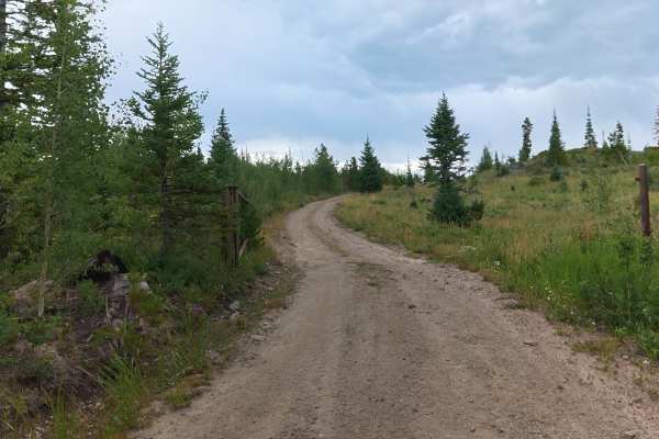
This is a fun trail with little use, and amazing views above 11,000 feet. There are side roads to check out, including one that takes you to a very cool restored log cabin. There is also the loop to the top of Owl Mountain. Unlicensed vehicles are permitted. No seasonal gate closures.

Photos of Baker Pass

Difficulty

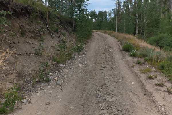
Moderate. First 11 miles is bumpy in places but fairly eay. Last 3 miles is narrow, steep and rocky. Oversize vehicles not recommended. Suitable for stock, high-clearance SUVs.

History

News of a silver strike on Jack Creek spread quickly back in the early 1880s. As prospectors flocked to the area, the population of Teller City grew to over 1300 by the end of 1881. A post office operated from 1880 to 1885. During that time, the town had two newspapers, a drugstore, a blacksmith shop, a doctor, a general store and an astonishing 27 saloons.

Technical Rating

5

Status Reports

Add Status Report
Kade S.
Aug 04, 2026
Open
NormalDusty
Great trip. Plan on taking most of the day. This is a crawl in 4low the whole way up and back from Teller City at least. Steep, rocky, some mud/water, etc. easy work for a stock JK Rubicon. Definitely need high clearance and low range. View from the top was awesome. Teller City ghost town is worth checking out too.
TJ Perry
Apr 19, 2026
Open
Muddy/WetSnow/Ice
Trail was good had a little bit of snow on it but it was hard snow. Tracked over it pretty good. Around 11 miles in the snow go a bit deep though. Probably would have been good to keep going but was by myself so didn’t want to push it.
J Allen
Apr 05, 2026
Open
Muddy/WetSnow/Ice
All the trails were open, no traffic to speak of. Some areas of light snow, deep snow, and some slick shallow mud. Trail was a lot of fun with good differences in terrain.
Chelsea Turner
Nov 01, 2025
Open
NormalMuddy/WetSnow/Ice
Greg Everett
Aug 31, 2025
2024 Triumph Scrambler 400X
Open
Normal
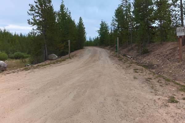
Overall great shape. North part out of Gould is well graded, smooth and wide (25 feet). The middle four miles of 740.1 (heading south, at split with 760.1) is characterized by mildly steep grades, lots of loose rock, narrow (10-12 feet wide), and occasionally rutted (but not horribly so). Great fun.
Chaze P
Aug 31, 2025
1999 Jeep Cherokee
Open
NormalDustyMuddy/Wet
A bunch of fun little mud puddles all over, narrow, single car road with switchbacks. An absolutely amazing view at the top, 100% worth the trip!
Scott Demaree
Aug 06, 2025
Open
Dusty
The higher you got the better the vistas. This trail goes from a 4 to a 5. The higher you get the more intense it becomes. Shelf trails. Lots of downed timber that has been cut so you can keep going. Water and mudholes the last 1/3 of the trip. 2 hours up and 2 hours back. Pay attention and enjoy.
Cy Foppe
Jun 29, 2025
2004 Lexus GX
Open
Dusty
First half or so of this trail is easy and then it gets steep, narrow, and very rocky. It has some switchbacks and shelf road parts that are filled with loose rocks and boulders that can lead to some pucker moments along the edges. Very fun trail with plenty of exhilarating instances and gorgeous views.
Alex B
Jun 18, 2025
Open
DustyNormal
Nick W
Jun 14, 2025
2024 GMC Canyon
Open
NormalDusty
Great conditions. Light ATV / UTV traffic. No snow
Andy Zito
Jun 09, 2025
Open
Normal
Full width road with varying terrain conditions. Some sections are packed dirt, but it is mostly loose rock. Several shallow water crossings, especially as you go up in elevation. Almost made it to the top but turned around due to snow pack. Easy to choose smooth lines on a dirt bike.
Tanner Wenzel
Sep 01, 2024
2010 Nissan Xterra
Open
DustyMuddy/WetRough/Deteriorated
Road is fairly clear, and slightly rocky up until the upper switchbacks, and then gets much more primitive and very narrow with only a few spots to pass until the top at the trailhead. Great views though!
Aaron Osterrieder
Oct 04, 2023
Open
Muddy/WetRough/Deteriorated
Jeff Moore
Sep 10, 2023
Open
Normal
Ryan Stice
Aug 26, 2023
Open
Muddy/Wet

Baker Pass Trail can be accessed by the following ride types:

  • Single Track
  • 50 Inch
  • 60 Inch
  • High Clearance
  • Full Width

Baker Pass Map

The onX Offroad Difference

onX Offroad combines trail photos, descriptions, difficulty ratings, width restrictions, seasonality, and more in a user-friendly interface. Available on all devices, with offline access and full compatibility with CarPlay and Android Auto. Discover what you're missing today!

Open Trail Map