Joshua Eggemeyer
Apr 25, 2026
2022 Ford Bronco
Open
DustyWashboard
This trail rose and fell in elevation a lot more than I expected, lots of steep sections with loose rock. Took us a few hours to make it all the way through.
William Bennett
Jan 03, 2026
Open
DustyRough/Deteriorated
This trail, if started from the West, starts off easy as the road heads up to an open excavation/mine site. Almost immediately past this point (you can see the pit to the left it’s huge) this becomes a standard “3” trail. There are no named obstacles but in the next year or two if heavy rains continue I believe this trail could and should be made a 4-5/10. There are numerous areas where rock crawling is already starting to take place as the trail has continued to erode over the past two years I’ve been wheeling it. Beautiful views, great beginner trail that can offer challenges and teachable moments to newcomers to Off-roading without being overly dangerous or difficult. Also several offshoots to explore. See more on FB @ ColoradoWk2Offroad. Also be aware of multiple water crossings and at one point next too Hwy 50 where you actually cross the Badger Creek, you have to enter the creek turn left and then find your outlet to the right before dumping into the Arkansas river. Here a lift is needed!
Rebecca Dilts
Dec 01, 2025
Open
Trail was extremely rough. So many BIG rocks and ruts. Drove 2mph. Took a long time. I would definitely rate much more difficult.
Alexander Gutierrez
Jul 31, 2025
Open
I’m a beginner with a little intermediate skills and it’s not green. Is deteriorated with loose rocks on climbs and descents. Doable but not green I would call it intermediate at least compared to trails seen on the NEBDR, NMBDR, and BigBend BDR
Nate Scott
Mar 30, 2025
2006 Suzuki DRZ400S
Open
NormalDusty
Really fun easy to intermediate route with a bit of everything: sand, rock, water crossings, jumps, berms. Great scenery. Combine with CR 45, which is also really cool, to avoid riding on 50.
Thomas Hastings
Mar 29, 2025
2024 Jeep Wrangler
Open
NormalDustyRough/Deteriorated
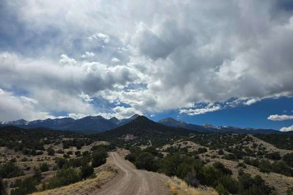
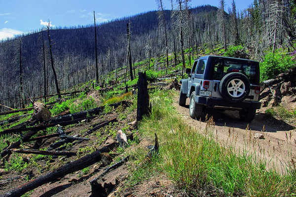
I’ve traversed this trail a couple times in snow which adds a little more “adventure” to the trail. This time it was dry, a spot here and there with a snow patch but nothing to be concerned with if you stick to the highlighted trail. It’s a rugged and scenic trail with a couple obstacles, but I believe any capable stock 4wd vehicle should not have any trouble.
David F
Mar 23, 2025
Open
NormalMuddy/WetSnow/Ice
My first time on this trail. It was mostly dry but just around 1/2 way in, during a climb (at around 8,500ft) there were 2 patches with snow and one was particularly tricky since it was warm (around 50°), the snow was wet/slick, and the trail was cambered enough to make you slide one way or the other….one way was off the edge and the other was into the ditch/wall of the mountain. I did, at first, slide into the wall-side (was definitely avoiding going off the edge) but I was able to back up and then push through. I would wait another week or so before going back, hoping it all melts. But the other 98% of the trail was was you see in most of these photos: dry/nice.
Mick DeNudt
Feb 15, 2025
2017 Jeep Wrangler
Open
the top the you could avoid that area by using sand road as a shortcut...bit the top part that had some ice and rutts with some fresh snow...it was slightly more difficult than a 2/3 but probably just because of the ice and snow... otherwise just rocky and narrow
Jeremy Portillo
Sep 06, 2024
2012 Toyota Tundra
Open
NormalDustyRough/Deteriorated
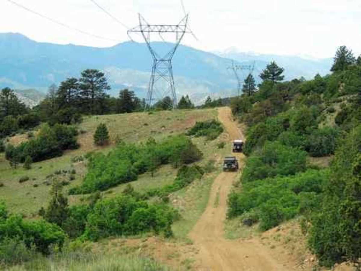
Trail was great! Definitely more difficult than a 3, but still very manageable. Lots of fun with lots of different terrain. Rocks, dry river bed, mountain dirt road, loose rock, short water crossing. Be careful coming down from the sand gulch direction around the mountain past the power lines, all loose rock and steep descents. Very tight trail at times! Tundra got some nice pinstripes from it✊🏽 if you can, at the end of the trail before following it all the way back to the highway to the Wellsville area, turn left and try to follow the Arkansas River, you get some really fun tight terrain there and awesome river views. Great trail! I’ll take the GX next time… 🤣
Josh Clark
Jul 03, 2024
Open
This was our second trail we did on our trip to Colorado. We took it as we had done one other 3 level, Phantom Canyon, and that was an easy dirt road with a few very small ledges. Mini vans and cars were on the trail. Badger Creek however, was far more challenging and difficult than Phantom Canyon. Lots of wash outs, dried up river and creek beds full of huge rocks and such. My stock 23 Taco made it with no issues, but the reason for this report is due to this trail being FAR more challenging than the other level 3 we did, plus no where near as many vehicles could do it. Unfortunately I was focused on driving and wife on navigating, so no pics. Sorry. FWIW, there is a point when you are on a BLM route on this trail and have the optin of climbing a steep rocky grade or a dirt trail. We thought the hill was our path, so I climbed it. Scary in my new truck, and when we got to the top, realized the dirt path was the easy way up. HAHAHA! I was proud we took the hard way and made it. LFG!!!!!!!!!
John Gibson
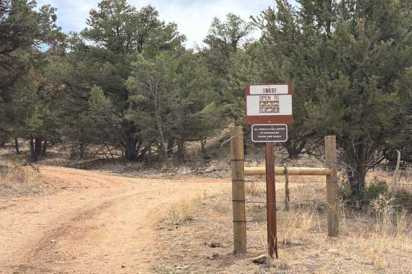
Apr 17, 2024
2021 Jeep Gladiator
Open
Normal
This was a nice drive with some beautiful views of the area. Seems to be mainly an access route to some of the large power line towers running through. There was typical loose rock and narrow hillside trail. A cut through is there at Sand Gulch rd(blm#), it is more rutted but a lot less rocky. That does cut through private property so stay the trail. Seems the owners have placed a lot of signs to let you know. A few good places to camp dispersed. We encountered some locals doing target practice, friendly and safe. This is easily passable by most vehicles and is a stretch to label this 3, but figured error on the side of caution.