Noah
Dec 29, 2025
2023 Toyota 4Runner
Open
NormalRough/Deteriorated
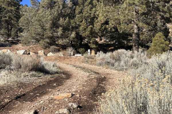
One section with some deep ruts, otherwise good. There was a dozer and a front loader out grading the first part going up.
Peter
Dec 27, 2025
2024 Ford Ranger
Open
Muddy/WetSnow/IceRough/Deteriorated
Some rocks on the trail after the rains. A creek washed part of the trail and now made it a steeper climb out of it. Lots of puddles. A little more harder than usual after the rains.
Michael Sagginario
Dec 14, 2025
2018 Jeep Wrangler
Open
It was a fun easy trail with some places to have fun. Nice views.
Royce Crow
Dec 13, 2025
2007 Hummer H3
Open
NormalDustyRough/Deteriorated
Trail was clear of snow and ice all the way through. Only one big mud hole that you can drive around if desired. The trail is much more chewed up than I’ve ever seen it. Lots of small rocks in the road between rattlesnake canyon and Big Bear make for a bumpy ride. There is also a small dugout section now that will test your vehicles articulation.
Adam Gonz
Nov 29, 2025
2024 Rivian R1S
Open
Muddy/WetRough/DeterioratedWashboard
The trail was pretty standard but their was one portion that could be challenging. It's on the way up the mountain and it has some deep divets. You'll need a 4x4 to navigate. There was some muddy areas but nothing too intense. Visibility was great even after sun set.
Aibner Contreras
Nov 23, 2025
2025 GMC Canyon
Open
Muddy/WetSnow/Ice
Breathtaking. There's 1 steep, rutted, slippery area. Probably impossible for non locker. 10in clearance will touch. Probably a lot easier if it dries up.
RJ GX
Nov 14, 2025
Open
NormalMuddy/WetRough/Deteriorated
Pretty easy trail with a few technical areas. I don't think a high clearance 2wd vehicle can make it but there might be a good chance soft roaders / subaru with x-mode (for the technical areas) can make it.
John Juarez
Nov 10, 2025
Open
NormalDusty
J I
Oct 24, 2025
Open
NormalDusty
Started at Baldwin Lake -> Joshua Tree. Not a lot of dust because of recent rains. Bobcat siting! Beautiful day and quiet on a Friday. Did not see another vehicle.
Alexandros Stellakis
Oct 23, 2025
Open
Normal
It wasn’t too dusty due to resent rain. The road was washboarded and rutted. Shelf road with some good hill climbs. The west side of the trail was the roughest part. Might be more of a challenge if you run it west to east.
Sebastien Saramito
Oct 13, 2025
2025 Jeep Wrangler
Open
NormalDusty
Martin Martinez
Sep 20, 2025
Open
DustyMuddy/WetRough/DeterioratedWashboard
Started this trail from Baldwin Lake and it was my first time off-roading with this car. Really easy trail with a few spots that require some extra attention. Half way through the trail there is a slope and it was the only time I was a little worried but got through it smoothly. Gorgeous views, really fresh on the Baldwin half. Once you get closer to Rimrock it’s very dusty, rocky, and warms up.
Christian Arroyo
Sep 01, 2025
2024 Toyota Land Cruiser
Open
Normal
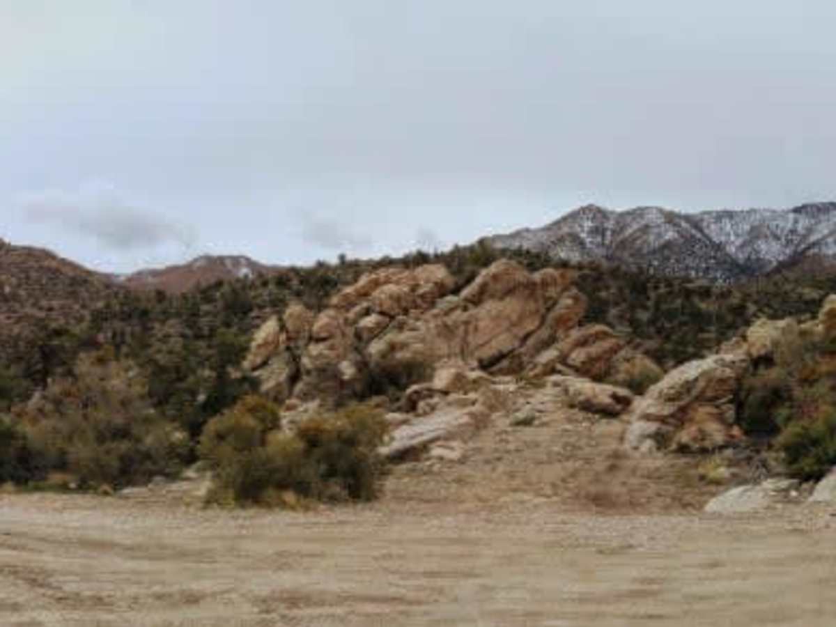
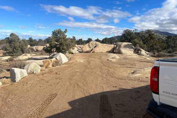
Overall an easy trail. Some sections where it will be more comfortable in 4HI and maybe at least one section with moguls (second picture) that I would advise using 4LO but other than that the trail can be to a probably be done in 2WD. Stock 4x4 vehicles should be fine as well, just take caution in some parts of the road where it is little rocky (choose the right lines and you’ll be fine). This is also a full size truck friendly trail.
Mason C
Aug 31, 2025
2025 Chevrolet Silverado
Open
Dusty
Today I came back with some friends, and as expected, the weekend crowd was bigger. Once you get into the mountains, there are a lot of loose rocks on the ground, so you really need to drive slow and be careful.
I also ran into three white/Jeep drivers coming from the Baldwin Lake side toward Rimrock. To the older white lady in the second Jeep, I want to say this: please watch your words and be respectful to others.
First, I was trying to give you room, but your team were in such a hurry that you hardly gave me a chance to do so. Second, not everyone’s driving skills or tires are perfect. On my right side, there was some space, but it was full of sharp rocks. I could have gotten out to spot, or even tried backing up to let you through, but your attitude made me feel you didn’t deserve that consideration.
Gene Tan
Aug 29, 2025
2000 Toyota 4Runner
Open
NormalDusty
It was a nice drive overall and got to see a lot of Joshua Trees on our way up to Baldwin Lake area. We have a mildly lifted, basically stock 4x4. I would say that the only technical part is a rutted hill near past the halfway point where I used 1st gear on 4lo (we don't have lockers). Very enjoyable ride. Also, if by chance anyone had picked up a FujiXT1 camera that we left behind please let me know.