Bailey Canyon

Total Miles16.3
Technical Rating
4Moderate
Best TimeSpring, Summer, Fall
Trail TypeFull-Width Road
Accessible By
Open Trail Map

Trail Overview

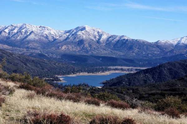
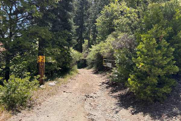
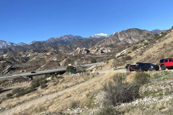
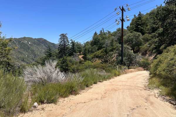
Bailey Canyon is a scenic trail running through the San Bernardino National Forest. There are views of Silverwood Lake, canyons full of trees, and the city near the south end of the trail. The trail is mainly dirt but turns to rock in some areas. Creek crossings are also possible at certain times of the year. This trail can be relatively easy but may be challenging during or just after the wet seasons. There are sections with deep ruts, downed trees, and rocks that came down from the hillside next to the trail. There are also overgrown bushes and trees that cover the majority of the trail areas and will cause pinstriping. There are no bypasses so scratches to vehicles are unavoidable. Cell service is patchy, mainly in the middle of the trail, so downloading maps ahead of time is recommended.

Photos of Bailey Canyon

Difficulty

You will come across deep ruts, downed trees, and overgrown greenery making this trail harder at certain times of the year.

Technical Rating

4

Status Reports

Add Status Report
Jordan Geisler
Nov 02, 2026
2025 Jeep Compass Trailhawk
Obstructed
Downed Tree
I would say this trail is pretty intimidating but not super technical. I entered off Palm Avenue and took it to Chainsaw. There’s a muddy, somewhat steep incline with a rut right at the bottom right near the start of the trail that is probably the most difficult obstacle from a technical standpoint. Trail has a good amount of rutting, standing water, some mud, and is very rocky around the peak. No huge rocks that aren’t avoidable or anything, but a few that just scraped my skip plates. Even aired down a bit it was not a particularly comfortable trail once in the rocky section. I never made it to the downed tree reported 2 days ago since I exited at Chainsaw, but marking as obstructed just in case.
Jorge Bravo
Oct 31, 2026
2023 Toyota Tacoma
Obstructed
Downed Tree
There is a downed tree somewhere after TLD chainsaw trail. Take TLD chainsaw to Rainbow trail FS-2N59 and exit onto highway 138. The trail is somewhat washed out due to to the recent rains. However, still possible in 2WD with some good tires. We did engage 4H/4L throughout the trail since the ground was wet and the rear end would slip out occasionally and would help when making a descent.
Jake FJ2TACO
Oct 12, 2026
2016 Toyota Tacoma
Open
Muddy/Wet
Great trails with beautiful views. Pretty easy going
Raul Covarrubias
Sep 23, 2026
2023 Toyota Tacoma
Open
This trail has many excellent spots to catch great views of so cal. It is very narrow trail, but no pin striping on this trip
Lu Mejia
Aug 29, 2026
2024 Chevy Colorado
Open
Normal
Went early morning, It was a nice trail, a lot of rocks towards the middle but able to cruise thru. Mostly stuck with 2WH most of the way but certain parts used 4x4 just to be safe
Peter
Jul 04, 2026
2024 Ford Ranger
Open
Normal
Can be done by stock 2wd. Some spots super tight and some spots will challenge 2wd. I did 99% of it 2wd. Added a few more oin strips. Some over growth and low hanging canopy.
Jonathan Garcia
Jun 28, 2026
Open
Normal
Curt F
Jun 28, 2026
Open
Muddy/WetWashboard
Open. It was misty. Low cloud cover. Surprised at the ruts on the trail. A lot more than I remember. But not a difficult run at all. Just 3 bad spots about 5-6 miles in from the south side (palm Ave entrance). Looks like runoff created a channel thru the trail. Not difficult to traverse. Some ruts uphill and that takes some planning to run. Pick the right line and you're good. And about 6, 7 miles a down hill rut. Go slow, pick a safe line, and you can make it. I was just surprised that it was there as I ran it in. 2WD prerunner a few years ago. But no one was out there. Just saw one jeep as we started. And some dirt bikers as we exited near Silverwood. Some standing water so we did get dirty running the mud. Too bad about the cloud cover as we had no scenic views. But it kept the temps cool and enjoyable.
David Resendez
Jun 26, 2026
2025 Toyota 4Runner
Open
NormalWashboard
Very rocky, be careful with loose cargo.
Chris 88
May 30, 2026
2026 Dodge Ram Ram RHO
Open
NormalDusty
Ben
May 28, 2026
2023 Jeep Gladiator
Open
NormalDustyMuddy/Wet
Took this trail from the south off of Palm. A few gas stations off of the 215fwy before Palm runs into the trail. Beautiful trail with great views and some large water puddles along the way. Plenty of room to air up/down and either end of the trail. Took about 2 hours.
Matt R
May 24, 2026
2021 Toyota Tacoma
Open
Normal
A bit rocky at times but trails were nice for the most part
Daniel Garcia
Apr 18, 2026
Open
NormalRough/Deteriorated
Trail was great. Normal for the most part. Some challenges in the trail. Definitely will need 4x4 in some areas.
Dave A
Apr 12, 2026
2000 Lexus LX
Open
Muddy/Wet
Nice gatekeeper at the start (south end) that nearly caught us. Took the wrong line and nearly flipped on our side the ruts were so deep! Third try we got through. After that it was an easy trail. Narrow in places and rocky in parts but nothing hectic. Was hoping for snow but we just got most and rain. Camper the night and left this morning out the north side.
Heather S
Mar 15, 2026
2018 Jeep Wrangler
Open
NormalRough/Deteriorated
Trail was in good condition. Two sections that were pretty rutted but still easy. Always a good trail for a scenic ride.

Bailey Canyon Trail can be accessed by the following ride types:

  • High Clearance
  • Full Width

Bailey Canyon Map

The onX Offroad Difference

onX Offroad combines trail photos, descriptions, difficulty ratings, width restrictions, seasonality, and more in a user-friendly interface. Available on all devices, with offline access and full compatibility with CarPlay and Android Auto. Discover what you're missing today!

Open Trail Map