Mount Pleasant Road

Total Miles 6.9
Technical Rating
3 Easy
Best Time Spring, Summer, Fall, Winter
Trail Type Full-Width Road
Accessible By
Open Trail Map

Trail Overview

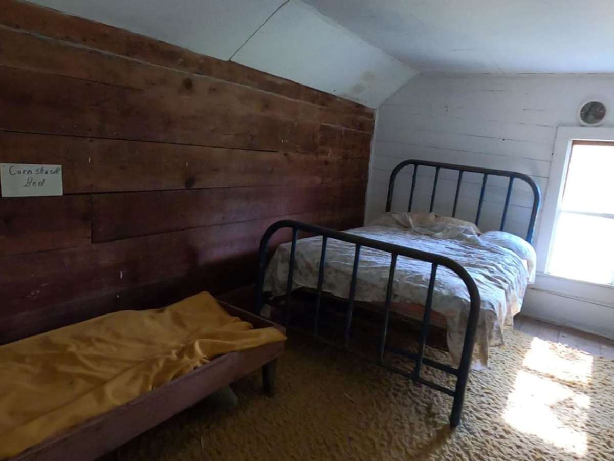
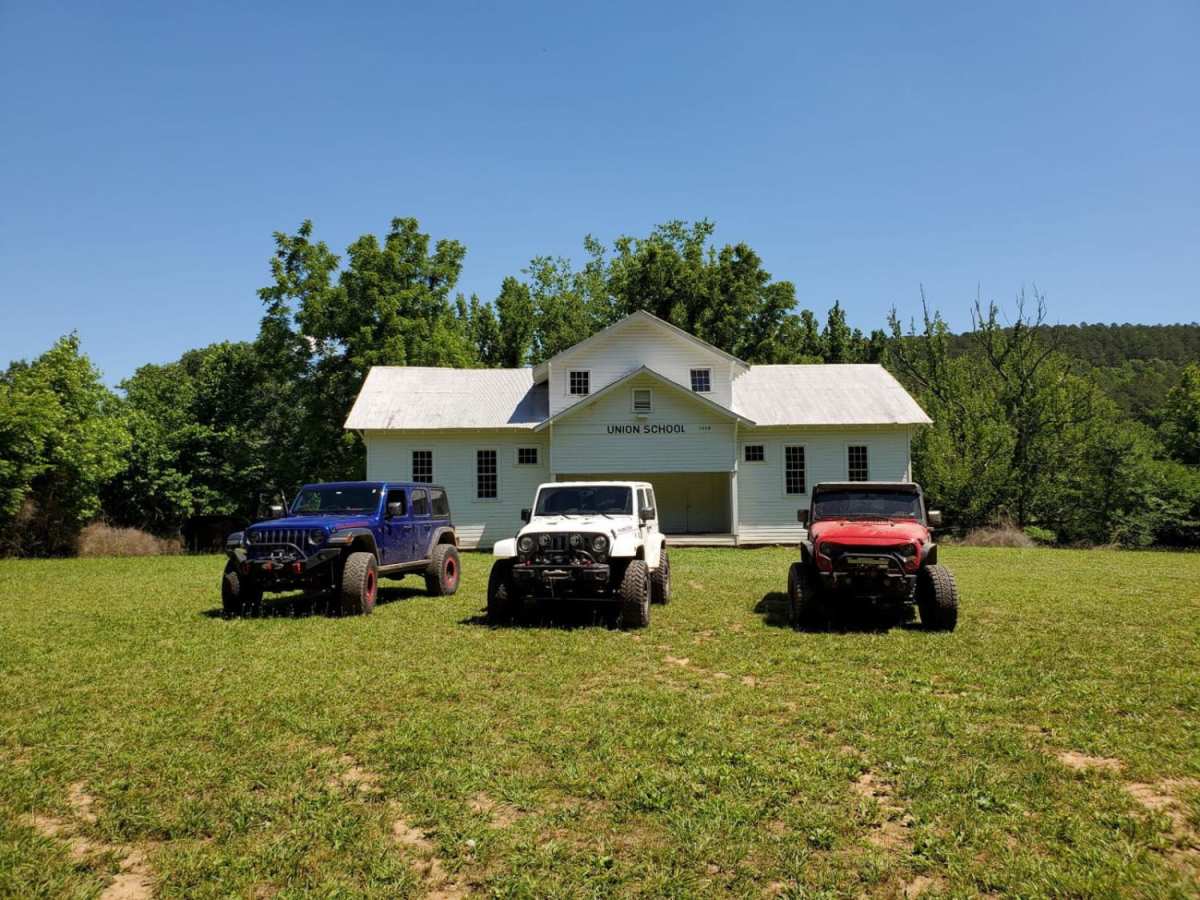
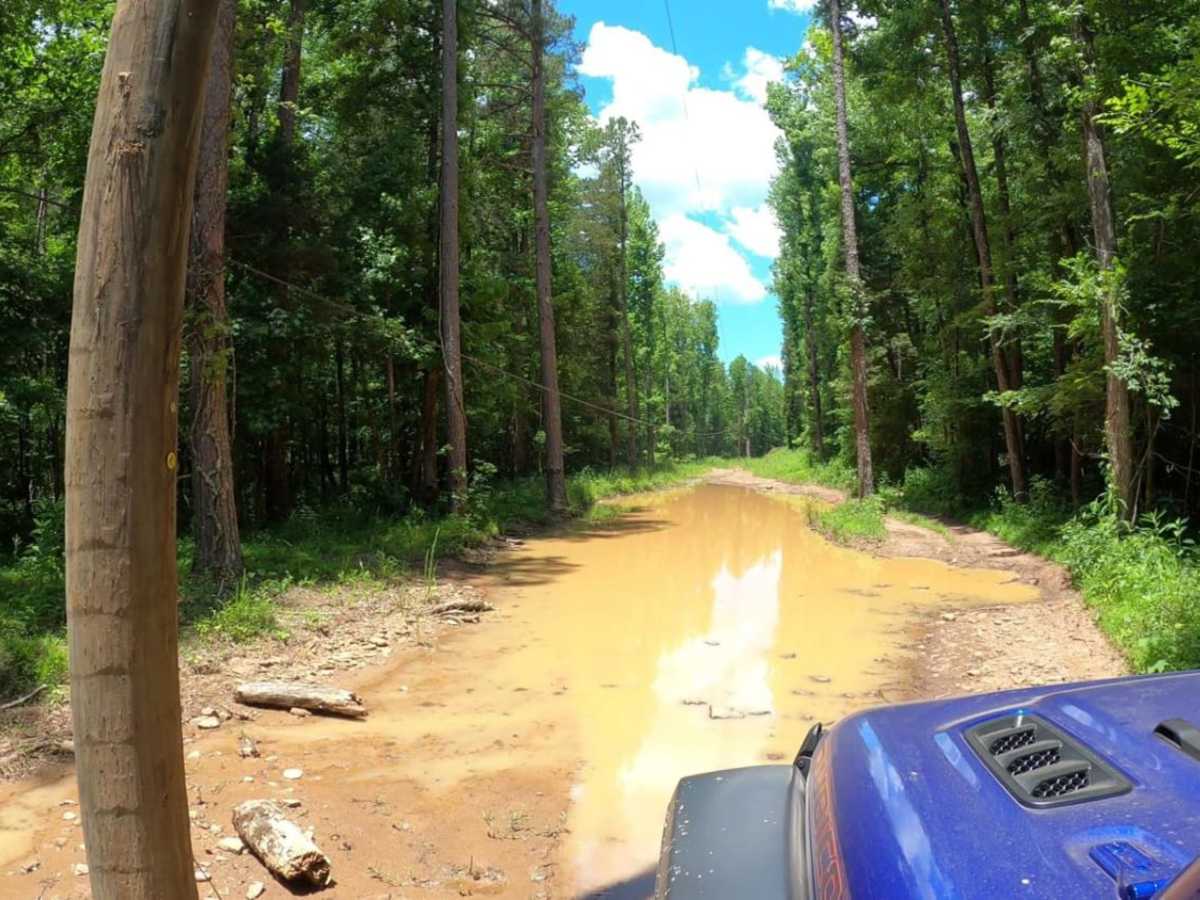
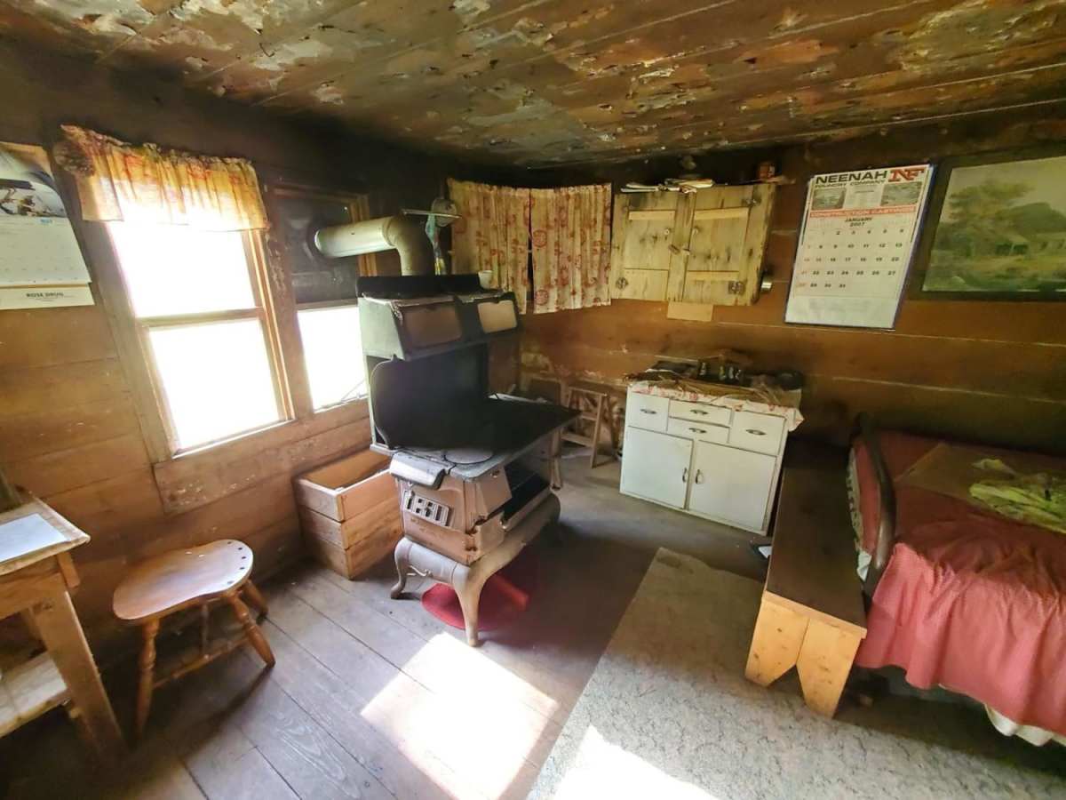
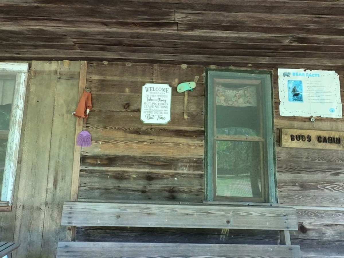
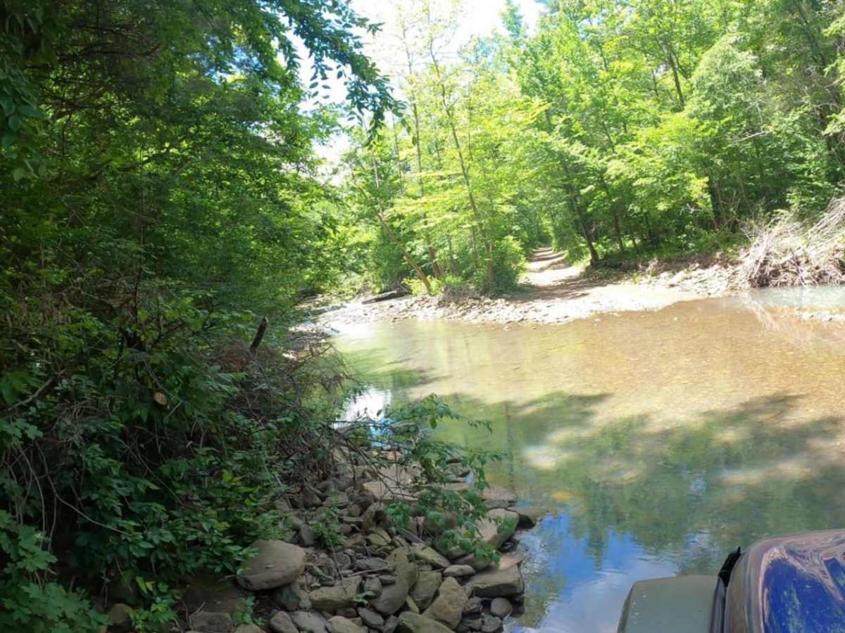
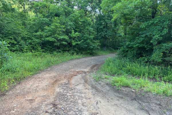
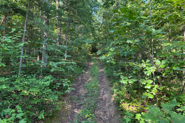
This is a fun, dirt and gravel road with 3 miles of single-vehicle trail. There are several water crossings, typically 12 inches deep, and some shallow mud holes, but it can be much deeper and more difficult in the spring when there is a lot of rain. Most of these mud holes have solid bottoms, but you can bypass those that don't. Some of the squeezes between trees can be tight for full size vehicles. The favorite along this trail is Bub's Cabin. This is a great spot to stop and eat lunch. The home is privately owned and maintained, and you can go in and look around, but please be respectful. There is no camping or staying in/on the property. There is a lot of private property along this route, so be sure to check the public land map if you are going to leave the trail for any reason. Near the end of the single vehicle trail, you'll be right next to a house and a river crossing. Look upriver to see a nice setting with a small waterfall. When you reach Highway 21, there is good spot to stop and air up before getting back on the highway. Other interesting things near this area are Car Wash Falls, Pam's Grotto and Haw Creek Falls. There is very little to no cell service in the area so download the map before you go.

Photos of Mount Pleasant Road

Difficulty

70% of the trail is easy gravel road, the other 30% requires medium to high clearance to navigate some of the rocky sections and creek crossings.

Technical Rating

3

Status Reports

Add Status Report
Trevor
Mar 03, 2026
Open
This trail is incorrectly labelled. The union schoolhouse is to the south on FSR 1409. The landmark on this trail is Bub's Cabin. I did run this trail in a stock full-size vehicle after a light rain overnight. I did have water over my hood in a spot or two.
Richard Viard Jr
Dec 14, 2025
Open
Sorry, i fibromyalgia and trying to remember everything lol. Going north, exiting the water crossing by the cabin is a little steep but not bad. After the cabin, you have shallow and deep holes (all manageable). One bypass is not meant to for full-size rigs. It has a bad as bad drop off. There is a hill climb thats rocky and depending on your rig, a spotter would be helpful. After the Gate, the road is relatively smooth.
Scott Cronister
Apr 28, 2025
Open
Just wanted to add that the Union School house is not on this trail, it is further south on FSR 1409, just off 1004 Rd on the west side of Little Piney creek. This trail should really be re-named in OnX as the landmark on the east end of this trail is actually Bub's Cabin. As previously mentioned, there are some rather deep mudholes on this trail and solo travel is not advised. Route finding is difficult on the west end and you will end up in an area where there is private property on both sides of the road. One of the property owners with some aggressive dogs is trying to prevent travel through the area with makeshift gates, rocks, and other obstacles however it is open and legal, but make sure you stay on the road. I will likely not go this way in the future, however Bub's Cabin is a neat place and can be accessed from the North and East via Rd 58/FSR 1004 then back up Mt. Pleasant Rd 1405 which are all easy routes, or via Big Bee Ridge for more of a challenge.
Trisha Moore
Mar 21, 2025
Open
Be aware that an owner along the trail sometimes tries to put up gates that say "No Trespassing" and/or "Road Closed". These are not legal gates. You can move them and go through. Contact local authorities if they are blocking the road. This trail has several water crossings and large pools of water to navigate. The bottoms seemed mostly rocky. Be sure to stop and look at Bubb's Cabin. He is there on weekends and loves to meet new people and tell them the history of the cabin. Fun one!
Mike Harris
Mar 09, 2025
Open
as you travel the trail a gentleman has put gates across the trail. we ran into a couple who are locals and they let us know he cannot do this. we opened the gates and drove thru. it was our first trip on a trail so not to technical. Good river crossings and plenty of water holes that were not to bad.
Lauren Carter
Feb 16, 2025
Open
High water, deep mud holes several creek crossings where water washed over the hood of the truck. Large rocks. Recommend narrow vehicle or bike to access to alternate routes with high clearance for water
Mark Moore
Nov 14, 2024
Open
Brent W
Oct 30, 2024
Open
Been on this trail many times. It was very dry in the creek crossings. No real issues anywhere else on the trail as far as difficulty. The Union School is a cool spot to stop and see some history. Bubs Cabin is great as well.
John Townsend
Oct 12, 2024
Open
Dry and dusty with a bit of traffic from RITO. Little to no water at creek crossings.
Jeremy Taylor
Aug 11, 2024
Open
Ran this from the east side off hwy 123. Great trail to practice line choices. Can’t really get into to much trouble with this trail. One section on the east side climb that was a little gnarly but there’s a bypass.
Chaz Birdsong
Mar 14, 2024
Open
From Bub’s Cabin to about 0.5 mile from Hwy 21 lots of mud holes right now. Varies in depth.
Joseph Snow
Oct 02, 2023
Open
Dan Martin
Aug 28, 2023
Open
Gerald Murphy
Apr 29, 2023
Open

Mount Pleasant Road Trail can be accessed by the following ride types:

  • Single Track
  • 50 Inch
  • 60 Inch
  • High Clearance
  • Full Width

Mount Pleasant Road Map

The onX Offroad Difference

onX Offroad combines trail photos, descriptions, difficulty ratings, width restrictions, seasonality, and more in a user-friendly interface. Available on all devices, with offline access and full compatibility with CarPlay and Android Auto. Discover what you're missing today!

Open Trail Map