Harquahala Peak

Total Miles 10.3
Technical Rating
4 Moderate
Best Time Spring, Summer, Fall
Trail Type Full-Width Road
Accessible By
Open Trail Map

Trail Overview

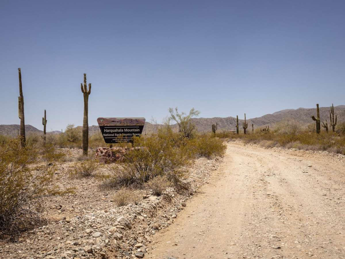
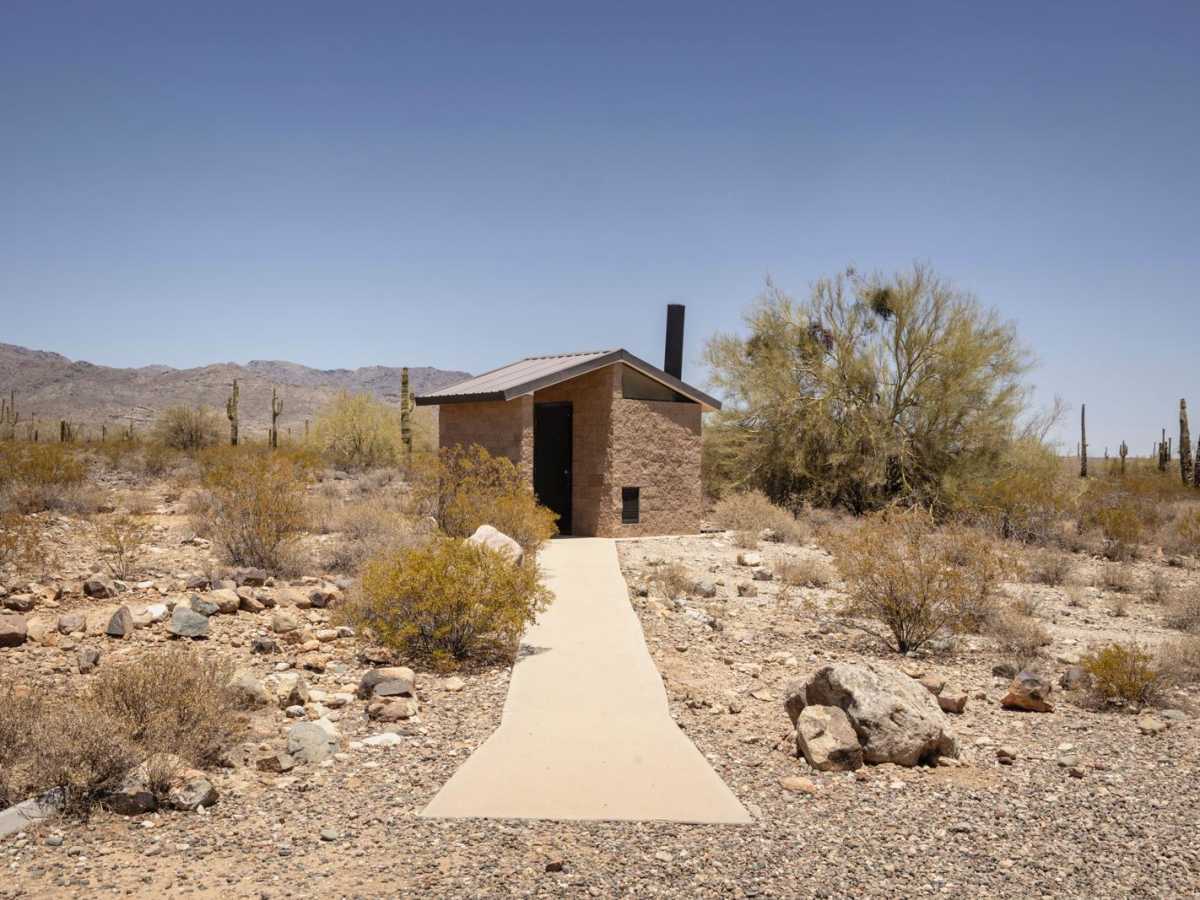
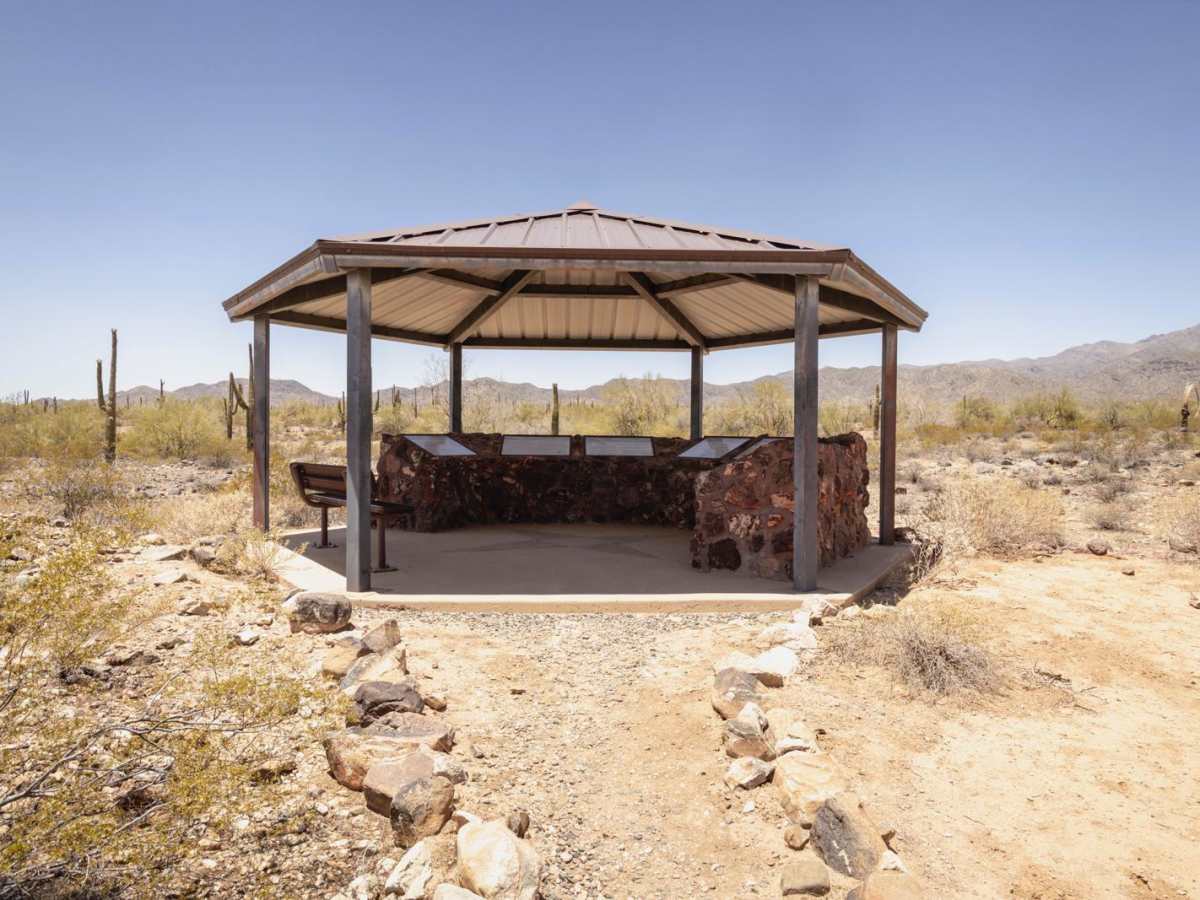
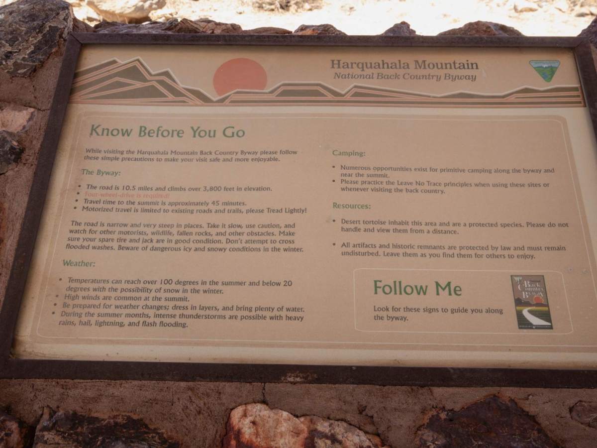
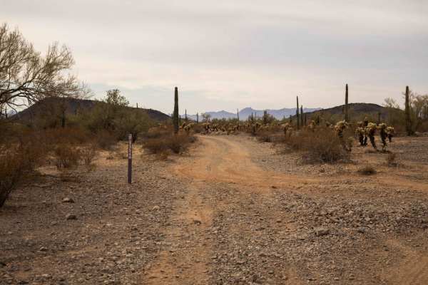
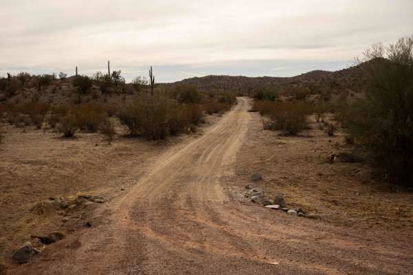
The Harquahala Peak Trail is one of the steepest and most iconic off-road climbs in central Arizona, ascending nearly 3,400 feet in just over 10 miles to the highest point in the Harquahala Mountains at 5,681 feet. Originally built for access to a historic solar observatory, the trail is one lane, rocky, and demands careful, low-gear driving--especially on the way down. The lower section of the trail includes several wash crossings, typically dry but occasionally sandy or rutted after weather events. As the climb begins, the road becomes progressively steeper, with long grades of loose rock, embedded stone, and switchbacks carved into the mountain face. Though the trail lacks major technical obstacles or ledges, the sustained steepness and constant rough surface make it a test of both driver skill and vehicle condition. Despite the challenge, the payoff is huge: breathtaking 360-degree views from the summit, the remains of the Smithsonian's Harquahala Solar Observatory, and dispersed camping areas tucked along the ridgeline with cooler temps and wide-open skies. Trail Features: Surface: Rocky dirt road, increasingly loose with elevation. Difficulty: Steep with traction challenges, but no technical rock crawling. Key Hazards: Off-camber exposure, steep grades, heat on descentVehicle Requirements: High-clearance 4x4 with low range strongly recommended. Camping: Primitive sites at and near the summit. Scenery: Desert floor, canyon views, and panoramic mountain vistasCell Service: Spotty to nonexistent--bring offline navigationTraffic: Light, but shared with hikers and mountain bikers near the top. Harquahala Peak is a must-drive trail for Arizona off-roaders seeking a true high-alpine summit drive with the feel of real mountain exposure. Tackle it in good weather, and be prepared for a challenging, rewarding climb with unmatched views at the top.

Photos of Harquahala Peak

Difficulty

This is an unmaintained trail with numerous wash crossings down low and long, steep grades of loose rock and switchbacks. Caution is urged. The views are incredible. There is no cell service, so offline maps are essential.

History

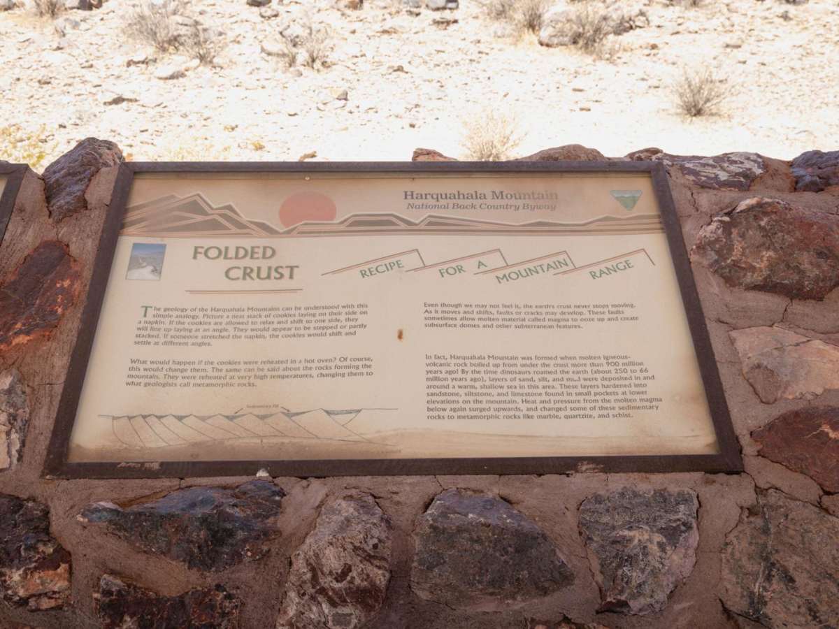
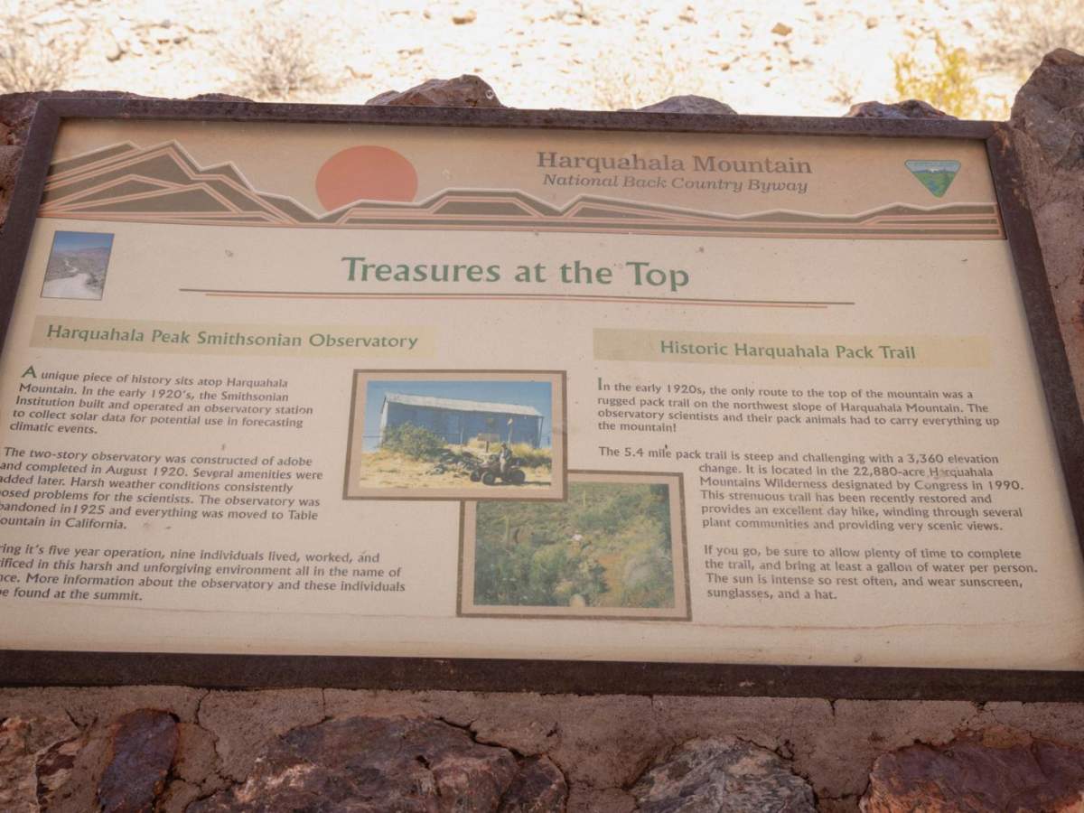
Harquahala Peak, the highest point in southwestern Arizona, is historically significant for its role as a location for the Smithsonian Astrophysical Observatory from 1920 to 1925. The observatory was built to study the sun and its impact on Earth's climate by measuring the solar constant. The peak is also notable for its name, derived from the Yavapai word "'Hakhe:la," meaning "running water".

Technical Rating

4

Status Reports

Add Status Report
Mclain
Nov 20, 2025
Open
This is a must-do for anyone with a 4x4 in the south west. The trail begins with several wash crossings and slowly begins climbing in elevation. The trail becomes very steep about 5 miles in, and becomes exceedingly steep as you near the top. The views at the top are incredible, photos and words cannot do it justice. I went shortly after recent rains, you could see forever. - Expect no one else to be out there when you go, so be prepared. According to the log book at the top, no one had been up there in 3 days. I had to move several large boulders which had fallen and blocked the trail. I saw no one on the way up or back down, so again, be prepared for anything. There is cellular reception at the top, but really no where else along the trail. - Although this is very steep, any 4x4 with low range will be able to make it to the top where you will take in truly breathtaking views.
AZ Desert
Aug 23, 2025
Open
Russ TGN
Aug 03, 2025
Open
Just finished Harquahala Peak & Observatory Trail with Valley Jeepsters on 8/3/25. It took us about 4 hours + 1 hour lunch at the top. Overall, the trail is wide and easy without any obstacles to worry about. Even the last mile which used to be washed out and rocky is now graded. Any Jeep with offroad tires can conquer it. Towards the top you will need 4L on a steep ascent with loose rocks. What the trail lacked in technicality, it more than made up for it with phenomenal views at the top as well as postcard perfect scenery on the way down. The trail is very remote, bring plenty of water and never travel alone! Few spots near the top can turn into waterfalls during heavy rain making it very challenging to get across. Also, don’t recommend doing this one at night as one wrong turn can be your last one.

Harquahala Peak Trail can be accessed by the following ride types:

  • Single Track
  • 50 Inch
  • 60 Inch
  • High Clearance
  • Full Width

Harquahala Peak Map

The onX Offroad Difference

onX Offroad combines trail photos, descriptions, difficulty ratings, width restrictions, seasonality, and more in a user-friendly interface. Available on all devices, with offline access and full compatibility with CarPlay and Android Auto. Discover what you're missing today!

Open Trail Map