Coco Archuleta
Dec 06, 2025
Open
Normal
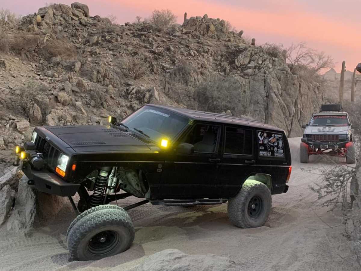
First off-roading trip for my new Bronco! Most of the trail was great - soft sandy areas that were fun to slide in with plenty of more challenging areas. Was a great trail for a newbie like me. We did hit the area between a canyon wall and big rock and decided to turn back. Also decided not to try the large hill to bypass it. But still had fun overall. Went during sunset, was absolutely beautiful.
Fernando Gonzalez
Oct 19, 2025
Open
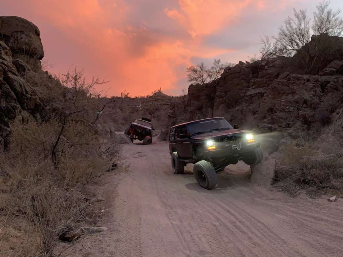
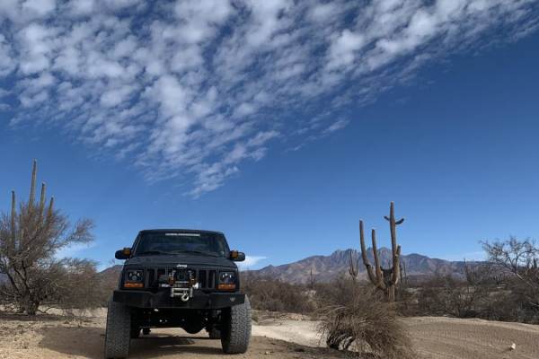
Before 10/19/25 I was able to do Bulldog Canyon 3554 to the northern part of Bulldog Canyon 10 in a 100% stock 2012 Jeep Liberty. But after going through the trail on Sunday with my WJ I'd say there is no way it'd make it. The recent monsoons definitely changed the conditions quite a bit. There are now quite a few sections that require some moderate flex and a careful line depending on the vehicle you're in, especially if it has an IFS. Even a few sections where you could possibly end up sideways. My WJ on a 2 inch lift with 31" in tires had the rear tires rubbing hard on the rear wheel wells & pretty flexed out. Vari-Loks saved me a few times. This trail has definitely become a bit more fun though given the increased challenges across the 3554 trail. It it was easy for you before you're probably fine. If you had any difficulties before you might want to be extra careful.
Kevin Yang
Sep 21, 2025
2024 Lexus GX
Open
Normal
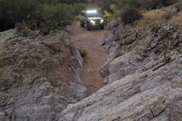
Most of this trail is very easy and plenty wide except once you get to the “canyon”, circled in red on my photos. It gets very narrow between a large rock and canyon wall. A jeep might be okay but a full size truck will struggle. You can bypass it taking the green route I highlighted in my photos. This bypass isn’t easy but most stock 4x4 can do it with a decent driver. The remainder of Bulldog Canyon back out to Bush highway is very easy.
Kevin Sweeney
May 31, 2025
Open
NormalDusty
Great trail for my Gladiator, had some fun!
Steve B
Apr 25, 2025
2024 Toyota 4Runner
Open
Normal
Gates are closed only because they don't have cattle guards. This trail is a nice easy run with only a couple hurtles. Be aware that running from Usery Pass to Blue Point (Bush HWY) the OnX GPS track doesn't quite line up with the actual trail. Once you hit the wash the green line veers left, Stay right to avoid any confusion. Theres a single major obstacle once you hit what I would assume to be the "Canyon"? You will need to climb the hill on your right, then once you make it to the top, proceed to the right to make your way to the Blue Point/Wolverine fork. Easy ride from Usery to Blue point it took me about 90 mins.
Carlos M
Apr 19, 2025
Open
Normal
Powell Nash-Hayes
Apr 18, 2025
1994 Toyota 4Runner
Temporarily Closed
Closed Gate
Troy P
Mar 06, 2025
2024 Jeep Wrangler
Open
NormalDusty
As described by the reviews. Entered from Usery, turned around at the narrow spot with the large rock about 2/3 in. Fun trip..
Blucifer Jongema
Feb 23, 2025
2023 Jeep Gladiator
Open
Normal
Easy like Sunday morning! Spots with deep sand and some light to moderate banking.
$10 Rec fee payable on AZ’s recreation.gov app.
Chris LaMontagne
Jan 05, 2025
Open
Casey S
Dec 26, 2024
Open
Open and clear, but very sandy. Main trail/road is closed 3/4 of the way through coming from the Ellsworth gate at the small hill you can climb and change direction. too narrow for a full size truck, but an older jeep or a SxS could easily make it through.
Martin Betancourt
Dec 22, 2024
Open
NormalDusty
Trail was open , first time ever being on a off-road trail and this was a nice start pretty easy to navigate only one area that was a little bit of a climb but nonetheless a nice trail to be on. Other riders were super friendly nice views all around
Darcene Stoddard
Nov 07, 2024
Temporarily Closed
Closed Gate
Breyden Heil
Nov 03, 2024
Open
Normal
There is a new annual pass that is required for the bulldog canyon OHV area... Most of the trail is a sandy wash that has some degree of embankment in certain areas. The first obstacle is a rock in a narrow alley that is easy with a stock 4x4 or truck. After that first obstacle it is just pretty views and smooth sailing until you get to the one very fun and interesting 50ish foot rock wall that has three different routes. My cayenne is on stock air ride and 33" tires and made it easily and the ram is also just on tire and also made it easily. The views make this trail very worth it.
Jay B
Nov 02, 2024
2011 Subaru Outback
Open
First time taking my stock Subaru Outback out on a dedicated trail system. I actually took this up to the North gate. Stock setup works fine, but there's an area in the last third of this particular route that you'd want to take it easy if it's your first time. Took me a couple tries to get up that steep, rocky hill (putting it in the CVT's "first gear" engaged the center diff and that made a real difference). Just be mindful after that section, it does get a bit rocky, but fun trail nonetheless! Don't have any basis of comparison to say whether conditions have improved or deteriorated, though.