
Off-Road Trails
Near Prescott Valley, Arizona
Off-Road Trails Near Prescott Valley, Arizona
Discover the best offroad trails near you. Browse trail maps, check difficulty ratings, and find your next adventure — whether you're looking for a quick ride or an all-day expedition.
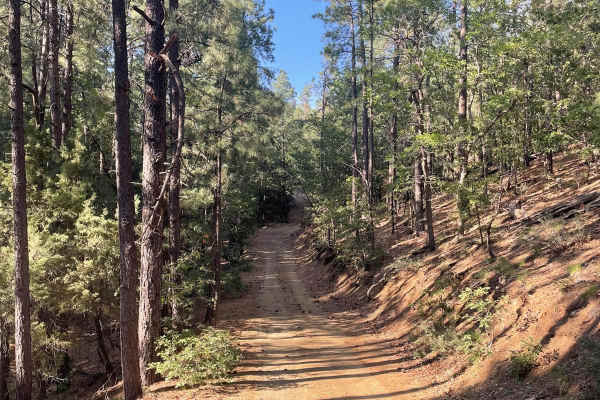
Nemo Spring
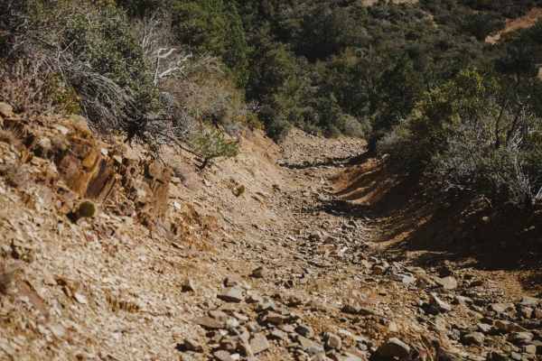
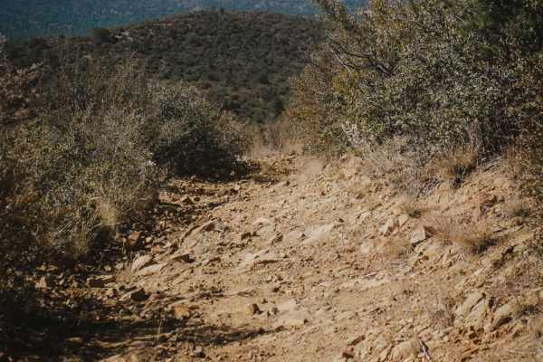
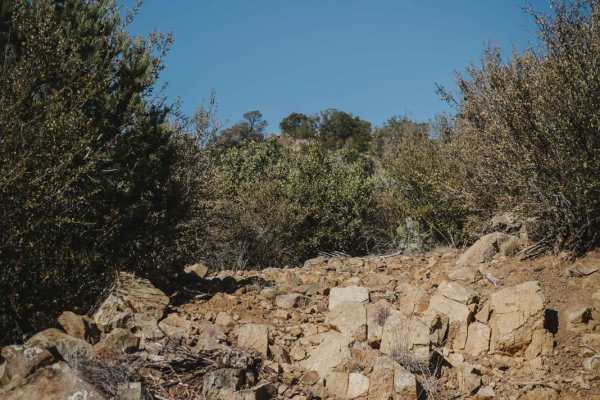
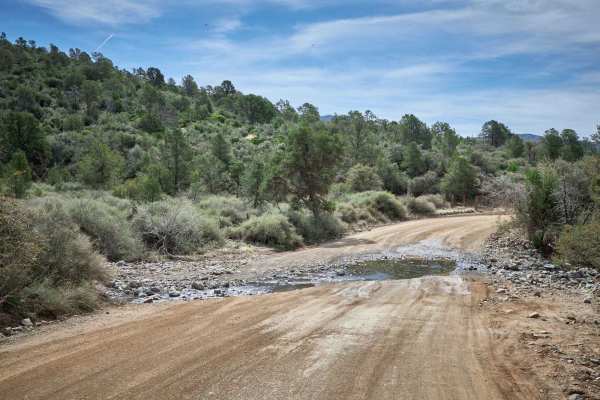
Nemo Spring is an intermediate 50-inch trail, full of small and sharp cobble rock, boulders, and chunky rock that make for a very bumpy ride. The surface of the trail is covered in rock almost the entire time. There are several very rocky and loose hill climbs and descents that sometimes are steep. ...
Learn more about Nemo Spring
Charcoal Gulch
Charcoal Gulch is a 50-inch trail that is an intermediate difficulty due to rocky climbs, narrow side-hilling, and off-camber sections that would be very difficult or dangerous for an ATV. The trail starts at the main staging area on a wide rocky trail, then goes past a wash and a couple of unmarked...
Learn more about Charcoal Gulch
White Horse Tank
White Horse Tank is an easy 50-inch trail near Prescott, Arizona, that has some easy challenges such as loose rocks, loose dirt, and one long hill climb/descent that is full of chunky loose rock. This trail has fewer sections of rocks than the surrounding trails such as Nemo Spring, Salida, and Char...
Learn more about White Horse Tank
Salida Connection
Salida Connection is an intermediate 50-inch trail in the Green Gulch Trail System near Prescott, Arizona. It's a wider two-track, with sections of loose dirt and rock and some steep ascents and descents. There's a section of switchbacks that are not too difficult because they are smooth and wide an...
Learn more about Salida Connection
Prospectors
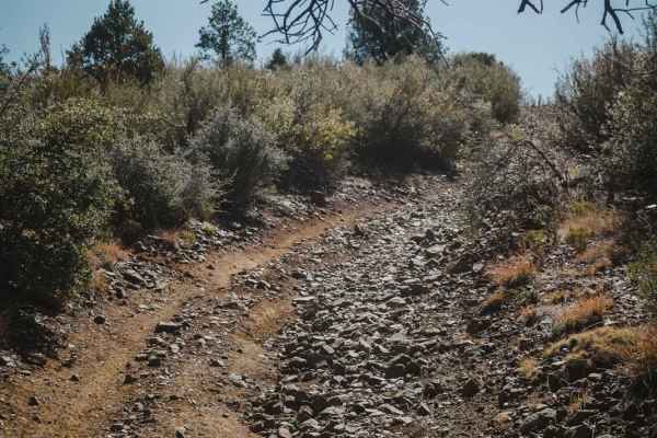
Prospectors is an intermediate ATV trail in the Green Gulch trail system near Prescott, Arizona, that has sections of steep uphills and downhills that are full of loose rock and dirt, with some off-camber sections and washouts. It is slightly easier than Salida and Nemo Spring since it is less steep...
Learn more about Prospectors
Red Mountain Trail
Red Mountain Trail is an advanced single track in the Green Gulch Trail System made up of rock ledges obstacles, loose dirt, embedded boulders, and steep sections of climbing/descent. From the intersection with Prospectors, it starts off as a two-track width and then later narrows to a single track ...
Learn more about Red Mountain Trail
Ruins & Gold Pans
If you are looking for a short and easy dirt road with lots of outdoor activities, Ruins & Gold Pans offers just that. The start of this dirt road is just off of Walker Road and is before Lynx Lake. The road is a semi-maintained dirt road with washboards, small bumps, and little precipitation run-of...
Learn more about Ruins & Gold Pans
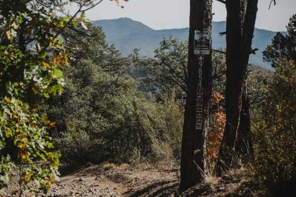
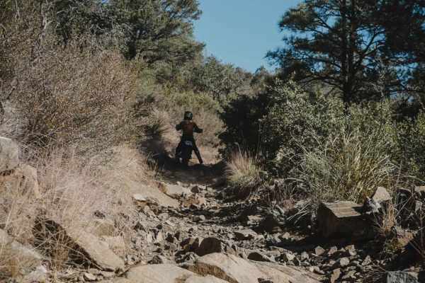
Puke Hill
Puke Hill is one of only a couple of single tracks in the Green Gulch Trail System in Prescott, Arizona. From west to east, it starts off as a faint trail that is really rocky. It gets up on top of a spine, going mostly straight with light curves. Then it drops straight down 1,000 feet all the way t...
Learn more about Puke Hill
Salida
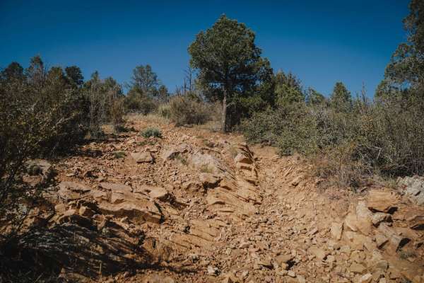
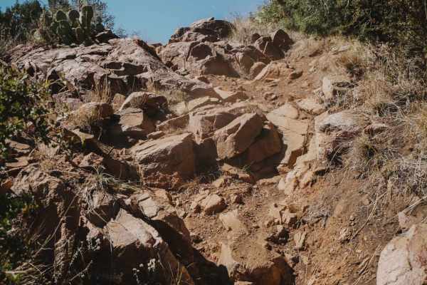
Salida is a challenging 50-inch trail that is very rocky for the entire length of the trail. It's mostly two-track width, with a few sections that are almost too narrow for an ATV. The trail is full of big loose rocks, boulders, chunky rock outcroppings, loose dirt, slab ledges, and washouts. There ...
Learn more about Salida
McCabe Mine & Cemetery Loop
The trail starts off as an easy semi-maintained trail until the 3.5-mile mark. After that, this trail becomes rutted and eroded in many spots. Keep an eye out for the McCabe Cemetery marker on your left while driving/riding to the loop. There is a small hill descent that is rutted and steep but not ...
Learn more about McCabe Mine & Cemetery Loop
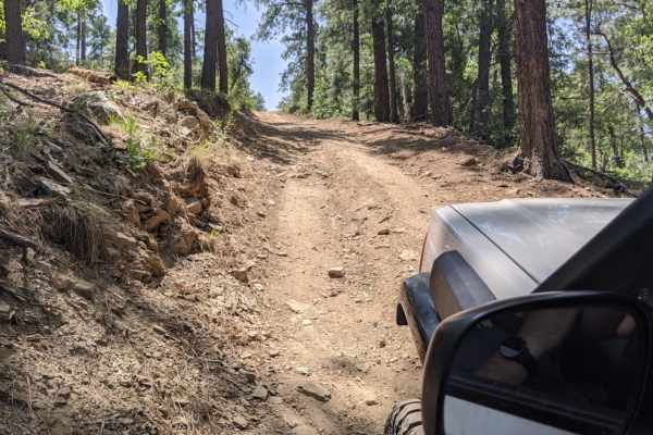
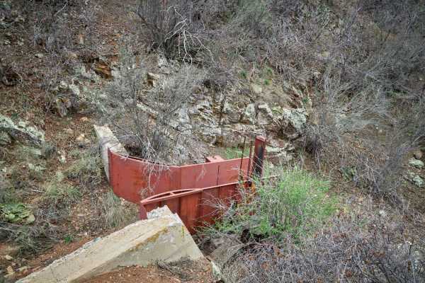
Bannie and Amulet Mine
This drive through ponderosa pines leads to two historic mine remains. Drivers may miss Bannie Mine, as it has little evidence left, but Amulet Mine features historic foundations and metal materials just off the side of the trail. Most of the trail is easy-going, but there is one steep hill climb. T...
Learn more about Bannie and Amulet Mine
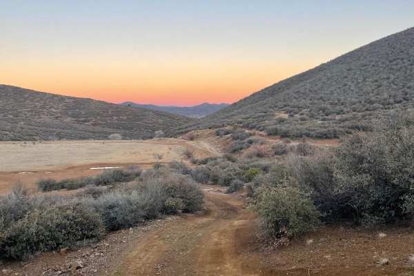
Pasture Blast
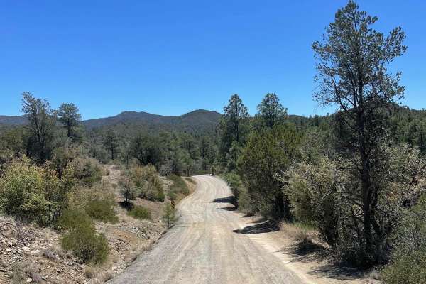
Pasture Blast is a wide rolling dirt road that cuts through the beautiful grassland of the Black Hills area outside of Prescott, AZ. Antelope, coyotes, and deer make this area their grazing ground due to the numerous water tanks in the area, as well as the abundance of food. Stunning views of the Mo...
Learn more about Pasture Blast
Texas Gulch
Texas Gulch starts as a wide, dirt road, gently rolling through the large power line towers. Quickly though, it becomes a rugged, single-lane two-track with erosion and washouts peppering its path. Be thankful for the 2 bars of LTE on this trail, because one wrong move may have you calling for help,...
Learn more about Texas Gulch
151 Spring Shelf
151 Spring Shelf is a road carved into the side of numerous hills in Prescott Valley. A shelf road, erosion hasn't claimed this trail just yet, though it is overgrown with vegetation. At pinch points, paint damage is all but guaranteed. Single lane, with little to no room to turn around, this trail ...
Learn more about 151 Spring Shelf
Seven Mile Gulch
Seven Mile Gulch is a nice wide two-track near Prescott, Arizona in the Lynx Lake Recreation Area. It climbs up from the north trailhead, which is accessed off of Walker Road from a dirt staging area. The trail curves through scrub oak and manzanita shrubs that are a bit overgrown at times, making t...
Learn more about Seven Mile Gulch
Powerline
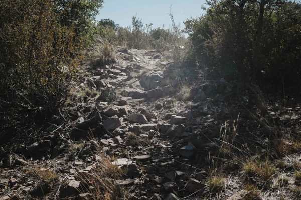
Powerline is a rough and rocky trail with extensive erosion, making it a challenging route for experienced drivers. Expect ledges, boulders, and off-camber sections that demand precise wheel placement. Cows roam freely along the trail, adding to the rugged backcountry feel. This is not a casual driv...
Learn more about Powerline
Exit Off Spruce Mountain Road
This dirt road is a route that branches off Spruce Mountain Lookout guided trail. The road starts off pretty mellow then starts to get steep and there are several sharp turns with loose rock scattered all over the surface of the trail. As you traverse down this trail, the road is very narrow so slow...
Learn more about Exit Off Spruce Mountain Road
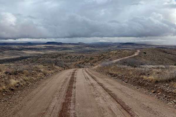
Orme Bypass
This route starts on the south side of Highway 169 and ends close to I-17. In dry conditions, this is a maintained dirt road that stretches 12.2 miles which any vehicle can make. If there has been moderate precipitation, parts of this road turn into very slippery clay-based mud with some slight uphi...
Learn more about Orme Bypass
Ambassador Mine
Ambassador Mine is a dirt road that accesses the Ambassador Mine area of the Prescott National Forest. This road is somewhat challenging from the start as the runoff from the storms has created massive deep ruts that run across the road. Alternate routes have been put in by side-by-side and other us...
Learn more about Ambassador Mine
Watershed
Watershed is a 50" trail near Prescott, Arizona that starts right off of the Senator Highway. There is a dirt parking lot at the northwest entrance to the trail for staging. Starting from the parking lot, you have to stay right for the motorized trail, as there is a non-motorized trail to the left. ...
Learn more about Watershed
ATV trails near Prescott Valley, Arizona
Explore ATV-friendly trails near you. These trails are accessible for vehicles up to 50 inches wide, perfect for ATVs and smaller off-road machines.
Nemo Spring
Nemo Spring is an intermediate 50-inch trail, full of small and sharp cobble rock, boulders, and chunky rock that make for a very bumpy ride. The surface of the trail is covered in rock almost the entire time. There are several very rocky and loose hill climbs and descents that sometimes are steep. ...
Learn more about Nemo Spring
Charcoal Gulch
Charcoal Gulch is a 50-inch trail that is an intermediate difficulty due to rocky climbs, narrow side-hilling, and off-camber sections that would be very difficult or dangerous for an ATV. The trail starts at the main staging area on a wide rocky trail, then goes past a wash and a couple of unmarked...
Learn more about Charcoal Gulch
White Horse Tank
White Horse Tank is an easy 50-inch trail near Prescott, Arizona, that has some easy challenges such as loose rocks, loose dirt, and one long hill climb/descent that is full of chunky loose rock. This trail has fewer sections of rocks than the surrounding trails such as Nemo Spring, Salida, and Char...
Learn more about White Horse Tank
Salida Connection
Salida Connection is an intermediate 50-inch trail in the Green Gulch Trail System near Prescott, Arizona. It's a wider two-track, with sections of loose dirt and rock and some steep ascents and descents. There's a section of switchbacks that are not too difficult because they are smooth and wide an...
Learn more about Salida Connection
UTV/side-by-side trails near Prescott Valley, Arizona
Find UTV and side-by-side trails near you. These trails accommodate vehicles up to 60 inches wide, ideal for UTVs, side-by-sides, and wider off-road rigs.
Ruins & Gold Pans
If you are looking for a short and easy dirt road with lots of outdoor activities, Ruins & Gold Pans offers just that. The start of this dirt road is just off of Walker Road and is before Lynx Lake. The road is a semi-maintained dirt road with washboards, small bumps, and little precipitation run-of...
Learn more about Ruins & Gold Pans
McCabe Mine & Cemetery Loop
The trail starts off as an easy semi-maintained trail until the 3.5-mile mark. After that, this trail becomes rutted and eroded in many spots. Keep an eye out for the McCabe Cemetery marker on your left while driving/riding to the loop. There is a small hill descent that is rutted and steep but not ...
Learn more about McCabe Mine & Cemetery Loop
Bannie and Amulet Mine
This drive through ponderosa pines leads to two historic mine remains. Drivers may miss Bannie Mine, as it has little evidence left, but Amulet Mine features historic foundations and metal materials just off the side of the trail. Most of the trail is easy-going, but there is one steep hill climb. T...
Learn more about Bannie and Amulet Mine
Pasture Blast
Pasture Blast is a wide rolling dirt road that cuts through the beautiful grassland of the Black Hills area outside of Prescott, AZ. Antelope, coyotes, and deer make this area their grazing ground due to the numerous water tanks in the area, as well as the abundance of food. Stunning views of the Mo...
Learn more about Pasture Blast
The onX Offroad Difference
onX Offroad combines trail photos, descriptions, difficulty ratings, width restrictions, seasonality, and more in a user-friendly interface. Available on all devices, with offline access and full compatibility with CarPlay and Android Auto. Discover what you're missing today!
Open Trail Map