
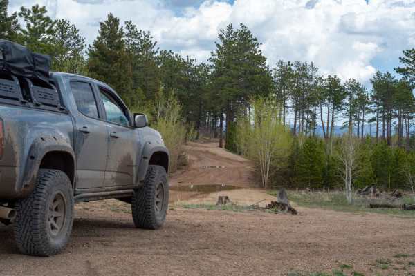
Off-Road Trails
Near Divide, Colorado
Off-Road Trails Near Divide, Colorado
Discover the best offroad trails near you. Browse trail maps, check difficulty ratings, and find your next adventure — whether you're looking for a quick ride or an all-day expedition.
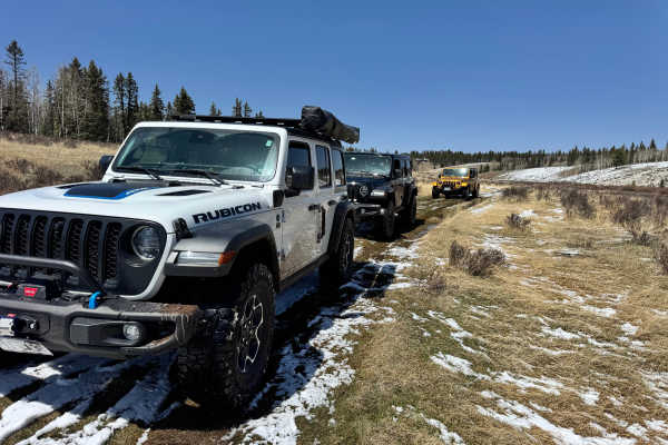
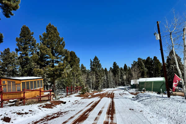
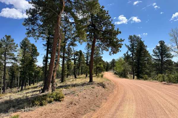
Crazy Gulch Road - FS 375
Access to this trail requires opening a gate—make sure to close it behind you to keep the area properly managed. The trail winds through a mix of pine and aspen forest before opening up into wide meadow sections, giving it a pretty balanced feel between tight wooded driving and more open cruising. T...
Learn more about Crazy Gulch Road - FS 375
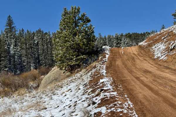
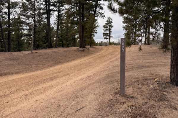
Cedar Cut 3 Road - FS 359
This route begins at a gated forest access point and quickly transitions from a wide, well-maintained dirt road into a narrower two-track that winds deeper into the pines. From the start, the trail gradually descends about 700 feet, moving through rolling terrain with a mix of open forest and tighte...
Learn more about Cedar Cut 3 Road - FS 359
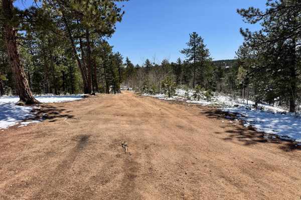
Cedar Cut 2 - FS 359
This trail winds through a mix of open meadow and dense pine forest, offering a good balance between easy cruising and light technical sections. It starts as a wide, well-defined dirt road with plenty of room to pass, then narrows in spots as it works its way through tighter tree cover. The scenery ...
Learn more about Cedar Cut 2 - FS 359
Rankin Road
Rankin Road near Divide, Colorado, is a simple but engaging trail that offers a good mix of easy driving and light technical sections. The trail starts as a typical dirt road, but you’ll quickly encounter some larger whoops that require moderate speed control. As you continue, the road narrows to mo...
Learn more about Rankin Road
Yucca Road - FS 359
Yucca Road - FS 359 starts near a small cluster of houses before quickly transitioning into a quiet pine forest, following a well-defined dirt road that drops roughly 600 feet in elevation over gentle terrain. Once past the residential area, the trail opens into more natural ground with tall pines, ...
Learn more about Yucca Road - FS 359
Wildhorn Road
Wildhorn Road (Teller County Road 3) is a scenic 4-mile light off-road trail consisting of mostly gravel and dirt. The trail connects through Pike National Forest from Florissant and towards popular trails in the area known as "The Gulches" and Phantom Creek. As you get closer North towards Pike Nat...
Learn more about Wildhorn Road
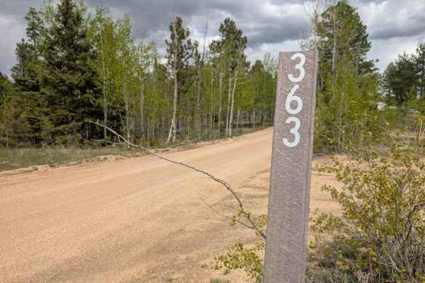
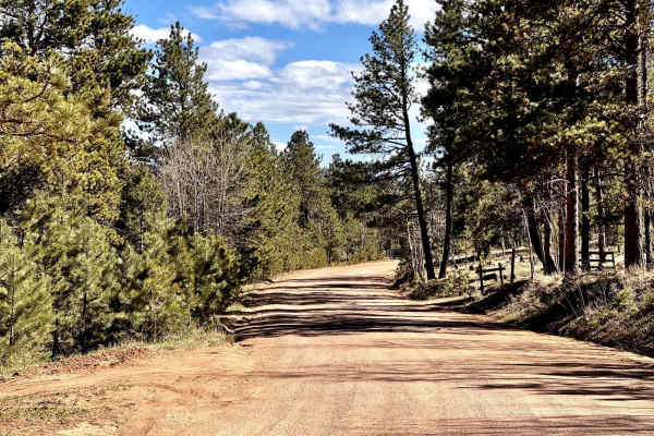
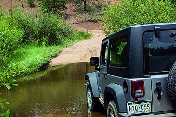
Phantom Road
Phantom Road (FS 363) is primarily a smooth, gravelly road about one and a half vehicles wide most of the way; however, the trail narrows, steepens, and the curves tighten toward the north end just before a shallow water crossing and connecting with Manchester Road. This trail tends to be very busy ...
Learn more about Phantom Road
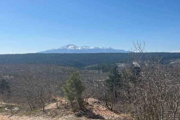
Phantom Creek, Signal Butte
A great way to check out views of Pikes Peak and Signal Butte. You'll pass through the Hayman Burn Area. It is interesting to observe the damage and recovery occurring there. If you want to camp, you can find a lot of options along the way. There's also a parking area with easy access to the trail s...
Learn more about Phantom Creek, Signal Butte
Cedar Mountain Road - Teller County Road 51
This is a popular and scenic OHV route running north of Florissant on the south side of the trail and ending near Westcreek on the north side. It offers scenic views, particularly on the northern section of the road. There are plenty of offroad trails that shoot off from this one for the opportunity...
Learn more about Cedar Mountain Road - Teller County Road 51
Manchester Road
This trail starts as a wider, smooth dirt road cutting through open meadow before quickly transitioning into a tighter, more technical route as it winds into the trees. The terrain narrows up with a mix of shallow ruts, loose gravel, and small boulder obstacles that keep you paying attention to tire...
Learn more about Manchester Road
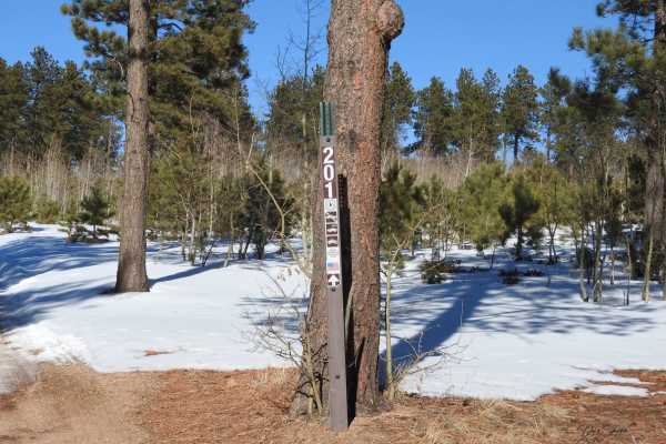
Forest Road 201
In the summertime, the road is fairly easy. In wintertime, it becomes more challenging depending on the amount of snow on the hills. It is easier to start at the top (east end) and travel for the most part downhill. Going in this direction, there are still a few hills that can be a challenge to get ...
Learn more about Forest Road 201
Schubarth Loop
This loop is really fun to explore, with its side roads and narrow, twisty terrain. There is a great overlook above the Air Force Academy where you can relax and eat lunch. It is also a fun area to camp in, with many different options inside the park's border. You'll pass through some private land, ...
Learn more about Schubarth Loop
Farish Rd 309
Farish Road 309 is an easy-going forest service road that winds through dense pine forest and open mountain meadows on a well-maintained red dirt surface. This route is suitable for nearly any vehicle in dry conditions, making it a great scenic drive for beginners, families, or anyone looking for a ...
Learn more about Farish Rd 309
Krass Road
This trail is part of a greater trail network and connects the lower sections of trails to the Cedar Mountain road, which is the main feeder road for the gulches. It runs through a burn area that is recovering. Near the bottom, you enter a treed area, and there is potential for water crossing. Mostl...
Learn more about Krass Road
Dist Boundary Road
20- 30 minutes one way. Wanders through big trees, and then it opens up into a burn area with big open views. There is a short section with some 3-4" rocks fully covering the rough trail. Other sections have big banked corners. There is an optional lookout point with a steep climb up and down. open ...
Learn more about Dist Boundary Road
Truman Road
Short singletrack out and back with a great view of Pike's Peak at the end. Several fun rollers at the end that have a bypass as well. Open all year and holds a decent amount of snow in a normal year, which can turn the easy spur into an impassable one. Please respect signs and do not go around the ...
Learn more about Truman Road
GPS Vehicle Trap - FR315
The primary trail surface is decomposed granite with some dirt and persistent surface mud. The trail tends to hold standing water on the north end. There is a great, quiet, and scenic cutoff from Rampart Range Road to Mount Herman Road in the Rampart Range. Late fall, winter, and early spring may ca...
Learn more about GPS Vehicle Trap - FR315
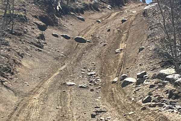
FS 948
FS 948 is a narrower and more technical forest trail that weaves through dense pine forest with a mix of rutted climbs, exposed roots, tight turns, and off-camber sections. While the trail is still relatively short and manageable for experienced drivers, the erosion and deeper washouts in several ar...
Learn more about FS 948
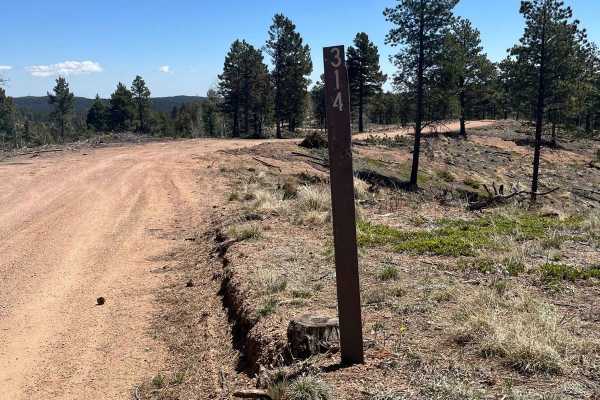
Ensign Gulch Road FR 314
This fun little cutoff route requires nothing more than a 4WD car to explore. As a scenic cutoff connecting Farrish Memorial Road and Beaver Creek Road, this trail allows for you to bypass the west half of Beaver Creek Road. This makes for an easy trail when exploring the Mount Herman/Rampart Range ...
Learn more about Ensign Gulch Road FR 314
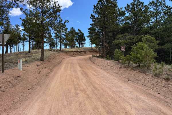
Farrish Memorial Rd 312
Farrish Memorial Road 312 is an easy forest service spur that winds through rolling pine forest and scattered aspens on a well-maintained red dirt surface. The route is beginner-friendly and suitable for most stock SUVs and crossovers during dry conditions, making it a great option for casual explor...
Learn more about Farrish Memorial Rd 312
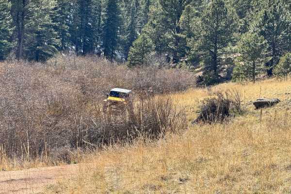
ATV trails near Divide, Colorado
Explore ATV-friendly trails near you. These trails are accessible for vehicles up to 50 inches wide, perfect for ATVs and smaller off-road machines.
Crazy Gulch Road - FS 375
Access to this trail requires opening a gate—make sure to close it behind you to keep the area properly managed. The trail winds through a mix of pine and aspen forest before opening up into wide meadow sections, giving it a pretty balanced feel between tight wooded driving and more open cruising. T...
Learn more about Crazy Gulch Road - FS 375
Cedar Cut 3 Road - FS 359
This route begins at a gated forest access point and quickly transitions from a wide, well-maintained dirt road into a narrower two-track that winds deeper into the pines. From the start, the trail gradually descends about 700 feet, moving through rolling terrain with a mix of open forest and tighte...
Learn more about Cedar Cut 3 Road - FS 359
Cedar Cut 2 - FS 359
This trail winds through a mix of open meadow and dense pine forest, offering a good balance between easy cruising and light technical sections. It starts as a wide, well-defined dirt road with plenty of room to pass, then narrows in spots as it works its way through tighter tree cover. The scenery ...
Learn more about Cedar Cut 2 - FS 359
Rankin Road
Rankin Road near Divide, Colorado, is a simple but engaging trail that offers a good mix of easy driving and light technical sections. The trail starts as a typical dirt road, but you’ll quickly encounter some larger whoops that require moderate speed control. As you continue, the road narrows to mo...
Learn more about Rankin Road
UTV/side-by-side trails near Divide, Colorado
Find UTV and side-by-side trails near you. These trails accommodate vehicles up to 60 inches wide, ideal for UTVs, side-by-sides, and wider off-road rigs.
Crazy Gulch Road - FS 375
Access to this trail requires opening a gate—make sure to close it behind you to keep the area properly managed. The trail winds through a mix of pine and aspen forest before opening up into wide meadow sections, giving it a pretty balanced feel between tight wooded driving and more open cruising. T...
Learn more about Crazy Gulch Road - FS 375
Cedar Cut 3 Road - FS 359
This route begins at a gated forest access point and quickly transitions from a wide, well-maintained dirt road into a narrower two-track that winds deeper into the pines. From the start, the trail gradually descends about 700 feet, moving through rolling terrain with a mix of open forest and tighte...
Learn more about Cedar Cut 3 Road - FS 359
Cedar Cut 2 - FS 359
This trail winds through a mix of open meadow and dense pine forest, offering a good balance between easy cruising and light technical sections. It starts as a wide, well-defined dirt road with plenty of room to pass, then narrows in spots as it works its way through tighter tree cover. The scenery ...
Learn more about Cedar Cut 2 - FS 359
Rankin Road
Rankin Road near Divide, Colorado, is a simple but engaging trail that offers a good mix of easy driving and light technical sections. The trail starts as a typical dirt road, but you’ll quickly encounter some larger whoops that require moderate speed control. As you continue, the road narrows to mo...
Learn more about Rankin Road
The onX Offroad Difference
onX Offroad combines trail photos, descriptions, difficulty ratings, width restrictions, seasonality, and more in a user-friendly interface. Available on all devices, with offline access and full compatibility with CarPlay and Android Auto. Discover what you're missing today!
Open Trail Map