
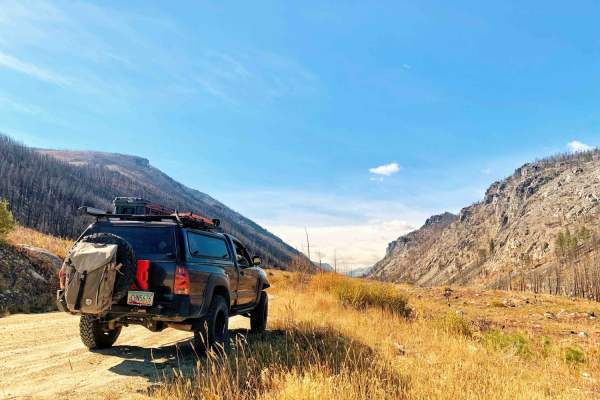
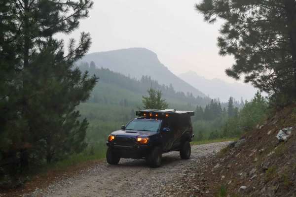
Off-Road Trails
Near Charlos Heights, Montana
Off-Road Trails Near Charlos Heights, Montana
Discover the best offroad trails near you. Browse trail maps, check difficulty ratings, and find your next adventure — whether you're looking for a quick ride or an all-day expedition.
Lost Horse Ridgeline Lower
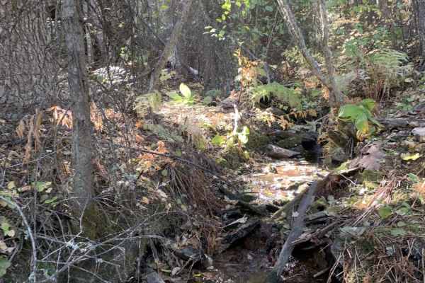
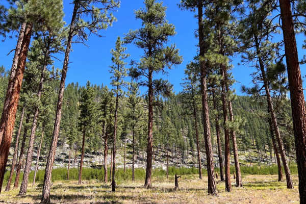
Beautiful ridgeline trail running up along the side of the mountain. This is a well-maintained dirt and gravel road that is wide enough in most places for two vehicles to pass. There are a few areas in the curves of the switchbacks that would have small waterfalls or running creeks in spring. All...
Learn more about Lost Horse Ridgeline Lower
Hays Creek Moose Creek
This is a nice ridgeline connection trail that when linked up with Moose Creek/Old Mine Trail and Lost Horse Ridgeline creates a full loop. The beginning of Lost Horse Observation Point is at one end of this trail and well worth the short out and back, with hands down the best viewpoint on this tra...
Learn more about Hays Creek Moose Creek
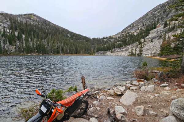
Camas Creek
The trail starts at a metal forest service gate. It is an in-and-out trail around 3 miles long and ends at a nice alpine lake. Just beyond the gate, the trail starts as a full road but quickly shrinks down to a 50-inch width, then to single track. The trail is short and moderately difficult overall....
Learn more about Camas Creek
Moose Creek/Old Mine
This can be used as an out and back trail ending at a nice little campsite with a view, or this trail can be connected up to Hays Creek Moose Creek Trail and Lost Horse Ridgeline to create a nice large loop. This trail has been rerouted due to the Forest Service rebuilding one of the creeks. The ro...
Learn more about Moose Creek/Old Mine
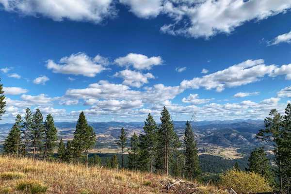
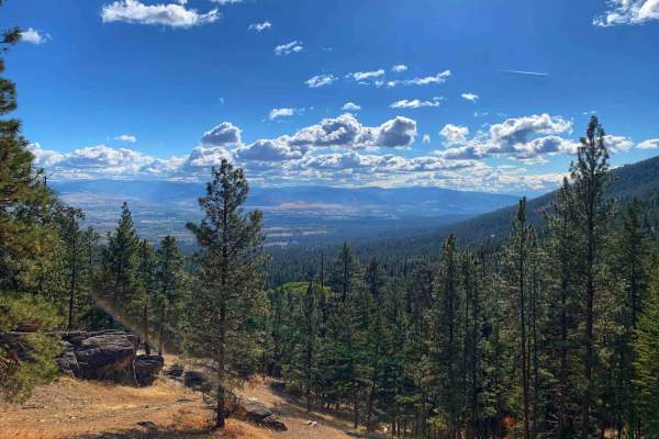
Lost Horse Observation Point
This is a truly stunning view out over the mountains and valley. It is one of the few in this area that can be driven to, most of the best viewpoints in this area are accessed from hiking trails. The Lost Horse Observation Point has a dirt parking area and multiple rock formations that can be explo...
Learn more about Lost Horse Observation Point
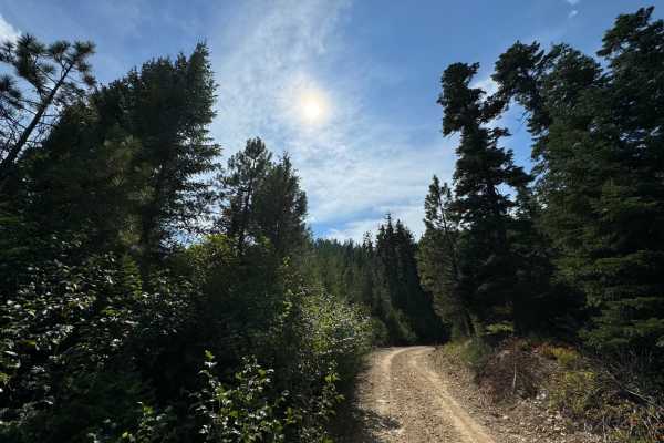
Como Crest
Short, quick, and scenic trail in the Bitterroot mountains that starts/ends at Lake Como. The dirt road is maintained in the summer months but not likely in the winter months. A gate at the beginning of the side offshoot trail is likely closed in the winter months. Was hoping that offshoot would lea...
Learn more about Como Crest
Ward Mountain
This is an excellent single-track trail that allows you to gain 4,800 feet in elevation in the 6.2 miles to the top of Ward Mountain. Fantastic views of the Bitterroot Valley and into the Roaring Lion Creek drainage. This trail has sustained climbs and loose rocks in certain areas. The first third o...
Learn more about Ward Mountain
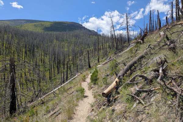
Roaring Lion
This is a short out-and-back dirt trail up one of the valleys with stunning panoramic views. There was a fire through the valley at some point that burned all the trees opening up what can be seen of the rock formations and the mountains. Roaring Lion Creek runs through the valley. At the end of ...
Learn more about Roaring Lion
Up and Up
This route starts as an easy dirt trail, accessible to 2WD and low clearance vehicles, with sweeping views over Lake Como. The higher the elevation, the better it gets. About halfway up, the trail turns from easy dirt to rocky and uneven. Higher clearance would be recommended. The trail also begins ...
Learn more about Up and Up
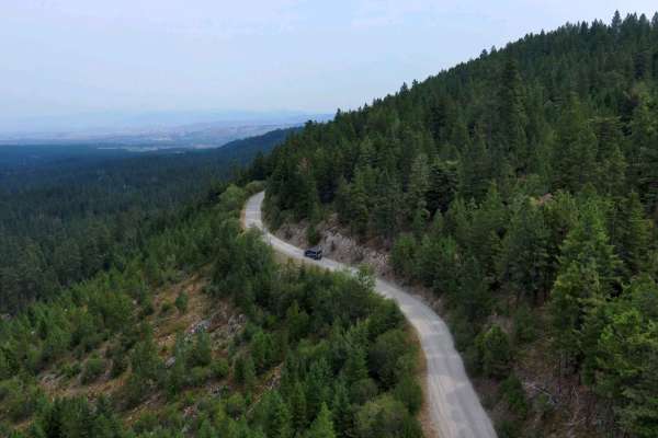
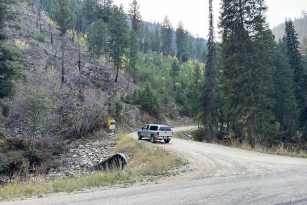
Blacktail Point Road
Blacktail Point Road is identified as Forest Road #13214 in the Bitterroot National Forest. This road is lightly traveled and is likely to appeal to off-roaders who enjoy exploring the backcountry to "get away from it all". The tread is a single lane dirt and rock surface, but there are abundant p...
Learn more about Blacktail Point Road
Shannon Bunkhouse
Shannon Bunkhouse trail is accessed from Lake Como Road and follows the first 3 miles of the Up and Up trail. After 3 miles of the Up and Up trail, there is an open area that is fairly flat. On the right side is a great view of Lake Como, and on the left is the beginning of the Shannon Bunkhouse tra...
Learn more about Shannon Bunkhouse

Waddell
If you are in the Como area and have a little extra time to kill, it would be worth doing this trail. The first half of the trail is nice and wide so passing other vehicles won't be an issue. Once you pass the winter gate which is a few miles up the trail, the trail does start to slowly narrow until...
Learn more about Waddell
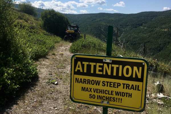
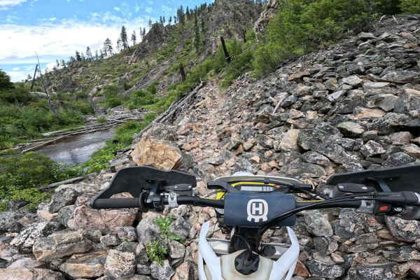
Blacktail ATV Trail
This trail is definitely for vehicles 50" or less in width (ATVs). The narrow tread, rocky sections, and ascending/descending hairpin turns require skillful wheel placement and control along the entire length of this trail. The trail is very lightly used and will emphasize a sense of adventure and ...
Learn more about Blacktail ATV Trail
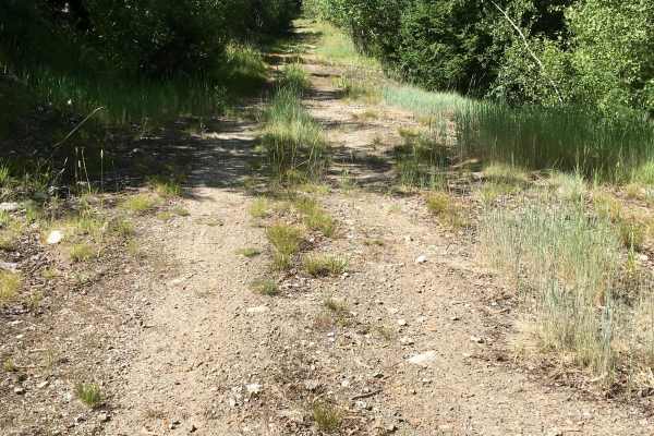
Tin Cup Dispersed
This is a shorter, very rutted dirt trail running along Tin Cup Creek with lots of dispersed camping access. Some sites are close to the stream with water access; some are just nestled in the trees. Lots of the sites are large enough to accommodate campers and trailers. It is slow going with all the...
Learn more about Tin Cup Dispersed
Tin Cup
Tin Cup trail is a trail that shoots off of the Tin Cup Creek trail. Although the beginning of this trail looks nice, smooth, and wide, you will quickly find out that this is not the condition of the entire trail. As you make your way towards the winter gate, the trail will start to narrow and quick...
Learn more about Tin Cup
Blodgett Canyon Overlook
Well maintained wide dirt road leading to several very popular hiking trails.Blodgett Overlook 1.4 mile hiking trail and Canyon Lake is 5 miles.There is a nice parking area for 10-15 cars at the end of this driving trail, a pit toilet, and some nice day use spots right on the creek. The trail up is ...
Learn more about Blodgett Canyon Overlook
Cold Spring Hill Road
The Cold Spring Hill Road, designated as FS #13216 by the Bitterroot National Forest, is a lightly used old logging road. It is primarily a one-lane dirt and rock road with abundant opportunities to pass oncoming traffic. There is quite a lot of vegetation growing into the roadway that can be prob...
Learn more about Cold Spring Hill Road
Cold Spring Hill ATV Trail
The Cold Spring Hill ATV trail, identified as Trail # 259 by the Bitterroot National Forest, ascends the Northeast slope of Cold Spring Hill. Cold Spring Hill is one of two prominent peaks in the North Fork Rye area of the Forest (the other being Deer Mountain). The trail was constructed partly fr...
Learn more about Cold Spring Hill ATV Trail
White Stallion
White Stallion is an easy trail that takes you from Sleeping Child Road to North Fork Rye and eventually to Rye Creed Road south of Darby, Montana. The first section from Sleeping Child, where you are climbing at a pretty good rate, is the roughest part of this entire trail. It is just a little bit ...
Learn more about White Stallion
Sleeping Child Trail
This route takes you on the Sleeping Child Trail to the top of Bald Top Mountain. The Bald Top ascent portion of the route is in decent condition, with minor rutting, plenty of loose rocks, and features incredible scenery. Sleeping Child Trail, on the other hand, is considerably rougher. If you love...
Learn more about Sleeping Child Trail
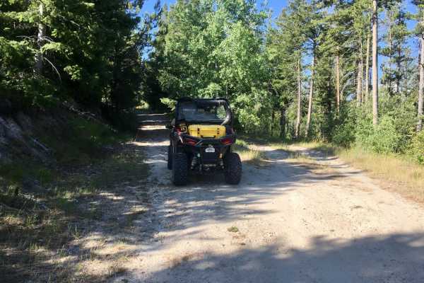
ATV trails near Charlos Heights, Montana
Explore ATV-friendly trails near you. These trails are accessible for vehicles up to 50 inches wide, perfect for ATVs and smaller off-road machines.
Lost Horse Ridgeline Lower
Beautiful ridgeline trail running up along the side of the mountain. This is a well-maintained dirt and gravel road that is wide enough in most places for two vehicles to pass. There are a few areas in the curves of the switchbacks that would have small waterfalls or running creeks in spring. All...
Learn more about Lost Horse Ridgeline Lower
Hays Creek Moose Creek
This is a nice ridgeline connection trail that when linked up with Moose Creek/Old Mine Trail and Lost Horse Ridgeline creates a full loop. The beginning of Lost Horse Observation Point is at one end of this trail and well worth the short out and back, with hands down the best viewpoint on this tra...
Learn more about Hays Creek Moose Creek
Moose Creek/Old Mine
This can be used as an out and back trail ending at a nice little campsite with a view, or this trail can be connected up to Hays Creek Moose Creek Trail and Lost Horse Ridgeline to create a nice large loop. This trail has been rerouted due to the Forest Service rebuilding one of the creeks. The ro...
Learn more about Moose Creek/Old Mine
Lost Horse Observation Point
This is a truly stunning view out over the mountains and valley. It is one of the few in this area that can be driven to, most of the best viewpoints in this area are accessed from hiking trails. The Lost Horse Observation Point has a dirt parking area and multiple rock formations that can be explo...
Learn more about Lost Horse Observation Point
UTV/side-by-side trails near Charlos Heights, Montana
Find UTV and side-by-side trails near you. These trails accommodate vehicles up to 60 inches wide, ideal for UTVs, side-by-sides, and wider off-road rigs.
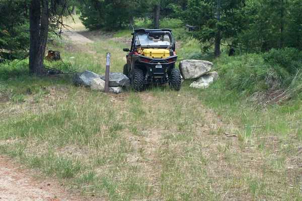
Lost Horse Ridgeline Lower
Beautiful ridgeline trail running up along the side of the mountain. This is a well-maintained dirt and gravel road that is wide enough in most places for two vehicles to pass. There are a few areas in the curves of the switchbacks that would have small waterfalls or running creeks in spring. All...
Learn more about Lost Horse Ridgeline Lower
Hays Creek Moose Creek
This is a nice ridgeline connection trail that when linked up with Moose Creek/Old Mine Trail and Lost Horse Ridgeline creates a full loop. The beginning of Lost Horse Observation Point is at one end of this trail and well worth the short out and back, with hands down the best viewpoint on this tra...
Learn more about Hays Creek Moose Creek
Moose Creek/Old Mine
This can be used as an out and back trail ending at a nice little campsite with a view, or this trail can be connected up to Hays Creek Moose Creek Trail and Lost Horse Ridgeline to create a nice large loop. This trail has been rerouted due to the Forest Service rebuilding one of the creeks. The ro...
Learn more about Moose Creek/Old Mine
Lost Horse Observation Point
This is a truly stunning view out over the mountains and valley. It is one of the few in this area that can be driven to, most of the best viewpoints in this area are accessed from hiking trails. The Lost Horse Observation Point has a dirt parking area and multiple rock formations that can be explo...
Learn more about Lost Horse Observation Point
The onX Offroad Difference
onX Offroad combines trail photos, descriptions, difficulty ratings, width restrictions, seasonality, and more in a user-friendly interface. Available on all devices, with offline access and full compatibility with CarPlay and Android Auto. Discover what you're missing today!
Open Trail Map