
Off-Road Trails in Baja California Sur
Discover off-road trails in Baja California Sur
Off-Road Trails in Baja California Sur
Discover the best off-road trails in Baja California Sur. Browse trail maps, check difficulty ratings, and find your next adventure — whether you're looking for a quick ride or an all-day expedition.
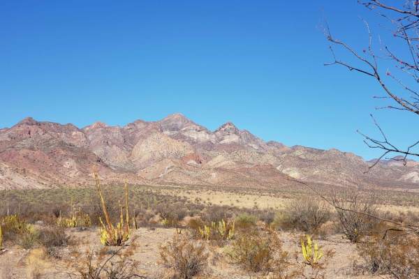
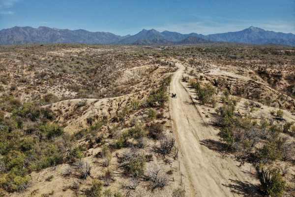
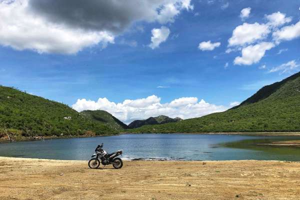
Valle de los Cirios
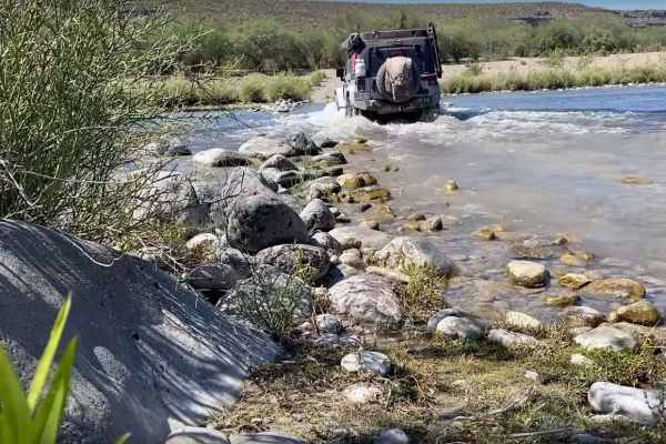
Traveling from Bahia de los Angeles back to the 1 near Benito Juarez. This route follows some old Baja 1000 tracks at points and terrain varies from rough rocky sections to sand. The route passes by Bahia San Rafael near the midpoint with beach access opportunities. No cell service, fuel or resupply...
Learn more about Valle de los Cirios
Los Naranjos
Los Naranjos is a trail that crosses from east to west Baja California Sur. It can be accessed via Route 19 on the Westside or via Route 1 on the East. I recommend a high clearance vehicle. On a 4wd, this trail can take up to 2.45 min to 3 hrs. With an approximate length of 33 miles or 54 km, it's a...
Learn more about Los Naranjos
San Juan de la Costa - San Evaristo
This trail goes from south to north starting from San Juan de la Costa. Getting to San Juan de la Costa from La Paz is a paved two-lane road. A high-clearance vehicle is recommended, 4WD in a few sections of loose slippery incline. This trail can take up to 2.5 hours. With an approximate length of 7...
Learn more about San Juan de la Costa - San Evaristo
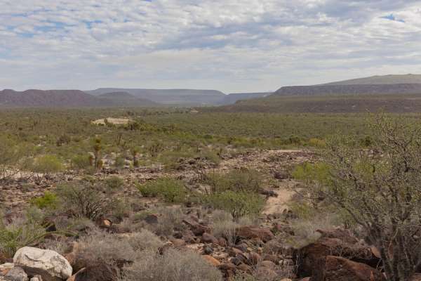
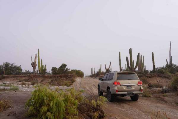
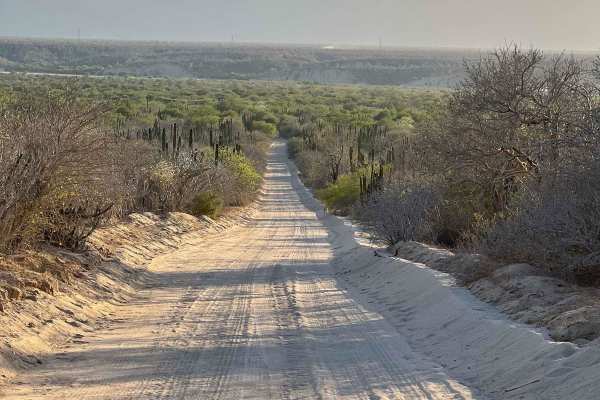
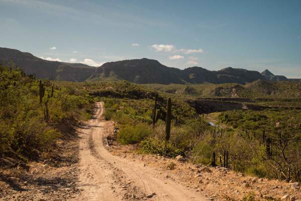
Desert Jungle to San Ignacio
This trail begins pretty mild, dusty, with a few rocky spots and surrounded by cacti. As the trail progresses, it opens up and then narrows again onto a rocky hill. This section is technical and definitely requires high clearance. The other side of the hill quickly transitions into a jungle-like lan...
Learn more about Desert Jungle to San Ignacio
San Juanico to San Ignacio via the Coast.
This route takes you from San Juanico to San Ignacio via the coast road. The terrain varies from slow corrugated roads with some large rocks that could cause flat tires to smooth fast sand roads. This is a quicker route between San Ignacio and San Juanico than the paved road if you're vehicle is abl...
Learn more about San Juanico to San Ignacio via the Coast.
El Refugio
This trail section is mainly a compact dirt road, with some wide and narrow sections. You'll find some rolling hills, loose rocks, water crossing, and loose sand. There is a very small farmers' community called El Refugio, so expect some cows, horses, and goats crossing the road. Most of the year, y...
Learn more about El Refugio
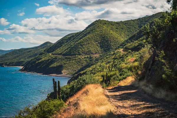
La Trinidad
On this trail, you can expect a little bit of everything, sand, loose rocks, water crossing, challenging up hills, and incredible views of the Pacific and Sea of Cortez side. You can take different roads that will take you to very different places. Be careful with loose cows on the road. The last se...
Learn more about La Trinidad
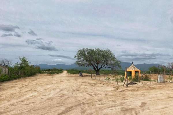
San Blas Trail
This is a very enjoyable trail to ride in any kind of vehicle. The trail is pretty much all two vehicles wide, with some ups and down hills, beautiful views, and river beds. Check out the small community of San Blas, which has a lovely local church. Watch out for cows and horses that run free across...
Learn more about San Blas Trail
Matancitas - Candelaria
This is one section of connecting trail, called La Candelaria, which is a small farmers' community that is in the middle of the Baja Sierras.This section has nice views, and is very fun to ride! It's pretty much all compact dirt, with some loose rocks, lots of curves, and hills.The surface can chang...
Learn more about Matancitas - Candelaria
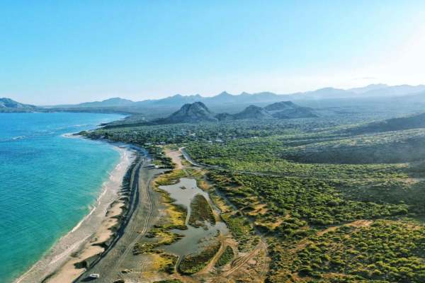
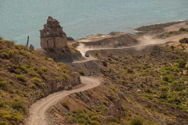
Cabo Pulmo National Park - La Fortuna
This is a fantastic trail that travels along the beautiful Gulf Of Cortez.The road has been well-cared for lately, but some sections can become a bit rough or challenging depending on recent weather. If you are planning to do it in a regular vehicle, it can only be done in the non-rainy season ( Aug...
Learn more about Cabo Pulmo National Park - La Fortuna
San Lucas to Presa las Palmas (Water Dam)
This trail is the way to go to the Presa las Palmas, from Cabo San Lucas Airport (as a reference to start from). It's a fun dirt road, with water crossing during the rainy season, river beds, and a small local community called El Sauzal. After some hills, you will end up in a very soft sandy river b...
Learn more about San Lucas to Presa las Palmas (Water Dam)
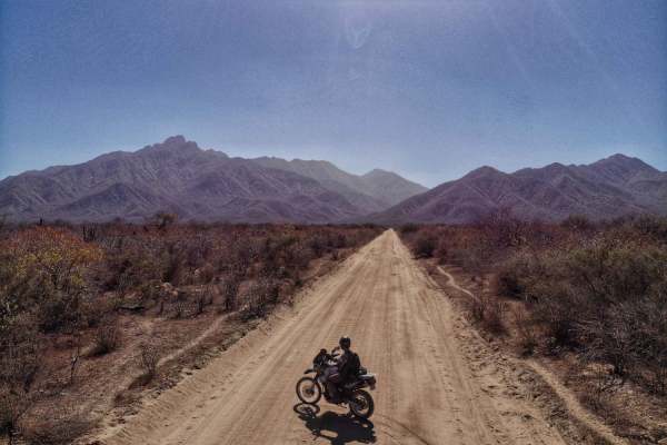
San Ignacio to San Juanico Cross Peninisula
Embark on a scenic journey along the broad dirt trail that stretches from the picturesque town of San Ignacio to the idyllic coastal haven of San Juanico. While this route typically accommodates two-wheel drive vehicles, inclement weather patterns prevalent in the area may warrant changes to the ter...
Learn more about San Ignacio to San Juanico Cross Peninisula
San Juanico to Mulege Transpeninsular Route
Embark on a picturesque offroad adventure through a diverse landscape that starts in the arid desert and meanders along a rugged riverbed, culminating in a breathtaking canyon before arriving at the charming town of Mulege. The trail primarily consists of unpaved, rocky terrain that presents some ch...
Learn more about San Juanico to Mulege Transpeninsular Route
Santa Anita
This trail connects to the La Trinidad Trail, and it will take you to or from Santa Anita town to East Cape or Santiago. It's an easy trail, with lots of loose gravel and loose sand. The trail has very beautiful views along the way and a riverbed crossing of San Jose. You will see a lot of giant Cac...
Learn more about Santa Anita
La Ventana to Bahia De Los Suenos Beach Route
This is a challenging sand route that runs parallel to the ocean, offering stunning views from the highest point above the surf. To navigate this route, a 4x4 with extra clearance, aired down tires, and recovery gear is recommended. It's important to remain on the flat section as high as possible an...
Learn more about La Ventana to Bahia De Los Suenos Beach Route
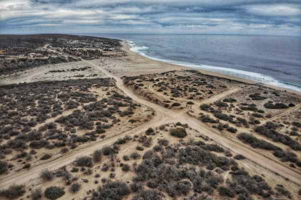
Laguna San Ignacio
The road/trail out to the point is predominantly easy and well-packed, taking roughly a half hour to get out there from the main road. The only thing that could make this route difficult is if the trail becomes wet, either from rain or high tide towards the end (tip). If wet, sections could prove ve...
Learn more about Laguna San Ignacio
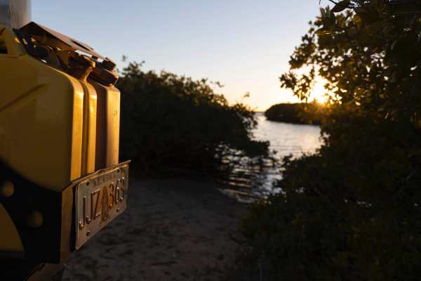
Mangrove Fishing
The trail is a straightforward sand/dirt track through cacti and mangroves, working slowly toward the water. The thick foliage in some sections of the trail causes the road to narrow, though the sand is so smooth in these sections it's easy to avoid too many scratches, and a steady speed is simple t...
Learn more about Mangrove Fishing
Sierra La Gata
La Sierra La Gata (El Carrizalito) is a trail that crosses from west to east Baja California Sur. It can be accessed via San Juan de Los Planes or Los Barriles. A high clearance vehicle is recommended, 4WD in a few sections of loose/incline sections. This trail can take up to 2hr to 2.5hrs. With an ...
Learn more about Sierra La Gata
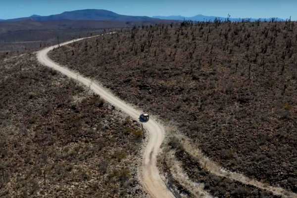
Palo Escopeta
This is a nice and fun trail. Most of it is a section that holds many races in Baja Sur. This trail has a little bit of everything, very wide sections, with incredible views, soft sand sections, up/down hills, river bed crossing, wide turns, and long straight sections as well. Pay close attention ea...
Learn more about Palo Escopeta
Km128 - San Evaristo
This route has an even dirt track with some long rocky sections with some dried-out river beds and paved water crossing in between the ranches, and a few small forested areas. There are a few homes and ranches throughout the trail, so locals lightly traffic it. On one end of the trail just before en...
Learn more about Km128 - San Evaristo
ATV trails in Baja California Sur
Explore ATV-friendly trails in Baja California Sur. These trails are accessible for vehicles up to 50 inches wide, perfect for ATVs and smaller off-road machines.
Los Naranjos
Los Naranjos is a trail that crosses from east to west Baja California Sur. It can be accessed via Route 19 on the Westside or via Route 1 on the East. I recommend a high clearance vehicle. On a 4wd, this trail can take up to 2.45 min to 3 hrs. With an approximate length of 33 miles or 54 km, it's a...
Learn more about Los Naranjos
San Juan de la Costa - San Evaristo
This trail goes from south to north starting from San Juan de la Costa. Getting to San Juan de la Costa from La Paz is a paved two-lane road. A high-clearance vehicle is recommended, 4WD in a few sections of loose slippery incline. This trail can take up to 2.5 hours. With an approximate length of 7...
Learn more about San Juan de la Costa - San Evaristo
Desert Jungle to San Ignacio
This trail begins pretty mild, dusty, with a few rocky spots and surrounded by cacti. As the trail progresses, it opens up and then narrows again onto a rocky hill. This section is technical and definitely requires high clearance. The other side of the hill quickly transitions into a jungle-like lan...
Learn more about Desert Jungle to San Ignacio
San Juanico to San Ignacio via the Coast.
This route takes you from San Juanico to San Ignacio via the coast road. The terrain varies from slow corrugated roads with some large rocks that could cause flat tires to smooth fast sand roads. This is a quicker route between San Ignacio and San Juanico than the paved road if you're vehicle is abl...
Learn more about San Juanico to San Ignacio via the Coast.
UTV/side-by-side trails in Baja California Sur
Find UTV and side-by-side trails in Baja California Sur. These trails accommodate vehicles up to 60 inches wide, ideal for UTVs, side-by-sides, and wider off-road rigs.
Los Naranjos
Los Naranjos is a trail that crosses from east to west Baja California Sur. It can be accessed via Route 19 on the Westside or via Route 1 on the East. I recommend a high clearance vehicle. On a 4wd, this trail can take up to 2.45 min to 3 hrs. With an approximate length of 33 miles or 54 km, it's a...
Learn more about Los Naranjos
San Juan de la Costa - San Evaristo
This trail goes from south to north starting from San Juan de la Costa. Getting to San Juan de la Costa from La Paz is a paved two-lane road. A high-clearance vehicle is recommended, 4WD in a few sections of loose slippery incline. This trail can take up to 2.5 hours. With an approximate length of 7...
Learn more about San Juan de la Costa - San Evaristo
Desert Jungle to San Ignacio
This trail begins pretty mild, dusty, with a few rocky spots and surrounded by cacti. As the trail progresses, it opens up and then narrows again onto a rocky hill. This section is technical and definitely requires high clearance. The other side of the hill quickly transitions into a jungle-like lan...
Learn more about Desert Jungle to San Ignacio
San Juanico to San Ignacio via the Coast.
This route takes you from San Juanico to San Ignacio via the coast road. The terrain varies from slow corrugated roads with some large rocks that could cause flat tires to smooth fast sand roads. This is a quicker route between San Ignacio and San Juanico than the paved road if you're vehicle is abl...
Learn more about San Juanico to San Ignacio via the Coast.
The onX Offroad Difference
onX Offroad combines trail photos, descriptions, difficulty ratings, width restrictions, seasonality, and more in a user-friendly interface. Available on all devices, with offline access and full compatibility with CarPlay and Android Auto. Discover what you're missing today!
Open Trail Map