
Off-Road Trails in Quebec
Discover off-road trails in Quebec
Off-Road Trails in Quebec
Discover the best off-road trails in Quebec. Browse trail maps, check difficulty ratings, and find your next adventure — whether you're looking for a quick ride or an all-day expedition.
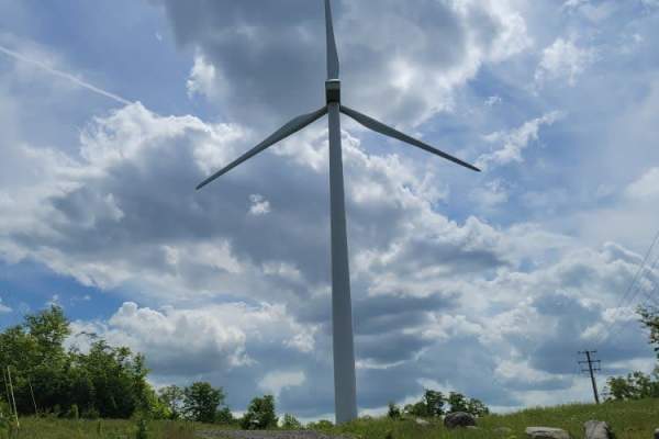
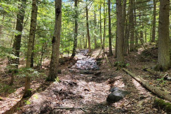
Wind and Water Trail
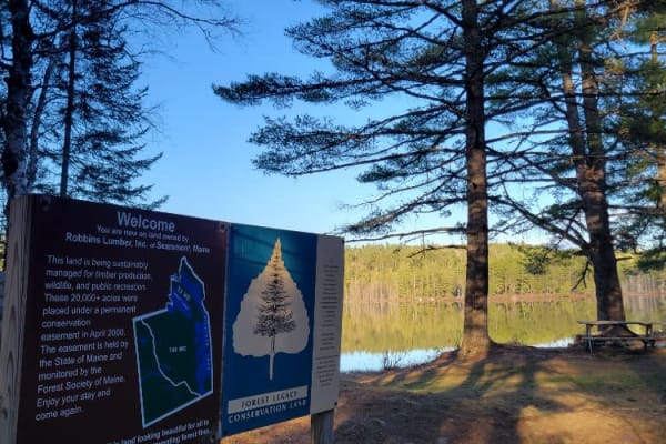
The Wind and Water Trail is a 40-mile trail that starts at Route 6 in Lincoln, Maine. At the start of the trail is a collection of windmills, each with its access road. These windmills are amazing to see up close, and some of the windmill sites open up to expansive views. Most of the trail is dirt w...
Learn more about Wind and Water Trail
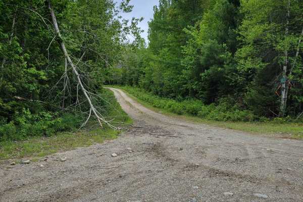
Indian Stream Road to Terrill Pond
This is an amazing out-and-back adventure that ends at the Canadian Border or at a beautiful pound called Terrill Pond. The road is a remote logging road system that has many gated offshoots that open and close based on logging activity and season. The road surface is mainly well maintained but ther...
Learn more about Indian Stream Road to Terrill Pond
Cedar Stream Road
This is an amazing route that circles around both the second Connecticut Lake and Lake Francis and crosses the upper Connecticut river with fly-fishing-only access. There are a few backcountry trout ponds that are walk-in only off the route. The road is a well-maintained logging road with active log...
Learn more about Cedar Stream Road
Gauntlet Falls West Trail
This Gauntlet Falls West Trail is a branch starting at the Katahdin Iron Works Historic site which is also the Ki-Jo Mary check-in point for the Northern Maine Woods. The trail is all dirt roads typically wide enough for 2 vehicles to pass. The trail has a variety of spurs to be explored with time. ...
Learn more about Gauntlet Falls West Trail
Oxhead Lakes Trail
This trail provides access to the Oxhead Ponds and a variety of other trails to be explored. The trail is dirt and wide enough for 2 vehicles to pass with ease. As a primary access road, it can be considered busy at times, but as a connector, it is a crucial part of other trails to be explored. Ther...
Learn more about Oxhead Lakes Trail
Greenwood Pond Trail
This trail to Greenwood Pond starts at the Katahdin Iron Works Historic Site which is also the Ki-Jo Mary check-in point for the Northern Maine Woods. The trail is all dirt roads typically wide enough for 2 vehicles to pass, but roughly 2/3rds of the way the trail becomes a bit narrower and in some ...
Learn more about Greenwood Pond Trail

West to Oxhead Connector
This trail is a connector between the West Lake Southern Tip and Oxhead Lakes Trail. The trail is primarily a dirt road, with some sections that are more water saturated and could be evaluated during the spring or other wet times of the year. The trail is less developed than some of the other larger...
Learn more about West to Oxhead Connector
West Lake Southern Tip
This trail traverses between Nicatous Lake to the east and West Lake to the west. The trail is primarily dirt and wide enough for vehicles to pass each other. There is a variety of spurs from this trail leading to either lake and to some private seasonal camps. Woods, water, and wildlife are abundan...
Learn more about West Lake Southern Tip
Big White Brook - Campsites
This Big White Brook trail is a short spur leading to a set of riverside campsites. The trail is typically wide enough for 2 vehicles to pass but narrows once you get closer to the camps. You can continue down the trail past the campsites to find a washout and a very overgrown uphill trail that mi...
Learn more about Big White Brook - Campsites
Brandy Pond West
This trail provides access to the western side of Brandy Pond. The trail is primarily dirt road, with some sections that are more water-saturated and could be evaluated during the spring or other wet times of the year. The trail is less developed than some of the other larger trails and is more acce...
Learn more about Brandy Pond West

Buffalo Stream East
This trail provides access to the eastern side of Buffalo Stream. The trail is primarily dirt/grass and is very narrow due to the soft white pine needles. Use caution as the narrowness of this trail may result in scratches on the vehicle. This trail dead ends at Buffalo Stream, where there used to b...
Learn more about Buffalo Stream East
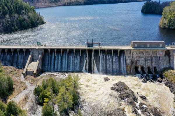
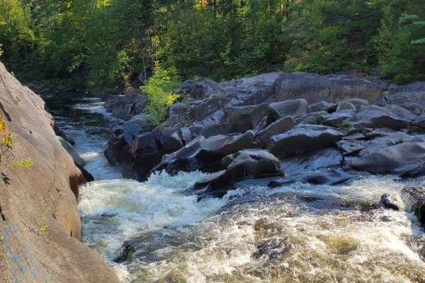
The Golden Road
The famous Golden Road from Millinocket to the Canadian Border, with stops at Ripogenus Falls, Ripogenus Gorge, and Ripogenus Dam. This route does enter North Maine Woods which requires paying an entrance fee at the checkpoint about halfway through the route (after the Falls/Gorge/Dam). North Maine ...
Learn more about The Golden Road
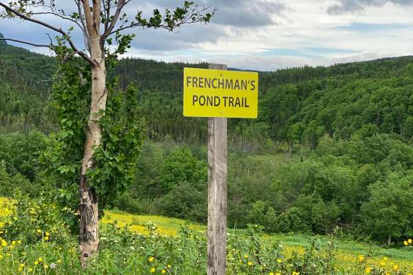
Frenchman's Pond Trail
This is a fairly easy trail through the backwoods and lakes north of Corner Brook and heading northwest to Cox's Cove, Newfoundland. There are a number of interesting points along the trail with scenic views of lakes, cliffs, valleys and several sign posts along the way. The trail can be run in eith...
Learn more about Frenchman's Pond Trail
Baker Hill Summit
This trail takes you to the top of Baker Hill. The trail is dirt and grass and somewhat elevated. The trail is less developed than some of the other larger trails and is more accepting of single-vehicle traffic. Towards the top, the trail spurs out into a few smaller dead ends and becomes a bit tigh...
Learn more about Baker Hill Summit
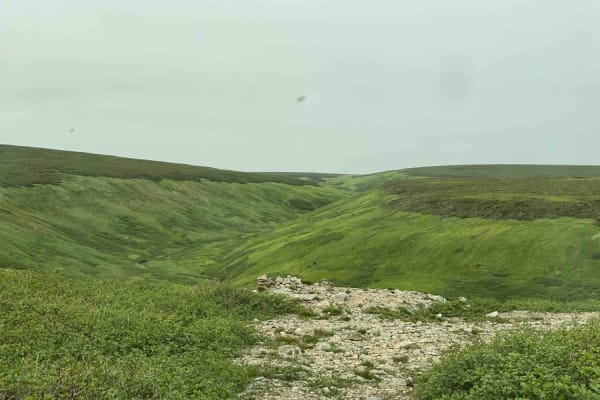
Big Pond Overlook Trail
This trail provides access to the two radio towers on the top of the plateau. It traverses up the narrow valley and opens up onto the plateau about two thirds of the way to the top. The trail is mostly rounded rocks in the valley and rocks and gravel at the upper section. The lower section has narro...
Learn more about Big Pond Overlook Trail
Quinn Loop Backdoor Trail
You start this journey on the Norcan Trail, a fairly simple trail that is mostly a dirt road with some crevasses. As you reach the Quinn Loop Backdoor Trail, things get more exciting with water crossings, boulders, off-camber obstacles, tight trails, and greasy conditions to be expected. A chainsaw ...
Learn more about Quinn Loop Backdoor Trail
Magalloway Road to Hawk Road
Very easy paper company roads except for one culvert washed out. There is plenty of room to turn around if needed. You are able to get around with a 4-door Jeep with no problem but definitely need 4WD. There are many spur roads that lead to some nice views as well as plenty of views along the way an...
Learn more about Magalloway Road to Hawk Road
New Hampshire Border into Maine
This a well-traveled paper company road. A lot of spur roads venture off the main road with a lot of beautiful views. There aren't a lot of signs with directions, so an updated app is a huge help. Some washouts are along the way, but they're passable with almost any 4WD vehicle.
Learn more about New Hampshire Border into Maine
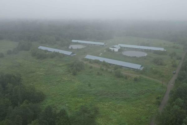
Deserted Pork Corridor
This is a quick way in or out of the forests south of Springfield, New Brunswick. Exiting Highway 615, you will find yourself passing some very large pork facilities that have been vacant for some time. The road is still groomed and graded, and a popular bypass to the more water-logged entrances nea...
Learn more about Deserted Pork Corridor
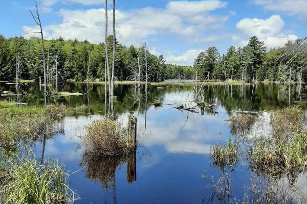
Shoe Lake
This trail throws you right into the mix. Expect numerous rock gardens with rocks ranging from basketball size to larger rocks that you should only tackle if you are lifted 3 inches or above. Most obstacles have a bypass around them (if needed). The bypasses can be difficult also but are passable. W...
Learn more about Shoe Lake
ATV trails in Quebec
Explore ATV-friendly trails in Quebec. These trails are accessible for vehicles up to 50 inches wide, perfect for ATVs and smaller off-road machines.
Oxhead Lakes Trail
This trail provides access to the Oxhead Ponds and a variety of other trails to be explored. The trail is dirt and wide enough for 2 vehicles to pass with ease. As a primary access road, it can be considered busy at times, but as a connector, it is a crucial part of other trails to be explored. Ther...
Learn more about Oxhead Lakes Trail
West to Oxhead Connector
This trail is a connector between the West Lake Southern Tip and Oxhead Lakes Trail. The trail is primarily a dirt road, with some sections that are more water saturated and could be evaluated during the spring or other wet times of the year. The trail is less developed than some of the other larger...
Learn more about West to Oxhead Connector
Brandy Pond West
This trail provides access to the western side of Brandy Pond. The trail is primarily dirt road, with some sections that are more water-saturated and could be evaluated during the spring or other wet times of the year. The trail is less developed than some of the other larger trails and is more acce...
Learn more about Brandy Pond West
Buffalo Stream East
This trail provides access to the eastern side of Buffalo Stream. The trail is primarily dirt/grass and is very narrow due to the soft white pine needles. Use caution as the narrowness of this trail may result in scratches on the vehicle. This trail dead ends at Buffalo Stream, where there used to b...
Learn more about Buffalo Stream East
UTV/side-by-side trails in Quebec
Find UTV and side-by-side trails in Quebec. These trails accommodate vehicles up to 60 inches wide, ideal for UTVs, side-by-sides, and wider off-road rigs.
Oxhead Lakes Trail
This trail provides access to the Oxhead Ponds and a variety of other trails to be explored. The trail is dirt and wide enough for 2 vehicles to pass with ease. As a primary access road, it can be considered busy at times, but as a connector, it is a crucial part of other trails to be explored. Ther...
Learn more about Oxhead Lakes Trail
West to Oxhead Connector
This trail is a connector between the West Lake Southern Tip and Oxhead Lakes Trail. The trail is primarily a dirt road, with some sections that are more water saturated and could be evaluated during the spring or other wet times of the year. The trail is less developed than some of the other larger...
Learn more about West to Oxhead Connector
Brandy Pond West
This trail provides access to the western side of Brandy Pond. The trail is primarily dirt road, with some sections that are more water-saturated and could be evaluated during the spring or other wet times of the year. The trail is less developed than some of the other larger trails and is more acce...
Learn more about Brandy Pond West
Buffalo Stream East
This trail provides access to the eastern side of Buffalo Stream. The trail is primarily dirt/grass and is very narrow due to the soft white pine needles. Use caution as the narrowness of this trail may result in scratches on the vehicle. This trail dead ends at Buffalo Stream, where there used to b...
Learn more about Buffalo Stream East
The onX Offroad Difference
onX Offroad combines trail photos, descriptions, difficulty ratings, width restrictions, seasonality, and more in a user-friendly interface. Available on all devices, with offline access and full compatibility with CarPlay and Android Auto. Discover what you're missing today!
Open Trail Map