
Dirt Bike Trails
Near Upper Santan Village, Arizona
Explore All Dirt Bike Trails Near Upper Santan Village, Arizona
Dirt Bike Trails Near Upper Santan Village, Arizona
Discover the best dirt bike trails near you. Browse trail maps, check difficulty ratings, and find your next adventure — whether you're looking for a quick ride or an all-day expedition.
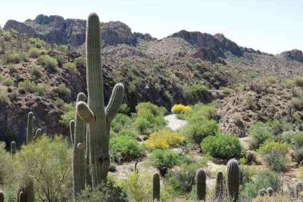
WhoopDeDo Roller Coaster
WhoopDeDo Roller Coaster is an exhilarating 21-mile desert trek designed for experienced four-wheel-drive drivers seeking scenic ridgelines, steep climbs, and a roller-coaster-style ride through Arizona’s rugged Mineral Mountains. Branching off State Route 79 near Florence, this route serves as a le...
Learn more about WhoopDeDo Roller Coaster

Upper Woodpecker to Ajax Mine
This trail follows the difficult wash known as Upper Woodpecker. At the eastern end of the wash, the trail climbs up a narrow winding trail to join Ajax Mine Road. The wash is very difficult. Lockers and 33 inch or larger tires are recommended. The trail following the wash is intermediate and does n...
Learn more about Upper Woodpecker to Ajax Mine
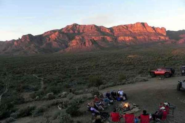
Superstition Backroads
The Superstition Backroads are easy Jeep trails, close to town, that take you on a short day trip to an abandoned gypsum mine. The western end of the trail is close to the Superstition Mountains. The main trail is 4, while a short optional climb and the Gypsum Overlook Loop are 5. There is a picnic ...
Learn more about Superstition Backroads
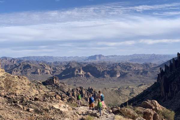
Peralta road
Peralta road is an easy, graded dirt road. Although the road is not challenging, it still leads to great views and has plenty of turn-offs for dispersed camping. If you are into hiking, this road ends at a trailhead for miles of great hiking. The trailhead has a restroom, but it can be crowded.
Learn more about Peralta road
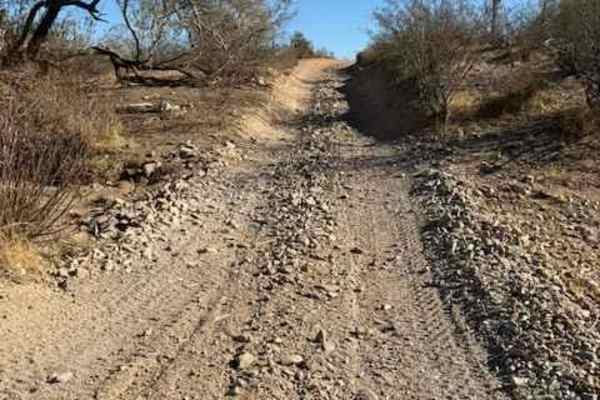
Nw2014
Nw2014 is located to the East of Arizona State Route 79 and South of the Box Canyon trail. It connects Box Canyon to the main North/South Nw2006 trail. The trail consists of dirt, small loose rocks, and minor ruts. Full-size vehicles are susceptible to pinstriping. One bar of Verizon LTE service was...
Learn more about Nw2014
Nw2006
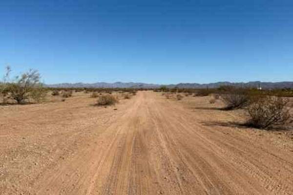
Nw2006 is located to the East of Arizona State Route 79. This is the main North/South connection between WhoopDeDo Roller Coaster and Box Canyon trails. This dirt trail is wide and suitable for full-size vehicles. There are plenty of large campsites suitable for large trailers and RVs on the sides. ...
Learn more about Nw2006
Nw2230
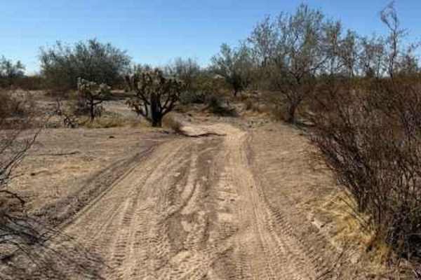
Nw2230 is located to the East of AZ State Route 79 and North of the Box Canyon trail. Coming from Box Canyon, it is a little difficult to find at first because of the dirt bike play area. The trail is a mix of single track and wash. Not suitable for full-size vehicles. Pinstriping is imminent and lo...
Learn more about Nw2230
Top Of The World
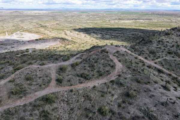
This is a short leisurely cruise through the desert. It is great for beginners, sightseeing, or testing out new parts. Parts of this trail pass through Arizona Trust Land, so a pass is required. The vast majority of this trail is a single-lane dirt road, with a few wash crossings. The highlight of t...
Learn more about Top Of The World
Nw2006a
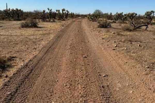
Nw2006a is located to the East of Arizona State Route 79 and South of the Box Canyon trail. This is a side trail to the main North/South Nw2006 trail. The trail consists of dirt and small rocks. It is wide and suitable for full-size vehicles. One bar of Verizon LTE service was available.
Learn more about Nw2006a
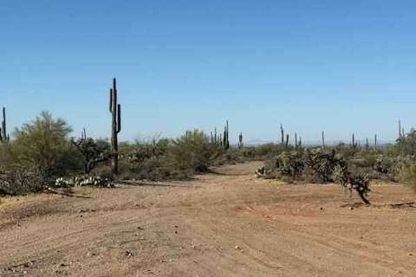
Nw2010
This is a main North/South trail through Arizona State Trust Land connecting Upper Woodpecker to WhoopDeDo Roller Coaster. This is a wide dirt road suitable for 2WD vehicles with plenty of room to pass. Large campsites are present off this road. Arizona State Trust Land requires a permit. An individ...
Learn more about Nw2010
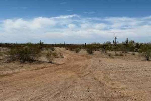
Nw2233
Nw2233 is located to the East of Arizona State Route 79 and South of the Box Canyon trail. This side trail connects Nw2006 to Nw2014 and consists of dirt and small rocks. It is a single track with places to pass. Pinstriping is possible for full-size vehicles. One bar of Verizon LTE service was avai...
Learn more about Nw2233
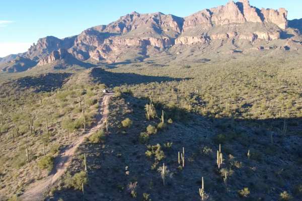
26 Hill
This off-road route is very short but very rewarding. '26 Hill' gets its name from the 26-degree steep angle (as pictured) you will be climbing at the end of this trail. You will be surrounded by rewarding views of the Superstition Mountains at the top. The climb and incline are the obstacles, in ad...
Learn more about 26 Hill
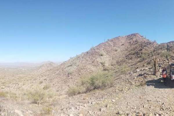
Haley Hills Overlook
This trail leads from the Vekol Wash to one of the crests of the Haley Hills. You can stand on top and see over both sides of the hill, north and south. Beware of lots of cholla cactus in the northern portion. This trail also connects with 2 other minor trails shortly after it leaves the wash.
Learn more about Haley Hills Overlook
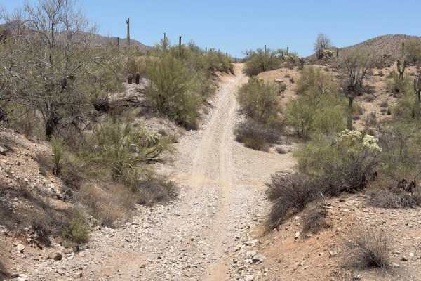
Sandman
Sandman trail snakes through sandy washes that cut between steep rock walls, making the route feel both intimate and wild. These dry creek beds are the natural arteries of the desert, often marked with fresh animal tracks and seasonal wildflowers. The route connects with other popular trails, rangin...
Learn more about Sandman
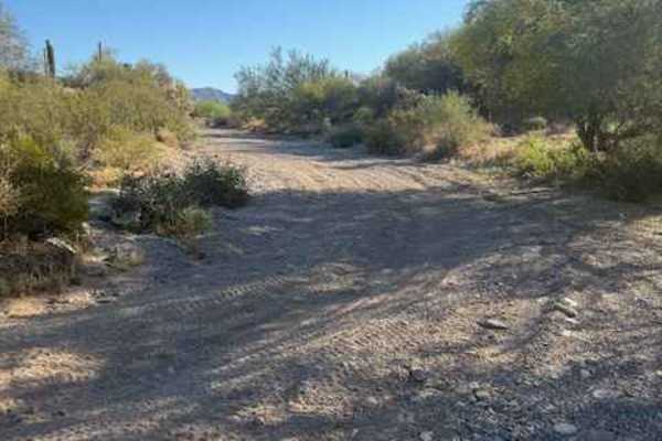
Nw2077a
This is a small wash consisting of dirt and rock. There are a few low-hanging trees and a landslide from the adjacent cliff partially blocking the wash. Mid-size and full-size vehicles can still pass, with pinstriping being inevitable. Traveling East will keep you on BLM and bring you to a well-grad...
Learn more about Nw2077a
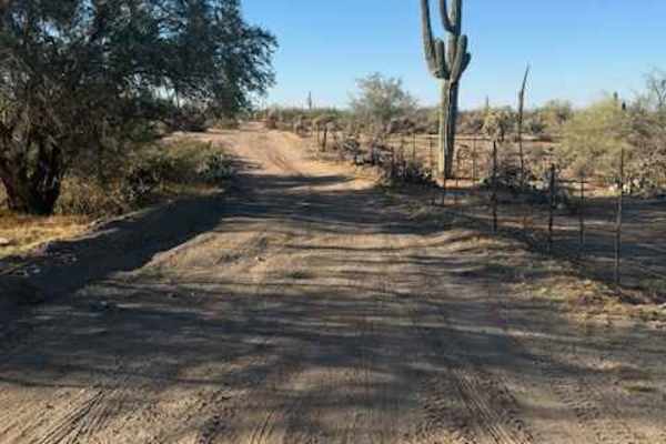
Nw2030
This trail consists of dirt and rock. It is on the BLM side and borders Arizona State Trust Land. It connects the main East and West arteries to a small wash. When guided, travelling West in the wash will bring you to an open gate to Arizoa State Trust Land. Note: Arizona State Trust Land requires a...
Learn more about Nw2030
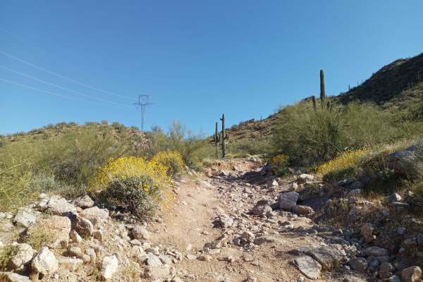
Power Line Road | Hidden Valley South
This trail has varying difficulty. There is an expert-level rock garden a couple of hundred feet long at the big hill climb, but otherwise, it's a level 4 difficulty. The rock garden has off-camber obstacles;higher clearance is recommended, as stock-height vehicles will likely get rocker damage. The...
Learn more about Power Line Road | Hidden Valley South
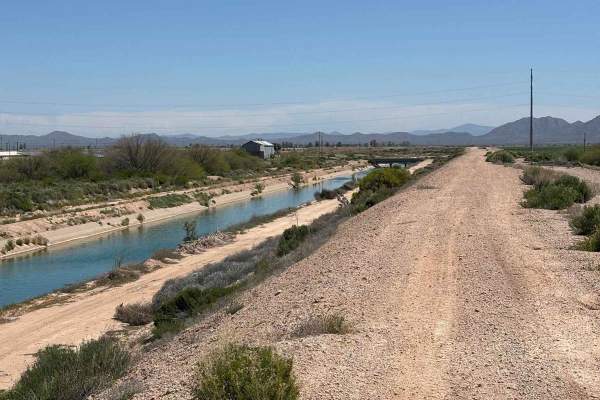
Eloy Canal Trail
The Eloy Canal Trail travels along the edge of the Arizona state water system on dirt roads parallel to the water. There are trails on either side of the water, with many bridges across. Additionally, there are artificial ridges along the edges of the canal which are fun to ride atop, providing wide...
Learn more about Eloy Canal Trail
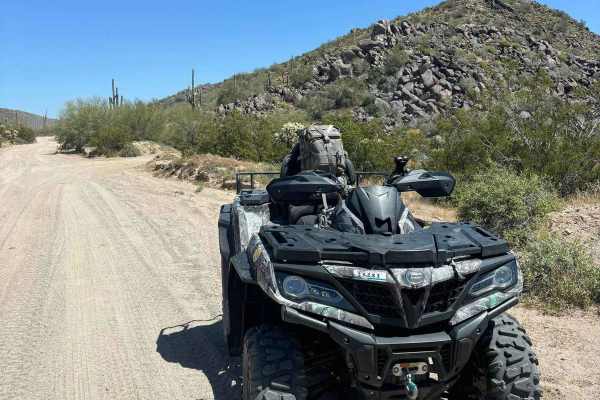
North Picacho Mountains Loop
This segment of trails is a fun and easy loop to introduce exploring the North Picacho Mountains. Traverse sandy, gravel, and slightly rocky trails through backcountry cactus forests with clear views of Newman Peak. Some good, flat dispersed camping spots with fire pits are present. This area is not...
Learn more about North Picacho Mountains Loop
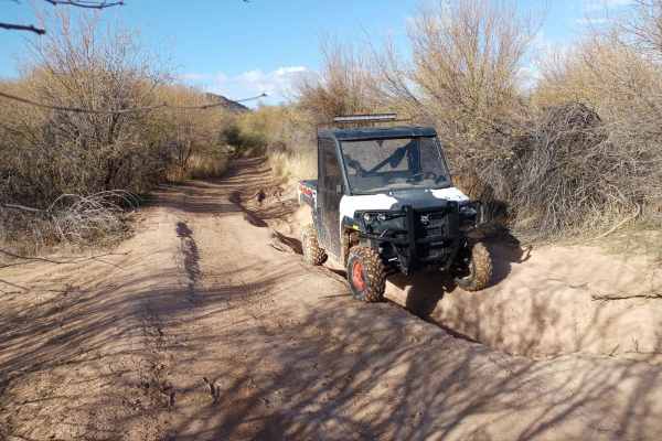
Upland BLM Inlet | Vekol Wash Access
This trail connects Upland Street to the Vekol Wash and the larger BLM Trail System. It's fairly beginner-level, however, there is very soft and deep sand at the crossing of the Vekol Wash, and it should not be attempted by most 2WD vehicles. Numerous low spots fill up with deceptively deep water af...
Learn more about Upland BLM Inlet | Vekol Wash Access
ATV trails near Upper Santan Village, Arizona
Explore ATV-friendly trails near you. These trails are accessible for vehicles up to 50 inches wide, perfect for ATVs and smaller off-road machines.
WhoopDeDo Roller Coaster
WhoopDeDo Roller Coaster is an exhilarating 21-mile desert trek designed for experienced four-wheel-drive drivers seeking scenic ridgelines, steep climbs, and a roller-coaster-style ride through Arizona’s rugged Mineral Mountains. Branching off State Route 79 near Florence, this route serves as a le...
Learn more about WhoopDeDo Roller Coaster
Upper Woodpecker to Ajax Mine
This trail follows the difficult wash known as Upper Woodpecker. At the eastern end of the wash, the trail climbs up a narrow winding trail to join Ajax Mine Road. The wash is very difficult. Lockers and 33 inch or larger tires are recommended. The trail following the wash is intermediate and does n...
Learn more about Upper Woodpecker to Ajax Mine
Superstition Backroads
The Superstition Backroads are easy Jeep trails, close to town, that take you on a short day trip to an abandoned gypsum mine. The western end of the trail is close to the Superstition Mountains. The main trail is 4, while a short optional climb and the Gypsum Overlook Loop are 5. There is a picnic ...
Learn more about Superstition Backroads
Peralta road
Peralta road is an easy, graded dirt road. Although the road is not challenging, it still leads to great views and has plenty of turn-offs for dispersed camping. If you are into hiking, this road ends at a trailhead for miles of great hiking. The trailhead has a restroom, but it can be crowded.
Learn more about Peralta road
UTV/side-by-side trails near Upper Santan Village, Arizona
Find UTV and side-by-side trails near you. These trails accommodate vehicles up to 60 inches wide, ideal for UTVs, side-by-sides, and wider off-road rigs.
WhoopDeDo Roller Coaster
WhoopDeDo Roller Coaster is an exhilarating 21-mile desert trek designed for experienced four-wheel-drive drivers seeking scenic ridgelines, steep climbs, and a roller-coaster-style ride through Arizona’s rugged Mineral Mountains. Branching off State Route 79 near Florence, this route serves as a le...
Learn more about WhoopDeDo Roller Coaster
Upper Woodpecker to Ajax Mine
This trail follows the difficult wash known as Upper Woodpecker. At the eastern end of the wash, the trail climbs up a narrow winding trail to join Ajax Mine Road. The wash is very difficult. Lockers and 33 inch or larger tires are recommended. The trail following the wash is intermediate and does n...
Learn more about Upper Woodpecker to Ajax Mine
Superstition Backroads
The Superstition Backroads are easy Jeep trails, close to town, that take you on a short day trip to an abandoned gypsum mine. The western end of the trail is close to the Superstition Mountains. The main trail is 4, while a short optional climb and the Gypsum Overlook Loop are 5. There is a picnic ...
Learn more about Superstition Backroads
Nw2014
Nw2014 is located to the East of Arizona State Route 79 and South of the Box Canyon trail. It connects Box Canyon to the main North/South Nw2006 trail. The trail consists of dirt, small loose rocks, and minor ruts. Full-size vehicles are susceptible to pinstriping. One bar of Verizon LTE service was...
Learn more about Nw2014
The onX Offroad Difference
onX Offroad combines trail photos, descriptions, difficulty ratings, width restrictions, seasonality, and more in a user-friendly interface. Available on all devices, with offline access and full compatibility with CarPlay and Android Auto. Discover what you're missing today!
Open Trail Map