
Dirt Bike Trails
Near Twilight, West Virginia
Explore All Dirt Bike Trails Near Twilight, West Virginia
Dirt Bike Trails Near Twilight, West Virginia
Discover the best dirt bike trails near you. Browse trail maps, check difficulty ratings, and find your next adventure — whether you're looking for a quick ride or an all-day expedition.
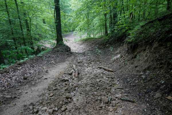
B36
This trail begins at the end of B16 and forms a loop with B37. It's a flat, easy route that descends gently from west to east along the hillside. The surface is mostly smooth with rocks pushed to the sides, shallow ruts, and no major obstacles. Watch for downed logs across the trail. There are a few...
Learn more about B36
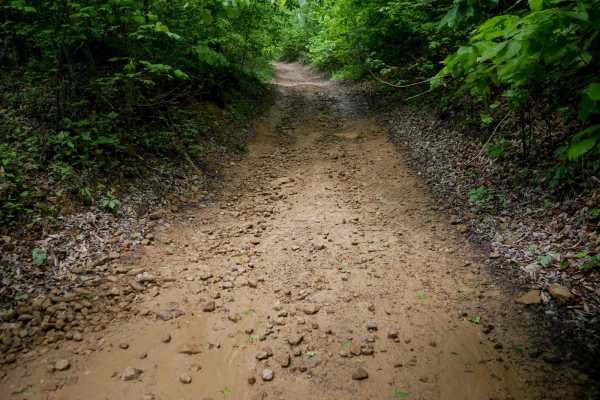
B37
This 1-mile trail climbs from east to west with mostly gradual grades and a few steeper sections. The surface includes loose rock, shallow ruts, uneven ground, and water bars. In places, the trail is narrow and slightly troughed, dug out below the surrounding forest floor. It forms a loop with B36 a...
Learn more about B37
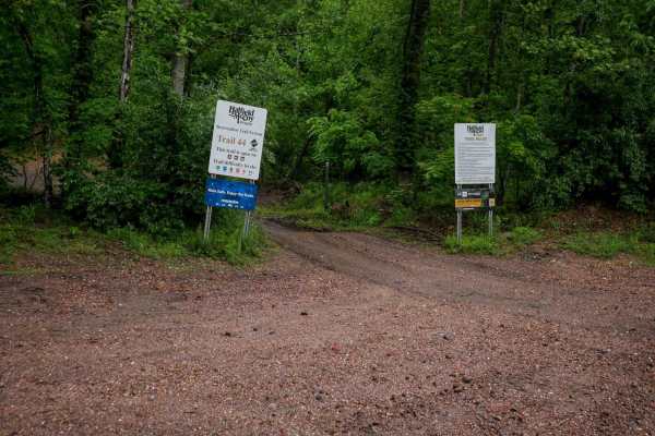
B44
B44 is a 1.5-mile route that begins at the north end of the Bearwallow parking lot and serves as a key entry trail into the system. The route starts with a semi-steep climb up a rutted path scattered with loose rocks and waterbars. It narrows in places as it cuts through thick brush and transitions ...
Learn more about B44
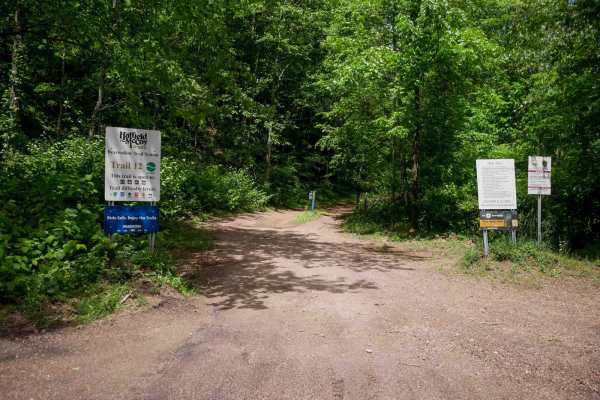
B12
This 2.7-mile-long easy access corridor leaves from the north end of the Bearwallow parking lot and offers a smooth, gradual route into the trail system. The path is mostly flat with gentle corners and shallow ruts. Most loose rock is pushed to the sides, though some sections contain more embedded o...
Learn more about B12
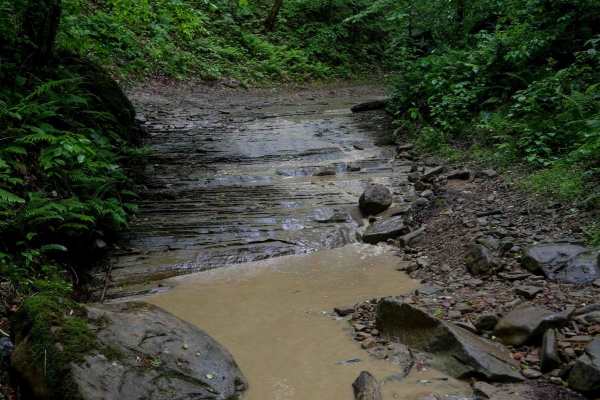
B46
Trail 46 is an advanced route that challenges drivers with constant slick, rocky terrain. After dropping down from B12, there's a massive slickrock slab at the intersection with a 45-degree broad, ramped rock face covered in water, making it feel like driving across a flat waterfall. The surrounding...
Learn more about B46
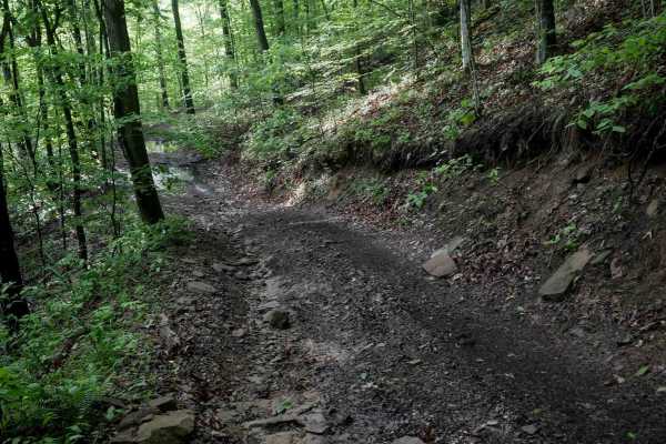
B93
This moderately easy 1.6-mile route starts near the staging area, and is a good start to your day trip with a bit more technical features. It features a mix of semi-steep grades and gradual climbs and descents over small hills. The path is one lane wide and shelfy in sections, with uneven ground, sh...
Learn more about B93
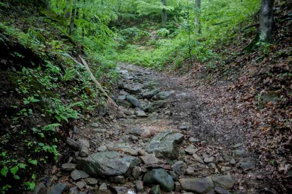
B45
B45 is a challenging descent (from north to south) featuring a very steep, rocky path with tight turns and narrow sections between overgrown trees. The initial descent is covered in large loose rocks and rutted surfaces. As the trail drops into a forested ravine, the terrain becomes slick with moist...
Learn more about B45
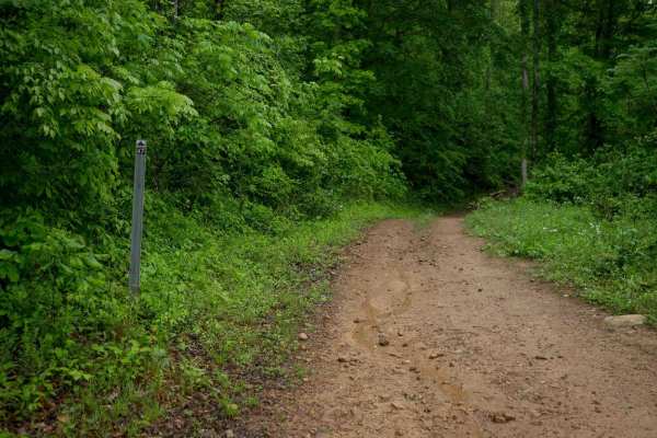
B47
B47 is an easy 0.8-mile connector that winds through dense, lush Appalachian forest. The path is mostly manageable for drivers with basic off-road experience, though it includes loose rocks, shallow mud puddles, and some low-hanging branches from the overgrowth. While there are a few steeper section...
Learn more about B47
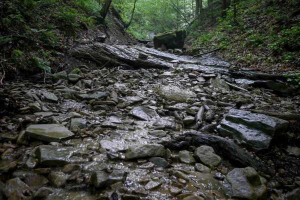
B76
B76 is a short but highly technical descent into a rocky ravine (from west to east). The upper section is steep and off-camber, filled with massive boulders, slick mossy rocks, and articulation points that will challenge even experienced drivers. Narrow passages between rock and dirt walls require c...
Learn more about B76
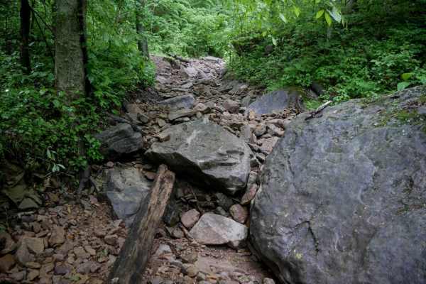
B73
B73 is a short but highly technical quarter-mile advanced trail that begins in a rocky ravine off of B47. The entire route is packed with loose river rock, large moss-covered boulders, and frequent ledges several feet high. Slick surfaces and downed logs increase the challenge, especially where narr...
Learn more about B73
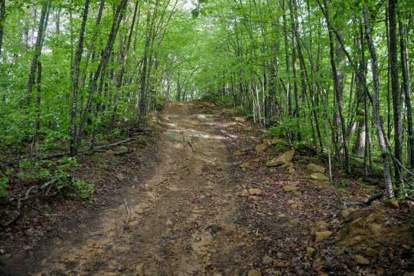
B59
This 1.2-mile loop off of B12 begins with a short, steep climb from the west end. The ascent includes embedded rock layers forming shelves less than a foot high - still easy and manageable. After the climb, the trail runs along a hilltop ridge on a gradual, easy path. Watch for downed trees and stic...
Learn more about B59
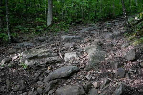
B88
This trail features a steep, shelfy descent under dense tree cover, with constant embedded rock obstacles, including boulders and shelves ranging from 1 to 3 feet tall. A slick leaf layer and greasy soil make traction difficult throughout the route. The trail follows a series of rock shelves on a st...
Learn more about B88
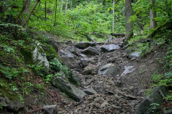
B79
Trail 79 is a short 130-yard advanced loop off Trail 14, offering a quick technical challenge for experienced drivers. When driven counterclockwise, it begins with a steep, loose, and rutted climb, then transitions into a more difficult rocky descent filled with large boulders, log debris, and 1-2 f...
Learn more about B79
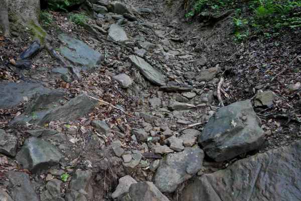
B87
This 280-yard advanced trail is packed with rock features and technical challenges. It splits off from trail 88 at a difficult section, with 88 acting more like a bypass around a steep descent of boulders and ledges. From the east end, trail 87 drops sharply into a rocky ravine lined with large boul...
Learn more about B87
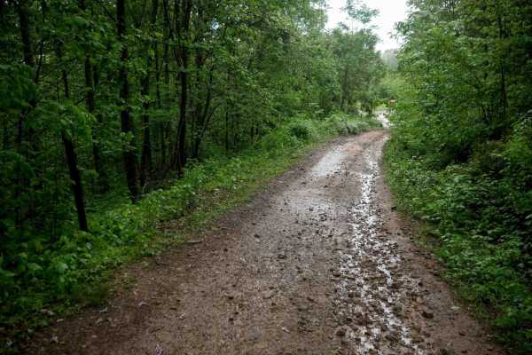
B48
B48 runs for 1.1 miles, beginning as a wide, flat trail that crosses open meadows along a hilltop. The terrain quickly changes as the route descends into a lush forest, narrowing and becoming more rugged with loose rock, ruts, and steeper grades, but mostly gradual corners. After the initial drop, t...
Learn more about B48
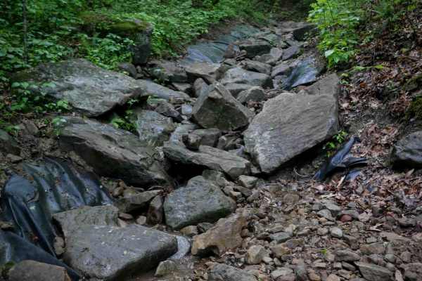
B75
This 0.7-mile advanced trail drops immediately into a rocky ravine and stays technical the entire way. From the north end, drivers will encounter a very steep descent over giant loose rock, deep ruts, and scattered downed logs. The trail is tight and narrow, lined closely by trees--including some gr...
Learn more about B75
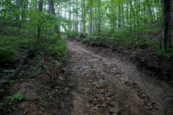
B92
This is a very steep and sustained half-mile climb from south to north, connecting B69 to B12. Most of the route is covered in smaller loose rocks, making traction a constant challenge. There are no large ledges or shelves, but the relentless incline and rocky surface make it more difficult. It's a ...
Learn more about B92
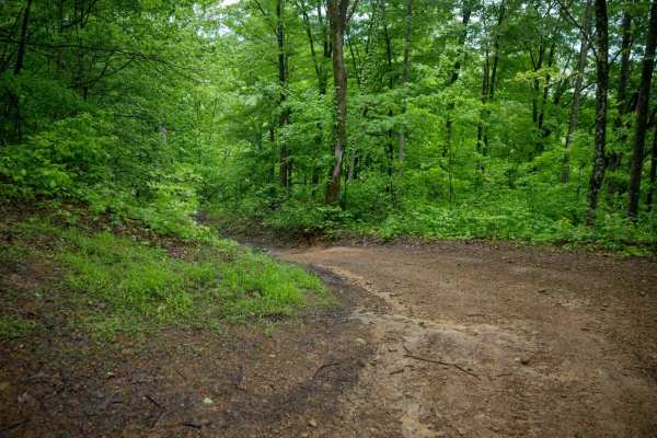
B41
B41 is a one-mile route that descends from west to east with a generally easy difficulty level despite its steeper slope in sections. The trail features loose rocks, shallow ruts, and water bars, with some narrower segments that require a bit more caution. Drivers will pass through classic Appalachi...
Learn more about B41
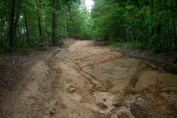
B16
This is a long, easy 4.3-mile trail in the Bearwallow system that serves as an access corridor into the northern part of the network. It starts wide and mostly gradual along a hilltop ridge, with a long section of chunky embedded rock before dropping into a looser, rockier descent. The trail narrows...
Learn more about B16
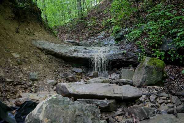
B81
B81 is a short loop off B14 - only 200 yards. When taken clockwise, the trail begins on a narrow path through overgrown bushes. It then doubles back on a tight hairpin turn that drops into a rocky, technical ravine. This section features a slickrock slab covered in water and a waterfall shelf with a...
Learn more about B81
ATV trails near Twilight, West Virginia
Explore ATV-friendly trails near you. These trails are accessible for vehicles up to 50 inches wide, perfect for ATVs and smaller off-road machines.
B36
This trail begins at the end of B16 and forms a loop with B37. It's a flat, easy route that descends gently from west to east along the hillside. The surface is mostly smooth with rocks pushed to the sides, shallow ruts, and no major obstacles. Watch for downed logs across the trail. There are a few...
Learn more about B36
B37
This 1-mile trail climbs from east to west with mostly gradual grades and a few steeper sections. The surface includes loose rock, shallow ruts, uneven ground, and water bars. In places, the trail is narrow and slightly troughed, dug out below the surrounding forest floor. It forms a loop with B36 a...
Learn more about B37
B44
B44 is a 1.5-mile route that begins at the north end of the Bearwallow parking lot and serves as a key entry trail into the system. The route starts with a semi-steep climb up a rutted path scattered with loose rocks and waterbars. It narrows in places as it cuts through thick brush and transitions ...
Learn more about B44
B12
This 2.7-mile-long easy access corridor leaves from the north end of the Bearwallow parking lot and offers a smooth, gradual route into the trail system. The path is mostly flat with gentle corners and shallow ruts. Most loose rock is pushed to the sides, though some sections contain more embedded o...
Learn more about B12
UTV/side-by-side trails near Twilight, West Virginia
Find UTV and side-by-side trails near you. These trails accommodate vehicles up to 60 inches wide, ideal for UTVs, side-by-sides, and wider off-road rigs.
B36
This trail begins at the end of B16 and forms a loop with B37. It's a flat, easy route that descends gently from west to east along the hillside. The surface is mostly smooth with rocks pushed to the sides, shallow ruts, and no major obstacles. Watch for downed logs across the trail. There are a few...
Learn more about B36
B37
This 1-mile trail climbs from east to west with mostly gradual grades and a few steeper sections. The surface includes loose rock, shallow ruts, uneven ground, and water bars. In places, the trail is narrow and slightly troughed, dug out below the surrounding forest floor. It forms a loop with B36 a...
Learn more about B37
B44
B44 is a 1.5-mile route that begins at the north end of the Bearwallow parking lot and serves as a key entry trail into the system. The route starts with a semi-steep climb up a rutted path scattered with loose rocks and waterbars. It narrows in places as it cuts through thick brush and transitions ...
Learn more about B44
B12
This 2.7-mile-long easy access corridor leaves from the north end of the Bearwallow parking lot and offers a smooth, gradual route into the trail system. The path is mostly flat with gentle corners and shallow ruts. Most loose rock is pushed to the sides, though some sections contain more embedded o...
Learn more about B12
The onX Offroad Difference
onX Offroad combines trail photos, descriptions, difficulty ratings, width restrictions, seasonality, and more in a user-friendly interface. Available on all devices, with offline access and full compatibility with CarPlay and Android Auto. Discover what you're missing today!
Open Trail Map