
Dirt Bike Trails
Near St. James, Michigan
Explore All Dirt Bike Trails Near St. James, Michigan
Dirt Bike Trails Near St. James, Michigan
Discover the best dirt bike trails near you. Browse trail maps, check difficulty ratings, and find your next adventure — whether you're looking for a quick ride or an all-day expedition.
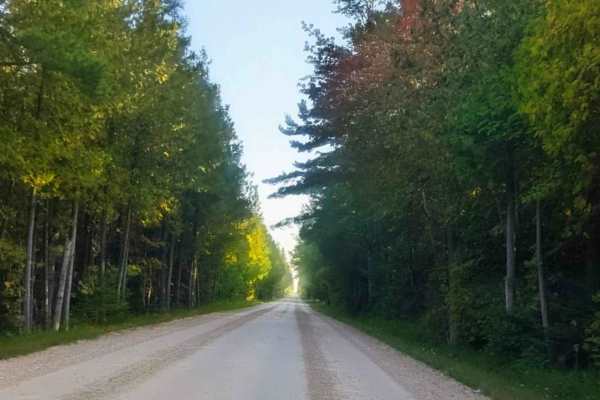
Seul Choix Pointe Lighthouse Road
The road to the Seul Choix Pointe Lighthouse is a scenic drive through a remote part of Michigan's Upper Peninsula. The road is two lanes with a wide shoulder. When we mapped the road in September 2025, the gravel was dry and graded.
The lighthouse is located in the town of Gulliver, which is about...
Learn more about Seul Choix Pointe Lighthouse Road
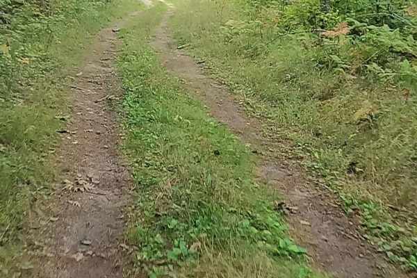
Old Stage Truck Road
Old Stage Truck Trail is a state-owned/ locally maintained, Level-2/ Level-3 Forest Service road with a surface composition of dirt, sand, gravel, and native material. This route is currently open and in fair condition; it is not a DNR route (ORV use is subject to local government regulations). It c...
Learn more about Old Stage Truck Road
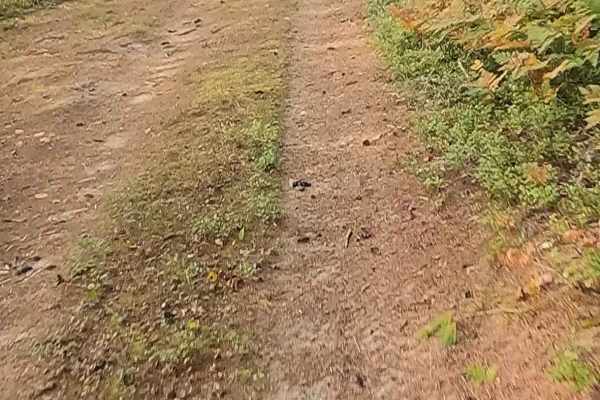
Orchard Hill Road
Orchard Hill Road is a state-owned/ locally maintained, Level-2/ Level-3 Forest Service road with a surface composition of dirt, sand, gravel, and native material. This route is currently open and in fair condition; it is not a DNR route (ORV use is subject to local government regulations). It cross...
Learn more about Orchard Hill Road
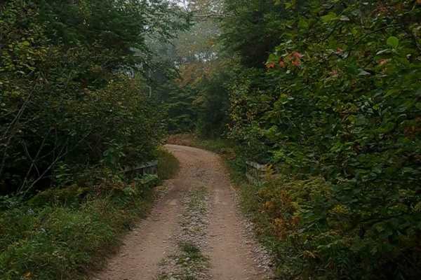
Paquinn Creek Road/ Sand Lake Road - FS 3374 (ORV Route A)
Forest Service Road 3374 - Paquinn Creek Road/ Sand Lake Road is a state-owned/ locally maintained, Level-2/ Level-3 Secondary Forest Road with a surface composition of dirt, sand, gravel, and native material. This route is currently open and in fair condition. A majority of this road is a DNR route...
Learn more about Paquinn Creek Road/ Sand Lake Road - FS 3374 (ORV Route A)
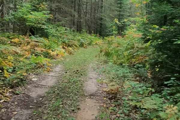
Strickler Truck Road - Timber Loop
Strickler Truck Road - Timber Loop is a state-owned/ locally maintained, Level-2 Forest Access Route with a surface composition of dirt, sand, grass, and native material. This route is currently open and in fair condition. It is not a DNR route (ORV use is subject to local government regulations) th...
Learn more about Strickler Truck Road - Timber Loop
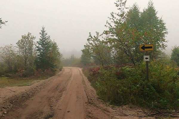
Cut River/Brevoort River Trail (ORV Route A)
Cut River/Brevoort River Trail is a state-owned/ locally maintained, Level-2/ Level-3 Secondary Forest Road with a surface composition of dirt, sand, gravel, and native material. This route is currently open and in fair condition. It is a DNR route (ORV use is subject to local government regulations...
Learn more about Cut River/Brevoort River Trail (ORV Route A)

Strickler Truck Road - Grouse Loop
Strickler Truck Road - Grouse Loop is a state-owned/ locally maintained, Level-2 Forest Access Route with a surface composition of dirt, sand, grass, and native material. This route is currently open and in fair condition. It is not a DNR route (ORV use is subject to local government regulations) th...
Learn more about Strickler Truck Road - Grouse Loop
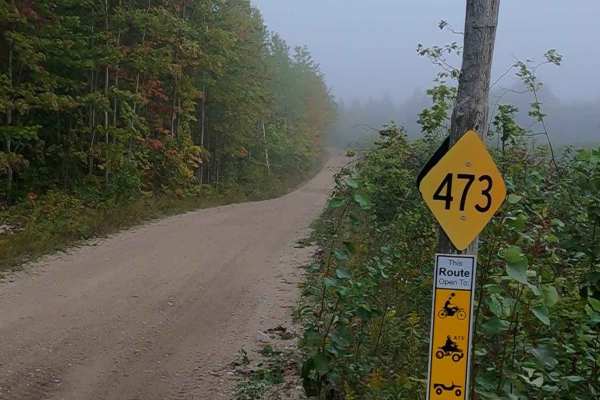
Epoufette (ORV Route A)
ORV Route A - Epoufette, also known as Trail 473/2/9, is a state-owned/ locally maintained, Level-2/ Level-3 Secondary Forest Road with a surface composition of dirt, sand, gravel, and native material. This route is currently open and in fair condition. A portion of this road is a DNR route (ORV use...
Learn more about Epoufette (ORV Route A)
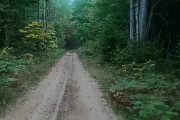
Prout Road (ORV Route A)
Prout Road is a state-owned/ locally maintained, Level-2/ Level-3 Secondary Forest Road with a surface composition of dirt, sand, gravel, and native material. This route is currently open and in fair condition. A portion of this road is a DNR route (ORV use is subject to local government regulations...
Learn more about Prout Road (ORV Route A)
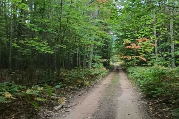
Strickler Truck Road
Strickler Truck Road is a state-owned/ locally maintained, Level-2/ Level-3 Primary Forest Access Road with a surface composition of dirt, sand, grass, and native material. This route is currently open and in fair condition. It is not a DNR route (ORV use is subject to local government regulations) ...
Learn more about Strickler Truck Road
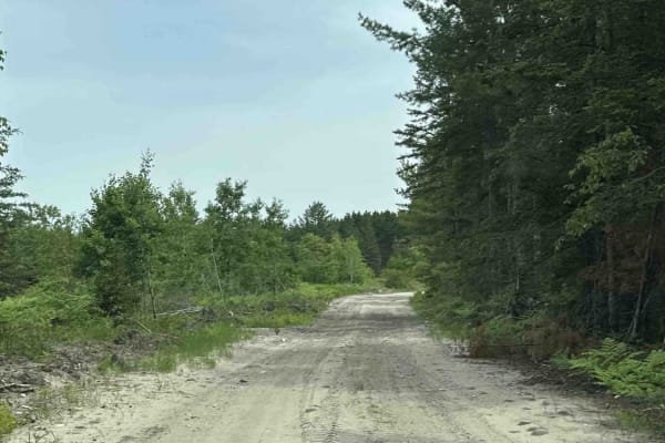
Brevoort River
Brevoort River is a trail that's open to all vehicle types and sizes, from large 4x4s to dirt bikes. The trail is mostly made up of sand and is surrounded by dense forests, with some clearings from logging. However, the northern section might be challenging for larger vehicles due to the overgrown b...
Learn more about Brevoort River
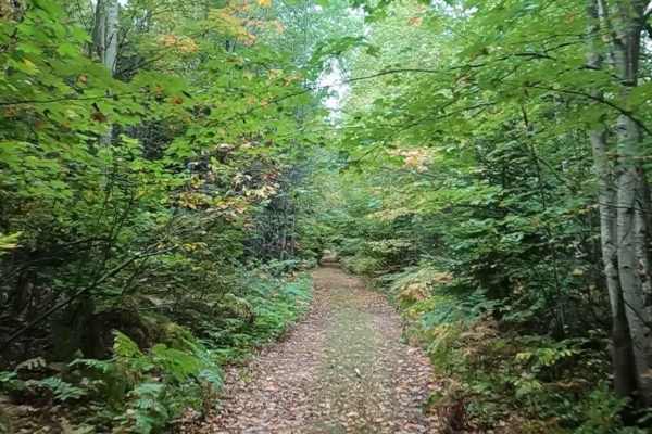
Little Dollar - Timber Trail
Little Dollar - Timber Trail is a state-owned/ locally maintained, Level-2 Forest Access Route with a surface composition of dirt, sand, grass, and native material. It is not a DNR route (ORV use is subject to local government regulations) that meanders through the hardwood/ coniferous forest nestle...
Learn more about Little Dollar - Timber Trail
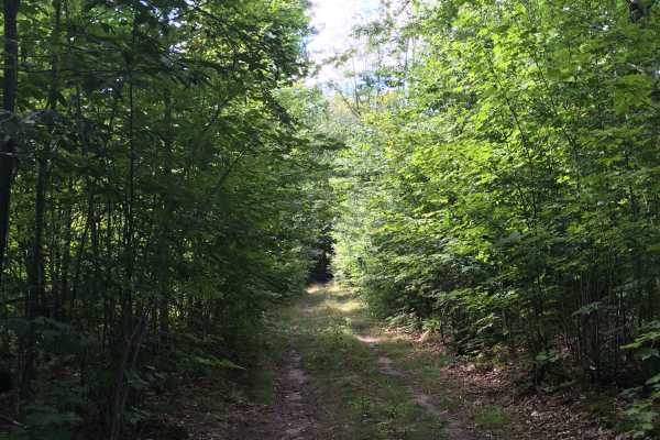
Blackberry Lane
This is a short but fun trail in the Sault Sainte Marie Forest Management Unit. It gets little use based on its condition when ran. It is a tree lined two track out and back that is mainly grass. It has a few mud/water spots, depending on the time of year and/or recent rainfall. It crosses a power l...
Learn more about Blackberry Lane
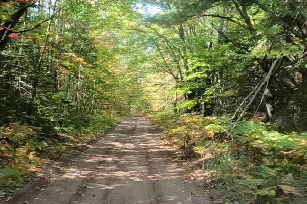
Hog Island Road - FS 3364 (ORV Route A)
Forest Service Road (FS) 3364, Hog Island Road, also known as Townline Road, is a state-owned/ locally maintained, Level-2/ Level-3 forest road with a surface composition of dirt, sand, gravel, and native material. This route is currently open and in fair condition; it is a portion of a DNR route, k...
Learn more about Hog Island Road - FS 3364 (ORV Route A)
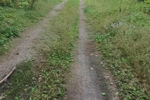
Brevoort Lake Road - FS 3424
Federal Forest Service Road (FS) 3424, also known as Brevoort Lake Road &/or Pipeline, is a federally owned/ locally maintained, Level-2/ Level-3 "There-and-back" forest road with a surface composition of dirt, sand, gravel, grass, and native material. This route is currently open and in fair condit...
Learn more about Brevoort Lake Road - FS 3424
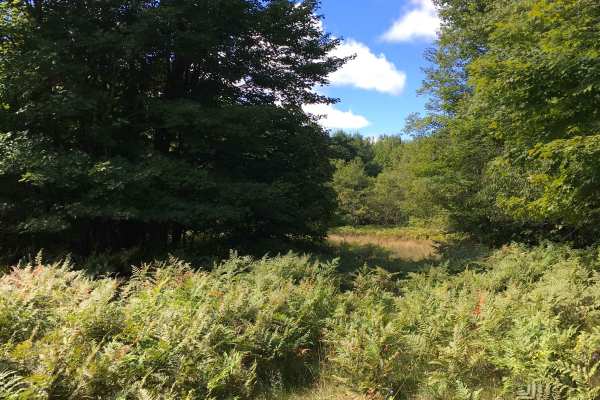
Spencer Trail
This trail is a fun grass two-track that winds through a heavily wooded section of a forest management unit. It is very tight in spots, so expect some branches to rub your vehicle sides. There are also several spots with low-hanging branches as well. There are a couple of heavily wooded spurs off th...
Learn more about Spencer Trail
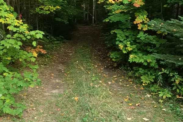
Brevoort West - FS 3782
Federal Forest Service Road (FS) 3782, also known as Brevoort West, is a federally owned/ locally maintained, Level-2/ Level-3 forest road with a surface composition of dirt, sand, gravel, grass, and native material. This route is currently open and in fair condition; it is not a DNR road (ORV use i...
Learn more about Brevoort West - FS 3782

Tucker Lake Trail
Tucker Lake Trail is a state-owned/ locally maintained, Level-2/ Level-3 forest road with a surface composition of dirt, sand, gravel, and native material. This route is currently open and in fair condition; it is not a DNR road (ORV use is subject to local government regulations). It is a timber lo...
Learn more about Tucker Lake Trail
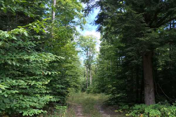
Fern Trail
This out-and-back trail through the northern MI forest is a bumpy two-track that ends in an area with several small clearings, making a great camping location. Depending on the time of year or recent rain, you could encounter a few wet and/or muddy spots to deal with, but nothing a stock 4x4 can't h...
Learn more about Fern Trail
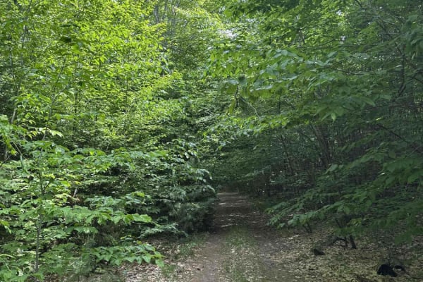
Dells Mills
Dells Mills is a trail accessible to all vehicle types and sizes, ranging from large 4x4s to dirt bikes. The trail is predominantly composed of dirt and mud, and it's surrounded by forests and swamplands. There are two mud holes that are over a foot deep and appear to have no bottom, so approach the...
Learn more about Dells Mills
ATV trails near St. James, Michigan
Explore ATV-friendly trails near you. These trails are accessible for vehicles up to 50 inches wide, perfect for ATVs and smaller off-road machines.
Seul Choix Pointe Lighthouse Road
The road to the Seul Choix Pointe Lighthouse is a scenic drive through a remote part of Michigan's Upper Peninsula. The road is two lanes with a wide shoulder. When we mapped the road in September 2025, the gravel was dry and graded.
The lighthouse is located in the town of Gulliver, which is about...
Learn more about Seul Choix Pointe Lighthouse Road
Old Stage Truck Road
Old Stage Truck Trail is a state-owned/ locally maintained, Level-2/ Level-3 Forest Service road with a surface composition of dirt, sand, gravel, and native material. This route is currently open and in fair condition; it is not a DNR route (ORV use is subject to local government regulations). It c...
Learn more about Old Stage Truck Road
Orchard Hill Road
Orchard Hill Road is a state-owned/ locally maintained, Level-2/ Level-3 Forest Service road with a surface composition of dirt, sand, gravel, and native material. This route is currently open and in fair condition; it is not a DNR route (ORV use is subject to local government regulations). It cross...
Learn more about Orchard Hill Road
Paquinn Creek Road/ Sand Lake Road - FS 3374 (ORV Route A)
Forest Service Road 3374 - Paquinn Creek Road/ Sand Lake Road is a state-owned/ locally maintained, Level-2/ Level-3 Secondary Forest Road with a surface composition of dirt, sand, gravel, and native material. This route is currently open and in fair condition. A majority of this road is a DNR route...
Learn more about Paquinn Creek Road/ Sand Lake Road - FS 3374 (ORV Route A)
UTV/side-by-side trails near St. James, Michigan
Find UTV and side-by-side trails near you. These trails accommodate vehicles up to 60 inches wide, ideal for UTVs, side-by-sides, and wider off-road rigs.
Seul Choix Pointe Lighthouse Road
The road to the Seul Choix Pointe Lighthouse is a scenic drive through a remote part of Michigan's Upper Peninsula. The road is two lanes with a wide shoulder. When we mapped the road in September 2025, the gravel was dry and graded.
The lighthouse is located in the town of Gulliver, which is about...
Learn more about Seul Choix Pointe Lighthouse Road
Old Stage Truck Road
Old Stage Truck Trail is a state-owned/ locally maintained, Level-2/ Level-3 Forest Service road with a surface composition of dirt, sand, gravel, and native material. This route is currently open and in fair condition; it is not a DNR route (ORV use is subject to local government regulations). It c...
Learn more about Old Stage Truck Road
Orchard Hill Road
Orchard Hill Road is a state-owned/ locally maintained, Level-2/ Level-3 Forest Service road with a surface composition of dirt, sand, gravel, and native material. This route is currently open and in fair condition; it is not a DNR route (ORV use is subject to local government regulations). It cross...
Learn more about Orchard Hill Road
Paquinn Creek Road/ Sand Lake Road - FS 3374 (ORV Route A)
Forest Service Road 3374 - Paquinn Creek Road/ Sand Lake Road is a state-owned/ locally maintained, Level-2/ Level-3 Secondary Forest Road with a surface composition of dirt, sand, gravel, and native material. This route is currently open and in fair condition. A majority of this road is a DNR route...
Learn more about Paquinn Creek Road/ Sand Lake Road - FS 3374 (ORV Route A)
The onX Offroad Difference
onX Offroad combines trail photos, descriptions, difficulty ratings, width restrictions, seasonality, and more in a user-friendly interface. Available on all devices, with offline access and full compatibility with CarPlay and Android Auto. Discover what you're missing today!
Open Trail Map