
Dirt Bike Trails
Near So-Hi, Arizona
Explore All Dirt Bike Trails Near So-Hi, Arizona
Dirt Bike Trails Near So-Hi, Arizona
Discover the best dirt bike trails near you. Browse trail maps, check difficulty ratings, and find your next adventure — whether you're looking for a quick ride or an all-day expedition.
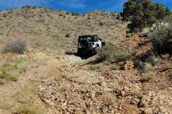
Cerbat Crest
Visit old mines and ride the crest of the Cerbat Mountains. Traverse eroded, rocky roads and viewed a large copper mine. This trip will take you to a number of old mines, but it will also allow you to view the open pit Mineral Park Copper Mine. We made this trip in a counterclockwise direction but ...
Learn more about Cerbat Crest
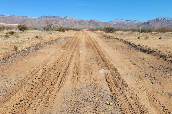
Spur Loop to Chloride AZ Peace Trail Connector (Southeast)
This is the south connector section from the town of Chloride to the Arizona Peace Trail system. This 8-mile point-to-point, two-track trail offers a little bit of everything as it parallels Highway 93--ruts, sand, rocky patches, short steep climbs, washes, etc. Throughout the trail, vegetation has ...
Learn more about Spur Loop to Chloride AZ Peace Trail Connector (Southeast)
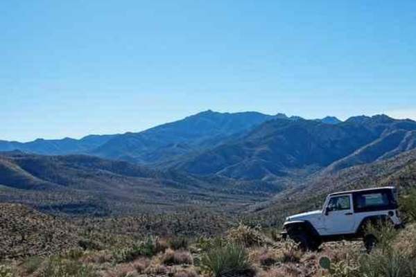
Hualapai Foothills
Explore the foothills of the Hualapai Mountains from Kingman to Walnut Canyon. This is an interesting, but not spectacular, trail. We like it because it gives a tour of the area without rising into the narrower and scratchier trails higher up in the Hualapai Mountains. This one is rocky, but not v...
Learn more about Hualapai Foothills
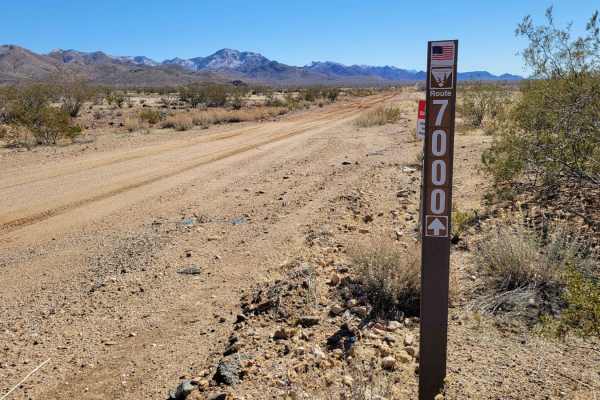
County Highway 125 - Route 7000
County Highway 125 - Route 7000 parallels Highway 93 and is a point-to-point connector route from Mineral Park Road to Cerbat Crest trail. It is a narrow, single-vehicle-wide trail that is unmaintained and has a few small obstacles peppered throughout the three miles. Several wash crossings will be ...
Learn more about County Highway 125 - Route 7000
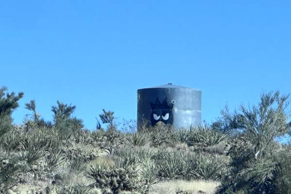
Angry Duck Trail
This 3.6-mile point-to-point trail runs along power lines in the foothills of the Hualapai Mountains. The trail gets its name from a large angry duck head painted on the side of a water tank along the trail. If starting this trail from the Hualapai Foothills trail you will start with a steep hill cl...
Learn more about Angry Duck Trail
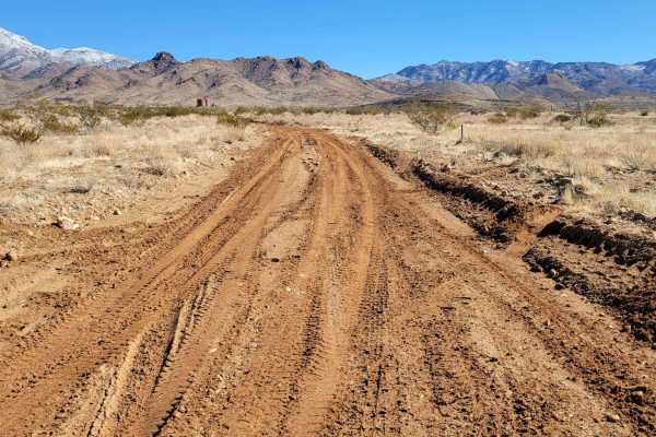
Emerald Isle Mine
This route is an out-and-back adventure up to the Emerald Isle Mine. At the time of mapping, the trail up to the mine was open (no barricades or closed gates), but that could potentially change at any time. It is unmaintained and has erosion damage on and beside the trail. Avoid wet conditions, as t...
Learn more about Emerald Isle Mine
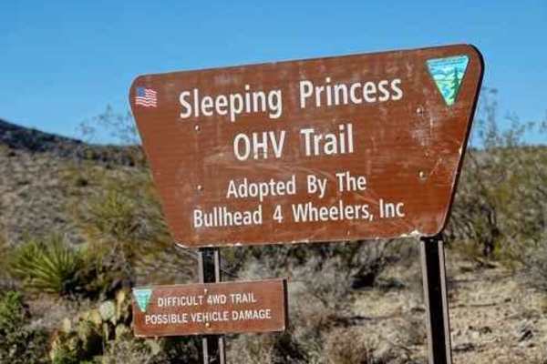
Sleeping Princess
This is a challenging and scenic Jeep trail through the Black Mountains. Its difficulty depends on the direction driven and the options chosen. This trail can be driven either way but it is recommended to start in Golden Valley and then run the main trail from north to south. This is in the downhill...
Learn more about Sleeping Princess
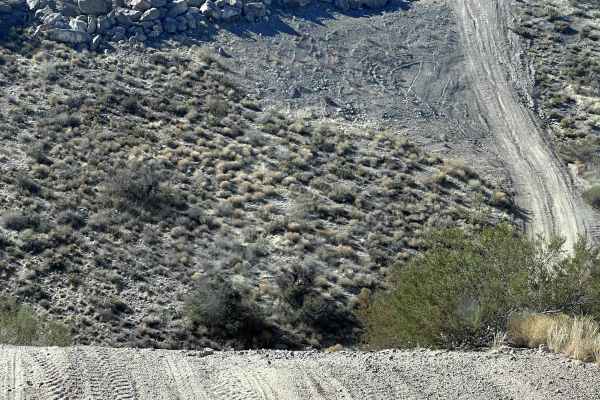
Kingman Rollercoaster
This 2.1-mile point-to-point trail is a fun trail that runs along a high-pressure gas line. There are several steep hill ascents and descents along this trail, making it feel like a rollercoaster. This is a maintained service road, the steep climbs with loose dirt are what gives this trail its ratin...
Learn more about Kingman Rollercoaster
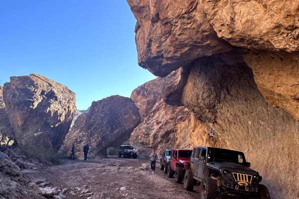
Secret Pass Technical Trail
This 16.2 mile out-and-back trail is part of the Secret Pass Trail System. The first 5.9 miles is an easy trail with obstacles under 12". There is a sign indicating the beginning of the technical portion of this trail. At 6.75 miles is the first technical obstacle the left side of the wash is the ea...
Learn more about Secret Pass Technical Trail
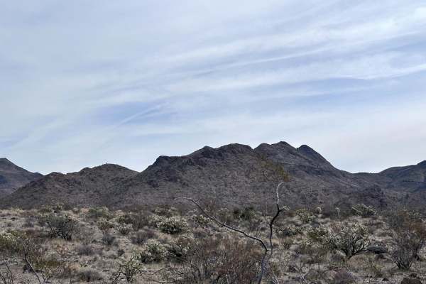
Number Five Trough Trail
This 4.1-mile point-to-point trail is a side trail of the Hualapai Foothills trail. The trail follows the wash, with sections in the wash. This trail passes through several watering tanks for livestock. Stay alert for any cattle and slow down while passing. The trail is passable by any stock 4WD veh...
Learn more about Number Five Trough Trail
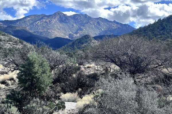
Yellow Flower Creek Loop
This 8.3-mile loop trail takes you into the Hualapai Foothills along the Yellow Flower Creek wash. The trail starts off the Hualapai Foothills trail. There is a lot of overgrowth on the trail and pin-stripping will occur. Several sections cross the Yellow Flower Creek, which is dry most of the year....
Learn more about Yellow Flower Creek Loop
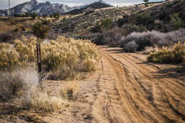
I-40 Parallel ATV Trail
This is an unmarked ATV trail starting from the DW Ranch Road exit of I-40 near Kingman, Arizona. It's a mix of sand wash and hard pack dirt with loose rock. There are three segments of the ATV trail, separated by short segments of jeep road in between. The beginning and end of the trail are both th...
Learn more about I-40 Parallel ATV Trail
Devil's Dip Parallel
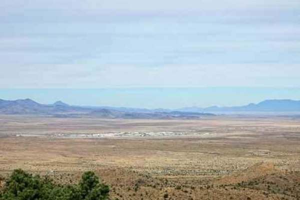
An easier Jeep trail parallel to Devil's Dip rock crawling trail can also be used to access Devil's Dip. Both Devil's Dip rock crawling trail and this one start at Exit 59 from I-40. Devil's Dip goes up the bottom of an unnamed wash, while this one follows easy roads higher above the same wash. De...
Learn more about Devil's Dip Parallel

Chloride Mines
This moderately challenging 18.4-mile point-to-point trail is perfect for intermediate offroaders seeking stunning high-desert vistas and a mix of gentle cruising and technical shelf-road driving in the Cerbat Mountains. Starting at an elevation of 3,578 feet, the route climbs up to a scenic 6,198 f...
Learn more about Chloride Mines
Hualapai Mountain Scenic Bypass
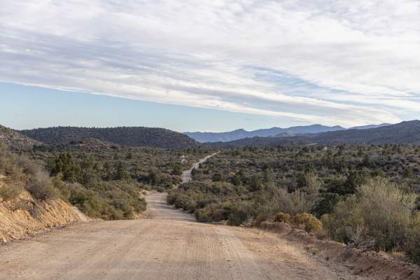
This is a great side trip to take if you are traveling through and need a break from the interstate. There is stunning scenery and lots of camping, not to mention the plethora of side trails just waiting to be explored. The road is very easy. There are a lot of potholes and gaps in the edges of the ...
Learn more about Hualapai Mountain Scenic Bypass
BLM Route 7125
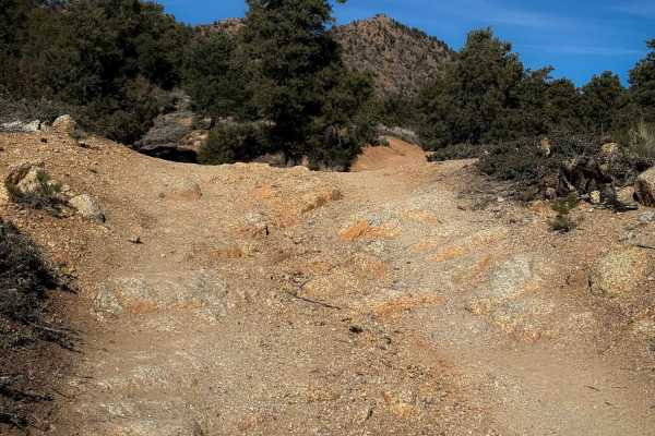
This is a 1.6-mile-long dirt bike trail through the Hualapai Mountains that is road-width for its entire length. It’s not overly difficult for dirt bikes, but it looks like this trail gets used by wider vehicles, as the trail signs do not have width designations in this system, so watch out for onco...
Learn more about BLM Route 7125
H1297
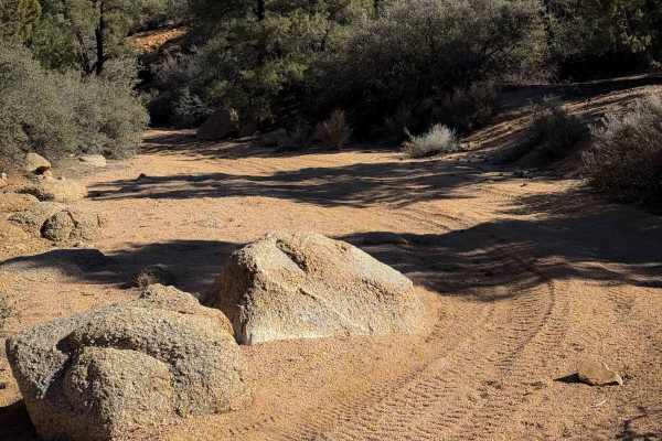
This is a 0.8-mile-long easy ATV trail through a sand wash in the Hualapai mountains. It is mostly flat and curvy through the tall pinyon trees, with a slight decrease in grade from north to south. It has deep sand in spots, with a few big boulders within the wash to watch out for that can mostly be...
Learn more about H1297
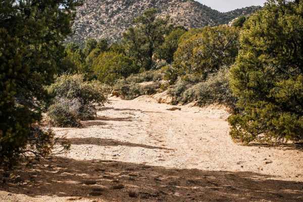
ATV Sand Wash Trail
This is a short ATV connector trail through a sand wash accessed off of DW Ranch Road near Kingman, Arizona. The trail goes through a smooth sandy wash that is a bit narrower than a road. It connects the Devil's Dip Parallel Jeep Trail to a nearby residential area. There are some narrow sections bet...
Learn more about ATV Sand Wash Trail
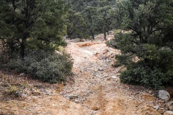
BLM Route 7125
This is an unnamed and unmarked dirt trail that is the width of a narrow road, with sharp loose small rocks, huge washouts, rain ruts, and lots of very off-camber sections. This trail would be very difficult for an ATV due to so many very off-camber sections. Winter is probably the best time to visi...
Learn more about BLM Route 7125
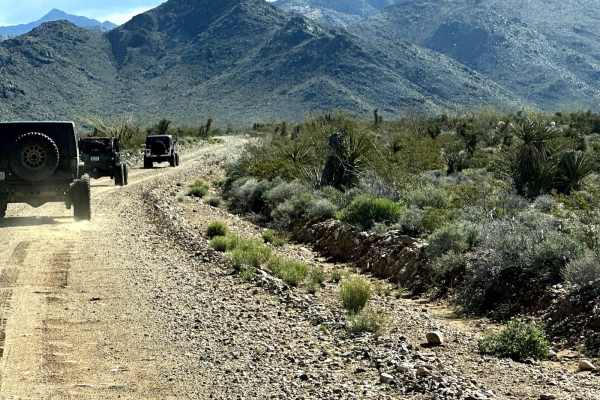
Walnut Creek to Survivalist Camp Trail
This 17.1-mile point-to-point trail takes you along Walnut Creek (seasonal water flow) past Walnut Ranch and the Hualapai Survivalist Camp and connects to the Hualapai Mountain Trail. At 0.7 miles on the trail, right before the 3-track rail crossing, you will pass a memorial for three local off-road...
Learn more about Walnut Creek to Survivalist Camp Trail
ATV trails near So-Hi, Arizona
Explore ATV-friendly trails near you. These trails are accessible for vehicles up to 50 inches wide, perfect for ATVs and smaller off-road machines.
Cerbat Crest
Visit old mines and ride the crest of the Cerbat Mountains. Traverse eroded, rocky roads and viewed a large copper mine. This trip will take you to a number of old mines, but it will also allow you to view the open pit Mineral Park Copper Mine. We made this trip in a counterclockwise direction but ...
Learn more about Cerbat Crest
Spur Loop to Chloride AZ Peace Trail Connector (Southeast)
This is the south connector section from the town of Chloride to the Arizona Peace Trail system. This 8-mile point-to-point, two-track trail offers a little bit of everything as it parallels Highway 93--ruts, sand, rocky patches, short steep climbs, washes, etc. Throughout the trail, vegetation has ...
Learn more about Spur Loop to Chloride AZ Peace Trail Connector (Southeast)
Hualapai Foothills
Explore the foothills of the Hualapai Mountains from Kingman to Walnut Canyon. This is an interesting, but not spectacular, trail. We like it because it gives a tour of the area without rising into the narrower and scratchier trails higher up in the Hualapai Mountains. This one is rocky, but not v...
Learn more about Hualapai Foothills
County Highway 125 - Route 7000
County Highway 125 - Route 7000 parallels Highway 93 and is a point-to-point connector route from Mineral Park Road to Cerbat Crest trail. It is a narrow, single-vehicle-wide trail that is unmaintained and has a few small obstacles peppered throughout the three miles. Several wash crossings will be ...
Learn more about County Highway 125 - Route 7000
UTV/side-by-side trails near So-Hi, Arizona
Find UTV and side-by-side trails near you. These trails accommodate vehicles up to 60 inches wide, ideal for UTVs, side-by-sides, and wider off-road rigs.
Cerbat Crest
Visit old mines and ride the crest of the Cerbat Mountains. Traverse eroded, rocky roads and viewed a large copper mine. This trip will take you to a number of old mines, but it will also allow you to view the open pit Mineral Park Copper Mine. We made this trip in a counterclockwise direction but ...
Learn more about Cerbat Crest
Spur Loop to Chloride AZ Peace Trail Connector (Southeast)
This is the south connector section from the town of Chloride to the Arizona Peace Trail system. This 8-mile point-to-point, two-track trail offers a little bit of everything as it parallels Highway 93--ruts, sand, rocky patches, short steep climbs, washes, etc. Throughout the trail, vegetation has ...
Learn more about Spur Loop to Chloride AZ Peace Trail Connector (Southeast)
Hualapai Foothills
Explore the foothills of the Hualapai Mountains from Kingman to Walnut Canyon. This is an interesting, but not spectacular, trail. We like it because it gives a tour of the area without rising into the narrower and scratchier trails higher up in the Hualapai Mountains. This one is rocky, but not v...
Learn more about Hualapai Foothills
County Highway 125 - Route 7000
County Highway 125 - Route 7000 parallels Highway 93 and is a point-to-point connector route from Mineral Park Road to Cerbat Crest trail. It is a narrow, single-vehicle-wide trail that is unmaintained and has a few small obstacles peppered throughout the three miles. Several wash crossings will be ...
Learn more about County Highway 125 - Route 7000
The onX Offroad Difference
onX Offroad combines trail photos, descriptions, difficulty ratings, width restrictions, seasonality, and more in a user-friendly interface. Available on all devices, with offline access and full compatibility with CarPlay and Android Auto. Discover what you're missing today!
Open Trail Map