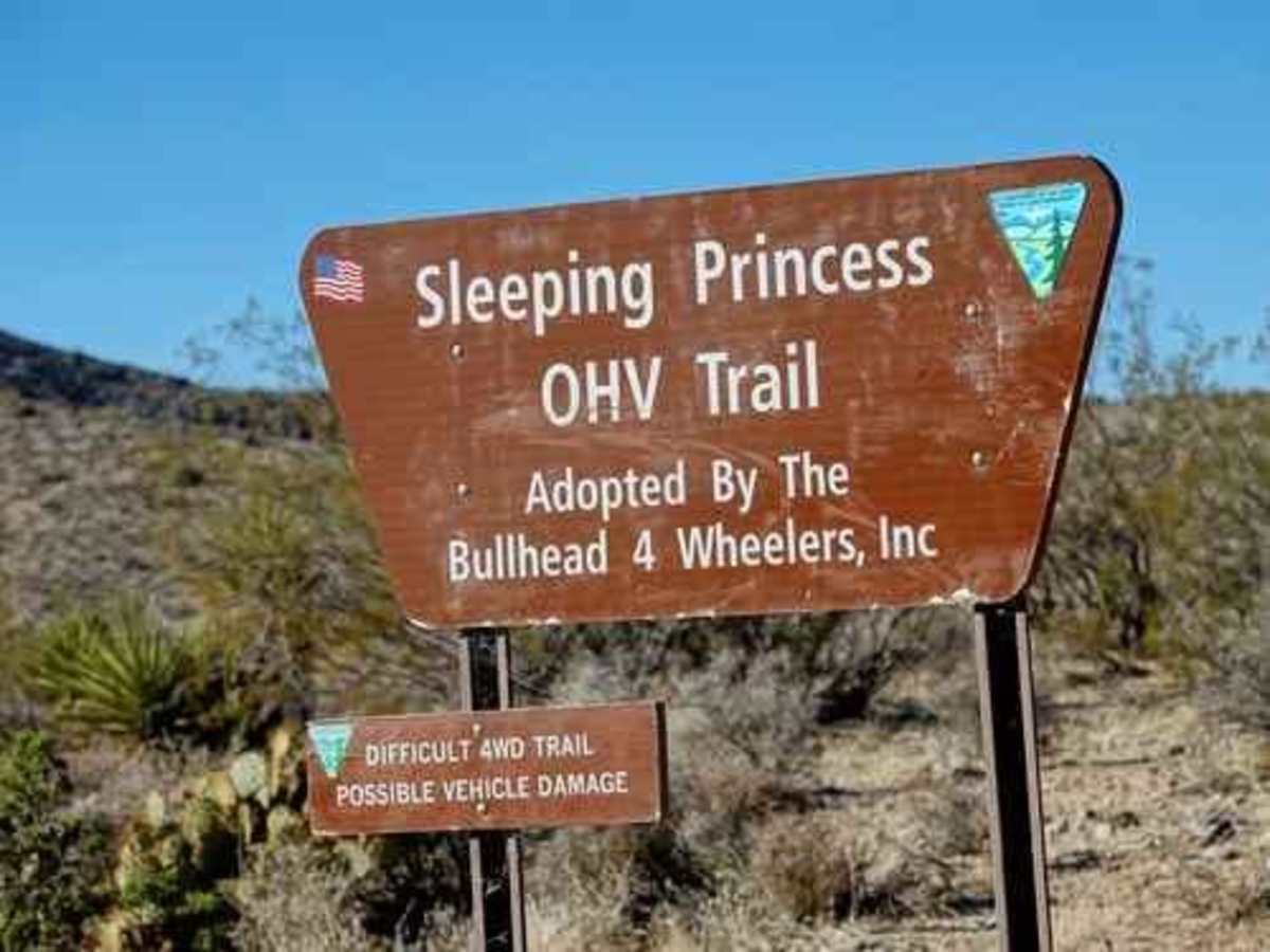
Sleeping Princess

Total Miles 27.9
Technical Rating
8 Difficult
Best Time Spring, Summer, Fall, Winter
Trail Type High-Clearance 4x4 Trail
Accessible By
Open Trail Map

Trail Overview

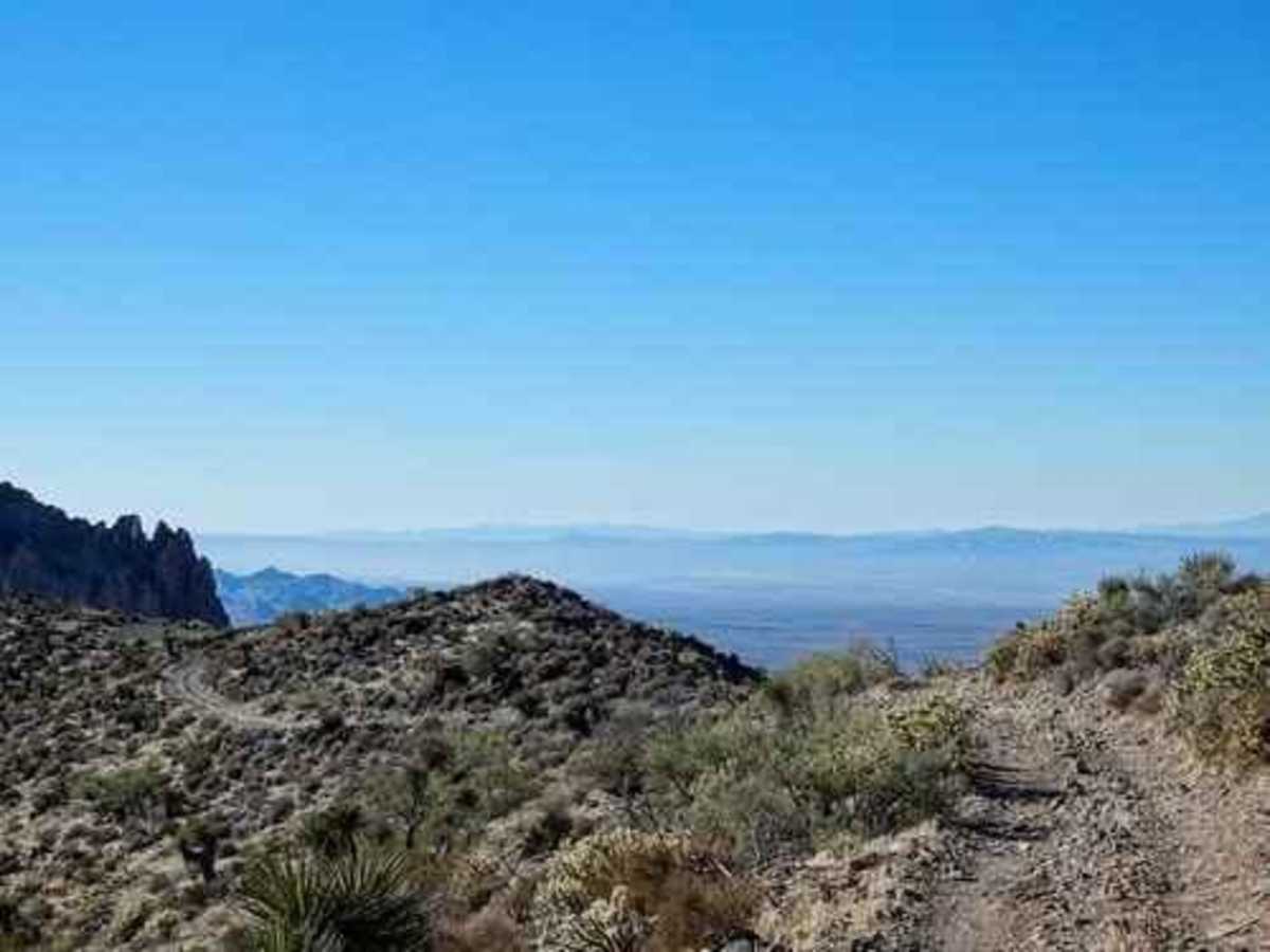
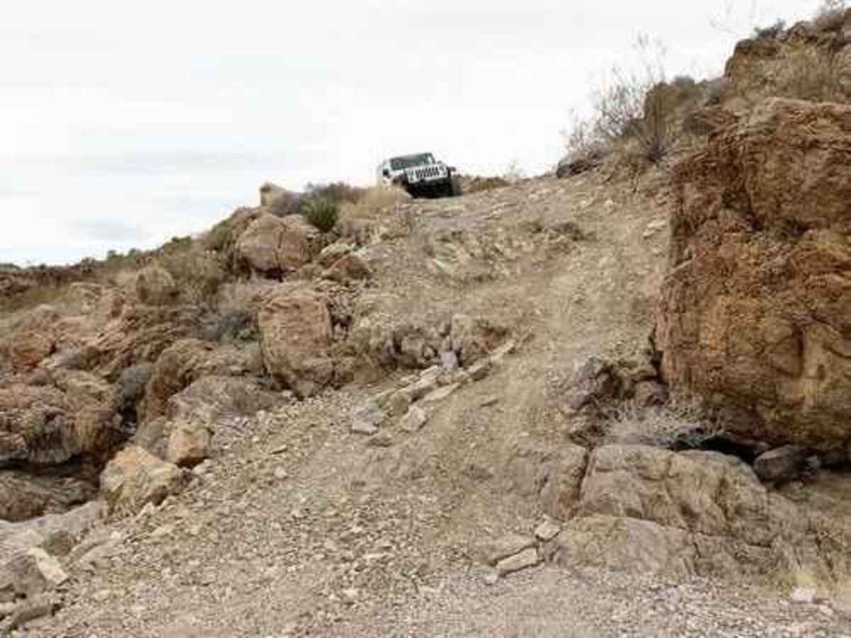
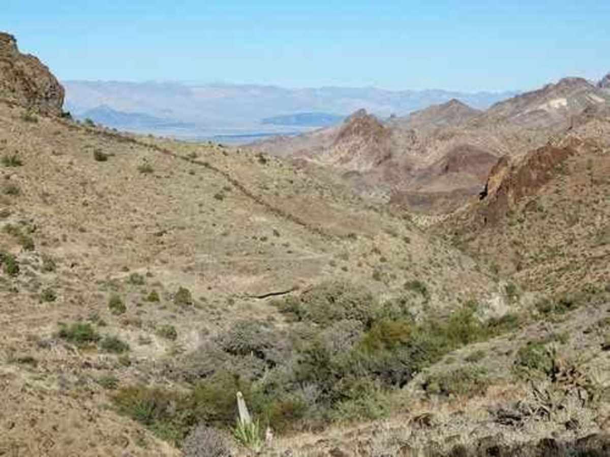
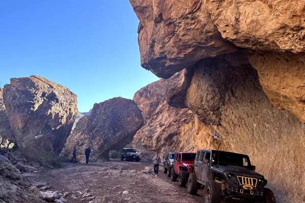
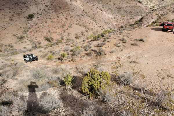
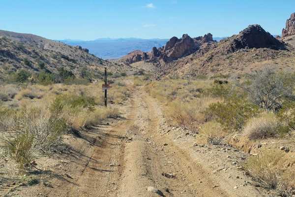
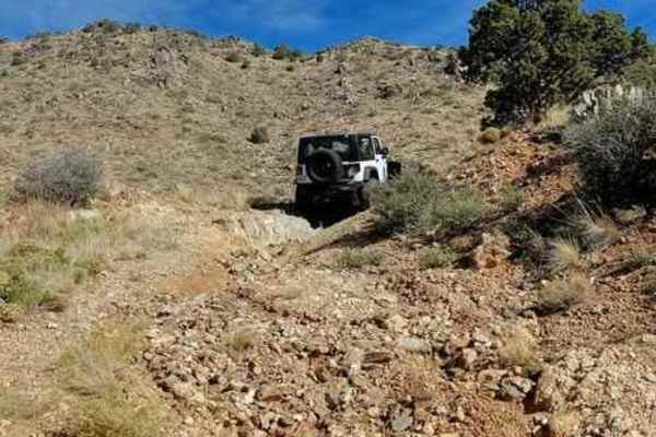
This is a challenging and scenic Jeep trail through the Black Mountains. Its difficulty depends on the direction driven and the options chosen. This trail can be driven either way but it is recommended to start in Golden Valley and then run the main trail from north to south. This is in the downhill direction, so you will not need full lockers. Lockers on both axles are recommended if going uphill. The real feature of this trail is a major hill that drops 1,000 feet in elevation with few chances to level out and catch your breath. There are long stretches with narrow, off-camber shelf roads, several loose descents (or climbs), a couple of short boulder fields, and great scenery you have little time to look at. The trail as shown is 29 miles, but do not let that discourage you. If you begin in Golden Valley, the first 5 miles are paved and the next 15 are graded enough to be quite smooth. This section does not have spectacular scenery but it's still enjoyable. Shortly after Willow Springs Ranch is Wayfarer's Inn. According to Offroad Passport, this is said to have had bars across the opening back in the day and was used as some kind of holding cell. The spray-painted writing on the door says "Eschew Against Dupery." Sleeping Princess begins at the end of the graded road and it is 2 miles along a ridge to the top of the major hill. There are great views of Mohave Lake and Laughlin along the ridge. The next mile or so is a lot of fun but has a very high pucker factor if you do not like narrow, off-camber shelf roads. If you are in a group, it is a good idea to send someone with a radio ahead to the next wide spot long enough for everyone to pull out for oncoming traffic. It is frequently a long way and this is no place to be backing up! At the bottom of the major hill is an optional loop on the left side of the trail called "Hell's Half Mile." It is less than a quarter mile. A bunch of boulders cause this loop to be rated 8. There is an optional climb-over that is not meant for 4-door Jeeps unless you like to "turtle." The next optional loop on the right side of the trail is the 8-rated "Bob Miller Extension." The Extension is the south leg of the loop. Most will drive the north road first then do the Extension. There is a nasty drop followed by several ledges and boulder fields. You can double your fun by doing it in both directions. After the extension, you can follow the track out to Highway 68. The heavily mined hill is interesting.

Photos of Sleeping Princess

Difficulty

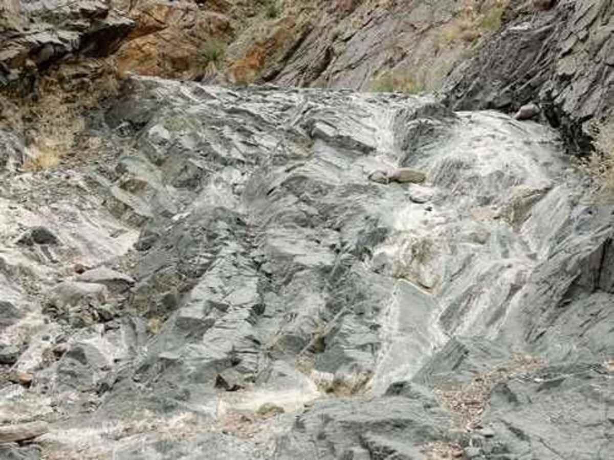
This is an off-camber trail with deep holes and large rocks that may exceed axle height. Expect erosion, loose rocks, sand, washes, shelves, and deep mud holes. There are obstacles and ledges up to 6 feet, and near-vertical grades 12-14 feet tall. There's potential for deep water crossings with strong currents. Caution: Vehicle damage and roll-overs are very possible.

Technical Rating

8

Status Reports

Add Status Report
Reginald Bale
Mar 21, 2026
Open
If running west to east, I can see why this trail is rated difficult. Loose rock jagged at times. Narrow lines and steep off camber edges would make the novice anxious. Majority of this is at the beginning of trail and like others have stated, it gets very easy and graded road. I’d say at least 33” tires and one locker. A few in our group were open diffs and they still made it thru.
Richard A
Oct 04, 2025
Open
We picked up the trail at B1486 from Twin Mills and headed east bound. The trail use to be a green trail in the past. So, I assumed it that the trail was now rated black because of the trail to the west side of the mountain range is black. I was wrong. There are two areas just east of Sleeping Wayfarer’s Inn that could be considered challenging, but passable. First was erosion on one side of a steel drainage pipe with about a 2 1/2 foot drop. There’s a bunch of rocks stacked for a ramp. The second area has one side of the trail washed out with about a 2-3 foot drop. It is possible to pass on one side, but it is tight. The trail is a 1-2 once you get east of the WS ranch to Estrella Rd and a 1 (asphalt road) south from Jurassic Dr to AZ 68
Mike Brown
May 22, 2025
Open
What an amazing trail. With the exception of the loop marked in my photo, and a section called Sleeping Hell’s Half Mile, this trail is a solid 6/10. The loop comes very close to a 9/10. I managed to escape the loop with minor damage. Narrow passages and several challenging waterfalls to navigate. There is even a 15-18’ nasty waterfall that I’m sure someone has attempted once or twice. I was solo so I took a pass. Beautiful overlooks and an awesome spring fed canyon you can access by taking road B1473 to the south. If you are into the geology, this is a must.
Kevin Acuff
Feb 08, 2025
Open
Stuart Bonomo
Apr 06, 2024
Open
This is a great trail for views and just enough but pucker. We ran it south to north I believe. We we riding alone (I know a big no no) so we’re ver cautious. The first real obstacle is a steep rock climb - nothing too bad, just be careful with the throttle and commit to your line. There were several other rock gardens along with very steep climbs. I didn’t see any of the options (outside of harder lines at the two rock gardens mid trail. Overall this was more like a 6-7 but well worth the effort to get there for the views! I didn’t have to use the front locker and was able to navigate the entire trail without a spot. We ran into a group of jeeps about half way through which helped. Have fun on this one! Beautiful views!
Mark G
Jan 30, 2024
Open

Sleeping Princess Trail can be accessed by the following ride types:

  • Single Track
  • 50 Inch
  • 60 Inch
  • High Clearance

Sleeping Princess Map

The onX Offroad Difference

onX Offroad combines trail photos, descriptions, difficulty ratings, width restrictions, seasonality, and more in a user-friendly interface. Available on all devices, with offline access and full compatibility with CarPlay and Android Auto. Discover what you're missing today!

Open Trail Map