
Dirt Bike Trails
Near Smiths Ferry, Idaho
Explore All Dirt Bike Trails Near Smiths Ferry, Idaho
Dirt Bike Trails Near Smiths Ferry, Idaho
Discover the best dirt bike trails near you. Browse trail maps, check difficulty ratings, and find your next adventure — whether you're looking for a quick ride or an all-day expedition.
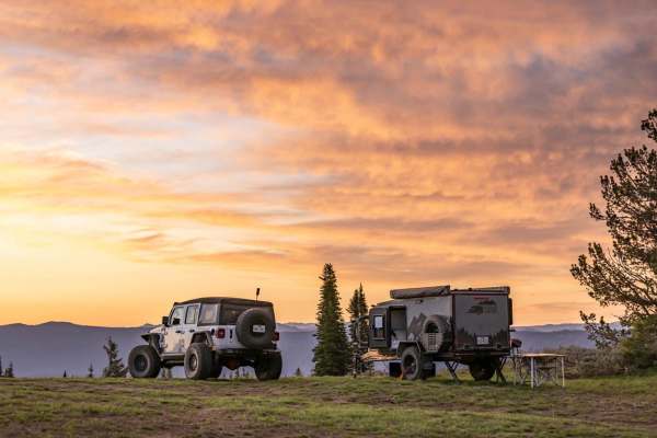
Forest Service Road 446
Forest Service Road 446 is located in the Boise National Forest Cascade, ID. It is a mixed-use, out-and-back road, approximately 12.6 miles long with nearly 4,100 feet of elevation gain. With a starting elevation at nearly 4,100 feet above sea level, the well-maintained dirt road will wind its way t...
Learn more about Forest Service Road 446

Airline
Airline is best run during spring or fall. It's a combination of smooth and flowy single track, coupled with both loose rock, and boulder sections. A fun adventure for intermediate riders. There are some spots of exposure on the trail, and it's recommended that you ride with a friend. If you are ru...
Learn more about Airline
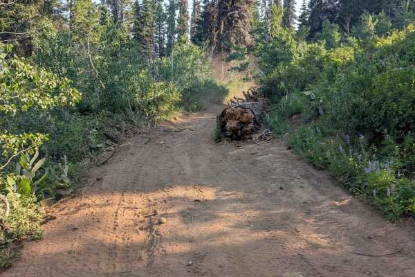
Spur 374BD
Road 374BD is a spur off of Road 374. The road is mainly dirt with sand. Some areas have rocks under 6 inches. There are ruts throughout this route. The road is one lane. Although it is wide enough for full-sized vehicles, there were large sections of fallen trees that could inhibit larger vehicles ...
Learn more about Spur 374BD
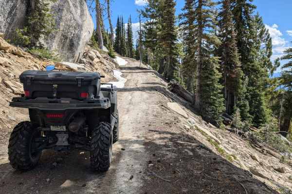
Forest Service Road 555BC - Scott Mtn. Lookout
This in-and-out trail is around 8 miles round trip. Don't let the length discourage you from exploring this trail. The road is packed sand and dirt with rocky stretches. There are narrow spots, so watch for other vehicles, especially around the blind corners. When completing this ride in mid-June, t...
Learn more about Forest Service Road 555BC - Scott Mtn. Lookout
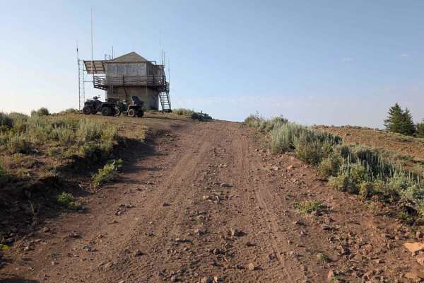
Road 3740 - Hawley Mountain Lookout
This road takes off from Road 374. It's a short ride to Hawley Mountain Lookout. The road is rocky, rutted, and has some steeper sections to navigate. Even though it's short, it's a fun ride with the reward of seeing a 1935 fire lookout and 360-degree views of the area.
Learn more about Road 3740 - Hawley Mountain Lookout
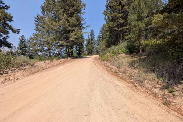
Road 374 - Southern Portion
This road is easily navigable by all vehicle sizes. Just be aware that it's a single-lane road and you may encounter other vehicles traveling from the opposite direction. The road is mostly sand with a few sections that are rocky. Staying on Road 374 will bring you to a fork in the road. Turning lef...
Learn more about Road 374 - Southern Portion
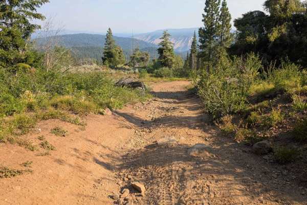
Road 374 - Northern Portion
This section of Road 374 continues from the fork in the road with Road 3740 (Road to Hawley Mountain Lookout) and continues to the next fork with Spur 374BD. The road starts off being fairly smooth with a surface of a sand and dirt mix. Fairly early in, it becomes rockier with rutted areas. It appea...
Learn more about Road 374 - Northern Portion
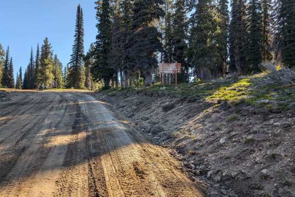
Forest Service Road 555 (FS 555) Scott Mtn-Deadwood
The starting point at this end of FS 555 (Scott Mtn-Deadwood) is on Hwy 17 (Banks-Lowman Hwy). There is a nice-sized parking area on Hwy 17 for unloading and loading rigs. It's a short drive of about 30 yards from the parking area to FS 555. Be aware of traffic on the highway as you cross. FS 555 im...
Learn more about Forest Service Road 555 (FS 555) Scott Mtn-Deadwood
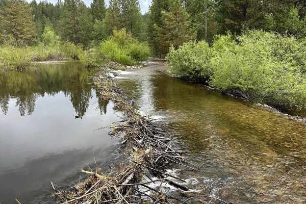
Missouri Mine Trail
This 8.7-mile point-to-point trail starts at the top of Grimes Pass and heads back down to Pioneerville. This fun short trail is passable by High-clearance 4X4 vehicles but has a lot of overgrowths that may cause pin-stripping. This trail has several sharp switchbacks as you leave the ridge line for...
Learn more about Missouri Mine Trail
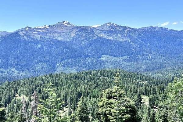
West Mountain
West Mountain is a 9-mile point-to-point trail that has multiple cut-off trails giving access to the West Mountain Jeep trail. The mountain views along this trail are spectacular. The trail is a maintained Forest Service road with light washboarding and shallow mud holes. The southern end of the tra...
Learn more about West Mountain
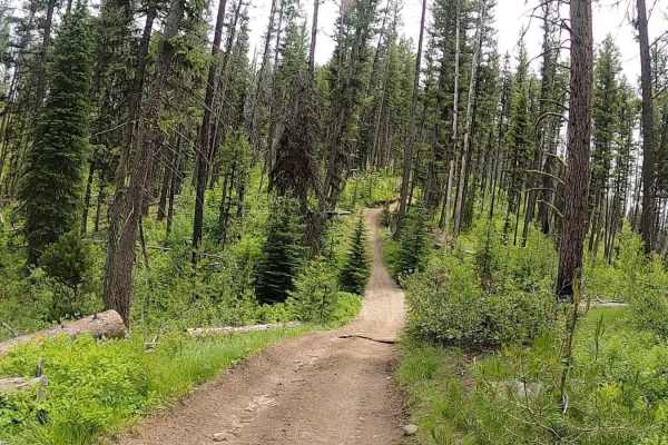
Telephone Ridge Trail #112
The Telephone Ridge Trail leaves from Forest Service Road 474 at an elevation of 5,540. This is a 50-inch trail that turns to a motorcycle trail after approximately 5 miles for a total of 10 miles round trip. The trail starts with a steep switchback and eventually climbs to an elevation of just ove...
Learn more about Telephone Ridge Trail #112
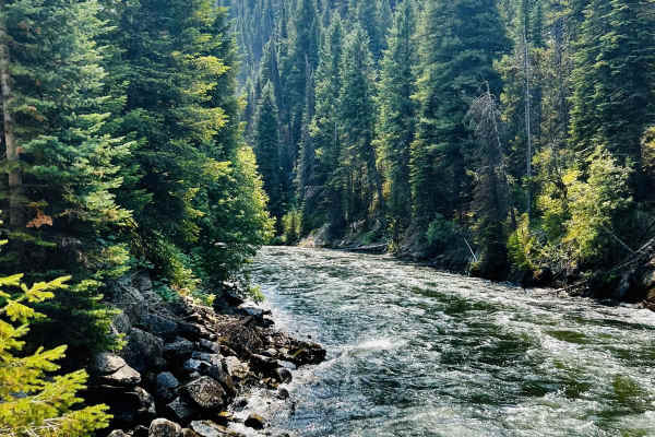
Bulldog Loop
It's a nice, easy ride if you are looking to take your dog on their first SxS ride. The trail starts at the Deer Creek Campground, where wildlife shows itself to us every night. The trail flows through the mountains, where there are a lot of burn areas, eventually making it down to Deadwood Reservoi...
Learn more about Bulldog Loop
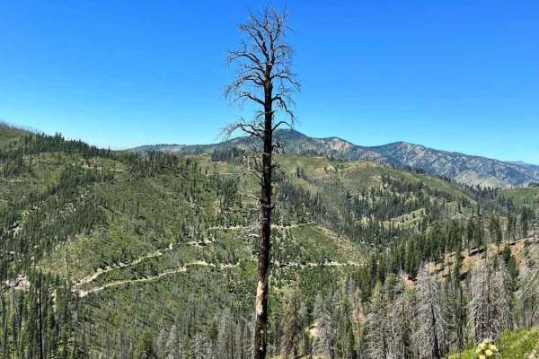
Rock Creek
Rock Creek trail is a 16-mile route that starts just south of Lowman, ID, winds its way up 2,200'+ in elevation, and then dumps the rider onto Highway 21 near Beaver Creek Summit. The route offers excellent views of the surrounding Boise Nat'l Forest, a few small creeks, a couple of great camping sp...
Learn more about Rock Creek
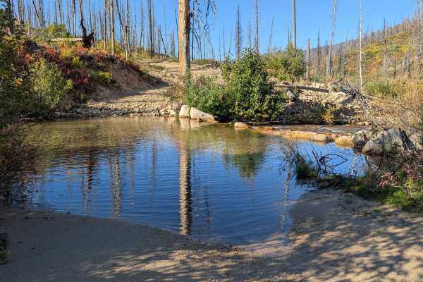
Long Creek - FS 545
Long Creek (FS 545) is approximately 15.5 miles long. It's open April 16th through December 14th. The starting point for this route turns off the Bear Valley to Lowman Road (FS 582) and ends at Red Mountain Road (FS 515). There is an area large enough for a pickup and ATV trailer to park where Long ...
Learn more about Long Creek - FS 545
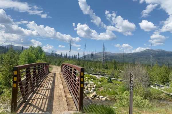
Boise National Forest #254 McCann Trail
The McCann Trail is an 8-mile trail located in the Cascade Ranger District of the Boise National Forest. The trail begins off Forest Service Road #472 Lodgepole Creek. The trail starts as an easy dirt road and winds up the mountain with beautiful views of Stolle Meadows and several creek crossings. ...
Learn more about Boise National Forest #254 McCann Trail
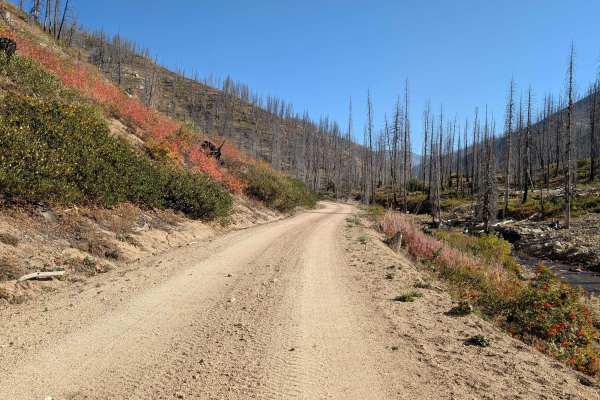
Red Mountain - FS 515
Red Mountain (FS 515) is 4.5 miles from the point it forks off the Bear Valley to Lowman Road, to where it ends at the Red Mountain Transfer Camp. This is a scenic drive with many parts following along Clear Creek. The road is a dirt and sand mixture with small rocks under 3 to 4 inches in places. I...
Learn more about Red Mountain - FS 515
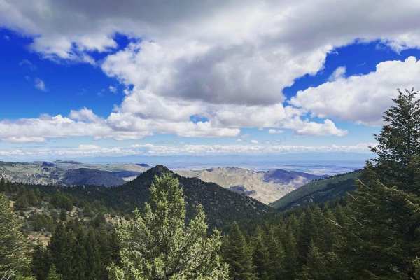
Harris Creek Trail
This 13.9-mile point-to-point trail connects the Bogus Basin area to the Harris Creek area. Stop at 3.5 miles from Bogus Basin and hike out to Coyote Rock, or stop at 7.4 miles from Bogus Basin and check out Sugarloaf Rock. There are several other hiking trails to explore along this route. There is ...
Learn more about Harris Creek Trail
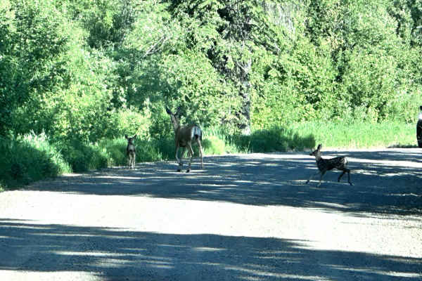
Middle Fork Weiser
Middle Fork Weiser is a 25.8-mile point-to-point road that crosses the West Mountains and parallels the Middle Fork of the Weiser River. This road gives access to several good hiking trails (Sheep Creek and Warm Spring Creek) and the Cabin Creek Campground. This is a maintained forest service road w...
Learn more about Middle Fork Weiser
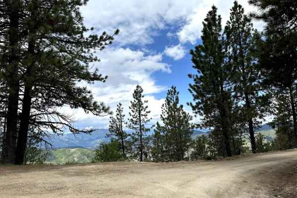
Grimes Pass Road
This 14.9-mile point-to-point trail takes you up to the top of Grimes Pass at 4835 FT. Starting from the south end it is a gentle climb of around 750 FT to the top of the Pass. Starting from the north end it is a steep climb of 1500 FT to the top of the Pass. Many other trails connect to this road f...
Learn more about Grimes Pass Road
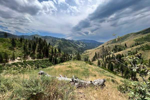
Bear Valley to Lowman
Starting at over 7,000' and dropping to an altitude of 3,800', this 23-mile dirt road connects the Bear Valley to Lowman from the north. Overall, this route is easy to travel with washboard roads and many twists and turns. It passes through a phenomenally beautiful country where you are likely to se...
Learn more about Bear Valley to Lowman
ATV trails near Smiths Ferry, Idaho
Explore ATV-friendly trails near you. These trails are accessible for vehicles up to 50 inches wide, perfect for ATVs and smaller off-road machines.
Forest Service Road 446
Forest Service Road 446 is located in the Boise National Forest Cascade, ID. It is a mixed-use, out-and-back road, approximately 12.6 miles long with nearly 4,100 feet of elevation gain. With a starting elevation at nearly 4,100 feet above sea level, the well-maintained dirt road will wind its way t...
Learn more about Forest Service Road 446
Spur 374BD
Road 374BD is a spur off of Road 374. The road is mainly dirt with sand. Some areas have rocks under 6 inches. There are ruts throughout this route. The road is one lane. Although it is wide enough for full-sized vehicles, there were large sections of fallen trees that could inhibit larger vehicles ...
Learn more about Spur 374BD
Forest Service Road 555BC - Scott Mtn. Lookout
This in-and-out trail is around 8 miles round trip. Don't let the length discourage you from exploring this trail. The road is packed sand and dirt with rocky stretches. There are narrow spots, so watch for other vehicles, especially around the blind corners. When completing this ride in mid-June, t...
Learn more about Forest Service Road 555BC - Scott Mtn. Lookout
Road 3740 - Hawley Mountain Lookout
This road takes off from Road 374. It's a short ride to Hawley Mountain Lookout. The road is rocky, rutted, and has some steeper sections to navigate. Even though it's short, it's a fun ride with the reward of seeing a 1935 fire lookout and 360-degree views of the area.
Learn more about Road 3740 - Hawley Mountain Lookout
UTV/side-by-side trails near Smiths Ferry, Idaho
Find UTV and side-by-side trails near you. These trails accommodate vehicles up to 60 inches wide, ideal for UTVs, side-by-sides, and wider off-road rigs.
Forest Service Road 446
Forest Service Road 446 is located in the Boise National Forest Cascade, ID. It is a mixed-use, out-and-back road, approximately 12.6 miles long with nearly 4,100 feet of elevation gain. With a starting elevation at nearly 4,100 feet above sea level, the well-maintained dirt road will wind its way t...
Learn more about Forest Service Road 446
Spur 374BD
Road 374BD is a spur off of Road 374. The road is mainly dirt with sand. Some areas have rocks under 6 inches. There are ruts throughout this route. The road is one lane. Although it is wide enough for full-sized vehicles, there were large sections of fallen trees that could inhibit larger vehicles ...
Learn more about Spur 374BD
Forest Service Road 555BC - Scott Mtn. Lookout
This in-and-out trail is around 8 miles round trip. Don't let the length discourage you from exploring this trail. The road is packed sand and dirt with rocky stretches. There are narrow spots, so watch for other vehicles, especially around the blind corners. When completing this ride in mid-June, t...
Learn more about Forest Service Road 555BC - Scott Mtn. Lookout
Road 3740 - Hawley Mountain Lookout
This road takes off from Road 374. It's a short ride to Hawley Mountain Lookout. The road is rocky, rutted, and has some steeper sections to navigate. Even though it's short, it's a fun ride with the reward of seeing a 1935 fire lookout and 360-degree views of the area.
Learn more about Road 3740 - Hawley Mountain Lookout
The onX Offroad Difference
onX Offroad combines trail photos, descriptions, difficulty ratings, width restrictions, seasonality, and more in a user-friendly interface. Available on all devices, with offline access and full compatibility with CarPlay and Android Auto. Discover what you're missing today!
Open Trail Map