
Dirt Bike Trails
Near Silver Peak, Nevada
Explore All Dirt Bike Trails Near Silver Peak, Nevada
Dirt Bike Trails Near Silver Peak, Nevada
Discover the best dirt bike trails near you. Browse trail maps, check difficulty ratings, and find your next adventure — whether you're looking for a quick ride or an all-day expedition.
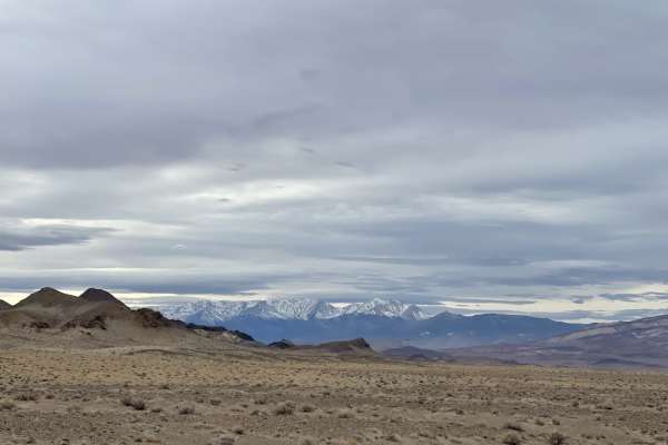
Cutting Through the Jawa Canyon
A mostly sandy and sometimes rocky run through a canyon where you'd expect the Jawa to ambush you at any moment (star wars reference)The trail is loose, sandy and occasionally gets rocky throughout with one technical section. Once you emerge on the SW east end it opens into wide-open trails and a b...
Learn more about Cutting Through the Jawa Canyon
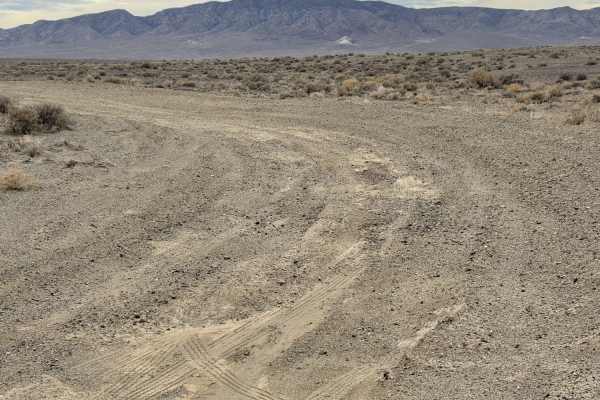
265 Camping Crossover
A sandy short dirt crossover with plenty of flat spots for dispersed camping featuring mountain and valley views. The road gets rutted in some spots and quite sandy in others. Do not attempt when wet. The area could be unbearably hot during the summer months, so be sure to bring plenty of water and ...
Learn more about 265 Camping Crossover
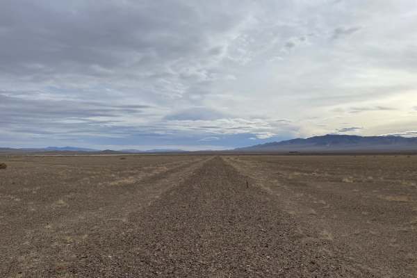
Old Narrow Gage Trail
This is a very rutted, soft, and technical ride along the edge of an old dry lake bed in the great Smoky Valley. Be aware of many deep washouts and look out for vehicle tracks veering off the main trail to avoid the washouts--it's a good sign that a big one is coming up. Sections of the trail almost...
Learn more about Old Narrow Gage Trail
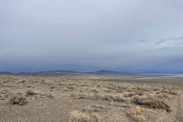
Emigrant Pass from "The Crossing" to Silver Peak Road
Mostly an easy trail with amazing views from the top of the Emigrant pass summit. It can be sandy in spots, especially at wash crossings. You may see Bighorn Sheep and Burros in the area as well as birds of prey. The tail is mostly desert terrain with some jumping cactus and grasslands by the marsh ...
Learn more about Emigrant Pass from "The Crossing" to Silver Peak Road
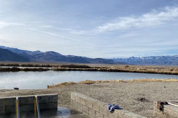
Coyote Rd.
The route starts at Fish Lake hot springs. The water temp is 100 degrees, and the springs is a concrete tub that can fit 12 people comfortably. There are also vault toilets and camping available. The road is wide, gravel and graded. There may be a lot of day traffic coming and going, and the area ma...
Learn more about Coyote Rd.
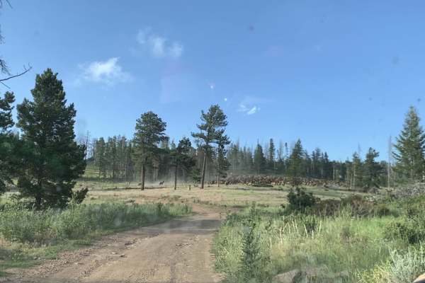
McAfee Rd.
Route starts at Fish Lake Hot Springs which has camps and a vault toilet. Area is patrolled by the sheriff, which is nice due to the high traffic at the springs. McAfee Road is not maintained, but is still in good shape. A high-clearance 2WD could run the route. There are numerous mines to check out...
Learn more about McAfee Rd.
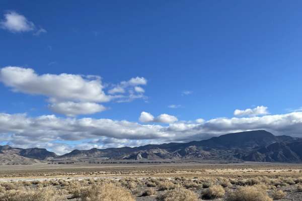
Teeth Rattler to The Crossing
This very easy two-lane, occasionally graded dirt road takes you back to "the crossing", which gives access to many other areas' trails. There are a few offshoots leading to some dispersed camping along the way. The trail can get busy, so be aware of oncoming traffic and large RVs and trailers. You ...
Learn more about Teeth Rattler to The Crossing
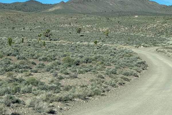
Gemfield Access Trail
Begin at the information sign approximately three miles North of the town of Goldfield while traveling on Highway 95. The trail runs West through the rolling hills for approximately three and a half miles. The trail should be done with a high clearance vehicle, ideally during dry times. There is one...
Learn more about Gemfield Access Trail
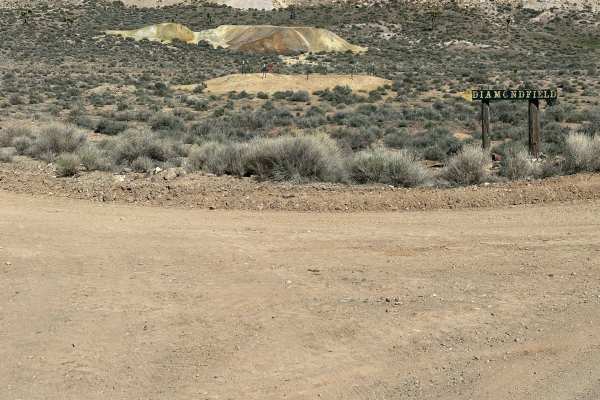
Diamond field Gulch
This is a graded trail, dusty and fairly smooth in the dry months. Very sloppy mud after any rain-expect caked-on mud on your vehicle and slippery conditions. The base is a mix of gravel and soil. Travel by passenger cars is possible during dry times if caution is used.
Learn more about Diamond field Gulch
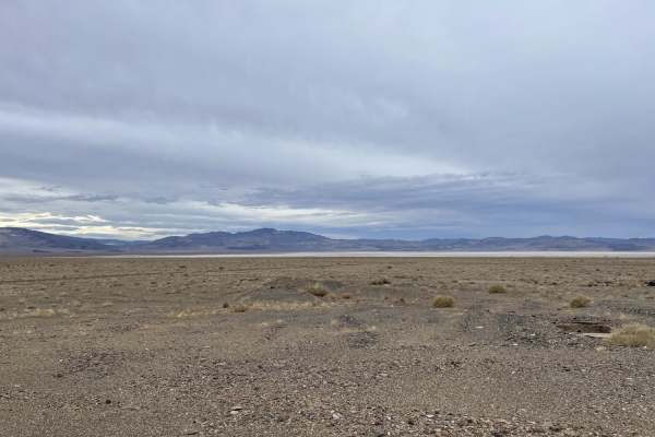
The Burned Out Ghost Town of Coalville to Emigrant Pass Road
Mostly easy dirt and sand trail that runs along the highway for a bit before cutting inland. Feel free to start or stop in the abandoned and mostly burned-out stopover town of Coalville. It's a must-see if you are a fan of graffiti art, abandoned buildings, and the history of a time long since past....
Learn more about The Burned Out Ghost Town of Coalville to Emigrant Pass Road
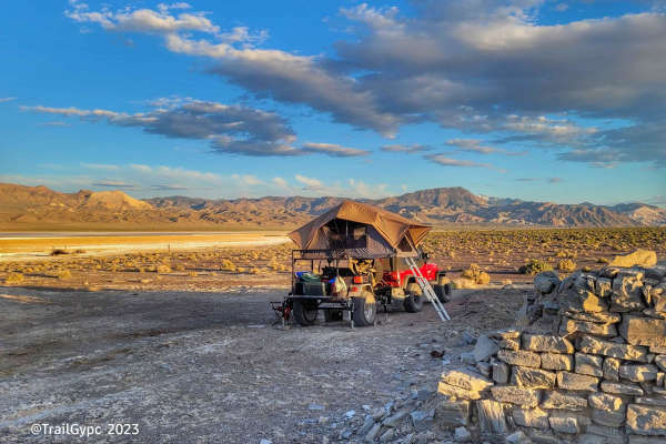
Fish Lake Playa
This is an old borax harvesting route on the west side of the Fish Lake Playa outside of the town of Dyer, Nevada. This trail offers a fairly easy way around the playa and a side trip to see the borax workings and adobe remains. The route can become sandy in spots, as well as a hard mineral-based gr...
Learn more about Fish Lake Playa
Fish Lake Springs Rd.
Fish Lake Springs Road is an easy, scenic gravel connector ideal for all vehicle types, linking the relaxing Fish Lake Hot Springs to the local saloon in Dyer, Nevada, with minimal highway travel. Spanning approximately 17 miles through the scenic Esmeralda County desert, this well-traveled, wide, a...
Learn more about Fish Lake Springs Rd.
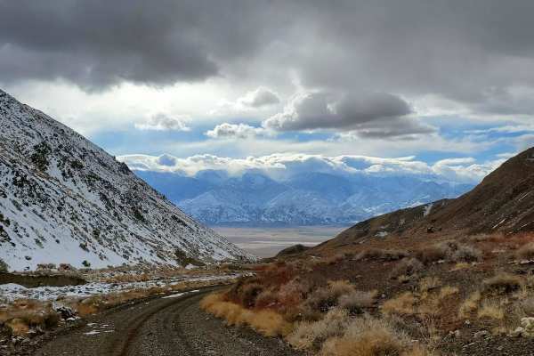
Cabin run via McAfee Road
Cabin run via McAfee Road is an ideal adventure for historic mining enthusiasts and scenic explorers seeking a journey from the flat farmlands of Fish Lake Valley deep into the rugged Silver Peak Range. Beginning near the town of Dyer, Nevada, at an elevation of approximately 4,800 feet, this 24-mil...
Learn more about Cabin run via McAfee Road
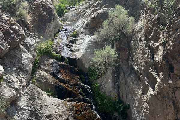
Stonewall Trailhead
This route leaves the graded Chrispa Hills road and follows a trail down a seasonal wash. The wash is packed gravel, easy for any 4x4, but could be sketchy during a rain event. The endpoint is at the US government fence/boundary. Access is controlled by the base commander; see details in the second ...
Learn more about Stonewall Trailhead
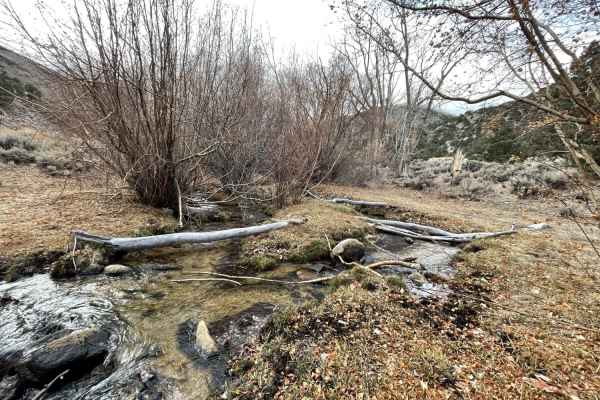
Chiatovitch Creek to Middle Creek
The lower trail is an easy grader with plenty of washboard and scattered rocks. It begins cutting through the neighborhood and while climbing offers amazing views of the valley below. Once you pass all the housing and cross into Inyo National Forest on middle creek and trail becomes narrow and rocky...
Learn more about Chiatovitch Creek to Middle Creek
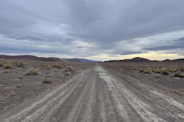
Emigrant Trail to "The Crossing"
A pretty drive to get you from the highway back to a network of fun trails and some dispersed camping spots. The drive takes you all the way through rocky canyons and alongside marshy tall grasses. Once you crest the hill, the valley is laid out before you, showing some of the wetlands and marshy, g...
Learn more about Emigrant Trail to "The Crossing"
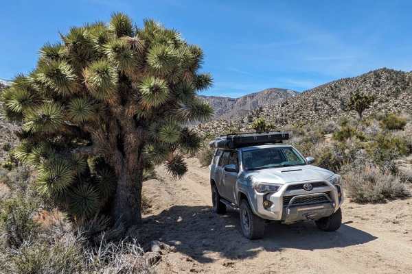
Willow Creek Road to Pigeon Springs
Sometimes you go exploring and find things you do not expect. This may be an adventure of that sort for you. Getting to this trail, you'll travel a nice and easy graded trail through the high desert. You'll reach an unassuming side trail that quickly starts to change. Huge and beautiful rock formati...
Learn more about Willow Creek Road to Pigeon Springs
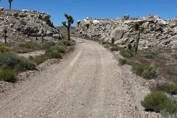
Missing RR Trestle
This exact route has some very challenging spots with the payoff of some very neat sites along the way. Generally, this is a gravel road, but the route over the hills has a section that is not for novice drivers, but there are ways around that area. This route started at the Stonewall Trailhead boun...
Learn more about Missing RR Trestle
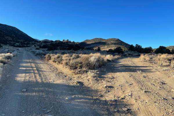
Red Rock Quicksilver Mine
This easy trail takes you all the way to the mining complex to the east and the historic mining complex. There are many structures still standing and plenty of kiosks and information about the area. It's a nice stop and even a great place to camp with established fire rings and a great view out the ...
Learn more about Red Rock Quicksilver Mine
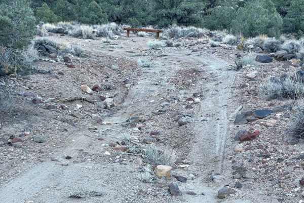
Rock Creek Rock Garden Hill Climb
A narrow, steep, seldom traveled trail that runs up the side of the hill. There are frequent rockslides leaving large boulders in the trail. The trail is sandy with very soft switchbacks and very steep drop-offs with narrow sections. There are also off-camber sections that are quite narrow. The view...
Learn more about Rock Creek Rock Garden Hill Climb
ATV trails near Silver Peak, Nevada
Explore ATV-friendly trails near you. These trails are accessible for vehicles up to 50 inches wide, perfect for ATVs and smaller off-road machines.
Cutting Through the Jawa Canyon
A mostly sandy and sometimes rocky run through a canyon where you'd expect the Jawa to ambush you at any moment (star wars reference)The trail is loose, sandy and occasionally gets rocky throughout with one technical section. Once you emerge on the SW east end it opens into wide-open trails and a b...
Learn more about Cutting Through the Jawa Canyon
265 Camping Crossover
A sandy short dirt crossover with plenty of flat spots for dispersed camping featuring mountain and valley views. The road gets rutted in some spots and quite sandy in others. Do not attempt when wet. The area could be unbearably hot during the summer months, so be sure to bring plenty of water and ...
Learn more about 265 Camping Crossover
Old Narrow Gage Trail
This is a very rutted, soft, and technical ride along the edge of an old dry lake bed in the great Smoky Valley. Be aware of many deep washouts and look out for vehicle tracks veering off the main trail to avoid the washouts--it's a good sign that a big one is coming up. Sections of the trail almost...
Learn more about Old Narrow Gage Trail
Emigrant Pass from "The Crossing" to Silver Peak Road
Mostly an easy trail with amazing views from the top of the Emigrant pass summit. It can be sandy in spots, especially at wash crossings. You may see Bighorn Sheep and Burros in the area as well as birds of prey. The tail is mostly desert terrain with some jumping cactus and grasslands by the marsh ...
Learn more about Emigrant Pass from "The Crossing" to Silver Peak Road
UTV/side-by-side trails near Silver Peak, Nevada
Find UTV and side-by-side trails near you. These trails accommodate vehicles up to 60 inches wide, ideal for UTVs, side-by-sides, and wider off-road rigs.
Cutting Through the Jawa Canyon
A mostly sandy and sometimes rocky run through a canyon where you'd expect the Jawa to ambush you at any moment (star wars reference)The trail is loose, sandy and occasionally gets rocky throughout with one technical section. Once you emerge on the SW east end it opens into wide-open trails and a b...
Learn more about Cutting Through the Jawa Canyon
265 Camping Crossover
A sandy short dirt crossover with plenty of flat spots for dispersed camping featuring mountain and valley views. The road gets rutted in some spots and quite sandy in others. Do not attempt when wet. The area could be unbearably hot during the summer months, so be sure to bring plenty of water and ...
Learn more about 265 Camping Crossover
Old Narrow Gage Trail
This is a very rutted, soft, and technical ride along the edge of an old dry lake bed in the great Smoky Valley. Be aware of many deep washouts and look out for vehicle tracks veering off the main trail to avoid the washouts--it's a good sign that a big one is coming up. Sections of the trail almost...
Learn more about Old Narrow Gage Trail
Emigrant Pass from "The Crossing" to Silver Peak Road
Mostly an easy trail with amazing views from the top of the Emigrant pass summit. It can be sandy in spots, especially at wash crossings. You may see Bighorn Sheep and Burros in the area as well as birds of prey. The tail is mostly desert terrain with some jumping cactus and grasslands by the marsh ...
Learn more about Emigrant Pass from "The Crossing" to Silver Peak Road
The onX Offroad Difference
onX Offroad combines trail photos, descriptions, difficulty ratings, width restrictions, seasonality, and more in a user-friendly interface. Available on all devices, with offline access and full compatibility with CarPlay and Android Auto. Discover what you're missing today!
Open Trail Map