
Dirt Bike Trails
Near Sayner, Wisconsin
Explore All Dirt Bike Trails Near Sayner, Wisconsin
Dirt Bike Trails Near Sayner, Wisconsin
Discover the best dirt bike trails near you. Browse trail maps, check difficulty ratings, and find your next adventure — whether you're looking for a quick ride or an all-day expedition.
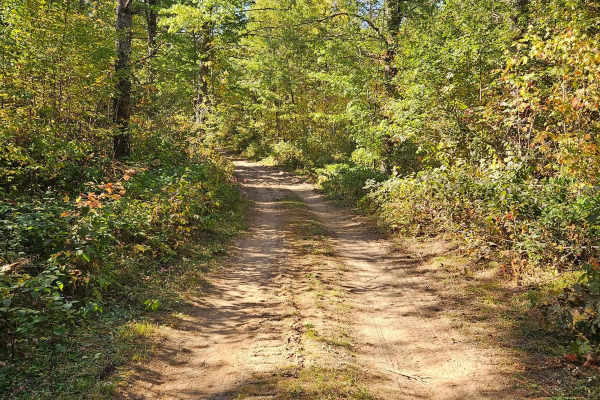
Sandy Summit Trail
The Sandy Summit Trail is a mellow and quiet trail that features a sandy/dirt trail with a few patches of rocks. There was a small sandy hill that had recently been graded, as indicated by the bulldozers parked along the trail. Trail conditions were dry and dusty. Cell service was spotty at times so...
Learn more about Sandy Summit Trail
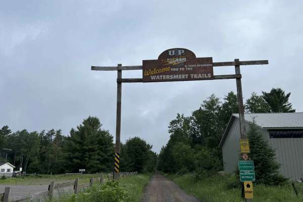
Gogebic County MI Trail LL/3
This is trail LL/ 3 located in Gogebic County, Michigan. This trail runs from its starting point at the Michigan/ Wisconsin border, and continues north to the town of Watersmeet, where it ends at the intersection of the Iron River-Marenisco Trail and Trail LL Bass Lake Road. This trail is a wide and...
Learn more about Gogebic County MI Trail LL/3
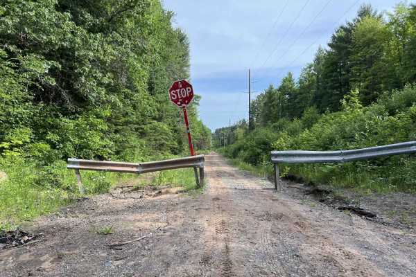
Trail LL - Paulding Lights
This is Trail LL, Paulding Lights, located in Gogebic and Ontonagon Counties, Michigan. This trail begins where Trail LL resumes as a gravel road (Bass Lake Rd) north of the town of Watersmeet. If traveling by ATV or SxS, a short paved route through town will need to be used in order to navigate fro...
Learn more about Trail LL - Paulding Lights
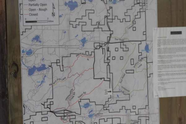
Tour Road
The route takes you through the Pelican River Forest in the North Woods of Wisconsin. The Pelican River Forest is privately owned by The Conservation Fund and open for public use when the gates are open and the roads are passable. This route loops from US 45 to the east back to US 45 on a gentle rol...
Learn more about Tour Road
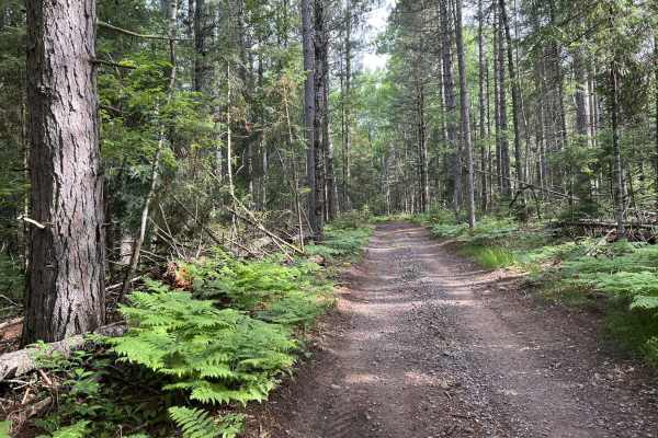
LL FDR-5288 Trail
Trail LL Fdr-5288 is a 64 inches wide and under trail open to ATV, SxS, and OHM. This trail runs from its Western starting point at its intersection with Trail LL, Paulding Lights, and ends at its intersection with FDR-5311. This is a very tight and winding dirt trail that traverses the eastern part...
Learn more about LL FDR-5288 Trail
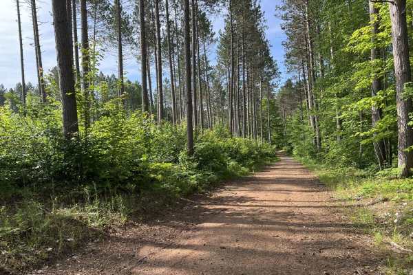
Trail LL FDR-5311
Trail LL FDR-5311 is located in Ontonagon County, Michigan. This lollipop-style trail starts at its intersection with Bond Falls Road. The trail is classified as a Lollipop style trail since it has a shared entry and exit point that is accessible by all vehicle types. The surface of this trail is mo...
Learn more about Trail LL FDR-5311
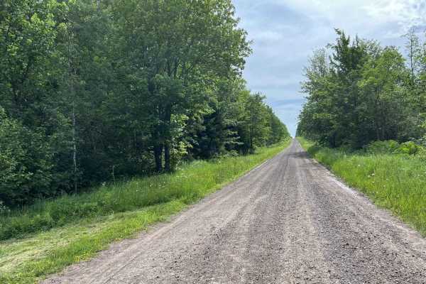
Swanson Road
Swanson Road is located in Ontonagon County, Michigan. This trail runs from its intersection with US Highway 45 to its intersection with FR-5320. This is a short access trail that will allow road-legal vehicles easy access to the southern Ontonagon County trails. The trail itself consists of wide op...
Learn more about Swanson Road
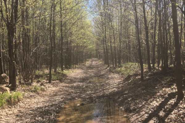
South Pelican
This trail runs next to the road and then dives into the woods for half of it. The east side of the route has some nice elevation changes with a few lower areas that have the potential to be muddy after rain. The west half goes into the woods where you can find a good number of shallow water holes o...
Learn more about South Pelican
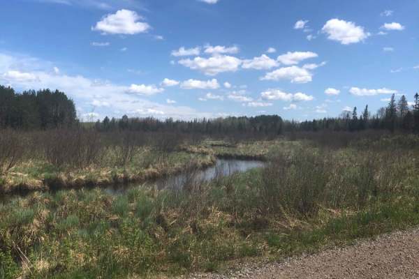
Pratt Junction
The best trail to take that conjoins Post Lake with Pelican Lake, which can then lead to the Harrison Hills system. The trail is mostly a gravel road, but has a small section of dirt on the Pelican Lake side. Along the way, there are excellent views of the woodlands and a stream. Good chance to see ...
Learn more about Pratt Junction
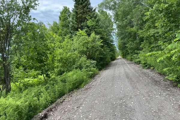
Trail SB Bergland
This is Trail SB located in Ontonagon County Michigan. This trail runs from the intersection of Hokens Road and Trail SB Bruce Crossing to Trail SB's end point in Bergland. This trail, like the majority of trail SB is a converted railroad grade. The scenery along this trail is a mix of trees alongsi...
Learn more about Trail SB Bergland
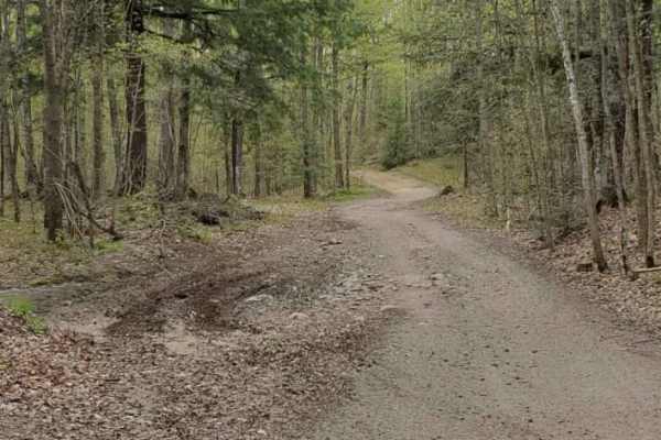
Pelcho Cut Across
To get you off pavement and onto this rocky, winding trail you will cut through Enterprise Lake Road in Elcho and Old Elcho Road in Pelican Lake. Most times the trail has many low wet spots, but none of them are usually deep. Most corners are pretty tight, but oncoming traffic can usually be seen. T...
Learn more about Pelcho Cut Across
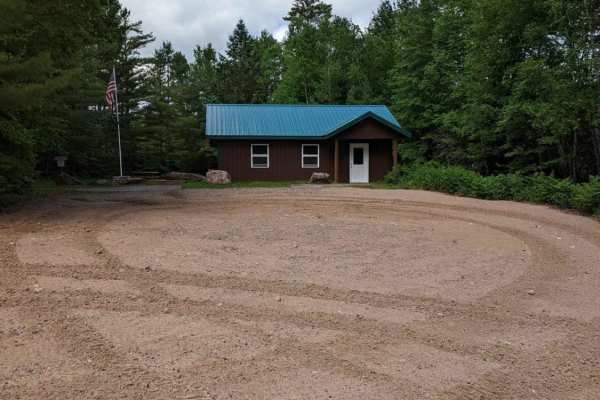
Parrish Mini Loop
Small trail loop near the Parrish Trail Head. Easy going, with a nice stop at the shelter located lakeside that has a water pump and bathroom. On a slow ride, this should only take 15 to 20 minutes to complete and breaks up the day with a more curvy trail.
Learn more about Parrish Mini Loop
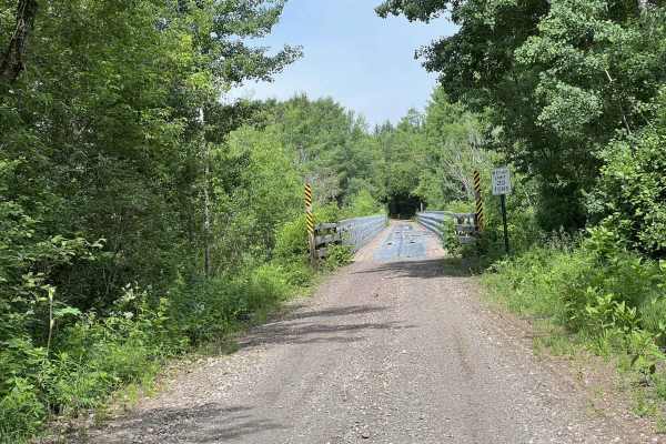
Trail SB Bruce Crossing
This is trial SB. This trail runs from its start point at its intersection with trail LL, located just north of Agate Falls. This trail runs until its endpoint at Hokens Rd. The trail is located in Ontonagon County, Michigan. This section of the SB railroad grade runs through several small towns; ho...
Learn more about Trail SB Bruce Crossing
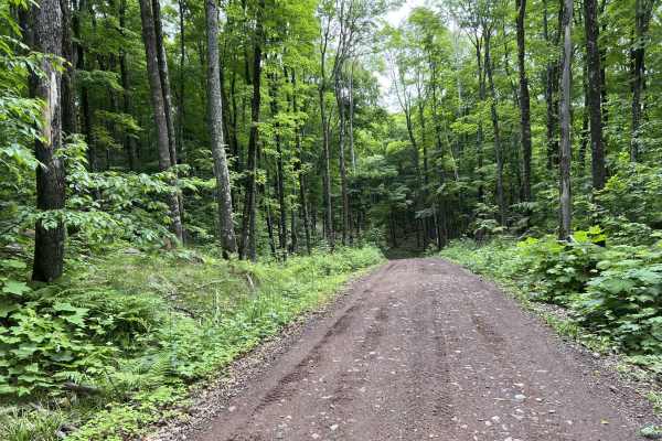
Trail P - FDR502
This is Trail P, Fdr 502. This trail is located in Ontonagon County, Michigan, northeast of the town of Bergland. Trail P runs from its intersection with Trail SB Bergland to its intersection with FDR 400 Bergland. This trail travels through a very dense forest within the Ottawa National Forest. The...
Learn more about Trail P - FDR502
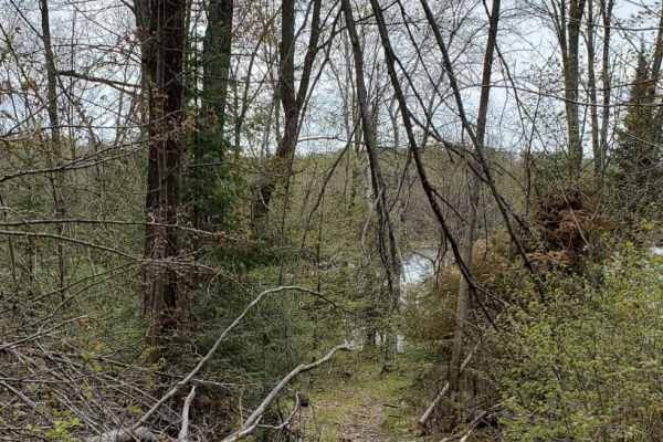
Minito Lake
Narrow winding dirt trail that goes right past the small Minito Lake State Natural Area. A short walking trail takes you down to the water side. The majority of this trail is narrow with a few wide spots to allow for oncoming traffic to pass. This trail is best taken at a slower pace, enjoy the scen...
Learn more about Minito Lake

West Elcho/Lily Mill Pass Through
Nice dirt trail spur going from West Elcho Road to Lily Mill Fire Lane. Most of the trail is easy one-lane traffic with some turnouts and wider spots to accommodate meeting other traffic. Plenty of rolling hills and tight bends make this a fun trail in the area to take your time passing through.
Learn more about West Elcho/Lily Mill Pass Through

West Elcho Bypass
Short route to keep off of the dirt road of West Elcho. Access directly from the County T trailhead. Winding trail is narrow in some spots, which requires pulling off to the side allowing traffic to pass. Mostly gravel/dirt trail with a few of the steeper hills being loose rock. There are a few gras...
Learn more about West Elcho Bypass
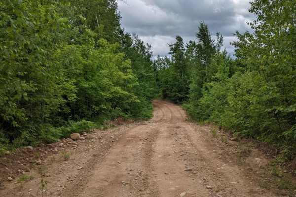
East Nickel
The east half of Five Cent Road. This trail passes through open forest and private land so be respectful when passing through. This is not one that travels fast, but will make plenty of dust during the dry season. This road is open to all traffic, but does see a lot of ATV/SxS traffic in the summer ...
Learn more about East Nickel
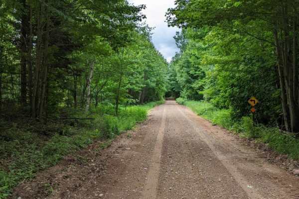
Half Nelson - West
Easy driving through rolling hills and forest. Most of the trail will fit two lanes of traffic, but there are many tight corners to watch for. This is mostly a gravel trail, so it will get dusty once the area dries out. There are a few turnout spots to take a break from the day and stay out of the w...
Learn more about Half Nelson - West

Nelson Fire Shortcut
This is a mostly single-lane gravel trail. Will be dry most of the time, but even after a rain, there won't be much if any mud to find. Some areas of the trail have a pretty tight vegetation canopy, which makes larger vehicles tougher to pass. This trail connects Nelson Fire Lane to West Elcho Road ...
Learn more about Nelson Fire Shortcut
ATV trails near Sayner, Wisconsin
Explore ATV-friendly trails near you. These trails are accessible for vehicles up to 50 inches wide, perfect for ATVs and smaller off-road machines.
Sandy Summit Trail
The Sandy Summit Trail is a mellow and quiet trail that features a sandy/dirt trail with a few patches of rocks. There was a small sandy hill that had recently been graded, as indicated by the bulldozers parked along the trail. Trail conditions were dry and dusty. Cell service was spotty at times so...
Learn more about Sandy Summit Trail
Gogebic County MI Trail LL/3
This is trail LL/ 3 located in Gogebic County, Michigan. This trail runs from its starting point at the Michigan/ Wisconsin border, and continues north to the town of Watersmeet, where it ends at the intersection of the Iron River-Marenisco Trail and Trail LL Bass Lake Road. This trail is a wide and...
Learn more about Gogebic County MI Trail LL/3
Trail LL - Paulding Lights
This is Trail LL, Paulding Lights, located in Gogebic and Ontonagon Counties, Michigan. This trail begins where Trail LL resumes as a gravel road (Bass Lake Rd) north of the town of Watersmeet. If traveling by ATV or SxS, a short paved route through town will need to be used in order to navigate fro...
Learn more about Trail LL - Paulding Lights
Tour Road
The route takes you through the Pelican River Forest in the North Woods of Wisconsin. The Pelican River Forest is privately owned by The Conservation Fund and open for public use when the gates are open and the roads are passable. This route loops from US 45 to the east back to US 45 on a gentle rol...
Learn more about Tour Road
UTV/side-by-side trails near Sayner, Wisconsin
Find UTV and side-by-side trails near you. These trails accommodate vehicles up to 60 inches wide, ideal for UTVs, side-by-sides, and wider off-road rigs.
Sandy Summit Trail
The Sandy Summit Trail is a mellow and quiet trail that features a sandy/dirt trail with a few patches of rocks. There was a small sandy hill that had recently been graded, as indicated by the bulldozers parked along the trail. Trail conditions were dry and dusty. Cell service was spotty at times so...
Learn more about Sandy Summit Trail
Gogebic County MI Trail LL/3
This is trail LL/ 3 located in Gogebic County, Michigan. This trail runs from its starting point at the Michigan/ Wisconsin border, and continues north to the town of Watersmeet, where it ends at the intersection of the Iron River-Marenisco Trail and Trail LL Bass Lake Road. This trail is a wide and...
Learn more about Gogebic County MI Trail LL/3
Trail LL - Paulding Lights
This is Trail LL, Paulding Lights, located in Gogebic and Ontonagon Counties, Michigan. This trail begins where Trail LL resumes as a gravel road (Bass Lake Rd) north of the town of Watersmeet. If traveling by ATV or SxS, a short paved route through town will need to be used in order to navigate fro...
Learn more about Trail LL - Paulding Lights
Tour Road
The route takes you through the Pelican River Forest in the North Woods of Wisconsin. The Pelican River Forest is privately owned by The Conservation Fund and open for public use when the gates are open and the roads are passable. This route loops from US 45 to the east back to US 45 on a gentle rol...
Learn more about Tour Road
The onX Offroad Difference
onX Offroad combines trail photos, descriptions, difficulty ratings, width restrictions, seasonality, and more in a user-friendly interface. Available on all devices, with offline access and full compatibility with CarPlay and Android Auto. Discover what you're missing today!
Open Trail Map