
Dirt Bike Trails
Near Roslyn, Washington
Explore All Dirt Bike Trails Near Roslyn, Washington
Dirt Bike Trails Near Roslyn, Washington
Discover the best dirt bike trails near you. Browse trail maps, check difficulty ratings, and find your next adventure — whether you're looking for a quick ride or an all-day expedition.
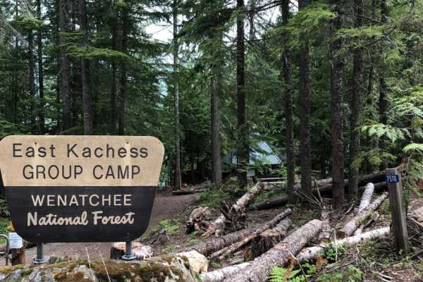
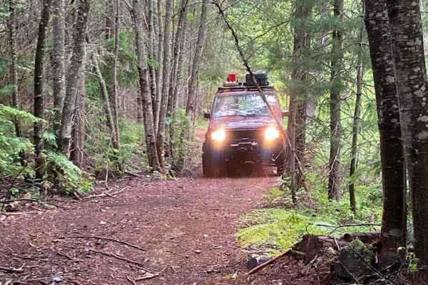
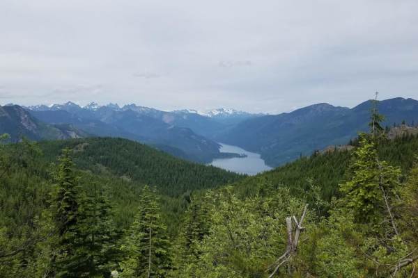
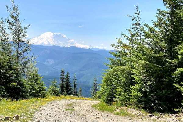
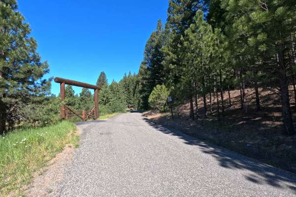
East Kachess Road 4818
This is a beautiful trail around the east side of Lake Kachess. Wrapped in tree cover, this road provides access to a number of additional trails and campsites, as well as views of the lake. The road is usually in good condition but sometimes has deep potholes. The East Kachess Group Campsite is ava...
Learn more about East Kachess Road 4818
Amabilis Mountain (from the SE side)
This trail route is full of loose gravel, rocks, and dirt. The trail features a pretty steady incline with a few rutted areas and a couple of areas of well-sized loose rocks. At the time I ran this trail (summer) there were multiple trees down, which caused me to have to turn around at the end of th...
Learn more about Amabilis Mountain (from the SE side)
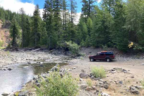
Cabin Creek Trail
Following Cabin Creek Road, this trail is mostly easy and one of the ways to get across Stampede Pass. At about 2 miles in, the road and bridge that crossed Cabin Creek are washed out, and there is a detour that brings you to a shallow (in the fall) water crossing at Cabin Creek. From there, the tra...
Learn more about Cabin Creek Trail
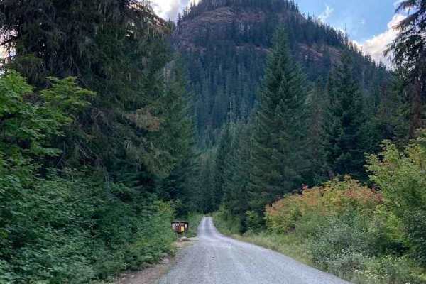
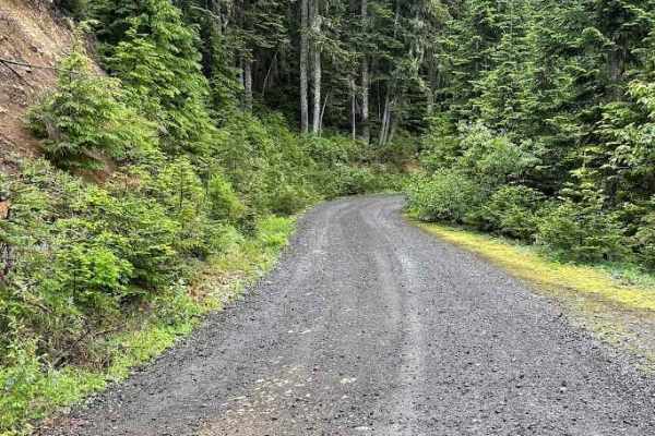
Tucker Creek Road
Tucker Creek Road offers a classic Pacific Northwest off-road experience with a mix of gravel, dirt, and rocky stretches that keep things interesting. The road is generally passable for high-clearance vehicles, but expect rough sections with ruts and deep puddles during the wet season. As you climb,...
Learn more about Tucker Creek Road
Kachess Lake Labyrinth - FS4828
Forest Service Road 4828 is a fun and approachable off-road trail that delivers both scenic beauty and technical driving in the heart of central Washington. The main road is a well-maintained gravel surface, generally hard-packed with occasional loose rock and shallow ruts. It's accessible for most ...
Learn more about Kachess Lake Labyrinth - FS4828
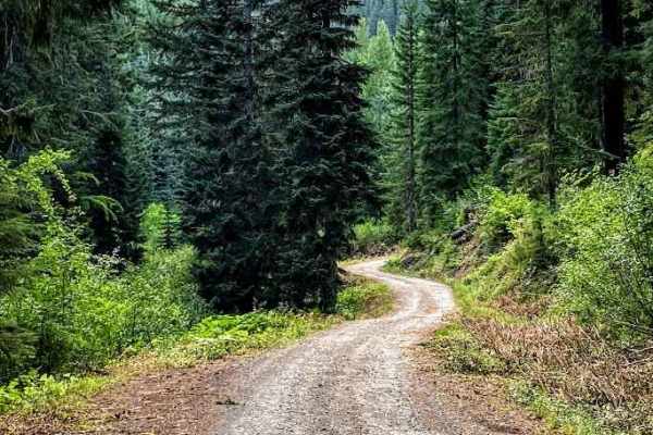
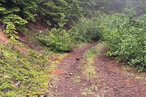
Knox Creek - 4308
Knox Creek Road Number 4308 runs through the Wenatchee National Forest, it is a natural surface road, that is tight, overgrown, and one lane with no turnouts. The road becomes steep at the end, one section requires a high clearance four-wheel drive vehicle as it has become very washed out over the y...
Learn more about Knox Creek - 4308
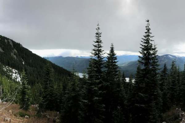
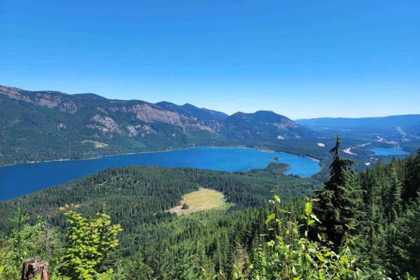
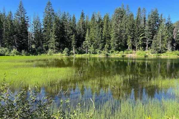
Kachess Overlook
This is an easy road that winds its way up the mountain past a waterfall and streams to find an incredible view of Lake Kachess and French Cabin Creek Basin. The road is covered in snow during winter, but becomes passable in early to mid June. Don't forget to stop along the way and enjoy the views b...
Learn more about Kachess Overlook
French Cabin Creek
French Cabin Creek runs through the Wenatchee National Forest. It is a gravel road with washboard sections and steep gradual inclines. There is an abundant amount of camping. Right after the bridge, you will find a large dispersed campground in French Cabin Creek Recreation Area. It is on either sid...
Learn more about French Cabin Creek
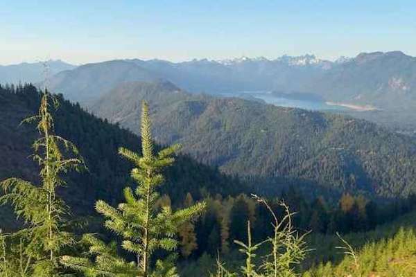
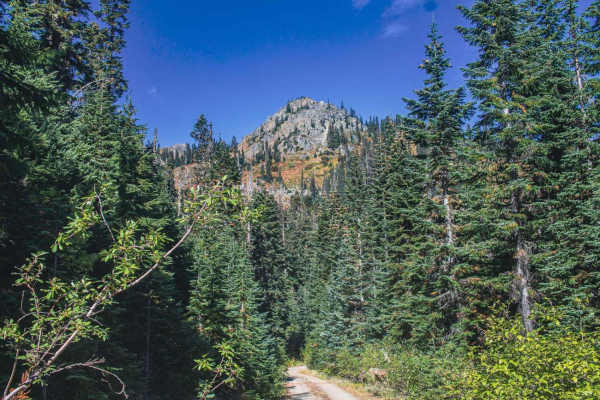
Amabilis Mtn Summit
You'll find this trail right off I-90 via the Cabin Creek Road exit. The entire trail is a single lane gravel and dirt road, with places to pull over every now and then. Should be no problem for most SUVs. At first there isn't much to see as you'll be going through tall trees in a switch back, but a...
Learn more about Amabilis Mtn Summit

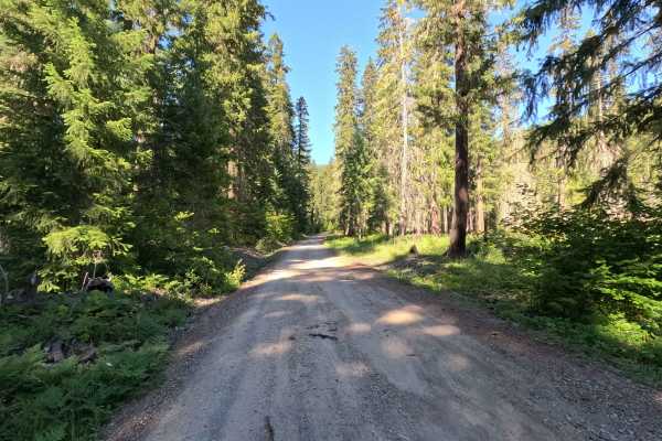
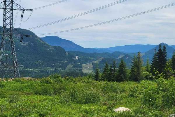
Log Creek - FS 4110
Log Creek - FS 4110 is a scenic gateway into the heart of the Wenatchee National Forest, offering an easy-to-moderate drive with incredible mountain viewpoints, large hunter camps, and multiple dirt bike staging areas. The road winds through beautiful mixed forest with frequent overlooks, making it ...
Learn more about Log Creek - FS 4110
Box Canyon Creek - FS 4930
Box Canyon Road, Forest Service Road 4930 in Washington, is a rugged mountain drive that offers both challenge and reward for off-road explorers. The road surface varies between hard-packed dirt and stretches of loose rock, with occasional ruts and washboards that keep drivers engaged. In wet weathe...
Learn more about Box Canyon Creek - FS 4930
Gale Creek - FS 4948
Gale Creek Road via Forest Service Road 4948 is an easy-to-moderate off-road route offering a relaxed drive through classic Pacific Northwest forest. The road surface shifts from well-graded gravel to compacted dirt with light washboarding, shallow potholes, and a few embedded rocks. Seasonal moistu...
Learn more about Gale Creek - FS 4948
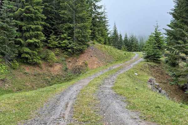
Little Salmon La Sac Road - FS 4315
Little Salmon La Sac Road is a 6.4-mile out-and-back route that climbs 2,661 feet from Highway 903 into the mountains above Cle Elum Lake. The single-lane gravel road features switchbacks, moderate rutting, water damage, and a few steeper sections with loose surfaces. As the route gains elevation, d...
Learn more about Little Salmon La Sac Road - FS 4315
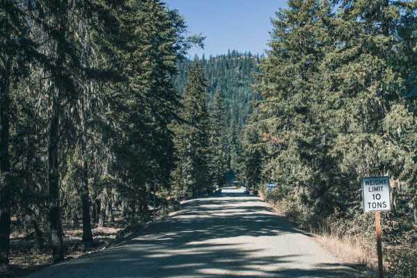
Stampede Pass - Crystal Springs to Greenwater
Crossing the Snoqualmie National Forest and private Weyerhaeuser land from I-90 to WA-410 is an easy and fun adventure. This route is closed in the winter due to snow. The route is mostly gravel and dirt, following a series of Forest Service roads and trails. The first and last few miles have a lot ...
Learn more about Stampede Pass - Crystal Springs to Greenwater
Cabin Creek Road (NF-41)
As you start on Cabin Creek Road, from the Stampede Pass side, you'll begin to ascend about 900 feet over 4.5 miles that will lead you along some beautiful views looking east over the mountains and hills. Be warned though, this part of the journey does ride close to some very steep drop offs and is ...
Learn more about Cabin Creek Road (NF-41)
Stampede Ridge - FS 5400
Stampede Ridge - FS 5400 is an enjoyable forest drive that climbs above Keechelus Lake into the rugged Cascade foothills of the Okanogan-Wenatchee National Forest. The road is primarily well-maintained gravel with sections of embedded rock, washboards, and occasional potholes, making it suitable for...
Learn more about Stampede Ridge - FS 5400
Intake Creek - FS 5220
Intake Creek - FS 5220 is a great gateway into the rugged backcountry of the Wenatchee National Forest. The route winds through dense pine and fir forest with occasional openings that reveal sweeping views of the surrounding ridges and valleys. It's an enjoyable drive on its own, but the real highli...
Learn more about Intake Creek - FS 5220
Middle Fork Teanaway - FS 4305113
Middle Fork Teanaway is a 1.5-mile out-and-back route that follows a single-lane gravel road into the Teanaway Community Forest. A Discover Pass is required for access. The route provides access to Indian Camp Campground and follows the Middle Fork Teanaway River through a scenic forested corridor. ...
Learn more about Middle Fork Teanaway - FS 4305113
Knob - FS 5403110
Knob - FS 5403110 is a short but surprisingly challenging climb in the Okanogan-Wenatchee National Forest. While it isn't a long trail, its steep grades, switchbacks, loose rock, and occasional rutted sections make it more technical than many of the surrounding forest roads. High-clearance 4WD is re...
Learn more about Knob - FS 5403110
Lizard Lake/Longworth Cr.
This is an alternate route from Stampede Pass Road on the other side of the valley. The route comprises Lizard Lake, Borup, and Longworth Creek Forest Service roads. It is a single-lane gravel road in good shape, with potholes, ruts, and minor rocky areas. The road passes a few viewpoints with good ...
Learn more about Lizard Lake/Longworth Cr.
ATV trails near Roslyn, Washington
Explore ATV-friendly trails near you. These trails are accessible for vehicles up to 50 inches wide, perfect for ATVs and smaller off-road machines.
East Kachess Road 4818
This is a beautiful trail around the east side of Lake Kachess. Wrapped in tree cover, this road provides access to a number of additional trails and campsites, as well as views of the lake. The road is usually in good condition but sometimes has deep potholes. The East Kachess Group Campsite is ava...
Learn more about East Kachess Road 4818
Amabilis Mountain (from the SE side)
This trail route is full of loose gravel, rocks, and dirt. The trail features a pretty steady incline with a few rutted areas and a couple of areas of well-sized loose rocks. At the time I ran this trail (summer) there were multiple trees down, which caused me to have to turn around at the end of th...
Learn more about Amabilis Mountain (from the SE side)
Cabin Creek Trail
Following Cabin Creek Road, this trail is mostly easy and one of the ways to get across Stampede Pass. At about 2 miles in, the road and bridge that crossed Cabin Creek are washed out, and there is a detour that brings you to a shallow (in the fall) water crossing at Cabin Creek. From there, the tra...
Learn more about Cabin Creek Trail
Tucker Creek Road
Tucker Creek Road offers a classic Pacific Northwest off-road experience with a mix of gravel, dirt, and rocky stretches that keep things interesting. The road is generally passable for high-clearance vehicles, but expect rough sections with ruts and deep puddles during the wet season. As you climb,...
Learn more about Tucker Creek Road
UTV/side-by-side trails near Roslyn, Washington
Find UTV and side-by-side trails near you. These trails accommodate vehicles up to 60 inches wide, ideal for UTVs, side-by-sides, and wider off-road rigs.
East Kachess Road 4818
This is a beautiful trail around the east side of Lake Kachess. Wrapped in tree cover, this road provides access to a number of additional trails and campsites, as well as views of the lake. The road is usually in good condition but sometimes has deep potholes. The East Kachess Group Campsite is ava...
Learn more about East Kachess Road 4818
Amabilis Mountain (from the SE side)
This trail route is full of loose gravel, rocks, and dirt. The trail features a pretty steady incline with a few rutted areas and a couple of areas of well-sized loose rocks. At the time I ran this trail (summer) there were multiple trees down, which caused me to have to turn around at the end of th...
Learn more about Amabilis Mountain (from the SE side)
Cabin Creek Trail
Following Cabin Creek Road, this trail is mostly easy and one of the ways to get across Stampede Pass. At about 2 miles in, the road and bridge that crossed Cabin Creek are washed out, and there is a detour that brings you to a shallow (in the fall) water crossing at Cabin Creek. From there, the tra...
Learn more about Cabin Creek Trail
Tucker Creek Road
Tucker Creek Road offers a classic Pacific Northwest off-road experience with a mix of gravel, dirt, and rocky stretches that keep things interesting. The road is generally passable for high-clearance vehicles, but expect rough sections with ruts and deep puddles during the wet season. As you climb,...
Learn more about Tucker Creek Road
The onX Offroad Difference
onX Offroad combines trail photos, descriptions, difficulty ratings, width restrictions, seasonality, and more in a user-friendly interface. Available on all devices, with offline access and full compatibility with CarPlay and Android Auto. Discover what you're missing today!
Open Trail Map